HKY_WX
-
Posts
3,246 -
Joined
-
Last visited
Content Type
Profiles
Blogs
Forums
American Weather
Media Demo
Store
Gallery
Everything posted by HKY_WX
-
Suns out and 73 here in Raleigh. Btw
-
That a nasty cellheading towards south Charlotte
-
This certainly will not be a bust for the northern NC border counties, which was always looking to be ground zero. The eastern portions will likely get more ZR this evening/night. This just doesn't appear to be overly impactful for the population centers.
-
Was just talking to him about this. Def something to watch tonight
-
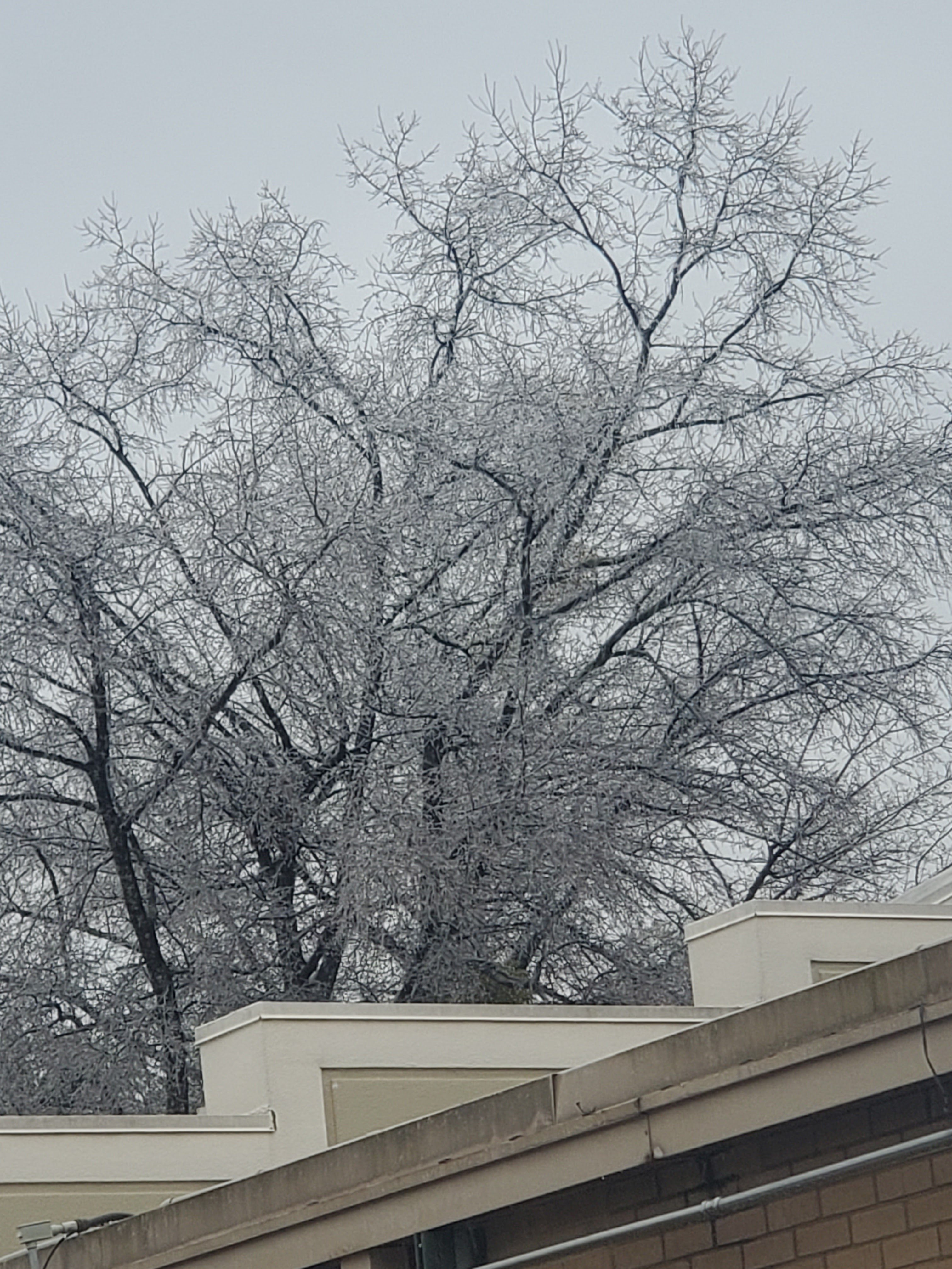
Here's the trees in NW Raleigh

-
Got a good glaze in the trees here NW of Raleigh
-
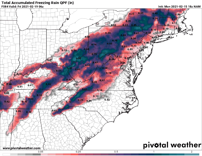
31 with zr here NW of raleigh. Forecast (No time for a map with a 2 month old lol) : Roxboro: .75 to 1 GSO: .5 to .75 Hillsborough: .5 Durham: .3 HKY .2 RDU: .1 to .25 (more in NW Wake) CLT: Trace
-
RDPS looks a bit colder at 18z. The main difference b/n the GFS/RDPS and the NAM/Hi-Res mods appears to be the precip' shield. The higher res American models appear to be putting more emphasis on sparser convective/dynamic bands (this is usually the case due to the model physics/resolution). A more steady/less dynamical precip shield would be more conducive for ZR accrual. This may be something to watch tonight to get a feel for which way this is headed.
-
Someone mentioned it yesterday, but timing and precip intensity is playing some havoc on these accrual maps. It's probably going to bounce around until gametime tomorrow.
-
RAP (old school model I used to use) has a couple ZR maxs. One is near Youngsville and Northern Wake county with .9 (which is cray)
-
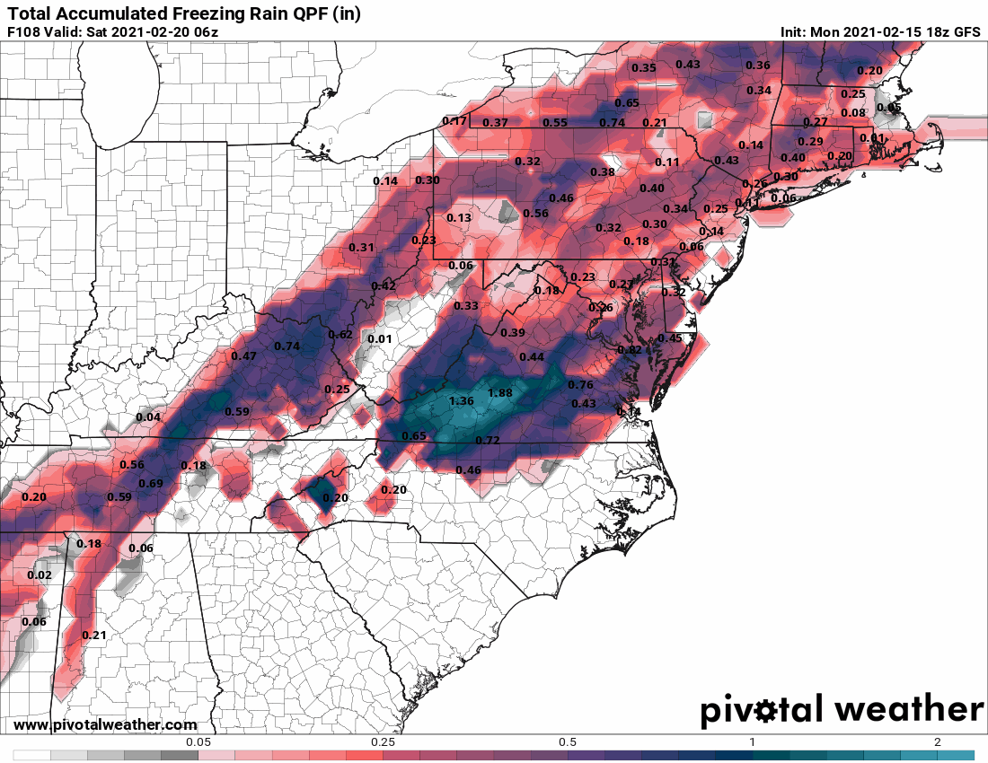
GFS up to .62 accrual for RDU now. RGEM is at roughly 1 inch. NAM up to .2. cut those #'s in half and blend them and you still get warning criteria ice.
-
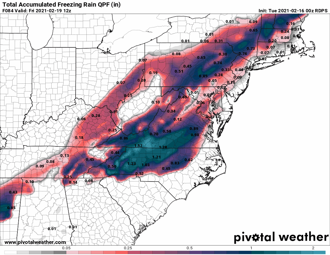
RDPS is trending the best ZR accrual towards the Triangle as the trends south continue. Looks like more sleet for the VA border counties if this is to be believed. I'll post a map tomorrow for those interested. (I usually only post maps for significant/major systems) fyi.

-
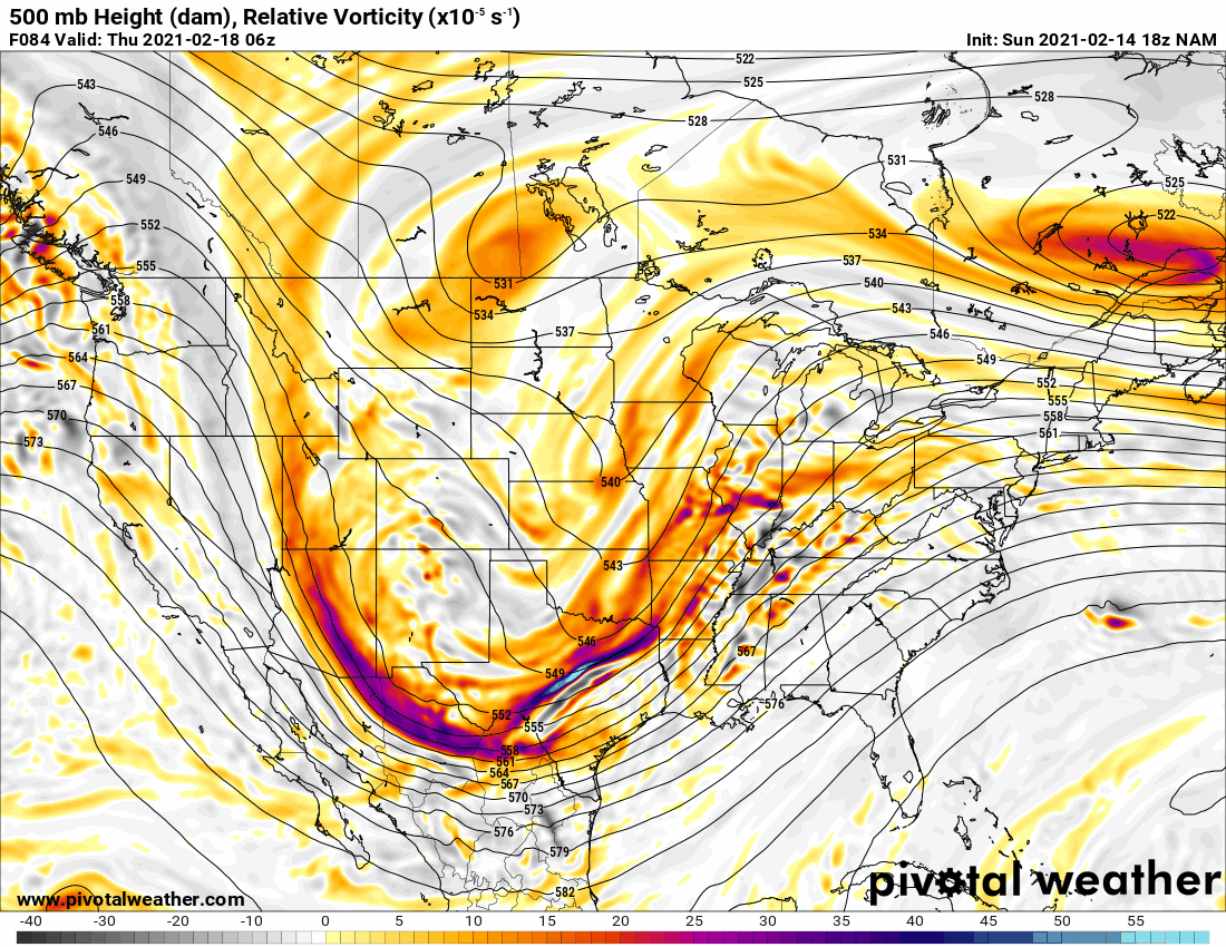
NAM has the SLP all the way down into the n-central GOM at hour 36
-
It was like 2005. Was prob the last good ZR storm i've seen. I was home for winter break from UNCG. I'm sure I said something smartazz to get him to say that.
-
He said that to me. That pompous azz lol. My brother still laughs at me about it.
-
GFS trend below for ZR. Main thing I would note is this is not just CAD related. Notice the ZR line over the Miss Valley is trending SE as well, meaning the HP is pressing further south. The trend today is been to push this HP and corresponding cold front through a bit deeper. Setting up a more suppressed solution. From Apps runner, to Miller B to now a hybrid Miller A/B.
-
Trends...
-
From a climo perspective, the 12z EURO SLP track is much more of a Snow to Sleet/Ice track (especially for interior sections of NC/VA). Certainly not a pure ZR track ending in rain that will push 10C+ 850 temps into interior NC... This will be interesting to following in the mods today/tomorrow. This system will likely feature much more sleet than we're seeing currently (at least for the interior/NW NC/S VA sections).
-
I do like the Hillsborough area a lot. The wife will have her say lol
-
I live near the RDU airport, so I'm on the edge. I'm planning on relocating North towards creedmoor or NW of wake forest sometime this summer. If the plague leaves.
-
In general 850 temps that high would prevent much accrual. For this reason, I think they will break one way or the other. My guess is they will be closer to 4-6C since the trend is towards a colder solution/suppressed SLP.
-
True, i'm thinking those #'s will come down though if we have the SLP in the positions the other models have it. Would make no sense to have a warm nose that strong.
-
Yes if it continues
-
It's a subtle trend, but the polar lobe over SE Canada continues to trends south/stronger. This will continue to strengthen the pinch of the confluent flow aloft over the northeast and induce higher pressure/HP at the surface. This produces a more transient pattern for our STJ s/w coming eastward.