

psuhoffman
-
Posts
27,417 -
Joined
-
Last visited
Content Type
Profiles
Blogs
Forums
American Weather
Media Demo
Store
Gallery
Everything posted by psuhoffman
-

Feb Long Range Discussion (Day 3 and beyond) - MERGED
psuhoffman replied to WinterWxLuvr's topic in Mid Atlantic
@Ji what’s sad is that if someone just sneezes while facing north a ridge pops to the Arctic circle these days regardless of the pattern. Any freaking excuse and warmth wants to surge north. -
Feb Long Range Discussion (Day 3 and beyond) - MERGED
psuhoffman replied to WinterWxLuvr's topic in Mid Atlantic
A lot of the good ensembles in the Eps and gefs have that progression. That might be the best way here if that ridge is going to pump like that. A weak wave to knock it down then something behind. We need the trough to eject pieces to prevent the ridge from going ape. -
Feb Long Range Discussion (Day 3 and beyond) - MERGED
psuhoffman replied to WinterWxLuvr's topic in Mid Atlantic
What did you do with Ji????? -
Feb Long Range Discussion (Day 3 and beyond) - MERGED
psuhoffman replied to WinterWxLuvr's topic in Mid Atlantic
Honestly from a pattern progression the cmc was always in the gfs camp. The op pumped the ridge same way but less extreme buy it also washed out that first wave. No one pointed out the snowstorm the cmc showed was actually from the NEXT wave and was a days later lol. And for that progression to work required the first lead wave to wash out and it was the only model showing that lol. But the cmc ensembles were fully in the gfs camp without that wonky split wave idea. I didn’t want to kill the mood by pointing that out though. -
Feb Long Range Discussion (Day 3 and beyond) - MERGED
psuhoffman replied to WinterWxLuvr's topic in Mid Atlantic
I’m waiting for the punch line -
Feb Long Range Discussion (Day 3 and beyond) - MERGED
psuhoffman replied to WinterWxLuvr's topic in Mid Atlantic
The GFS pumps the ridge so far north the first wave cuts so severely it might destroy the setup for the next behind it. It gets trapped so far NW we get no 50/50 and enough ridging for the next wave to possibly cut also. Lol. -
Feb Long Range Discussion (Day 3 and beyond) - MERGED
psuhoffman replied to WinterWxLuvr's topic in Mid Atlantic
I’ll say a prayer for you -
Feb Long Range Discussion (Day 3 and beyond) - MERGED
psuhoffman replied to WinterWxLuvr's topic in Mid Atlantic
A little similar to some of the 1994 ice storms wrt pattern there. But I’m not getting into that. I don’t like ice. Could care less ice v rain unless there is snowcover to preserve. -
Feb Long Range Discussion (Day 3 and beyond) - MERGED
psuhoffman replied to WinterWxLuvr's topic in Mid Atlantic
And gfs looks exactly like it... For reference this is what the euro looks like at about the same time... It’s a huge difference but really due to a rather subtle difference that has huge impacts on the pattern. The euro ejects the western trough in pieces and such never pumps the ridge. The gfs and Icon does not and pumps the ridge. Looking across ensemble members that’s a consistent theme between good v bad members on both gefs and eps. We need the western trough to eject pieces east to knock down the ridge. Otherwise it pumps a ridge that links up with the NAO “block” and its game over -
Feb Long Range Discussion (Day 3 and beyond) - MERGED
psuhoffman replied to WinterWxLuvr's topic in Mid Atlantic
Icon did not get us off to a glorious start. It says “what block? Why don’t I just blast a ridge from Mexico to Greenland instead.” Before anyone bothers to look...It’s raining in Green Bay there. -
I was at that game. 1993. He beat the Eagles at the Vet. If I recall we had like a 1 point lead and then the dolphins got a late FG to win.
-
Feb Long Range Discussion (Day 3 and beyond) - MERGED
psuhoffman replied to WinterWxLuvr's topic in Mid Atlantic
I don’t want to start a war with anyone without knowing the whole story, especially over something this petty...but here is my take... Using 12z EPS but GEFS isn’t much different Day 1 looks like an epo ridge with effective flow into our source regions to me... Day 5 no complaints there... day 8!!!! still there...keep in mind signals get muted that far out in range. After that the pacific ridge retrogrades and that Pac NW trough retrogrades with it into the EPO domain flipping it around day 9/10. A few days ago when it was still way out at like day 14-16 guidance hinted the epo ridge might linger a few days longer but saying because it lasted 7-8 days instead of 10-11 based on a day 15 prog seems overly petty to me. It also seems inconsequential to the threat window days 8-15 that I’m looking at. Because look what that sets up day 12 yes the epo flips...but AFTER a solid week of flow straight out of the Arctic into our source regions. I’m sorry but that’s not good enough? But also that’s not a bad look there. That isn’t a vortex of doom in the N pac just a typical trough. And we have a block still in eastern Canada and a 50/50 low trapped to our northeast so our flow will be out of the north. That area had a solid week of cross polar flow to seed cold. And look where that’s being fed with there. Yes the flow traverses the extreme north Pac after coming off Siberia and through the Bering Sea. Not exactly tropical in origin. And the true mid latitude maritime pac air is directed into the southwest and is cut off by the northwest flow across the US. That’s a good look to get something to amplify into the east and it should be plenty cold enough given the antecedent setup. Now ideally I’d like that ridge to pull back a little more. It’s tight. With a block like that though sometimes something could dig in pretty sharp. But my fear there would be something miller bs us because it amplifies too far northeast. But that has nothing to do with the EPO. And before we worry about that it’s 12 days away..I promise the ridge axis will shift slightly. If it adjusts west just a bit we’re golden. So let’s see. But back to the EPO issue yes the northern stream would pick up some maritime influence from its brief traverse over the gulf of AK but if that is enough to totally wreck our source region immediately after seeding it with arctic air for 7 straight days...and I am not exxagersting here...we should close up shop and pack it in. Seriously what do we need a 30 day straight off Siberia flow? Or a solar storm that infuses stratospheric air straight to the ground like day after tomorrow??? What are we looking for here??? Now if we’re looking way way out...if the NAO flips positive and that trough stays near AK then yea we will be in trouble. But now we’re looking way out and adding some ifs and buts. Maybe they are doing that. I don’t know. But imo if the next 2 weeks fail it’s not because the epo broke down in 7 days instead of 10. -
Feb Long Range Discussion (Day 3 and beyond) - MERGED
psuhoffman replied to WinterWxLuvr's topic in Mid Atlantic
This hand is being over played imo. The epo ridge is going up for about 6 days (instead of 10) but the extended days were at like day 13-16. That’s not reliable range. The models did get the epo ridge going up correct just had it linger too long. But frankly an extended epo ridge is unlikely in a Nina with a strong Pac jet. The play was always to get some cold into the pattern then hope we do better with a colder base state to start with a blocking pattern. Anyone expecting weeks of a epo NAO ridge bridge was crazy. If we get a week of epo ridge to inject true cold into N America then an eastern trough after and it’s still not cold enough I don’t want to hear anymore crap about the pattern. How many things do we expect to go right AND to stay lined up for THAT long. It doesn’t work that way. If we need 15 things to all be perfect AND to stay that way for weeks and weeks...well don’t hold your breath. -
Feb Long Range Discussion (Day 3 and beyond) - MERGED
psuhoffman replied to WinterWxLuvr's topic in Mid Atlantic
And I’m not sure what this is in reference too but I’ve seen his tweets shared on my Twitter feed comparing the pattern to 2010 several times and I think I remember a comment where he said he would be shocked if DC to Boston wasnt above normal snow by Mid Feb do not sure how not bullish that is lol. -
Feb Long Range Discussion (Day 3 and beyond) - MERGED
psuhoffman replied to WinterWxLuvr's topic in Mid Atlantic
Ok back on topic...no one noticed the rather significant improvement on the 18z Gefs???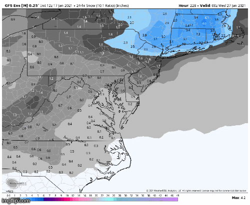
-
Feb Long Range Discussion (Day 3 and beyond) - MERGED
psuhoffman replied to WinterWxLuvr's topic in Mid Atlantic
I stopped watching his videos regularly years ago but yesterday I threw one on out of curiosity and he outlined the same progression I laid out a few days ago. It honestly made me feel less confident in my prediction. -
Feb Long Range Discussion (Day 3 and beyond) - MERGED
psuhoffman replied to WinterWxLuvr's topic in Mid Atlantic
Sounds like a normal day to me -
Feb Long Range Discussion (Day 3 and beyond) - MERGED
psuhoffman replied to WinterWxLuvr's topic in Mid Atlantic
+1 -
The VAST majority of Eagles fans wanted the GM gone. Some wanted both GM and coach gone. Almost no one wanted the coach gone and GM back. Way more agree with me that the GM is the main problem. Also...when it comes to coaching decisions Eagles fans imo aren’t the best to base your decisions on. They would fire every coach after every loss. Eagles fans are as logical wrt coaching expectations as Ji with snow.
-
Feb Long Range Discussion (Day 3 and beyond) - MERGED
psuhoffman replied to WinterWxLuvr's topic in Mid Atlantic
All of them. It was impressive!!! -
Feb Long Range Discussion (Day 3 and beyond) - MERGED
psuhoffman replied to WinterWxLuvr's topic in Mid Atlantic
I have no idea. I’m just saying objective studies of it’s accuracy shows it has no validity. Their seasonal forecasts have a slightly better track record and show some skill above just random chance. But their day to day forecasts do not. -
Agree but not my decision
-
Feb Long Range Discussion (Day 3 and beyond) - MERGED
psuhoffman replied to WinterWxLuvr's topic in Mid Atlantic
Of course it’s non zero. If I made a random prediction for every day of the year I would hit several times by random chance also. -
That was hard to watch and I hated every bit of that but I honestly don’t think it had anything to do with the decision. If it did they would have fired him immediately. Plus the GM knew about that plan going in so....they weren’t hiding it. They said during the week they intended to rest several starters and get the 3rd string QB some playing time. They said they were treating it like a preseason game. So then after suddenly it’s a problem? If it was that’s as much the GMs fault. In the end the coach and GM had a toxic relationship and the owner went with the wrong guy imo. The fact they are very close didn’t help.
-
Feb Long Range Discussion (Day 3 and beyond) - MERGED
psuhoffman replied to WinterWxLuvr's topic in Mid Atlantic
Scientific analysis of their day to day forecasts show they have no more accuracy than random chance.

