WxUnit
-
Posts
34 -
Joined
-
Last visited
Content Type
Profiles
Blogs
Forums
American Weather
Media Demo
Store
Gallery
Everything posted by WxUnit
-
HRRR has been anticipating the southeast turn very shortly. If that doesn't happen, and it keeps chugging east we'll know it'll be a nowcast situation for this evening. Regardless these MCSs have been fascinating to watch so far. More then I can remember over the last day running over the same areas.
- 2,604 replies
-
- 1
-

-
- severe
- thunderstorms
- (and 7 more)
-
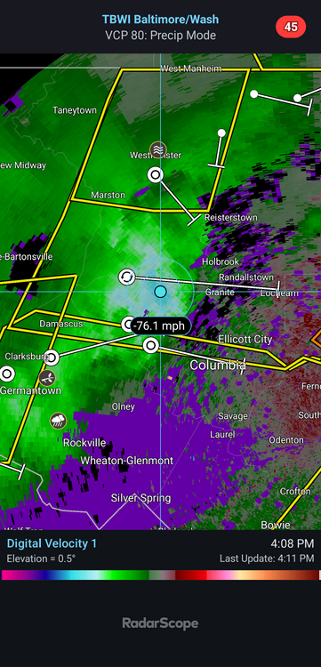
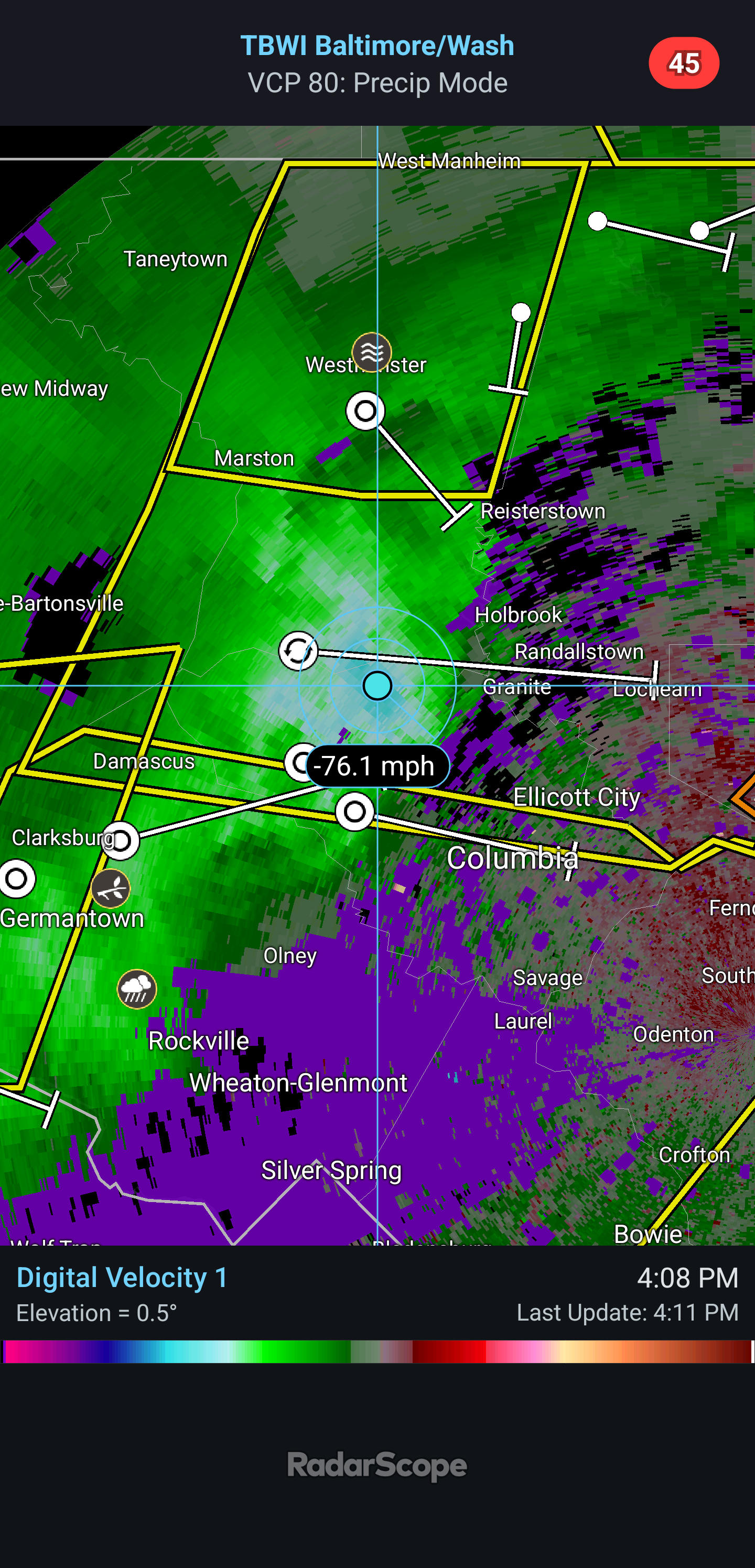
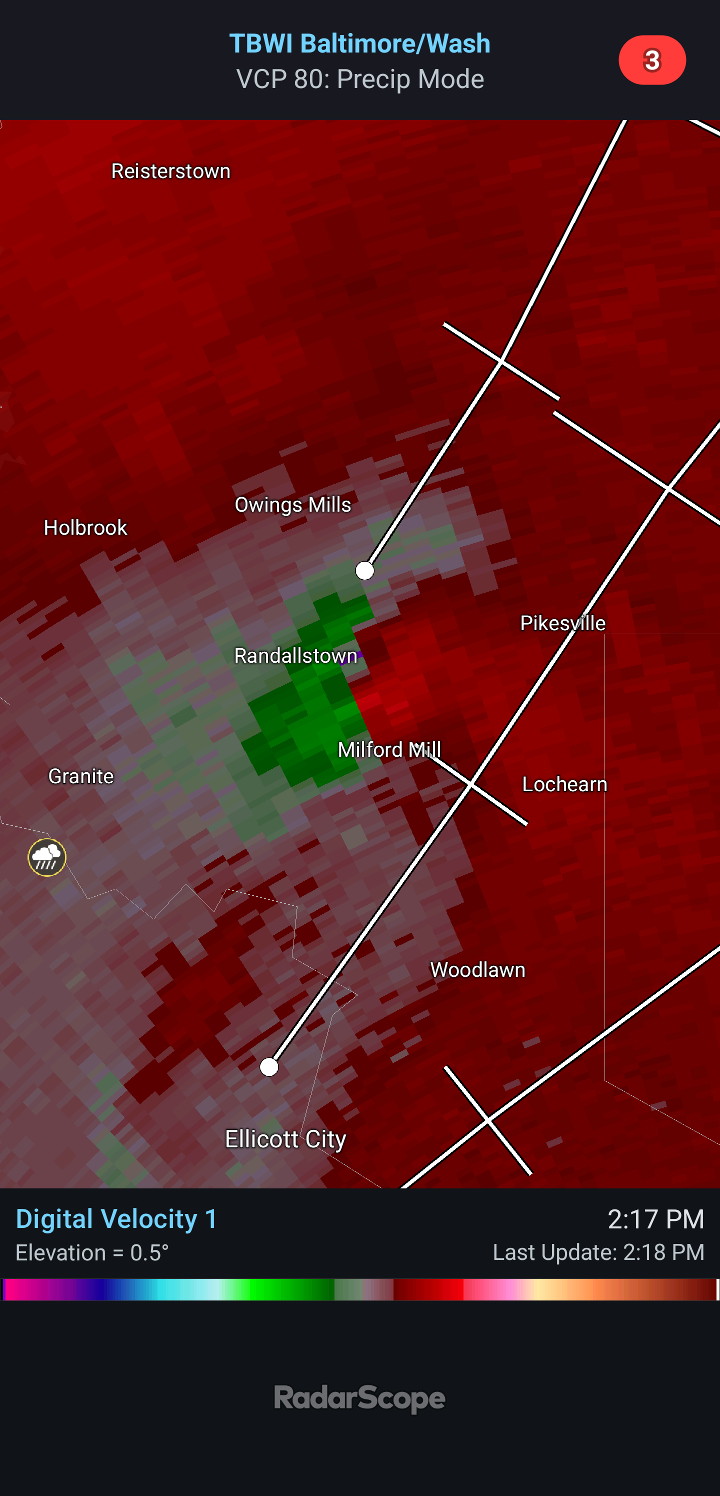
Terminal radar reveals velocities nearing 80mph. Despite was some have noted via the KLWX radar with weakening, terminal radar is showing a completely different picture.
- 2,604 replies
-
- 1
-
-
- severe
- thunderstorms
- (and 7 more)
-
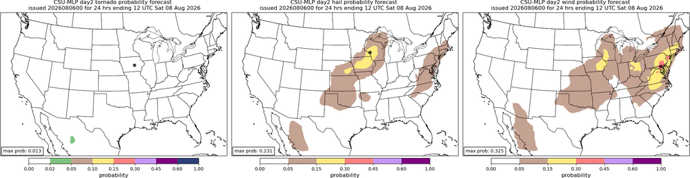
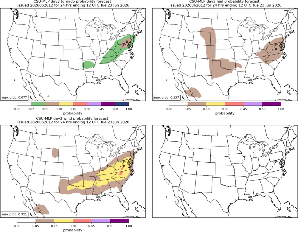
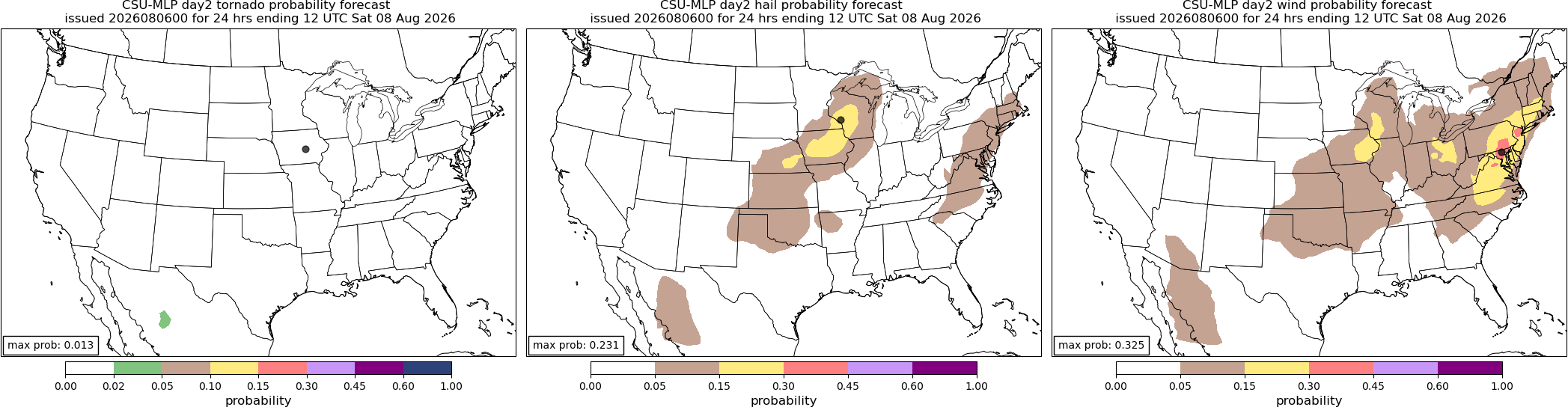
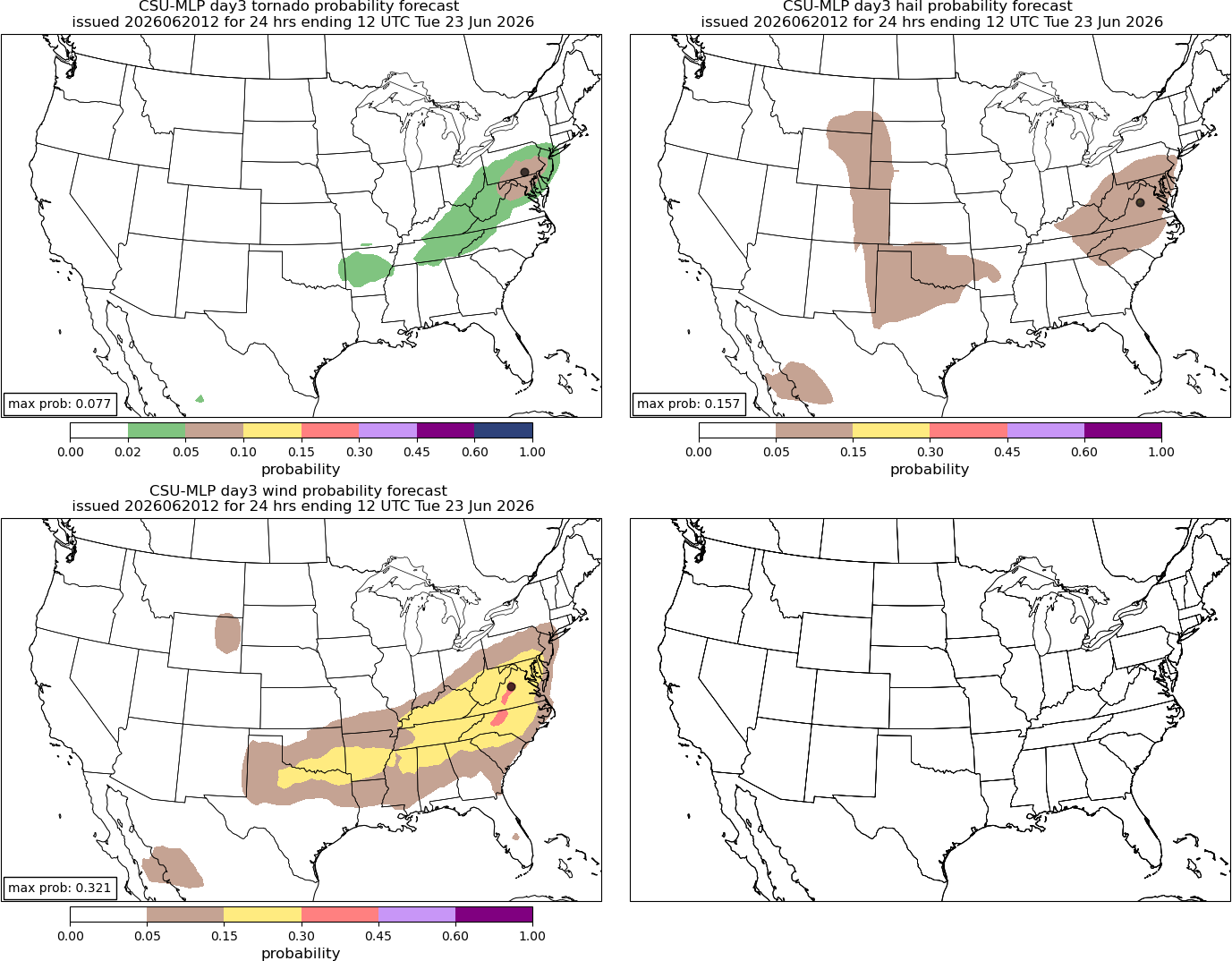
Csu wind probabilities are fairly high tomorrow. SPC only has a smaller marginal risk though, maybe it gets expanded and/or upgraded.
- 2,604 replies
-
- 1
-
-
- severe
- thunderstorms
- (and 7 more)
-
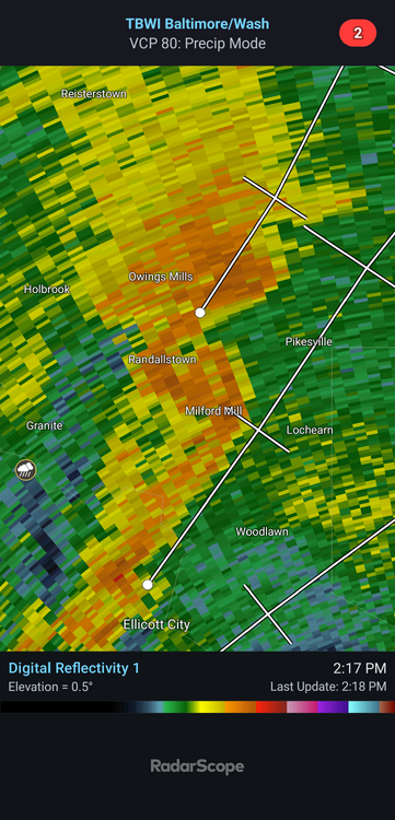
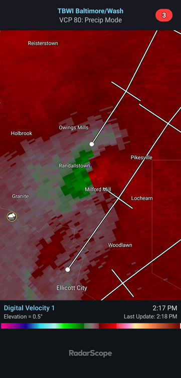
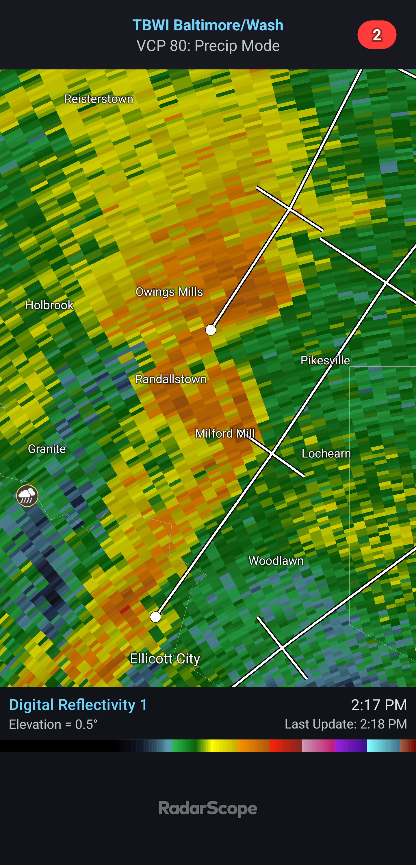
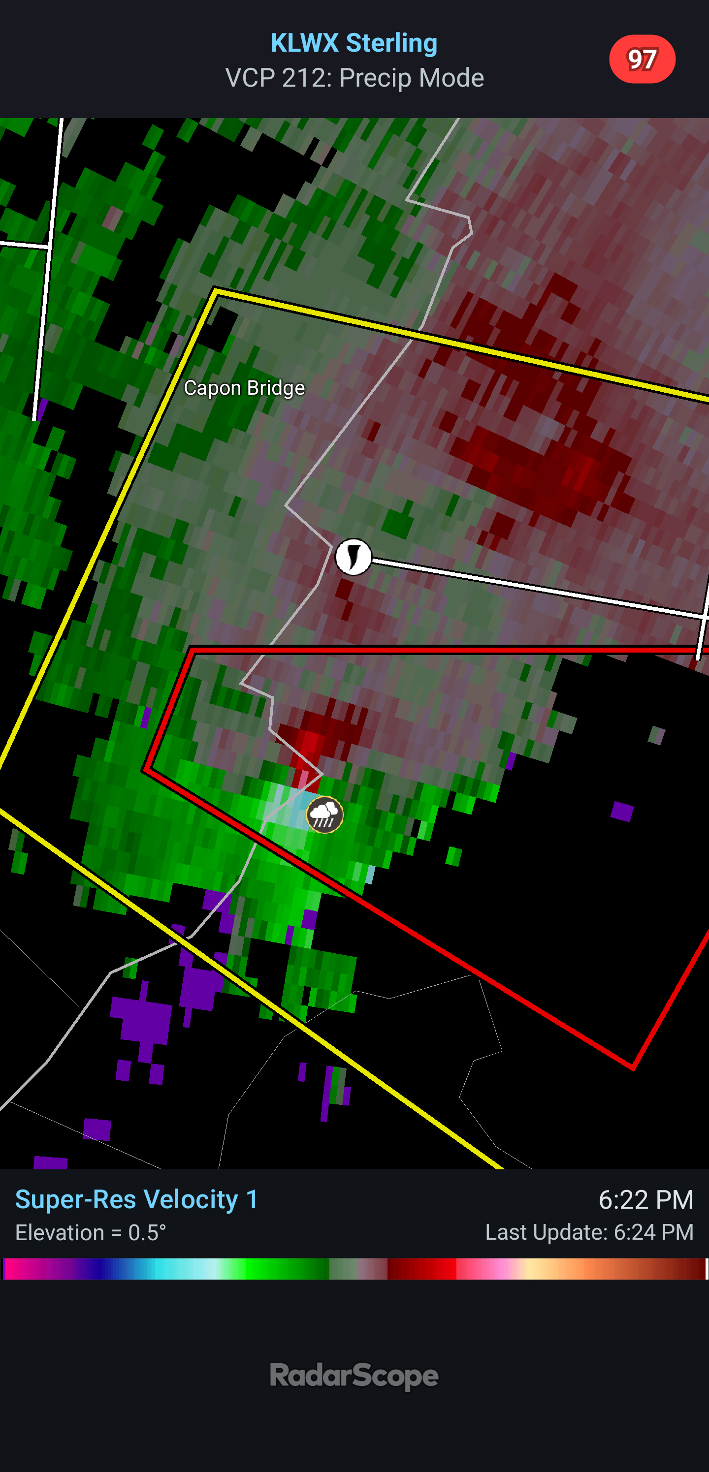
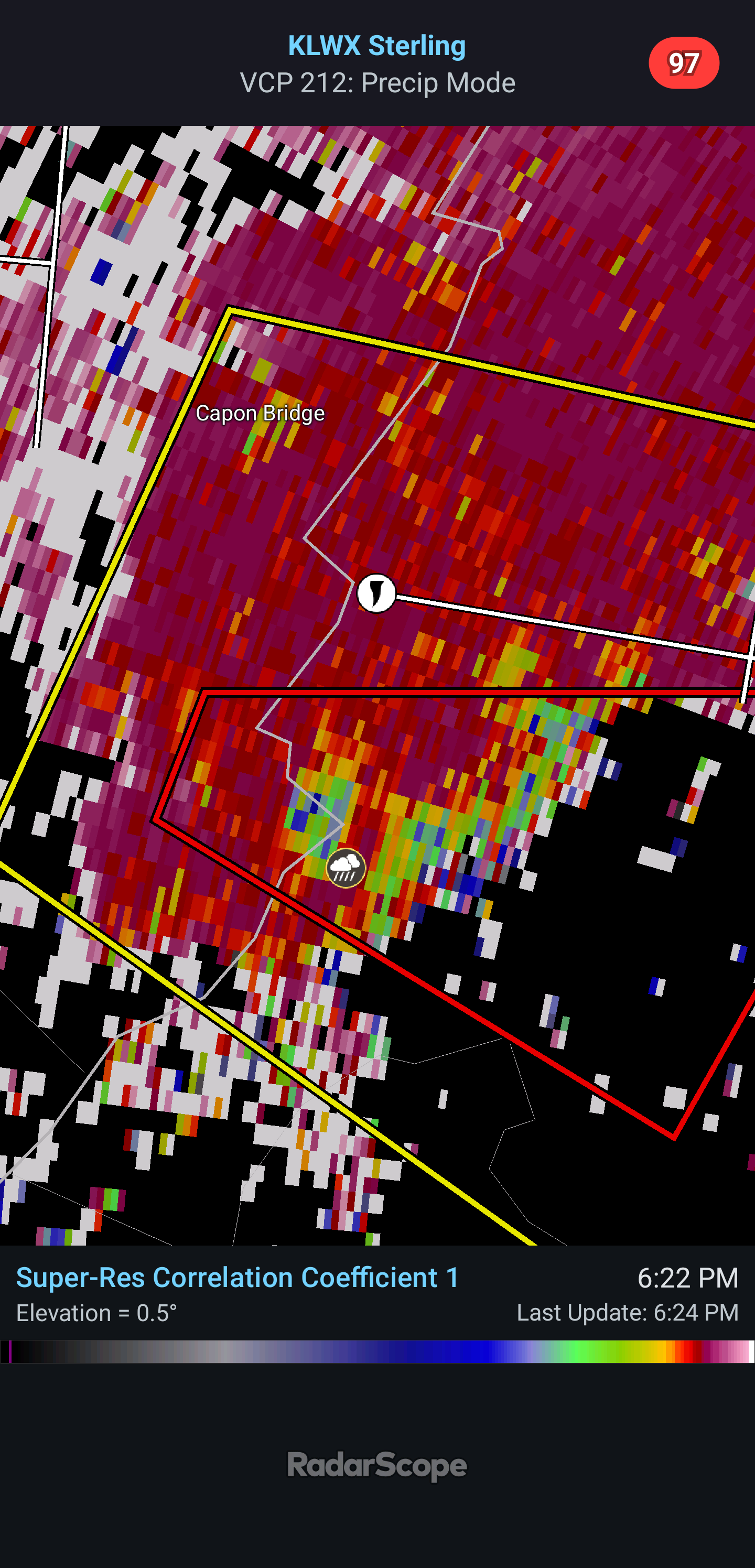
Via terminal radar possible tornado just north of Milford Mill
-
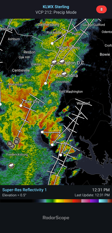
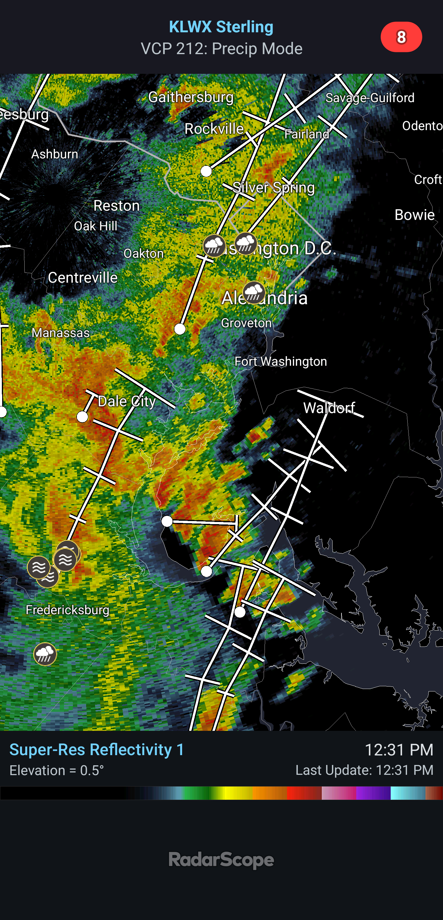
Looks like some supercells are already trying to get going as they move towards DC. A lot already have a bit of a rotation going on them.
- 2,604 replies
-
- 2
-
-
- severe
- thunderstorms
- (and 7 more)
-
Wow
- 2,604 replies
-
- 2
-
-

-
- severe
- thunderstorms
- (and 7 more)
-
E PA/NJ/DE Summer 2026 Obs/Discussion
WxUnit replied to PhiEaglesfan712's topic in Philadelphia Region
Tornado watch out for the area, goes until 9pm. 40% Tornado, 40% hail, 70% wind probabilities. -
E PA/NJ/DE Summer 2026 Obs/Discussion
WxUnit replied to PhiEaglesfan712's topic in Philadelphia Region
Radar does look pretty bad for anything of significance. Seems odd to me with all we had at play today that we seem to be failing. Oh well -
E PA/NJ/DE Summer 2026 Obs/Discussion
WxUnit replied to PhiEaglesfan712's topic in Philadelphia Region
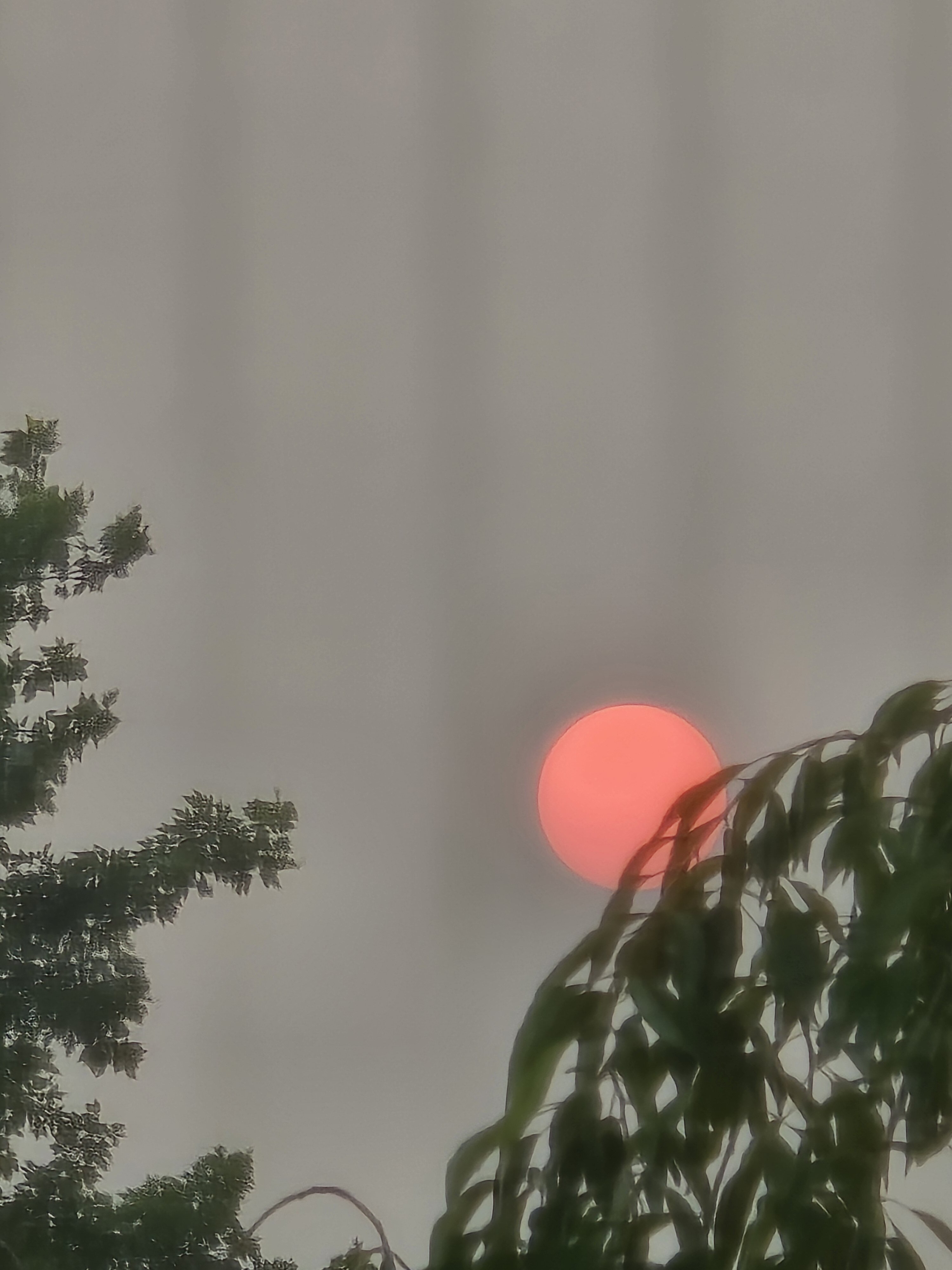
Almost like 2023 with the red glow during the sunset and through the smoke.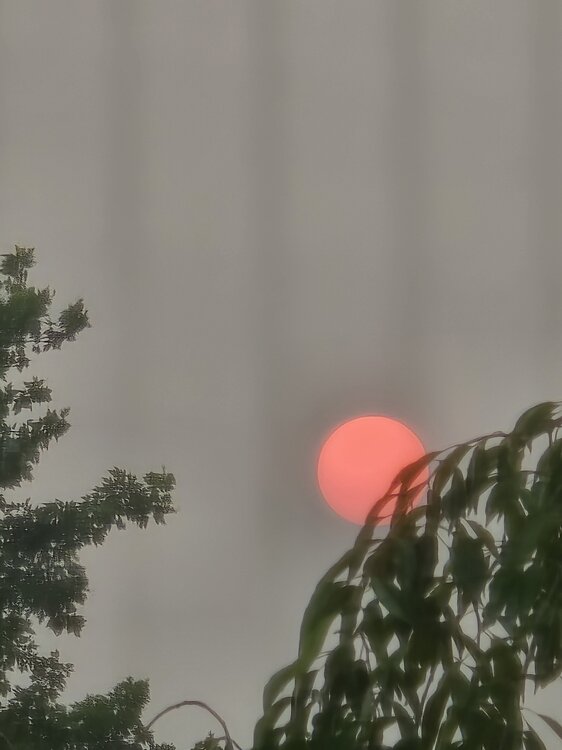
-
E PA/NJ/DE Summer 2026 Obs/Discussion
WxUnit replied to PhiEaglesfan712's topic in Philadelphia Region
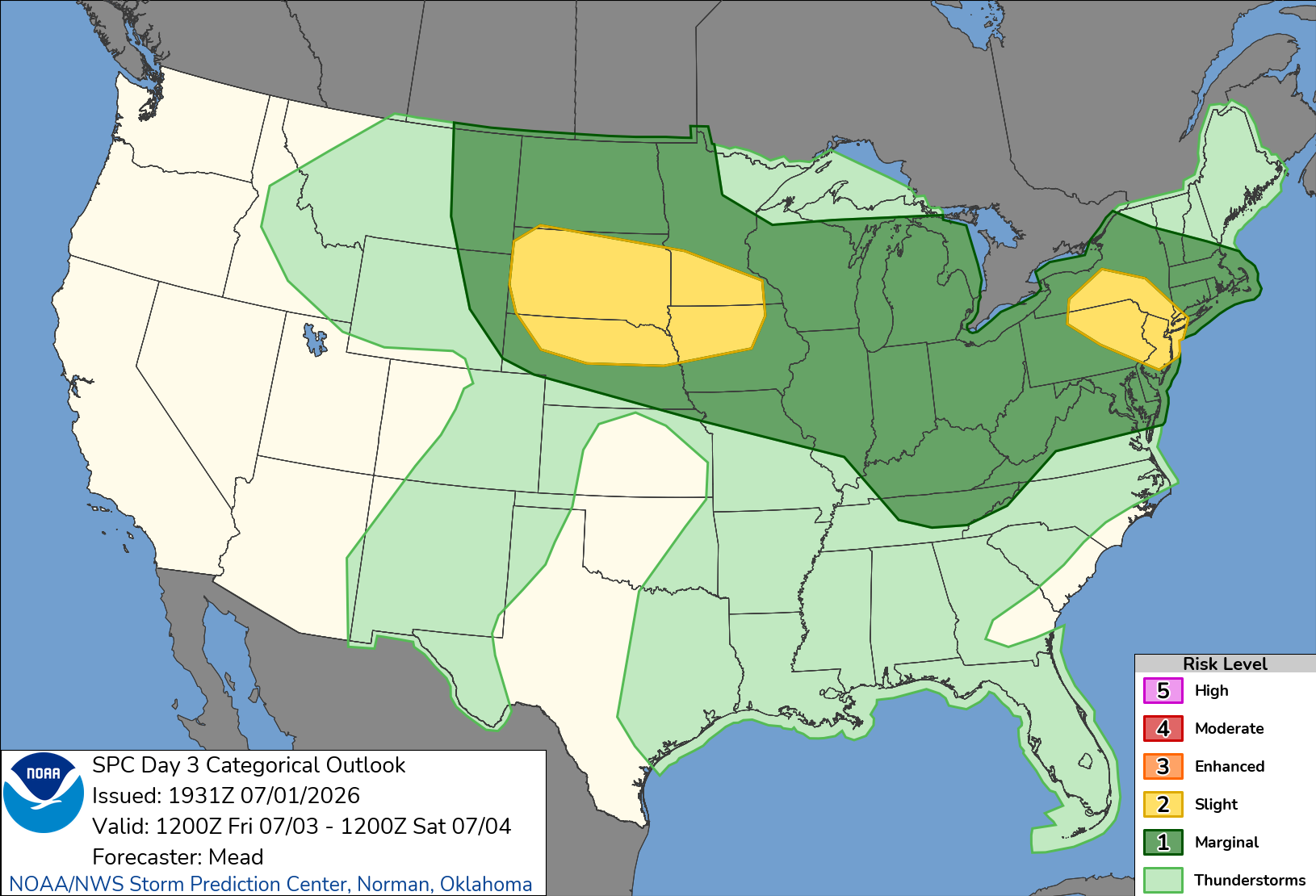
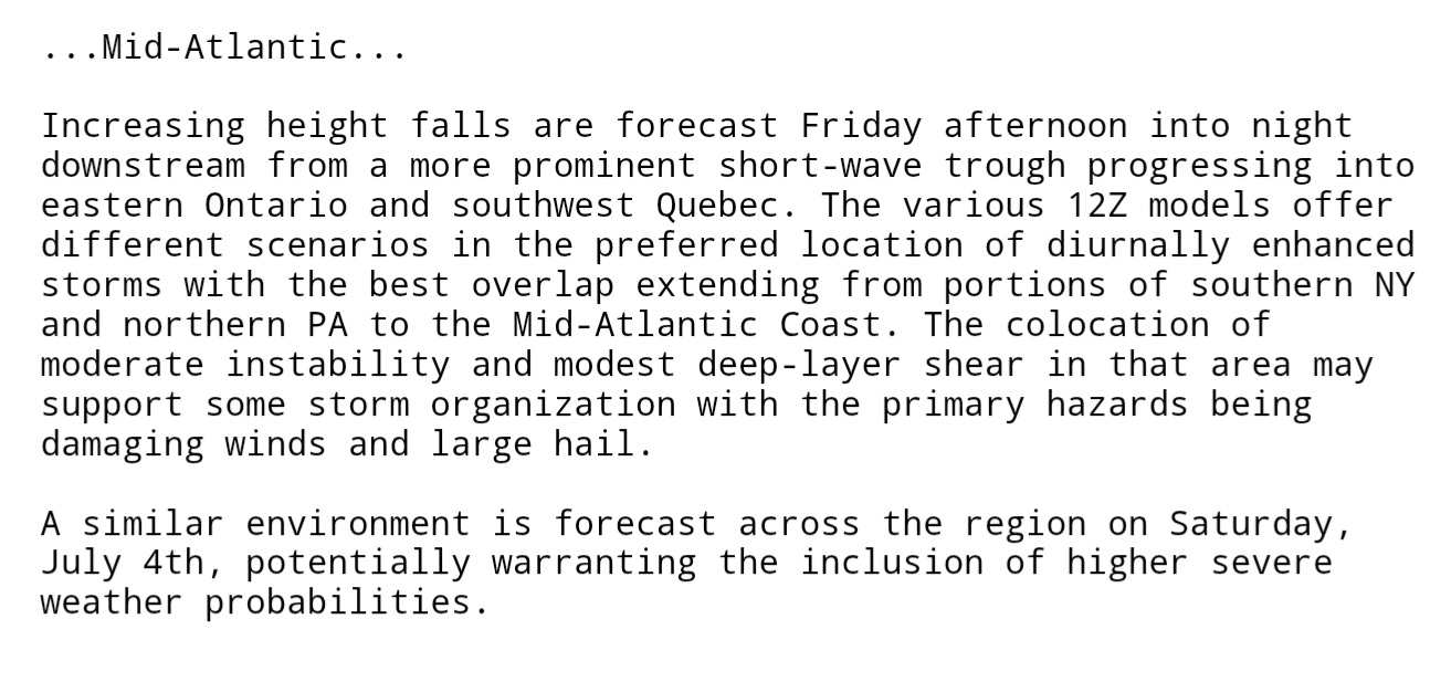
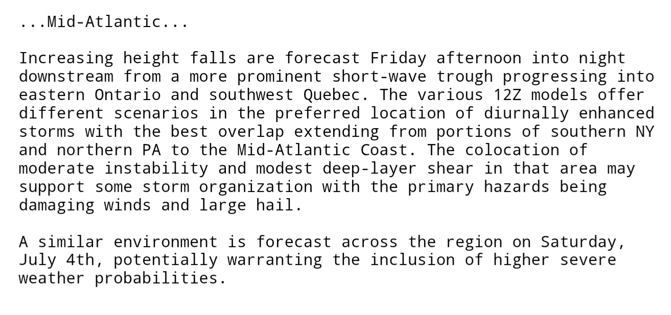
Need to monitor both Friday and Saturday for severe weather. As of right now Saturday looks to have the best potential.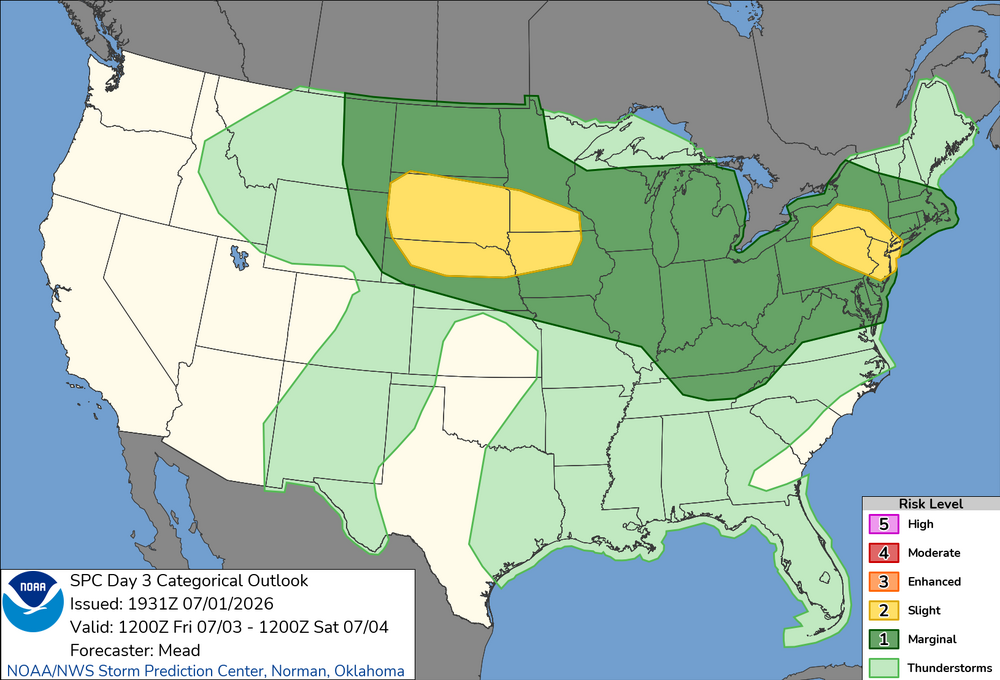
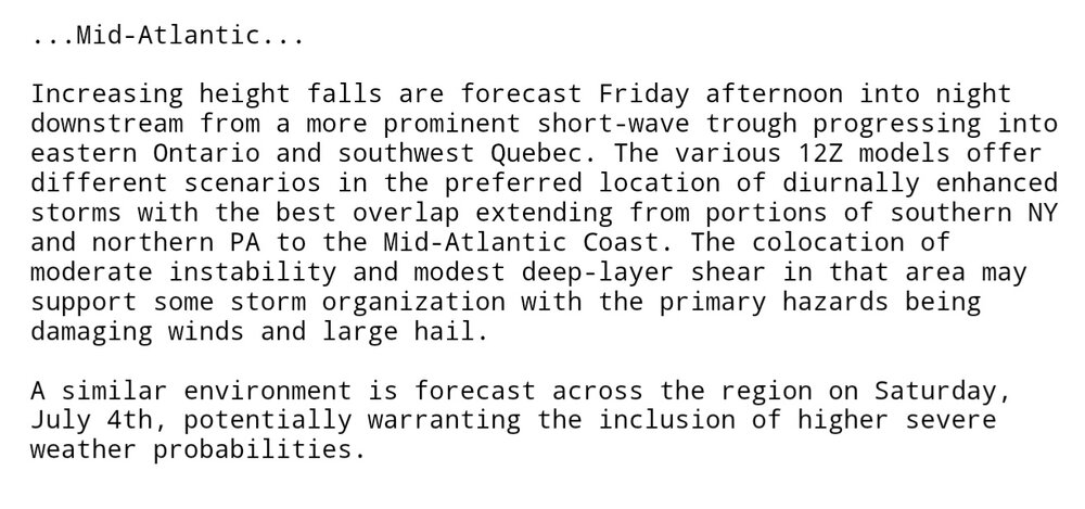
-
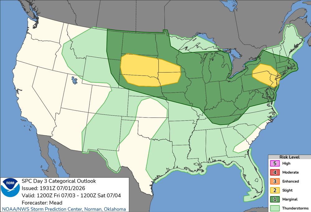
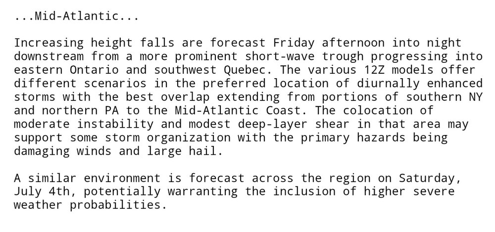
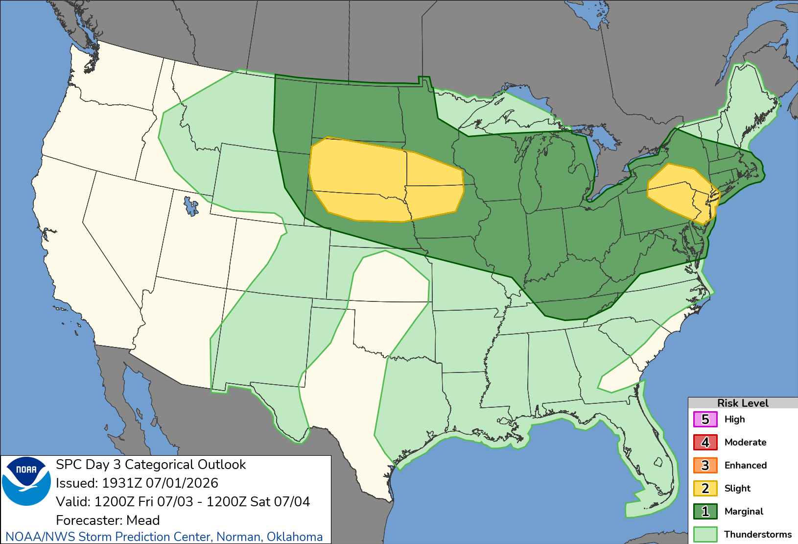
SPC mentions both Friday and Saturday have very similar severe setups. A slight risk was added to the northern areas in the new Day 3 outlook with higher potential mentioned as well.
-
E PA/NJ/DE Summer 2026 Obs/Discussion
WxUnit replied to PhiEaglesfan712's topic in Philadelphia Region
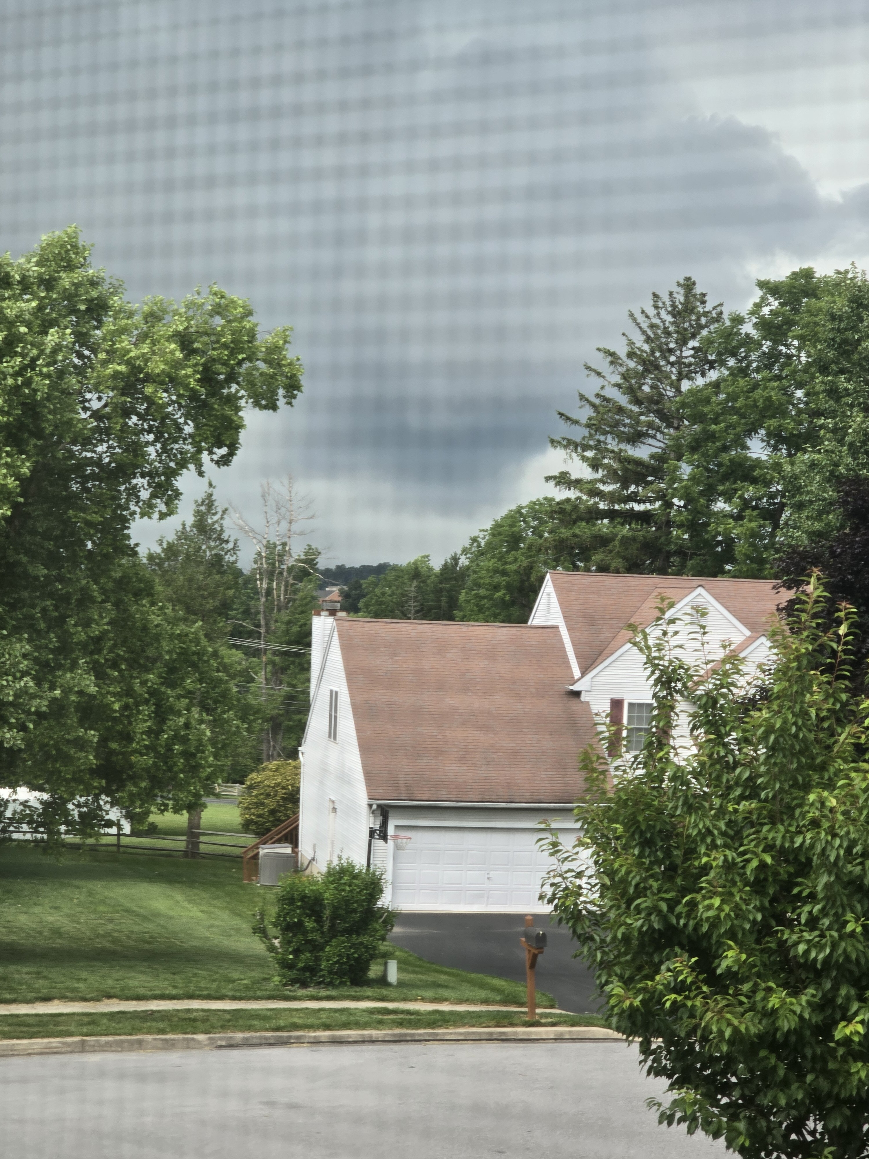
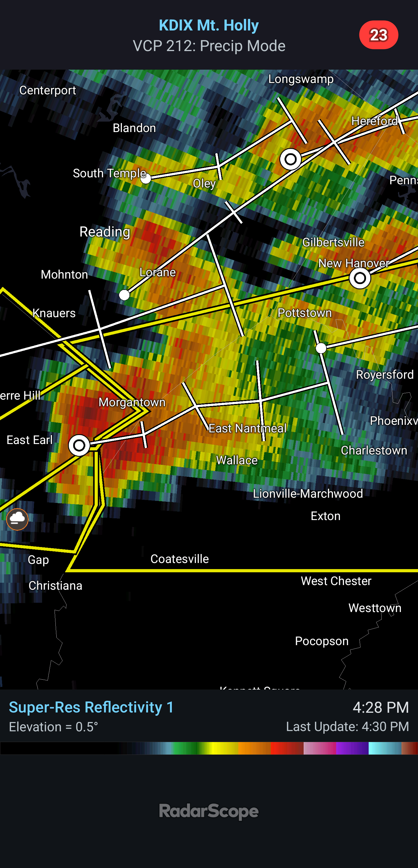
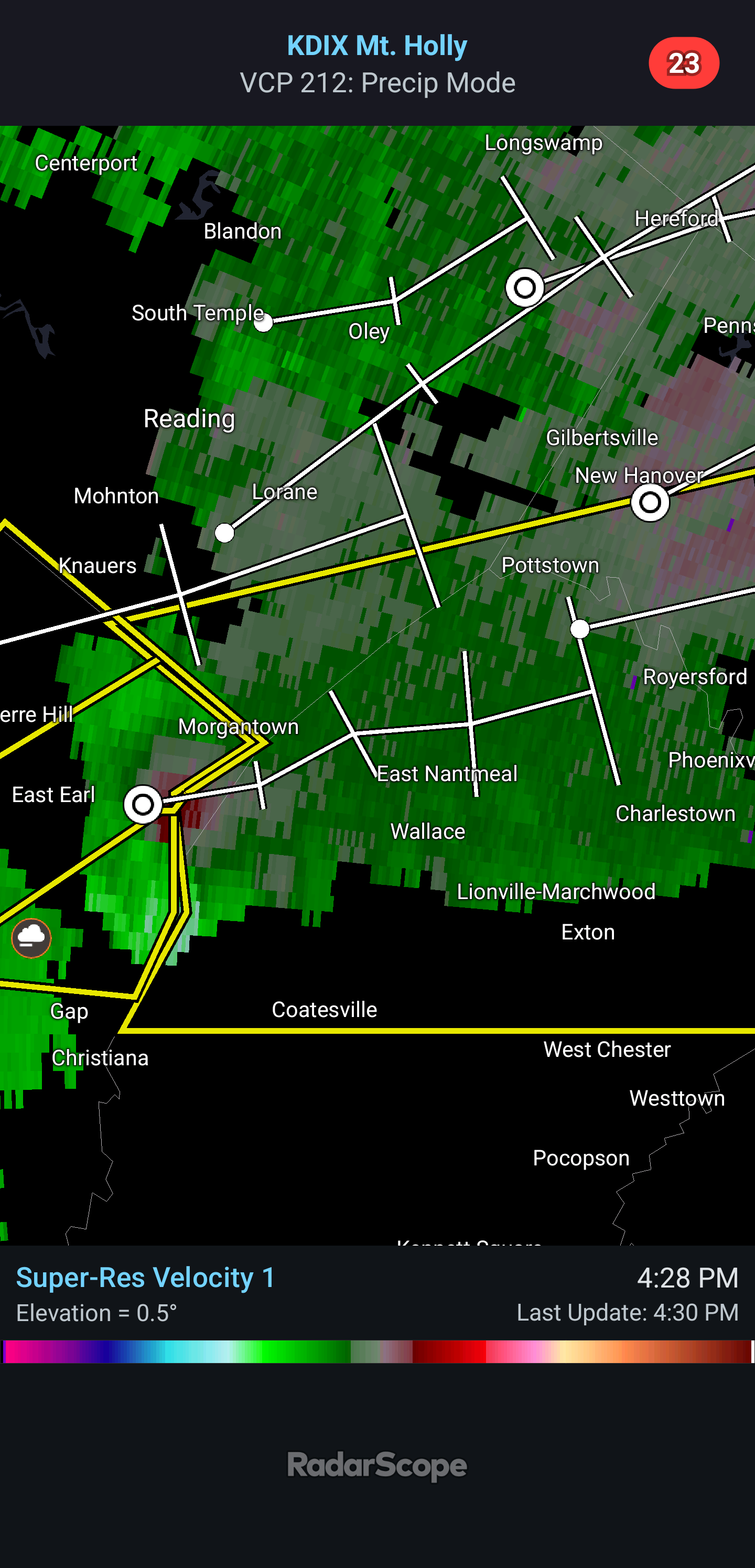
Earlier in the Exton PA area where the rotating storm went just north. Was able to photograph a funnel cloud from it. Was rapidly rotating like nothing Ive seen before.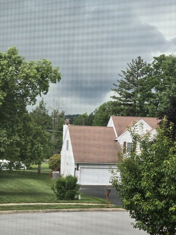
-
E PA/NJ/DE Summer 2026 Obs/Discussion
WxUnit replied to PhiEaglesfan712's topic in Philadelphia Region
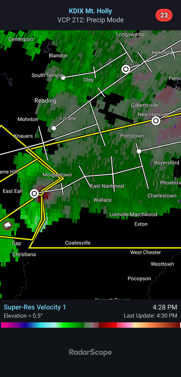
Supercell coming into Chester County with decent rotation. Large rotating wall cloud already reported on it.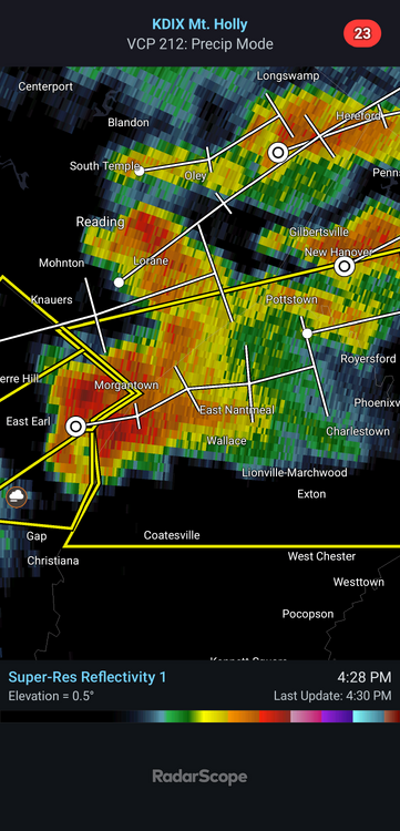
-
WPC has a slight risk of excessive rainfall and seems to indicate some areas could see 2+ inches of rain. "Current probs off the latest ensembles and National Blend indicate a large zone of 30-50% probs for >2" across the aforementioned area above with deterministic outputs closer to 2-3.5" into parts of Southern New England. The 00z HREF (only covers through 00Z 6/23) and 00Z REFS indicate 30-60% neighborhood probabilities for at least 2" per 6-hrs from D.C. to NYC and would be enough for some urban flash flooding concerns."
-
Probabilities of all severe hazards seemed to go up significantly between the 6z and 12z runs. Definitely worthy of a watch for the next couple of days.
.thumb.png.77c9dc49b2ce92bc38e4f31af79c039f.png)
- 2,604 replies
-
- 3
-

-
-
- severe
- thunderstorms
- (and 7 more)
-
E PA/NJ/DE Summer 2026 Obs/Discussion
WxUnit replied to PhiEaglesfan712's topic in Philadelphia Region
I wouldnt really throw in the towel yet. The NAM runs, while still an overall miss, trended better. This system itself is also super dynamic and is expected to spawn a tornado outbreak in the Midwest the day before. I would never count out a strong low pressure system moving just to our north at this time of year. I think this is one that could surprise. -
Some potential beginning to show up next week with more consistent warmth and moisture setting in. Multiple days are showing up both on the CIPS and the CSU prediction models, the SPC also gave a mention On Wednesday and Thursday, the cold front is forecast to move slowly southeastward across the southern Plains and mid Mississippi Valley, extending east-northeastward into the Mid-Atlantic. A severe threat could develop along and ahead of the front each afternoon and evening. However, uncertainty concerning the exact location of the front is substantial at this extended range.
- 2,604 replies
-
- 1
-
-
- severe
- thunderstorms
- (and 7 more)
-
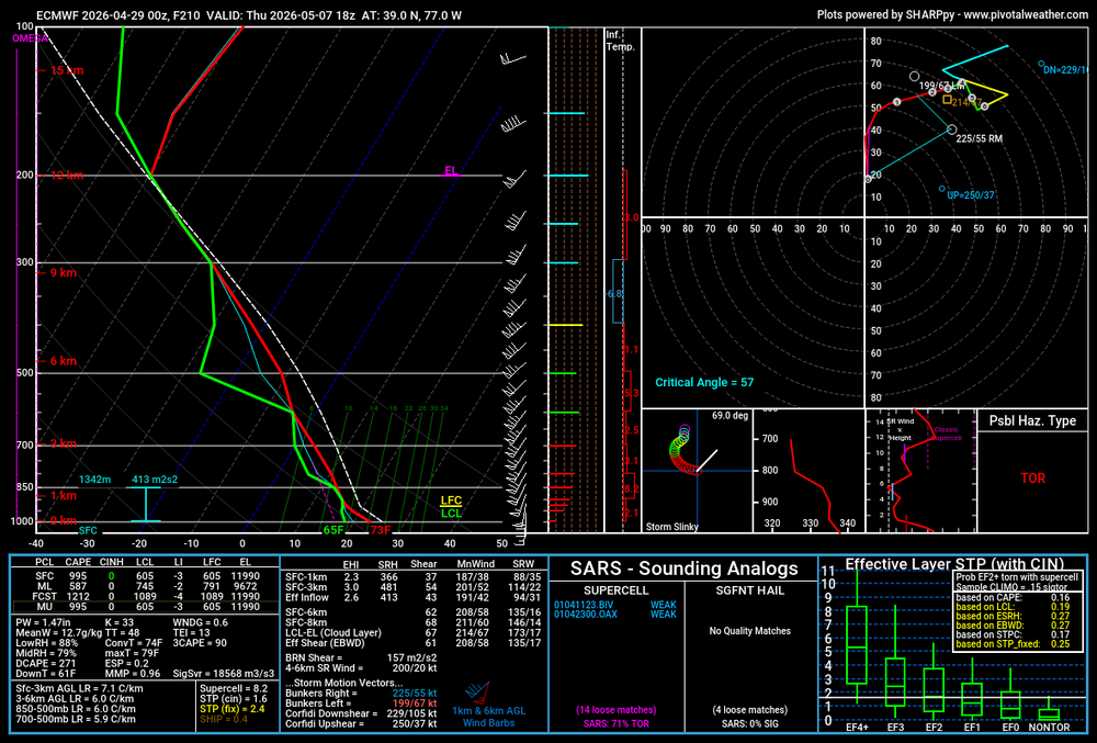
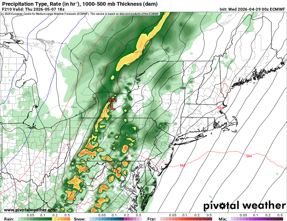
00z Euro had an interesting look for next Thursday. Decent shear and placement of the low, would like to see some more instability though. Still, its far out and possibly something to track over the next week.
- 2,604 replies
-
- 2
-
-
- severe
- thunderstorms
- (and 7 more)
-
E PA/NJ/DE Spring 2026 Obs/Discussion
WxUnit replied to PhiEaglesfan712's topic in Philadelphia Region
This is exactly what I think. The low level jet is so strong with this event I and think the general region is bound to see some very strong winds mixing down to the surface with storms. I also think we can't rule out the earlier supercell threat, which some models are hinting at in southeast PA. -
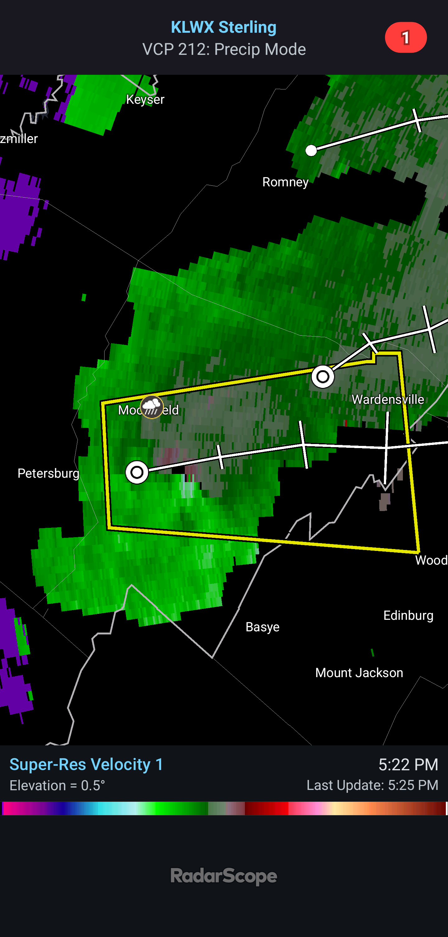
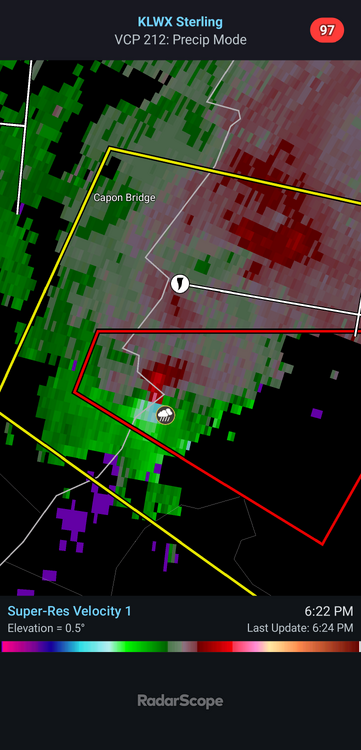
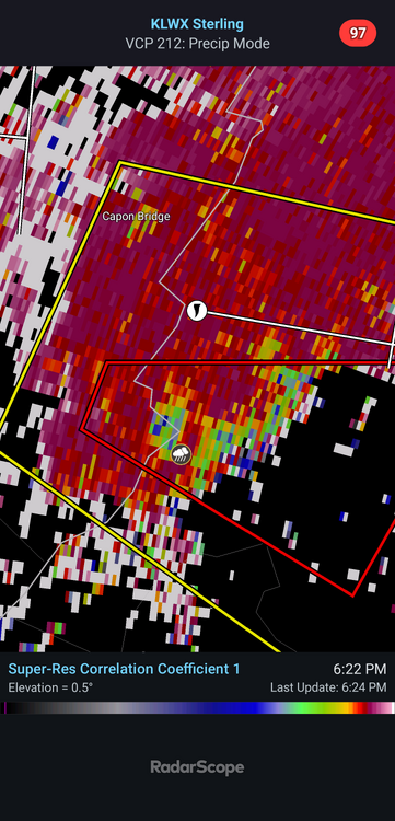
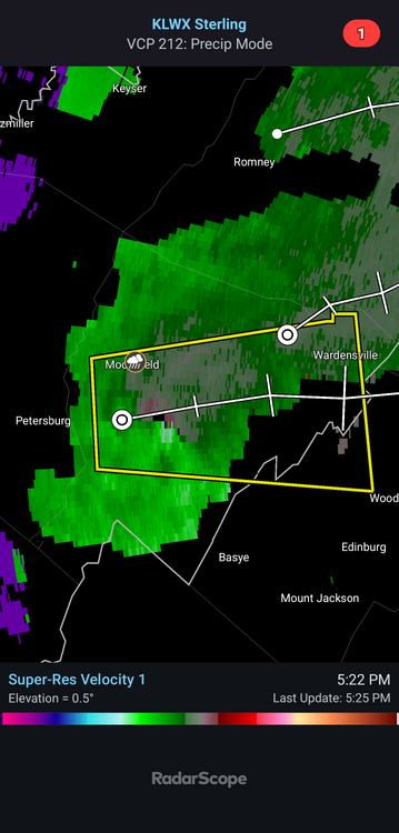
Pretty good cell going in West Virginia. Tagged for a possible tornado as well.
.thumb.png.e41318926ae4358472eed3b9409a5617.png)
- 2,604 replies
-
- 1
-
-
- severe
- thunderstorms
- (and 7 more)
-
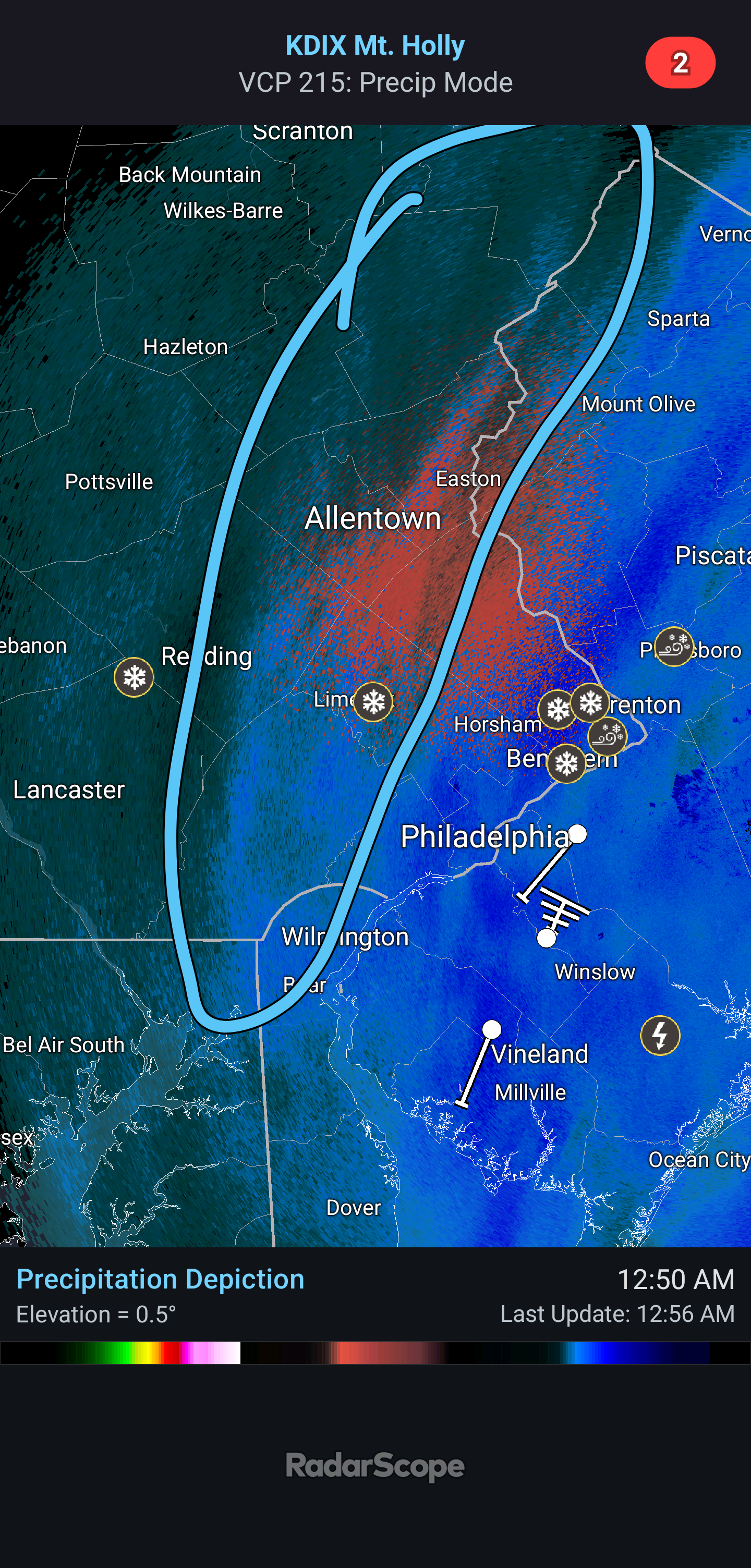
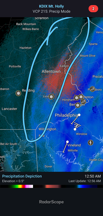
A nice secondary band appears to have formed further west. Moderate snow and 28.8⁰F.
-
The band looks to be expanding out a little more each radar scan. Would love to see it expand out into the burbs for everyone. Would be great to see.
-
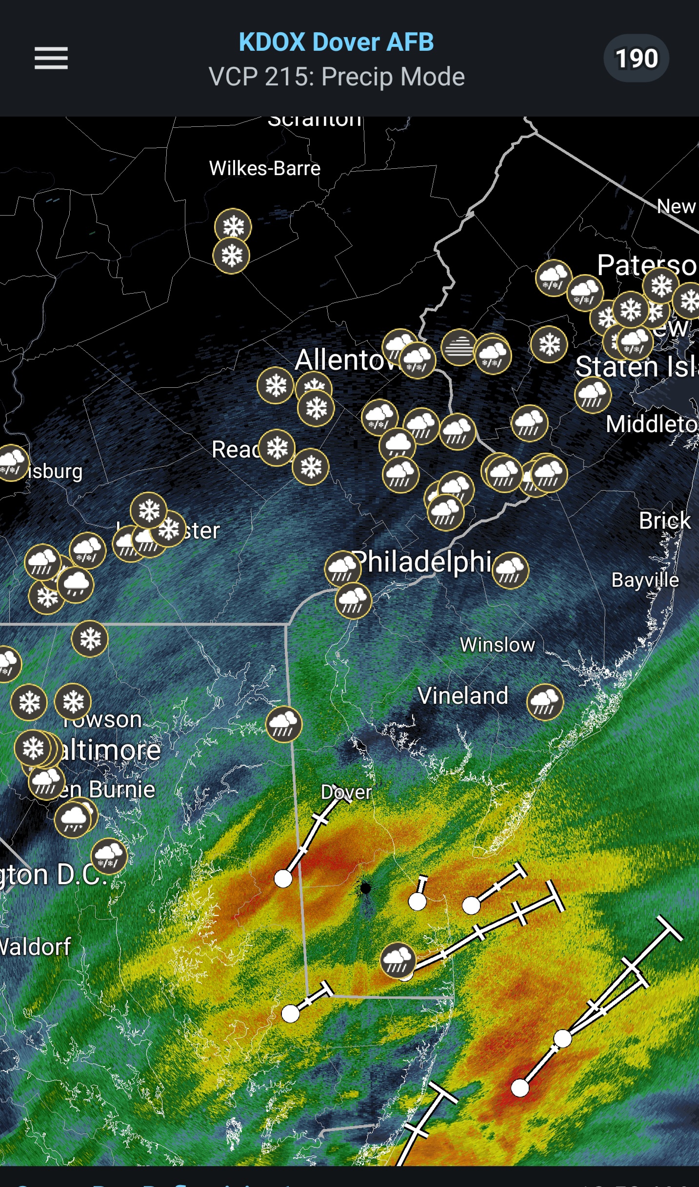
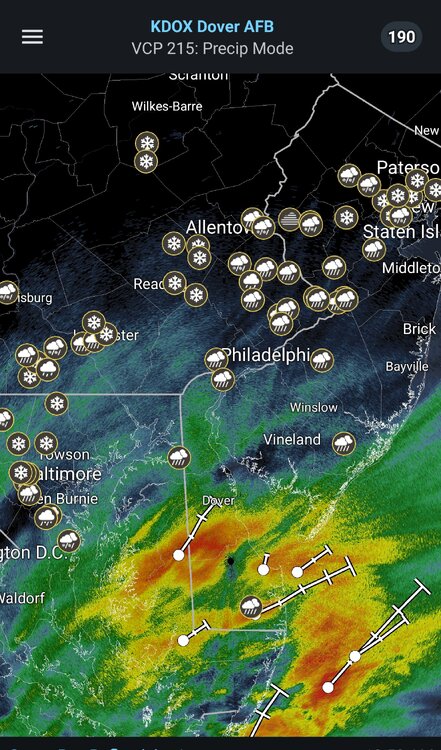
Returns coming out of Delaware are very encouraging!
-
Current sitting at 34.5⁰F with light snow falling. No accumulation yet, probably won't see much until late afternoon.
-
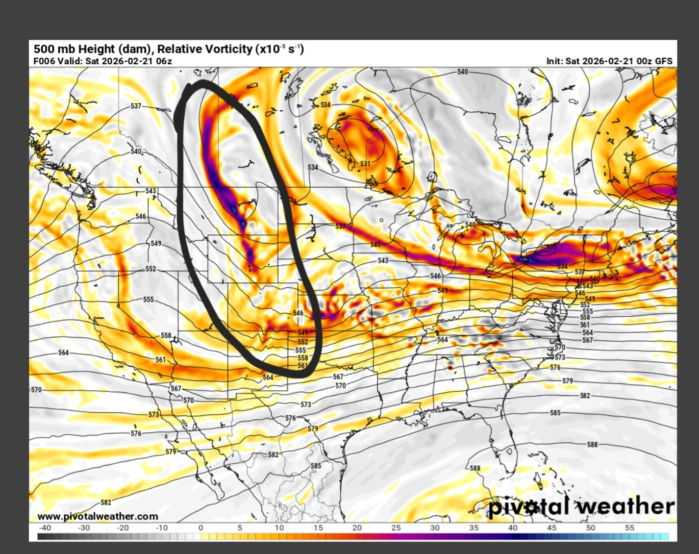
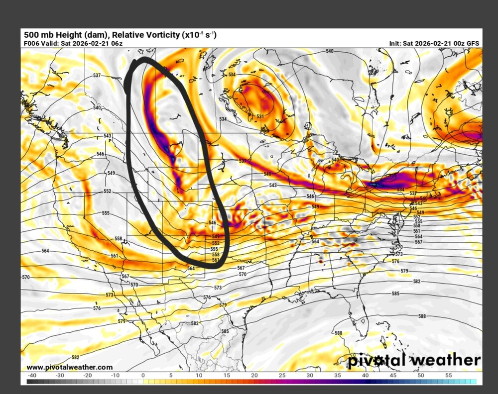
For reference at six hours out...

.png.5b3b1af0e77188154c10940bebb58281.png)


.png.c3678c42b33551cb499b1a26daa194dd.png)