wthrmn654
-
Posts
3,953 -
Joined
-
Last visited
Content Type
Profiles
Blogs
Forums
American Weather
Media Demo
Store
Gallery
Everything posted by wthrmn654
-
OK what did i miss? Just got back from a house fire on shelter Island.
-
Can't get a freaking noreaster anymore only 1 in the past 2 years possibly 2...
-
Spring this year may be one of memories... it's been forever ago qr have had this much cold, ice and water temps in the 30s . Unless that's a big big stretch of 70s/80s early on i can't see it getting warm for a while unless your away from shorelines.
-
You might just need some drugs lmao
-
You literally said cmc looks like crap just before he posted it looks crappy...
-
Average the left and right tracks and it will probably be the overall outcome
-
Can you or other pros please do model run analysis from now on, you are way better then those saying it's west, it's east, huge hit, not a hit, etc. Confusion
-
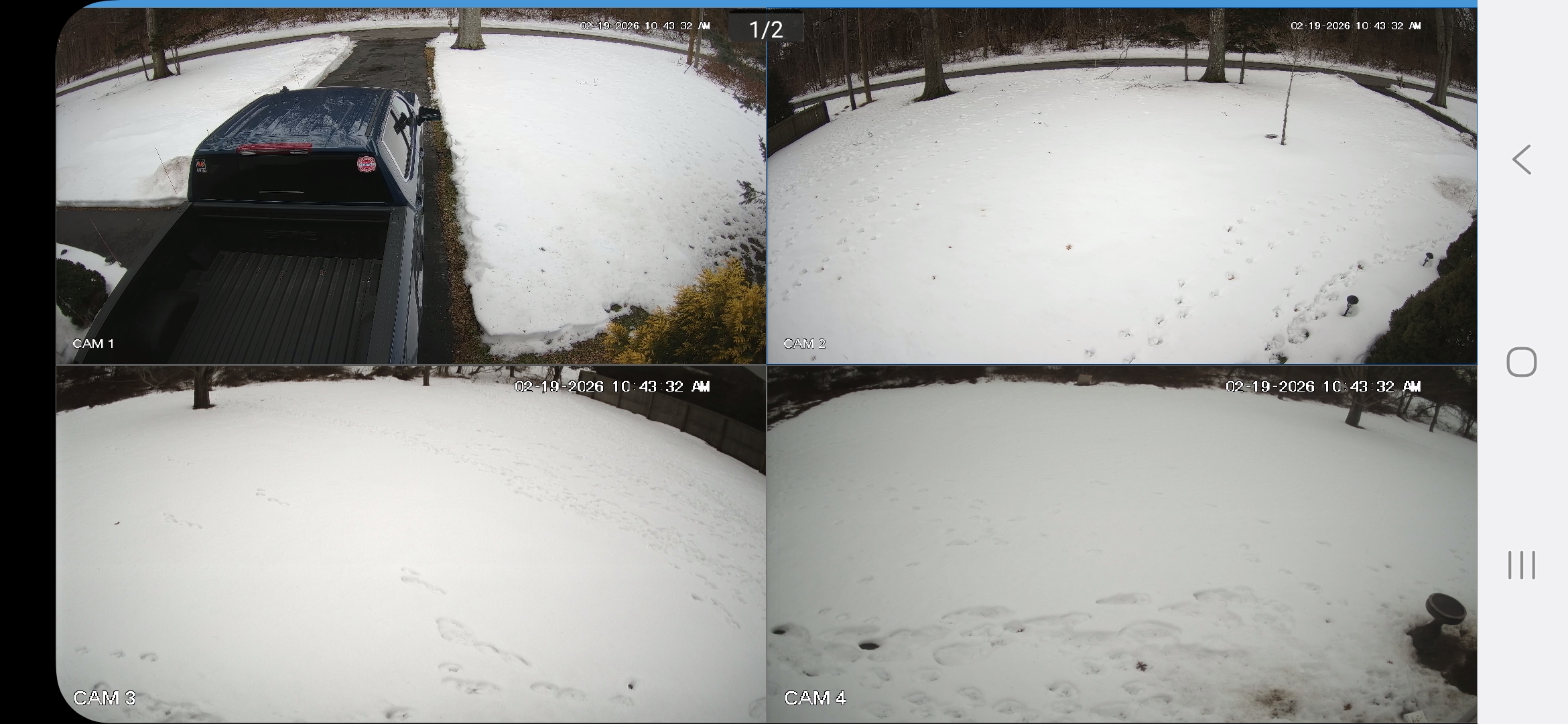
Well see based on what I'm seeing , it's 4-5 inches thick still as of this morning. Driving around other then shoulders, areas where wind blew snow away. Everything is covered solidly, even the ice on water is doing really well, but sloth very obvious reductions in thinner areas or where open water and currents is normal.
-
Looks almost as good when we got it bank in January lol
-
The offical observation says a trace at 7 am yesterday. Per nws
-
You're posting the same map on every sub forum in here... why? Are you trying to get the entire east coast to hate you? But it does look pretty if only it could verify
-
High if 36, down to 34 right now, the not hitting 40°F stretch continues worn 4 or 5 inches of solid snow cover still evident... going on nearly 30 days of not hitting 40 since jan 22nd.. Central Park had snow depth of over an inch end yesterday at 23 days, tired at 21st longest with longest ever being 56 days back 2/17/48
-
Seems fitting but this is like the winter Olympics final game, models version USA, versus, Europe, versus the other countries. Who will be crowned gold? Stay tuned
-
Idk if it was posted here or on Facebook but the snow depth forecast i think from euro was way off.. showed long island having no snow cover left by o think yesterday. Meanwhile I still have over 4 or 5 inches on ground
-
31.7
-
31.7 This cold is resilient this winter jeez
-
32.3
-
Sounds funnier though
-
33.6 and dropping whore frost tonight. I think unless that's differentfrom freezing fog hmm now idr
-
It's down to 34 already!
-
Which snowman here is obsessed with wind events? This could be your storm
-
Correction high of 37.5 now 35.8. Still haven't hit 40. Quite the impressive stretch to be honest.
-
Surprisingly that's more snow showing then grass only along road edges is grass showing lol it's down to 36..
-
When snowman runs out is weenies
-
Currently 37 and a little fog more hazy then Anthony