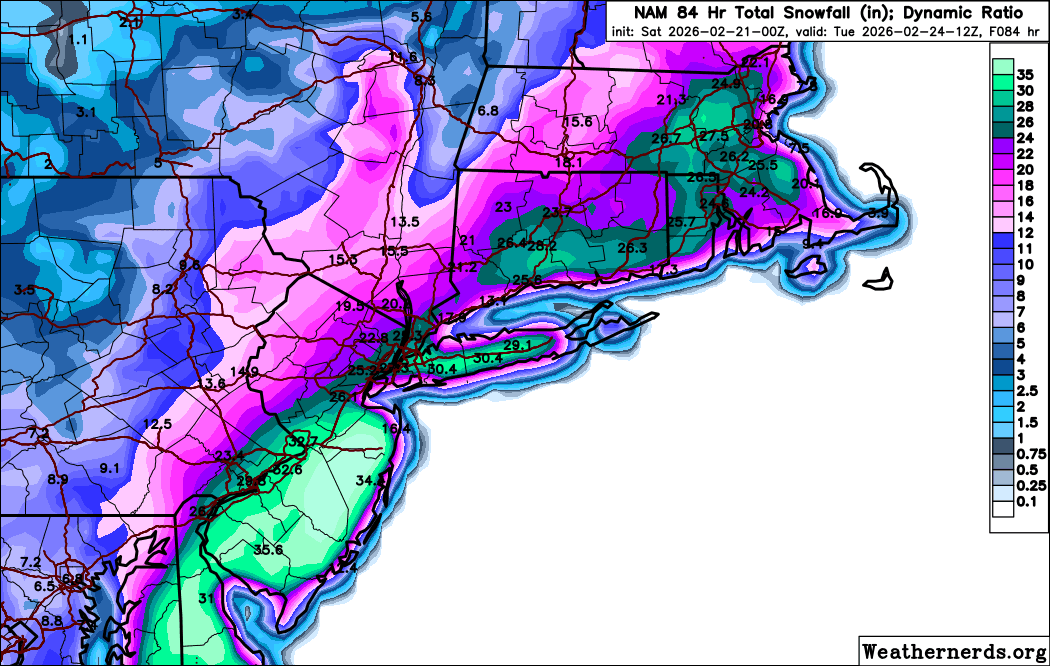
KEY MESSAGE 2...
Confidence has increased enough to warrant winter storm watch
issuance for the entire CWA. Latest 12Z guidance coming into
better agreement on potent northern stream shortwave energy
diving SW from wrn Canada and the northern Plains into the
plains and mid Mississippi valley by Sunday morning, phasing
with southern stream coming out of the SW states and Mexico to
carve out a deep closed low aloft over the Mid Atlantic and
induce rapid cyclogenesis off the Mid Atlantic coast, with the
surface low bombing out from from 1008 mb off the N Carolina
coast Sunday morning to 970-975 mb near 38-39N/71W by Monday
morning, then passing just outside the 40N/70W benchmark Monday
afternoon, GFS still more intense and closer to the coast than
the ECMWF, with its heaviest snow bands directly over the area
as opposed to just offshore. NAM and SREF have both trended
toward a heavier snowfall scenario as well, which has been a
good signal in past heavy snowfall events.
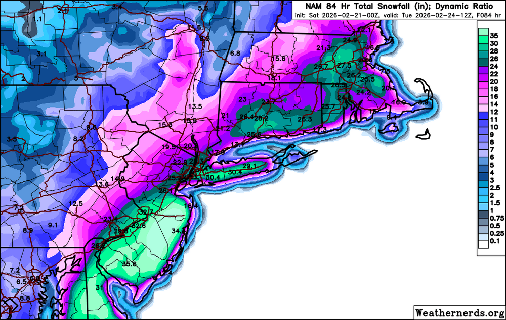
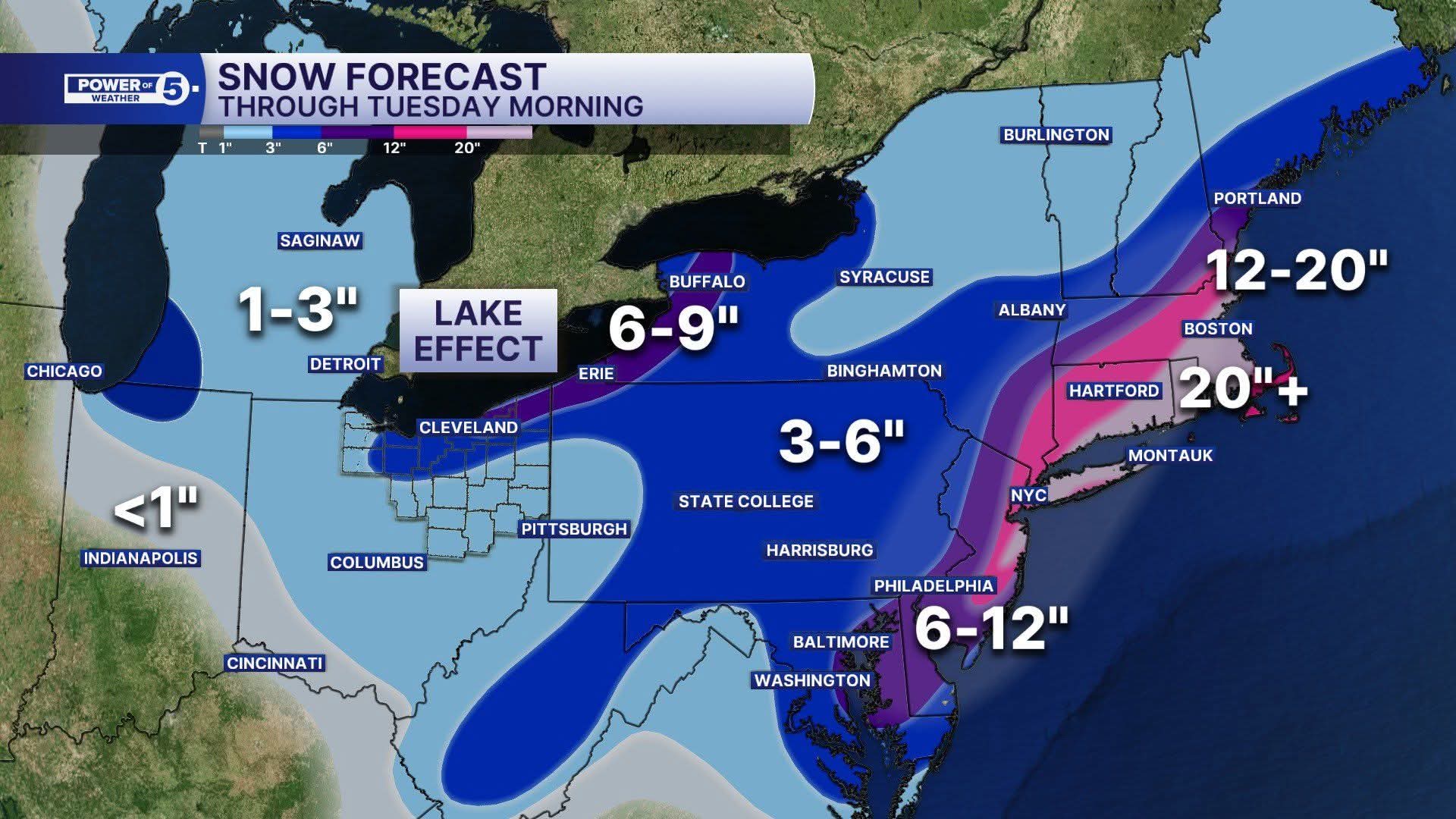
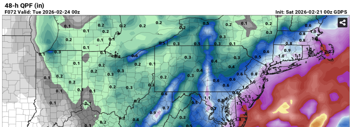
Snow should start Sunday morning, and may mix with rain at times
especially in the NYC metro area, NE NJ and western Long Island.
Then as precip intensity picks up later in the day Sunday
p-type should become all snow throughout. Heaviest snow looks to
fall from late day Sunday into Monday morning, then snow tapers
off Monday afternoon.
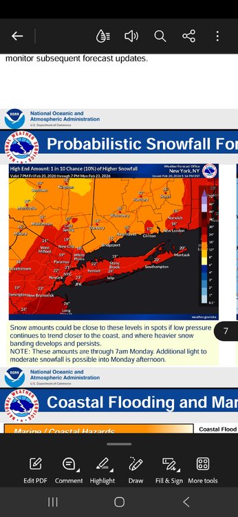
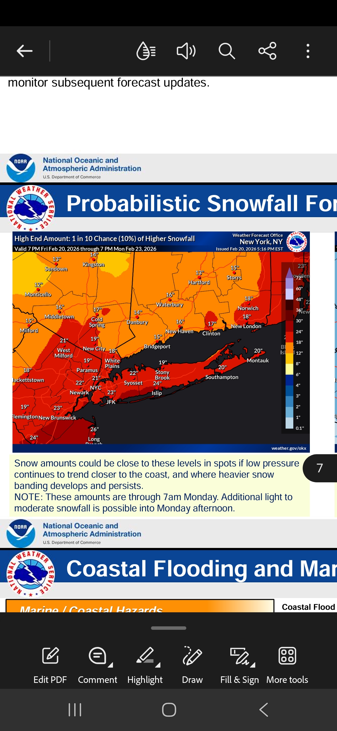
Greatest likelihood of seeing 6+ inches will be along the coast,
especially eastern Long Island where up to a foot of
accumulation is possible. Winds will also be strong Sunday night
into Monday morning especially along the coast as the sfc low
deepens, with blowing and drifting snow and some downed tree
limbs as winds gust to at least 40-45 mph, and possible blizzard
conditions in Suffolk, and near blizzard conditions elsewhere
along the coast including NYC. NAM/GFS both signal potential for
wind gusts to 60 mph late Sunday night into Monday morning,
though these winds can sometimes be overdone in heavy snow
events. If trends for heavy snow and strong winds continue to
increase and expand northward, the potential for blizzard
conditions could encompass all coastal areas.
.KEY MESSAGE 3...
Strengthening E-NE winds Sunday into Sunday night could produce
a surge of 2.5-3.5 ft, producing widespread moderate to
locally major coastal flooding along the back bays of western
Suffolk and srn Nassau, Peconic Bay, and western Long Island
Sound, and widespread minor to locally moderate flooding in NY
Harbor and Jamaica Bay, the lower Hudson River, and ern Long
Island Sound. The main high tide cycle of concern is Sunday
night. Areas of dune erosion are likely, with localized
overwashes possible along the ocean beachfront Sunday night into
Monday morning.
Additional coastal flooding will likely linger into the
Monday afternoon high tide cycle, with a strong northerly flow
limiting impacts somewhat to minor/locally moderate categories.
.KEY MESSAGE 4...