wthrmn654
-
Posts
3,953 -
Joined
-
Last visited
Content Type
Profiles
Blogs
Forums
American Weather
Media Demo
Store
Gallery
Everything posted by wthrmn654
-
15k without power long island says 84 mph at montauk lighthouse but I be to look at graphs to verify cross sound ferry says only 43 mph not sure what happened there....
-
Man the radar is exploding over ocean heading my way
-
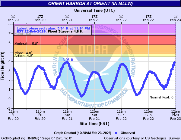
Anyone keeping eyes on tide gauges?! Unless I'm crazy, one out here on orient is getting very close to minor stage already and high tide isn't till 4 am!
-

-
My God that cell over ocean is getting nastier and nastier every update of radar
-
You're back from bed already? Lol
-
34 mph at cross sound ferry highest now, 45 at montauk lighthouse also highest
-
It's coming
-
Ny state dot plow truck over turned on sunrise highway this evening near Bayshore
-
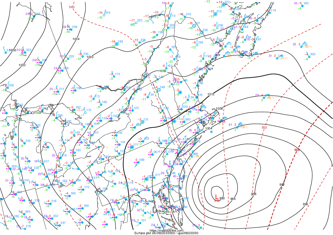
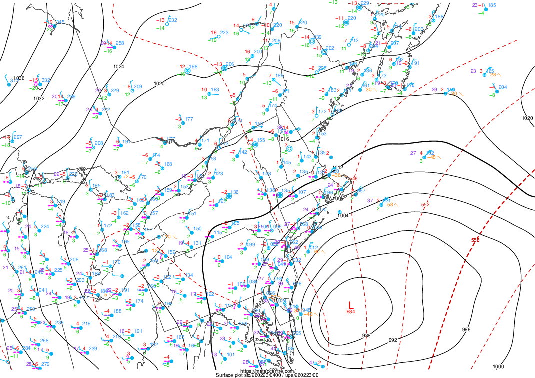
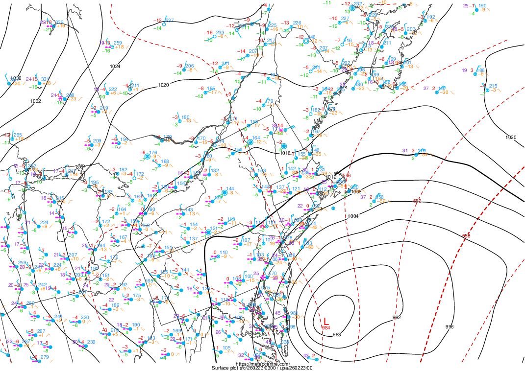
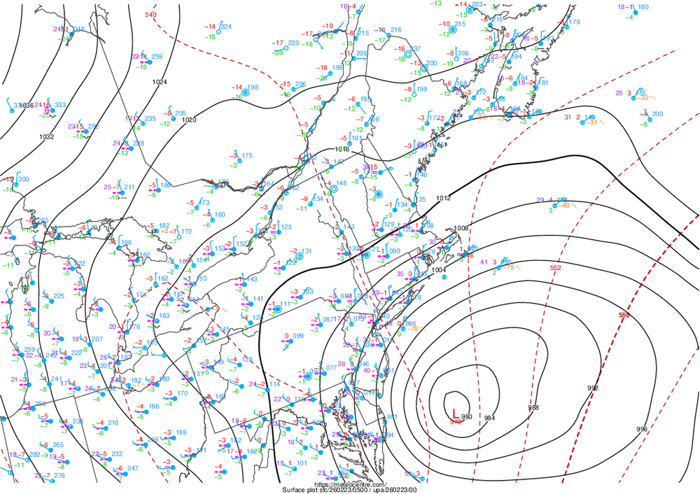
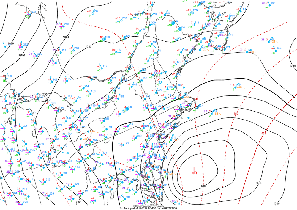
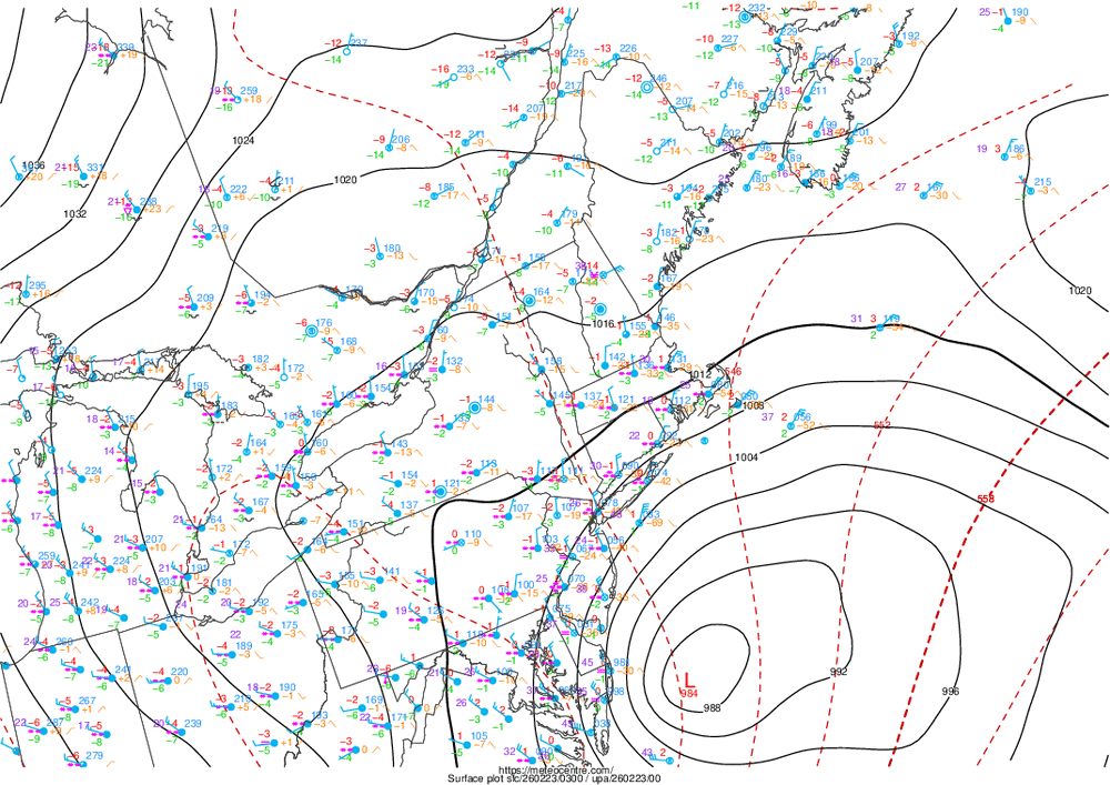
Per latest it's down to 979 mb and it's not moving! Here's last 3 updates BOTTOM ONE IS LATEST.
-
Video on Facebook, tesla cybertruck pulling a stuck tractor trailer in New Jersey.. I've seen it played the video several places already lol
-
Did any models have really really low pressures? Whatever models did, I'd believe those snow totals lol
-
My weather app is even going all in! Historic blizzard boom cyclone!

-
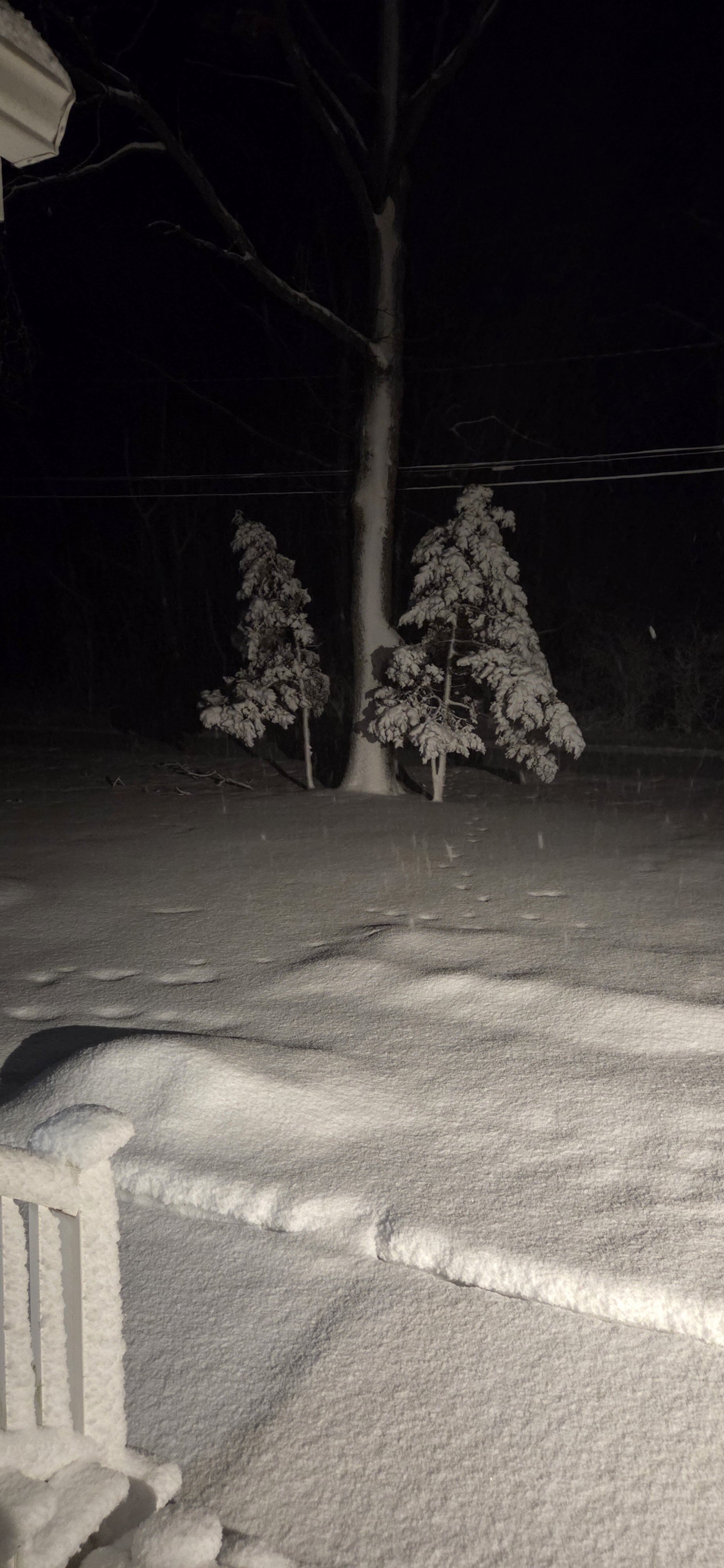
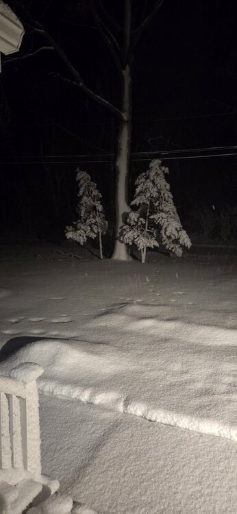
Snow stakes look so funny 1 sided covered

-
Trees dp not look happy
-
About 5 inches, the snow stakes have snow on them sideways and the trees look like there ready to snap
-
Omg he does exist, and I thought he was just AI trolling us
-
I believe the mta full closure 1 am That may only be lirr
-
In Upton ny
-
Mesoscale Discussion 0115 NWS Storm Prediction Center Norman OK 0624 PM CST Sun Feb 22 2026 Areas affected...New York City into Southern New England Concerning...Heavy snow Valid 230024Z - 230530Z SUMMARY...A long-duration moderate/heavy snowfall event will increasingly impact NYC into parts of southern New England this evening into Monday morning. 1-2 inch per hour snowfall rates will be likely, particularly after midnight EST. DISCUSSION...Recent regional radar imagery from the northern Mid-Atlantic/southern New England shows a band of moderate to heavy snow moving slowly northward into Long Island. Already, recent surface observations reported 1 inch in the last hour at Islip, LaGuardia, and JFK. This band should continue to impact parts of southern New England this evening. The highest snowfall rates will at least initially remain near the coast. With time, the 994 mb low analyzed off the Mid-Atlantic coast will deepen, particularly after 11 pm/midnight EST. This will eventually promote a broader zone of stronger isentropic ascent that will promote more widespread moderate/heavy snow farther north. Surface winds will also concurrently increase with the deepening of the low. Blizzard conditions will be possible late this evening into Monday morning. ..Wendt.. 02/23/2026 ...Please see www.spc.noaa.gov for graphic product... ATTN...WFO...BOX...OKX...ALY... LAT...LON 40437381 40837418 41297422 41837324 42027152 41987060 41757033 41347048 40437381
-
Long Island Rail Road (LIRR) service is suspending system-wide on Sunday, February 22, 2026, due to a severe winter storm. Service will be reduced starting at 7 p.m. and fully shut down by 1 a.m. Monday, February 23, 2026, with no service until further notice. Passengers should check the MTA website
-
You got everyone is a tizzy lol that was great!
-
18z hrrr with the big totals for long Island may happen if these bands setup on long Island like this
-
It's puking snow already over am inch looks like
-
No afternoon Monday