wthrmn654
-
Posts
3,953 -
Joined
-
Last visited
Content Type
Profiles
Blogs
Forums
American Weather
Media Demo
Store
Gallery
Everything posted by wthrmn654
-
Glad the snow pack got crust wind would of blown out all away lol
-
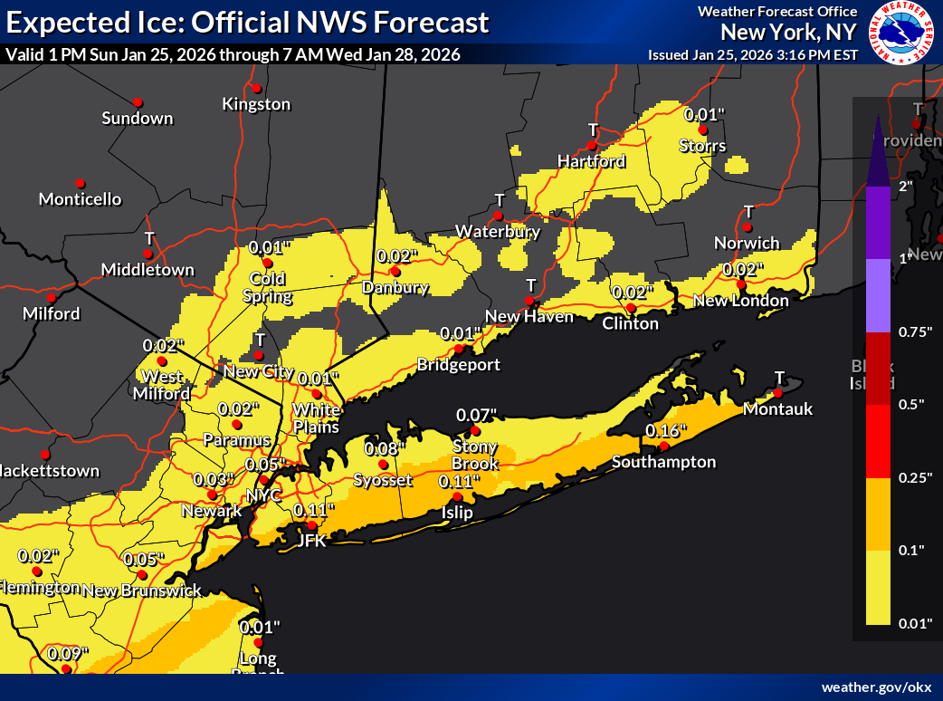
Does anyone know radar estimates for precip? 1.5 seems high
-
Currently 25, 30 at Montauk
-
Sounds and looks like more snow then sleet falling
-
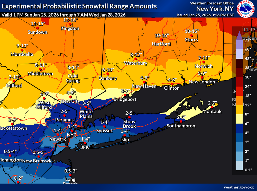
Everyone saw double digits the doubters owe apologies.
-
Wow is it getting windy as hell!
-
Are radar estimates of well over an inch of liquid so far accurate??
-
Who else wants some snow balls lol, whoever said this would end early your up next
-
Reports of an avalanche in Pennsylvania, with 10-15 feet of snow on some road
-
I'm at 11 reports of a foot i think in sag harbor.
-
Who said long island wouldn't see double digits ? I wanna throw a snowball at them lol
-
Also at jfk and Newark
-
Records broke Bridgeport, LaGuardia, Islip
-

-
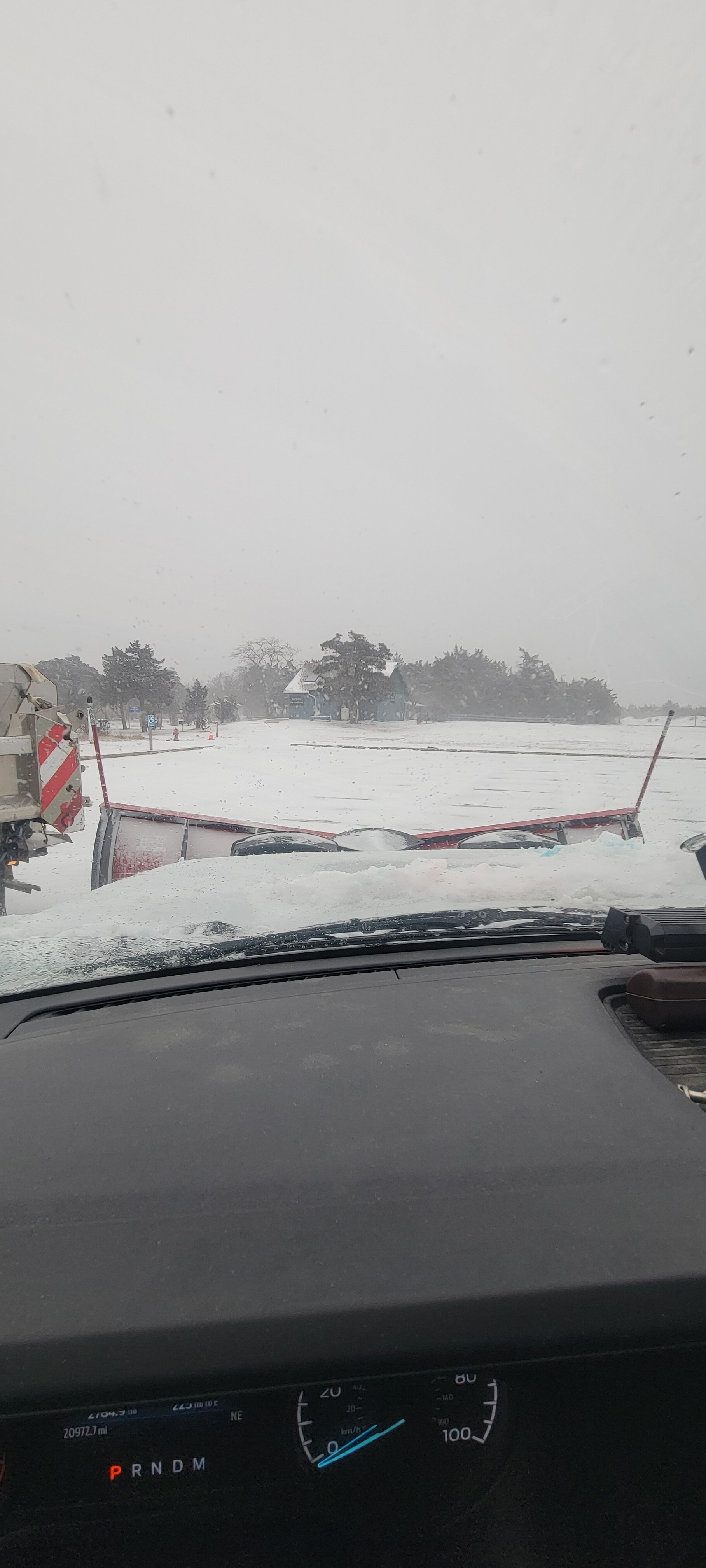
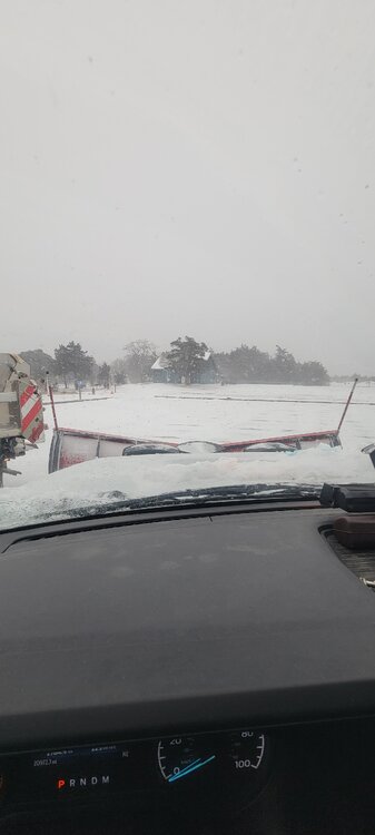
The snow has gotten noisier, but it looks like all snow maybe more snow pellets but very low visibility. Temp is dropping as well
-
4 pm and still 100%snow
-
Where are the Debbie downers now? Solid forecast by Upton.
-
Hard to measure but my driveway fairly protected 10 in a drift but 7 and 8 inches otherwise.
-
Extremely heavy snow visibilities about 10 feet. 0 mix 20 degrees
-
Abandoning ship were getting sent home is bad plowing tomorrow should be fun
-
Tell @eduggs that
-
Extremely icy, route 25 was snow covered and I was spinning wheels before dot went by.
-
Sister says it's very very icy in Tennessee trees are breaking etc
-
Note to self, make sure you pick the right set of flannel pants and not the ones that are 5 to l sizes to small..... I'm going be a suffering today lmao
-
Correction, it's 12 degrees on the nws Nimbus unit.