Powerball
-
Posts
14,471 -
Joined
-
Last visited
Content Type
Profiles
Blogs
Forums
American Weather
Media Demo
Store
Gallery
Everything posted by Powerball
-
Seems it could have been GRR and/or IWX, as they opted to go with a single watch over the whole area. The GRR portion of the watch in particular looks iffy though.
-
True. Though just as much blame goes to MKE / LOT. Watches are issued in coordination with local WFOs...
-
Setup's even messier than I imagined a couple days ago. The evolution of convection is going to be wild today...
-
Messy setup.
-
It ended up being largely a nothingburger for Michigan any way, outside a narrow corridor from the Tri-Cities to Lake St. Clair. Instability, low-level moisture and shear were sufficient, but the nebulous forcing wasn't enough to overcome the residual cap and the dry air advecting in aloft. Kind of unfortunate, because I'm sure meaningful rain would have been nice for the Detroit area after the past few days..
-
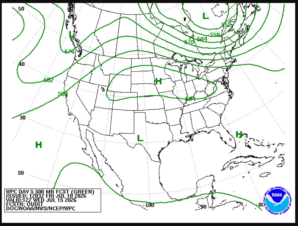
Pretty large enhanced risk area stretching back into NE OH tomorrow, on top of the broader slight risk area for MI / IN and the rest of OH. Seems to be some question as whether the pre-frontal trough vs. actual cold front will be the focus point though...
-
Kind of funny that the COD website was up and running before the official site.
-
Looks like the smoke's going to stick around for Detroit much of the day on Friday as well...
-
I'm guessing there will be a lag with the live maps updating (they're still not working).
-
Gotta love how the satellite's out of commission indefinitely the one day it's needed especially bad, lol...
-
Fun times in Detroit. Strong to severe cap busters on top of wildfire smoke...
-
The HRRR *has* backed off on the visibility restrictions for the southern half of MI, so there's that...
-
Really surprised at how well the dewpoints held up despite the NW flow and deep subsidence.
-
Yes to downsloping.
-
On the plus side, that might be enough to hold temps down on Thursday...
-
Oof...
-
That might also explain why the models have backed off on what was nascent potential for cap busters along the front Wednesday...
-
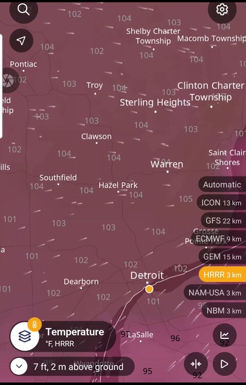
100*F+ seems fairly likely for Detroit tomorrow. About as perfect as a setup as you can get...
-
Funny thing is, while humidity will be lower, there's likely a better shot at 100s with this round compared to the last one, with the peak currently projected to be Tuesday/Wednesday. Duration is a lot more questionable though (especially with NE extent).


-
The bolded is certainly impressive, and surprising.
-
There were also several reports I've seen of a full-blown dust storm preceeding the rain....
-
https://x.com/i/status/2073156007291699252
-
95*F still did manage to happen after all at the last possible moment (5pm obs). So that's 3 total for Detroit this heatwave..
-
There's also a SPC Enhanced Risk area now for Southern MI, all the way from Lake Michigan to Detroit, for daamging winds. Funny enough, there are areas in the Enhanced Risk now that weren't even in the Slight Risk earlier. SPC mesoanalysis does indicate the atmosphere's finally recovering across Metro Detroit from this morning's outflow bubble as well...
-
That is (unironically) a very good analogy, lol...