Maggie Valley Steve
-
Posts
979 -
Joined
-
Last visited
Content Type
Profiles
Blogs
Forums
American Weather
Media Demo
Store
Gallery
Everything posted by Maggie Valley Steve
-

2025-2026 Fall/Winter Mountain Thread
Maggie Valley Steve replied to Buckethead's topic in Southeastern States
37 at the house currently. The driveway is almost shoveled down to the road! -
2025-2026 Fall/Winter Mountain Thread
Maggie Valley Steve replied to Buckethead's topic in Southeastern States
For what it's worth, the 12Z 3km NAM suggests an inch of snow tomorrow night into early Wednesday here in Western Haywood County. Clouds are moving in currently over the Valley. It would be nice to get above freezing today. -
2025-2026 Fall/Winter Mountain Thread
Maggie Valley Steve replied to Buckethead's topic in Southeastern States
6 this morning at the house. -
2025-2026 Fall/Winter Mountain Thread
Maggie Valley Steve replied to Buckethead's topic in Southeastern States
So my totals for the winter so far for snow will include 3 inches back in November, about an inch and a half with a couple of light events in December and January with about an inch with several dusting and the Big Dog Friday night into yesterday of 10.5. Total so far with my yard = about 16 inches of snow. -
2025-2026 Fall/Winter Mountain Thread
Maggie Valley Steve replied to Buckethead's topic in Southeastern States
Public Works just plowed again and was laying salt. I guess we're OK up here regarding salt for now! -
2025-2026 Fall/Winter Mountain Thread
Maggie Valley Steve replied to Buckethead's topic in Southeastern States
I agree with your A+ rating. The guidance overall handled it rather well with sniffing it out which is really important for seeing the possibilities a week out! I do not see any real relaxation of the pattern well into February. We are paying for the warm Christmas. -
2025-2026 Fall/Winter Mountain Thread
Maggie Valley Steve replied to Buckethead's topic in Southeastern States
I'm going to attempt to clear the driveway enough to get one vehicle out today. It looks like the Town of Maggie Valley plowed the road leading up to the house early this morning. Those little blessings of being the last house within the Town limits I suppose. So it looks like a minor event may be possible Tuesday night into Wednesday. We'll see about that potential the next 24 to 48 hours. I've heard rumors that NCDOT is running out of salt. I hope it just a rumor locally for our Mountain Region! -
2025-2026 Fall/Winter Mountain Thread
Maggie Valley Steve replied to Buckethead's topic in Southeastern States
-3 this morning with clear skies. The views are amazing with everything covered in snow. -
2025-2026 Fall/Winter Mountain Thread
Maggie Valley Steve replied to Buckethead's topic in Southeastern States
Getting some very gusty winds here at the house. Occasionally near whiteout conditions from all the blowing snow. Hopefully it blows off my driveway. The leaf blower was useless and I'm not up to shoveling the whole way down to the road! -
2025-2026 Fall/Winter Mountain Thread
Maggie Valley Steve replied to Buckethead's topic in Southeastern States
I've had a peak of sun through the light flurries the past half hour. Visibility is up to a mile and half. Looks like that's a wrap on the first part of the storm. We'll see what any flow snow brings later this afternoon and overnight. -
2025-2026 Fall/Winter Mountain Thread
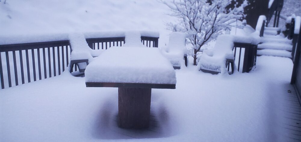
Maggie Valley Steve replied to Buckethead's topic in Southeastern States
Currently light snow and 11F. I haven't added too much to my storm total since noon. 10.4 inches and slowly adding. We've had some wind gusts a bit earlier, but really not much wind at all. I see the flow snow in Eastern Tennessee is out of due North now. -
2025-2026 Fall/Winter Mountain Thread
Maggie Valley Steve replied to Buckethead's topic in Southeastern States
Up to double digits. A little over 10 inches and the rate and size of flakes have picked up the past 15 minutes. -
2025-2026 Fall/Winter Mountain Thread
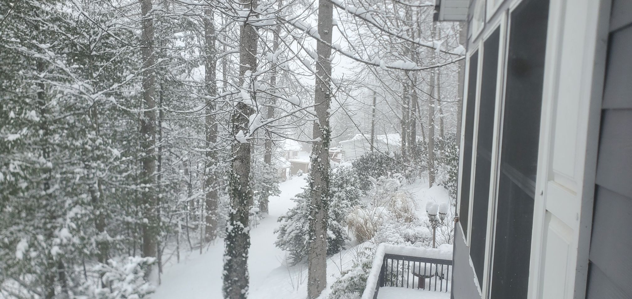
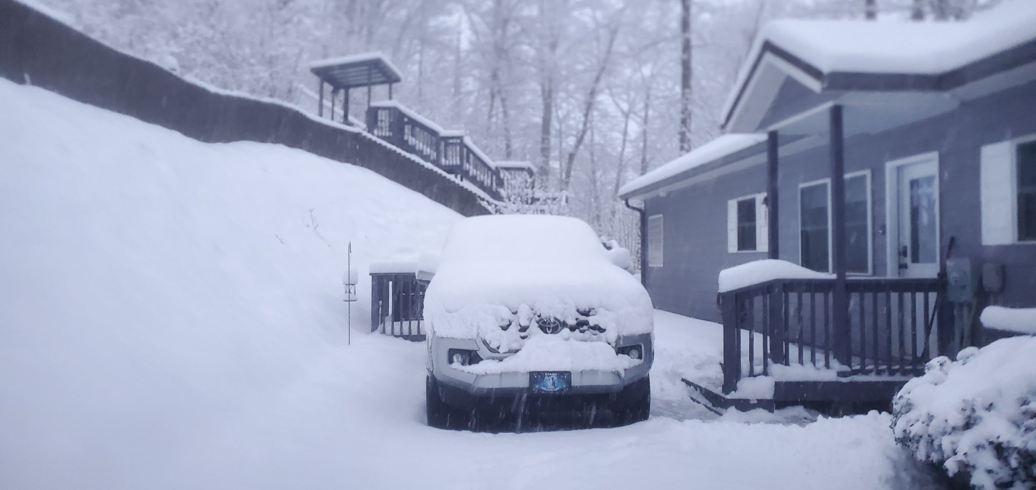
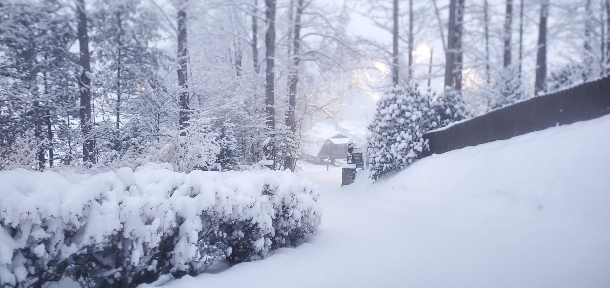
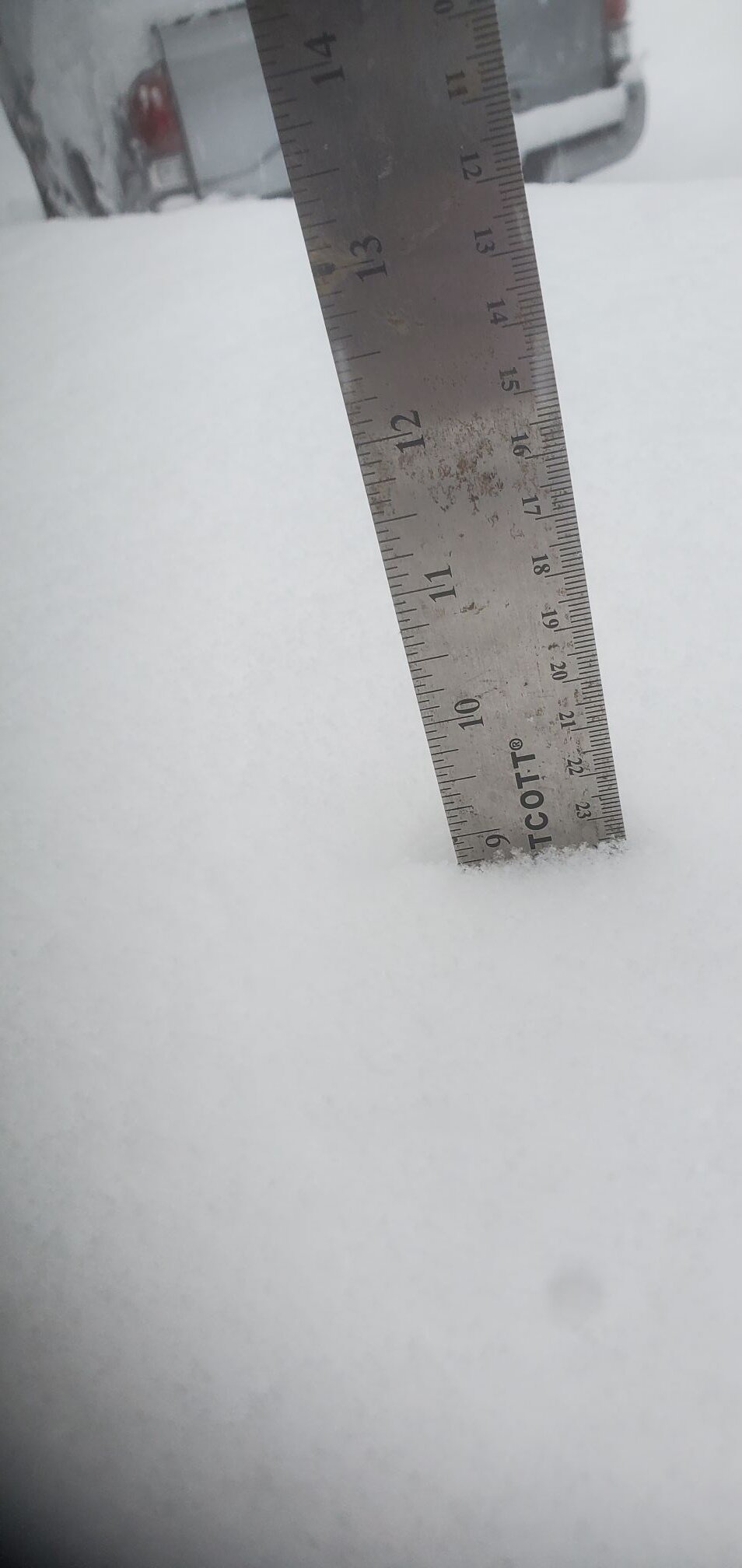
Maggie Valley Steve replied to Buckethead's topic in Southeastern States
Near 10 inches now. I'll take another measurement to report to GSP around 12:30. A couple of shots from the front porch.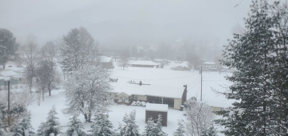
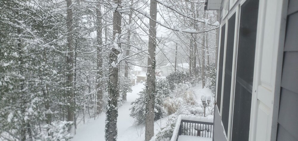
-
2025-2026 Fall/Winter Mountain Thread
Maggie Valley Steve replied to Buckethead's topic in Southeastern States
13 with Moderate snow with visibility less than a 1/4 mile. The upper trough is dropping SE from Western Tennessee with the upper low beginning to close off over Northern Mississippi and Nothern Alabama. Will be watching to see if the trough goes to neutral/negative tilt as the day wears on. I see no signs of the snow letting up throughout the next 24 hours at least. -
January 30th- Feb 1st ULL and coastal storm obs
Maggie Valley Steve replied to JoshM's topic in Southeastern States
9 inches and counting here in Maggie Valley.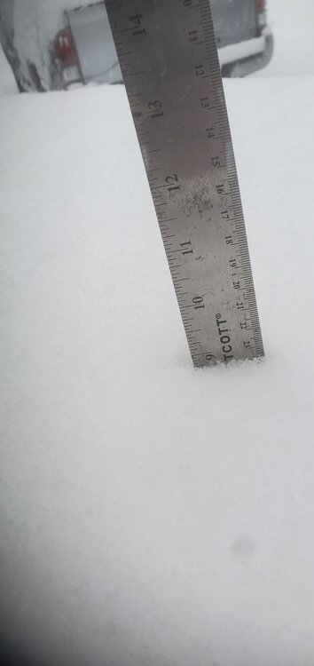

-
2025-2026 Fall/Winter Mountain Thread
Maggie Valley Steve replied to Buckethead's topic in Southeastern States
9 inches so far!
-
2025-2026 Fall/Winter Mountain Thread
Maggie Valley Steve replied to Buckethead's topic in Southeastern States
Down to 14 and heavy snow. The upper low is getting closer. Incredible rates now. -
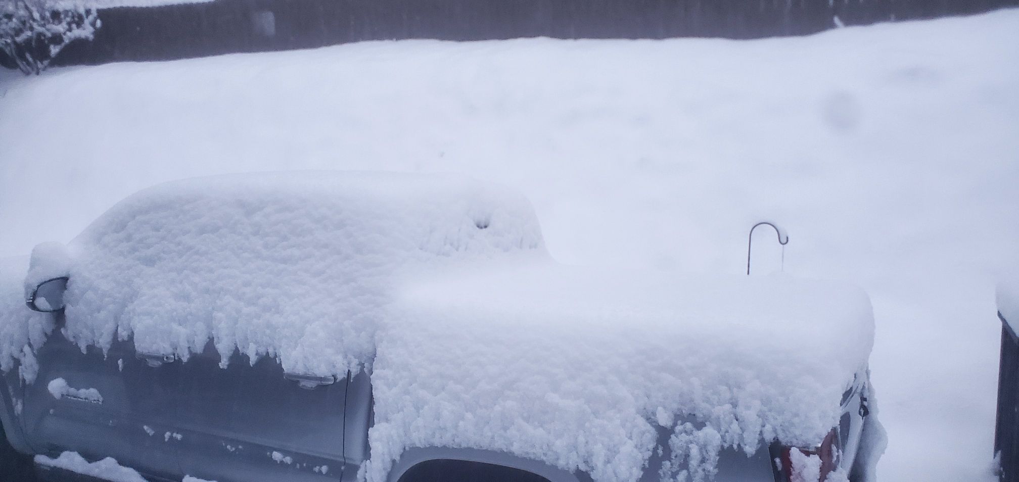
2025-2026 Fall/Winter Mountain Thread
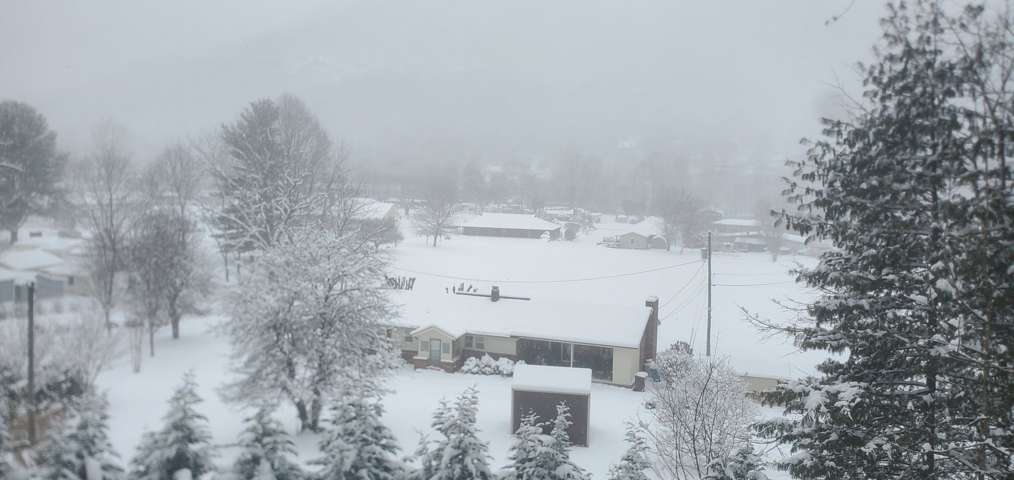
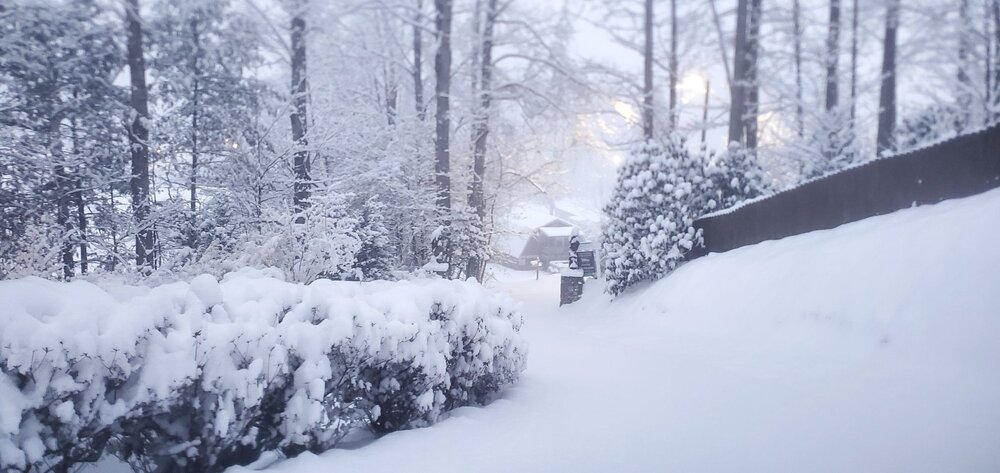
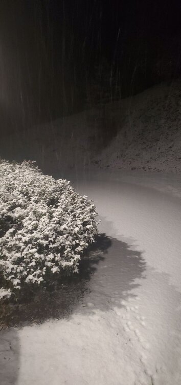
Maggie Valley Steve replied to Buckethead's topic in Southeastern States
First morning shots. There was no hyping here in the Mountains that's for sure.


-
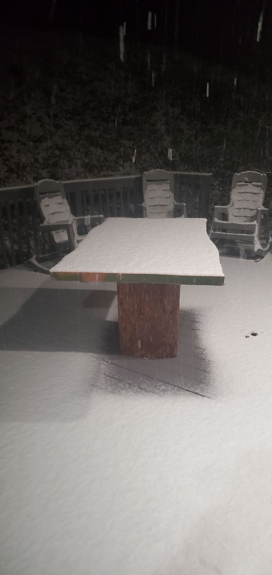
2025-2026 Fall/Winter Mountain Thread
Maggie Valley Steve replied to Buckethead's topic in Southeastern States
Eyeballing about an inch and counting. I'll measure tomorrow morning on my snowboard.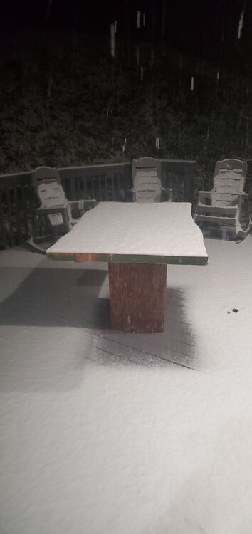
-
2025-2026 Fall/Winter Mountain Thread
Maggie Valley Steve replied to Buckethead's topic in Southeastern States
Same here! Very little wind at all. -
2025-2026 Fall/Winter Mountain Thread
Maggie Valley Steve replied to Buckethead's topic in Southeastern States
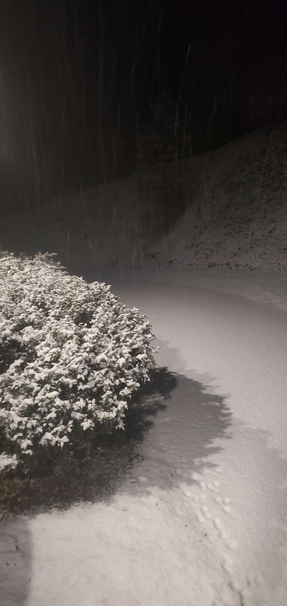
Light snow and 28. Already a dusting including the driveway. -
2025-2026 Fall/Winter Mountain Thread
Maggie Valley Steve replied to Buckethead's topic in Southeastern States
Flurries have started at Valley floor. It took a while to saturate enough. -
2025-2026 Fall/Winter Mountain Thread
Maggie Valley Steve replied to Buckethead's topic in Southeastern States
Light flurries on Hemphill Bald just above Cataloochee. It's that time folks. Enjoy! -
2025-2026 Fall/Winter Mountain Thread
Maggie Valley Steve replied to Buckethead's topic in Southeastern States
Folks in the Tennessee forum are reporting snow in Knoxville area now. -
2025-2026 Fall/Winter Mountain Thread
Maggie Valley Steve replied to Buckethead's topic in Southeastern States
Looks like our upper trough that will develop into a closed upper low is progressing nicely. That trough is currently located over Illinois dropping S. The shortwave to the W is dropping quickly through the Rockies. There are several surface waves riding along the Gulf Coast as well. I'm seeing signs of frontogenesis over Eastern Tennessee with rising clouds. Locally, some lower clouds are developing over the ridge tops. It is probably another 3 to 4 hours before flurries begin.