Maggie Valley Steve
-
Posts
967 -
Joined
-
Last visited
Content Type
Profiles
Blogs
Forums
American Weather
Media Demo
Store
Gallery
Everything posted by Maggie Valley Steve
-

2025-2026 Fall/Winter Mountain Thread
Maggie Valley Steve replied to Buckethead's topic in Southeastern States
Looks like that's it for now. We'll see if the flow snow brings anything with the Arctic front. -
2025-2026 Fall/Winter Mountain Thread
Maggie Valley Steve replied to Buckethead's topic in Southeastern States
Sleet and graupel at the house. -
2025-2026 Fall/Winter Mountain Thread
Maggie Valley Steve replied to Buckethead's topic in Southeastern States
Flurries at Cataloochee now. I suppose there's a non zero chance. -
2025-2026 Fall/Winter Mountain Thread
Maggie Valley Steve replied to Buckethead's topic in Southeastern States
Enjoy gang! Not expecting much of anything here. -
2025-2026 Fall/Winter Mountain Thread
Maggie Valley Steve replied to Buckethead's topic in Southeastern States
Yes sir. I was hoping for a day or two of near 60 highs, and that evaporated to low 50's one day at best. That's been the trend all winter except for the week of Christmas. -
2025-2026 Fall/Winter Mountain Thread
Maggie Valley Steve replied to Buckethead's topic in Southeastern States
WWA issued for Yancey, Madison and Mitchell Counties above 3500ft. -
2025-2026 Fall/Winter Mountain Thread
Maggie Valley Steve replied to Buckethead's topic in Southeastern States
Definitely looking like an Advisory level event for tomorrow afternoon into Saturday. GSP mentioned in their morning AFD that it is very possible they'll issue a WWA either this afternoon or tomorrow morning. My driveway is a sheet of ice this morning. Not sure we can keep our Vet appointment later this morning. -
2025-2026 Fall/Winter Mountain Thread
Maggie Valley Steve replied to Buckethead's topic in Southeastern States
Looks like a 1/4 inch covering everything and 27 currently. -
2025-2026 Fall/Winter Mountain Thread
Maggie Valley Steve replied to Buckethead's topic in Southeastern States
Down to 34 with very low ceiling around 3300ft just above the house. Radar from Morristown suggests we could see snow in the next hour or two. We'll see. -
2025-2026 Fall/Winter Mountain Thread
Maggie Valley Steve replied to Buckethead's topic in Southeastern States
It's warmed up to 53 this afternoon and the snow melt at the Valley floor is almost done. Looks like the surface low has developed in NE Georgia, so a couple of low topped thunderstorms are likely as Buckethead just posted. It looks like a dusting to an inch this evening into early Thursday morning for most of us in the Mountains with higher totals in the Northern Mountains. -
Mid-Long Range Discussion 2026
Maggie Valley Steve replied to BooneWX's topic in Southeastern States
Exactly how many times are going to post the same exact thing Jeremy? It gets tiresome. -
2025-2026 Fall/Winter Mountain Thread
Maggie Valley Steve replied to Buckethead's topic in Southeastern States
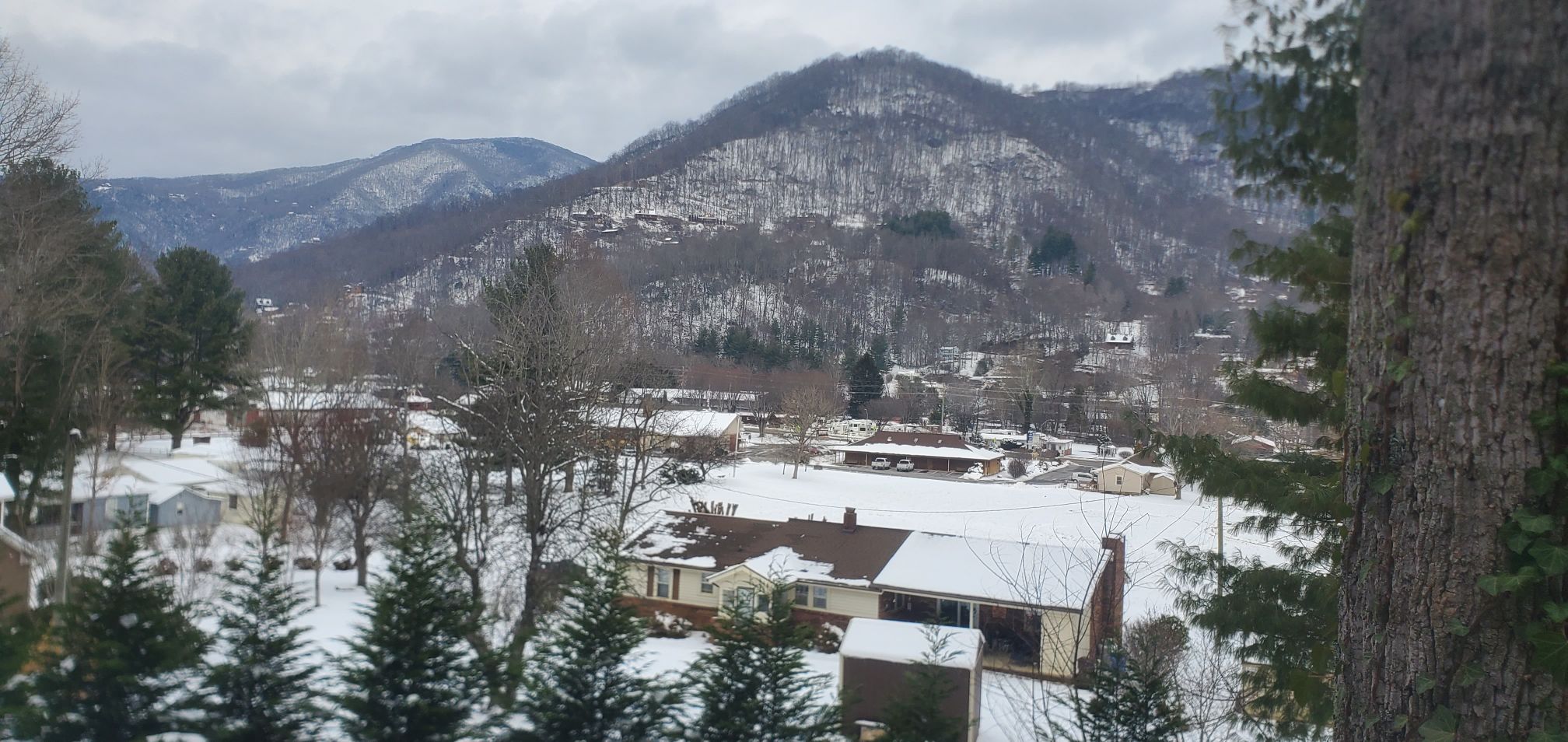
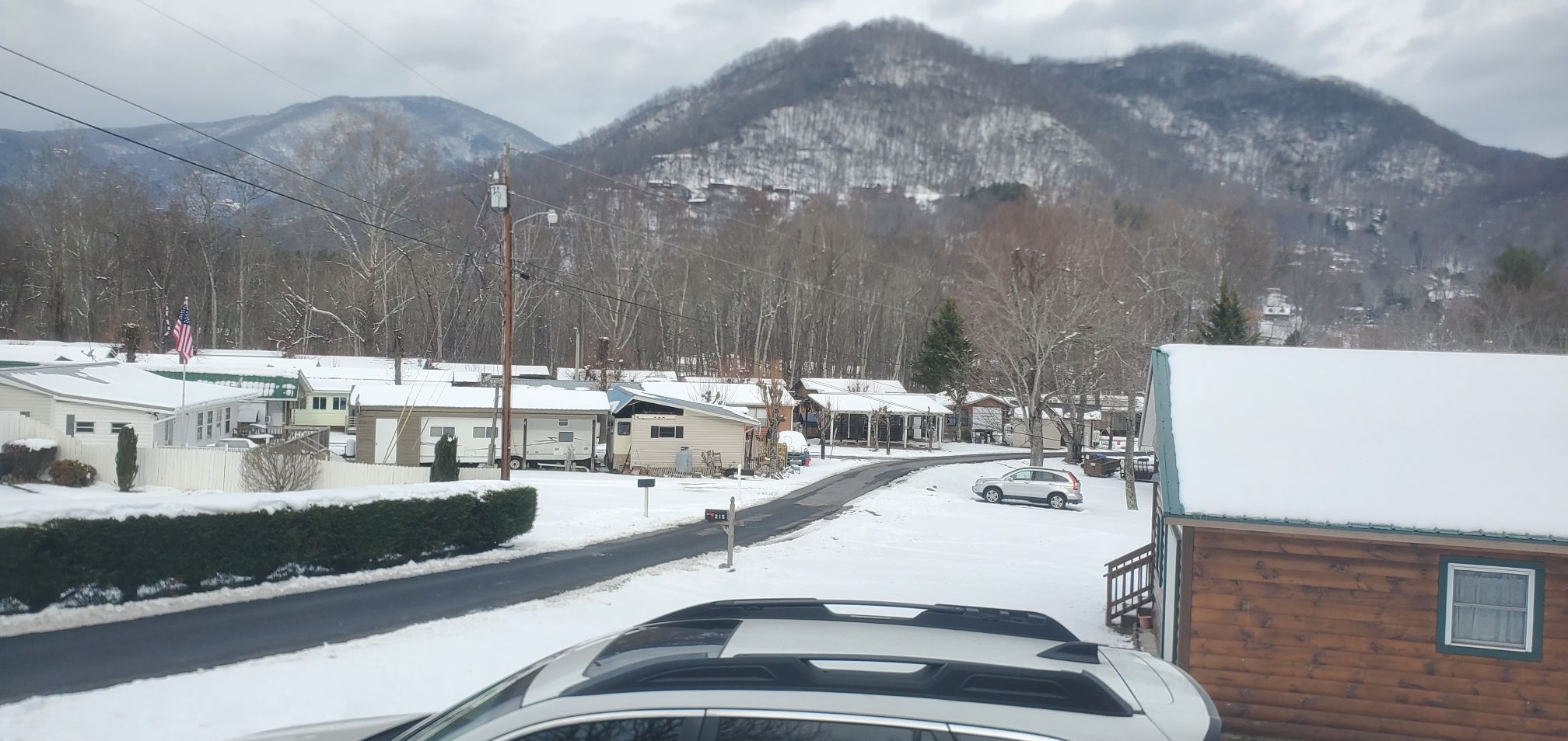
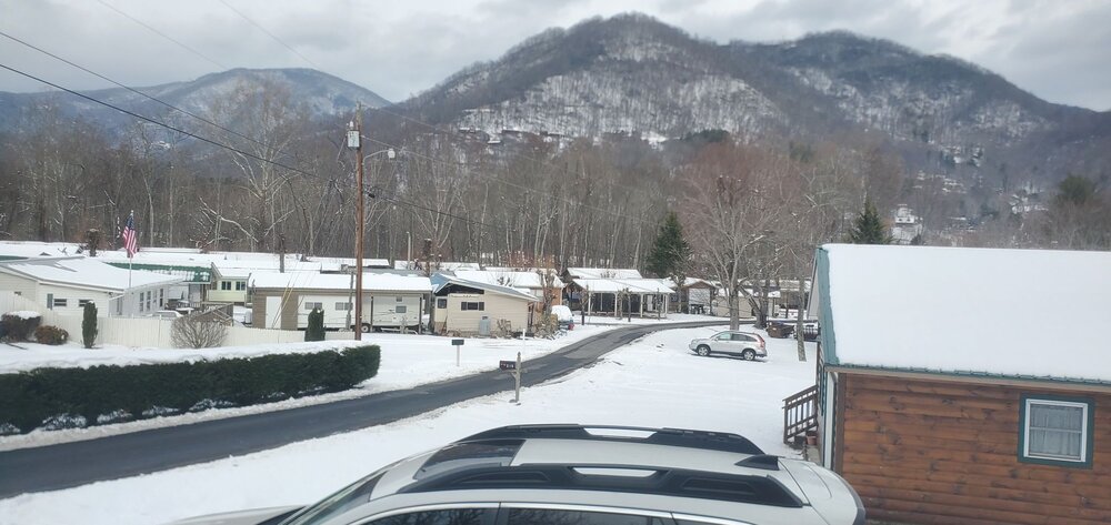
Day 4 with a blanket of snow.
-
2025-2026 Fall/Winter Mountain Thread
Maggie Valley Steve replied to Buckethead's topic in Southeastern States
20 for my low this morning. Thick cloud deck overhead. -
2025-2026 Fall/Winter Mountain Thread
Maggie Valley Steve replied to Buckethead's topic in Southeastern States
37 at the house currently. The driveway is almost shoveled down to the road! -
2025-2026 Fall/Winter Mountain Thread
Maggie Valley Steve replied to Buckethead's topic in Southeastern States
For what it's worth, the 12Z 3km NAM suggests an inch of snow tomorrow night into early Wednesday here in Western Haywood County. Clouds are moving in currently over the Valley. It would be nice to get above freezing today. -
2025-2026 Fall/Winter Mountain Thread
Maggie Valley Steve replied to Buckethead's topic in Southeastern States
6 this morning at the house. -
2025-2026 Fall/Winter Mountain Thread
Maggie Valley Steve replied to Buckethead's topic in Southeastern States
So my totals for the winter so far for snow will include 3 inches back in November, about an inch and a half with a couple of light events in December and January with about an inch with several dusting and the Big Dog Friday night into yesterday of 10.5. Total so far with my yard = about 16 inches of snow. -
2025-2026 Fall/Winter Mountain Thread
Maggie Valley Steve replied to Buckethead's topic in Southeastern States
Public Works just plowed again and was laying salt. I guess we're OK up here regarding salt for now! -
2025-2026 Fall/Winter Mountain Thread
Maggie Valley Steve replied to Buckethead's topic in Southeastern States
I agree with your A+ rating. The guidance overall handled it rather well with sniffing it out which is really important for seeing the possibilities a week out! I do not see any real relaxation of the pattern well into February. We are paying for the warm Christmas. -
2025-2026 Fall/Winter Mountain Thread
Maggie Valley Steve replied to Buckethead's topic in Southeastern States
I'm going to attempt to clear the driveway enough to get one vehicle out today. It looks like the Town of Maggie Valley plowed the road leading up to the house early this morning. Those little blessings of being the last house within the Town limits I suppose. So it looks like a minor event may be possible Tuesday night into Wednesday. We'll see about that potential the next 24 to 48 hours. I've heard rumors that NCDOT is running out of salt. I hope it just a rumor locally for our Mountain Region! -
2025-2026 Fall/Winter Mountain Thread
Maggie Valley Steve replied to Buckethead's topic in Southeastern States
-3 this morning with clear skies. The views are amazing with everything covered in snow. -
2025-2026 Fall/Winter Mountain Thread
Maggie Valley Steve replied to Buckethead's topic in Southeastern States
Getting some very gusty winds here at the house. Occasionally near whiteout conditions from all the blowing snow. Hopefully it blows off my driveway. The leaf blower was useless and I'm not up to shoveling the whole way down to the road! -
2025-2026 Fall/Winter Mountain Thread
Maggie Valley Steve replied to Buckethead's topic in Southeastern States
I've had a peak of sun through the light flurries the past half hour. Visibility is up to a mile and half. Looks like that's a wrap on the first part of the storm. We'll see what any flow snow brings later this afternoon and overnight. -
2025-2026 Fall/Winter Mountain Thread
Maggie Valley Steve replied to Buckethead's topic in Southeastern States
Currently light snow and 11F. I haven't added too much to my storm total since noon. 10.4 inches and slowly adding. We've had some wind gusts a bit earlier, but really not much wind at all. I see the flow snow in Eastern Tennessee is out of due North now. -
2025-2026 Fall/Winter Mountain Thread
Maggie Valley Steve replied to Buckethead's topic in Southeastern States
Up to double digits. A little over 10 inches and the rate and size of flakes have picked up the past 15 minutes.