Maggie Valley Steve
-
Posts
865 -
Joined
-
Last visited
Content Type
Profiles
Blogs
Forums
American Weather
Media Demo
Store
Gallery
Everything posted by Maggie Valley Steve
-

2025-2026 Fall/Winter Mountain Thread
Maggie Valley Steve replied to Buckethead's topic in Southeastern States
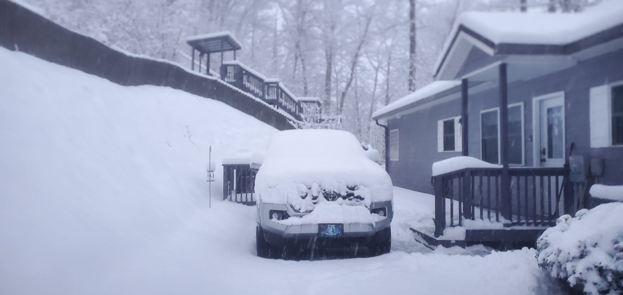
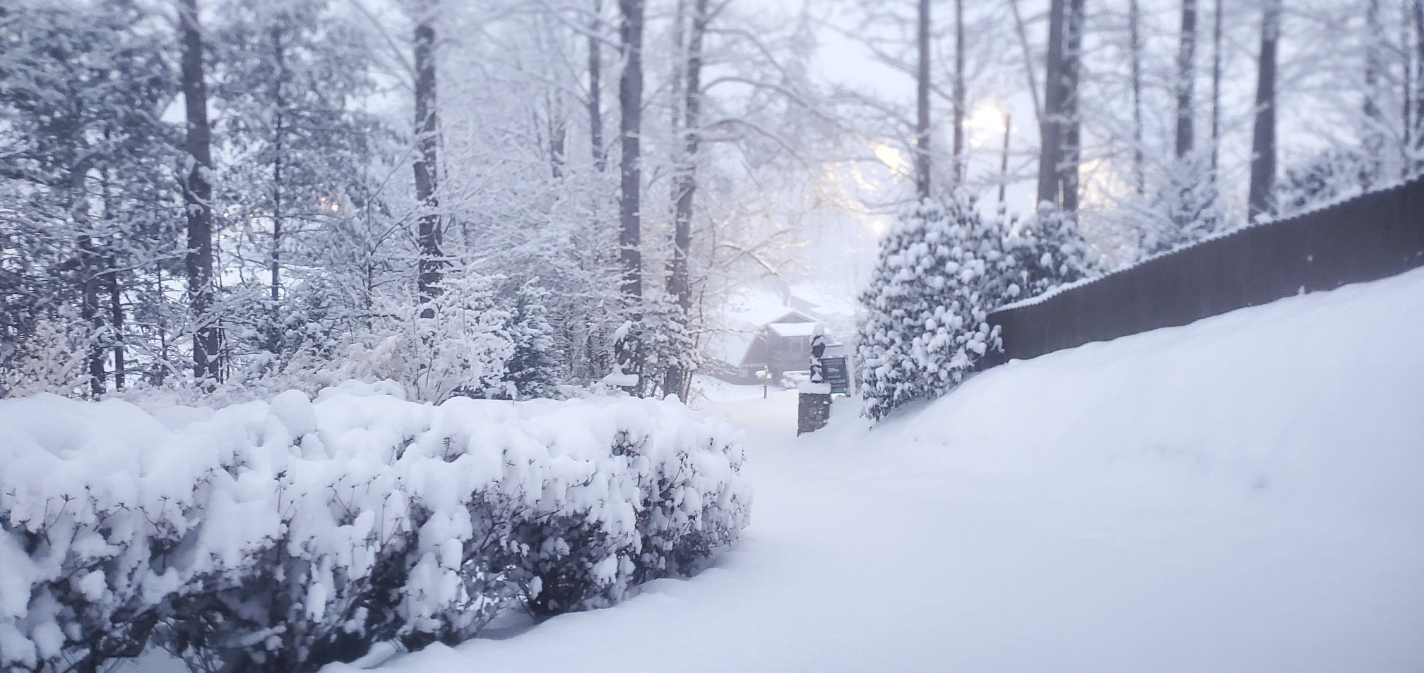
13 with Moderate snow with visibility less than a 1/4 mile. The upper trough is dropping SE from Western Tennessee with the upper low beginning to close off over Northern Mississippi and Nothern Alabama. Will be watching to see if the trough goes to neutral/negative tilt as the day wears on. I see no signs of the snow letting up throughout the next 24 hours at least. -
January 30th- Feb 1st ULL and coastal storm obs
Maggie Valley Steve replied to JoshM's topic in Southeastern States
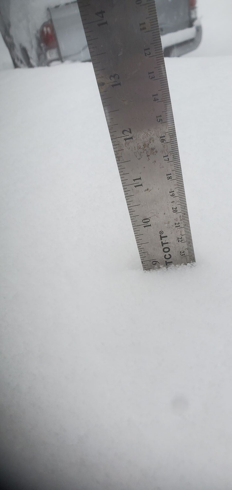
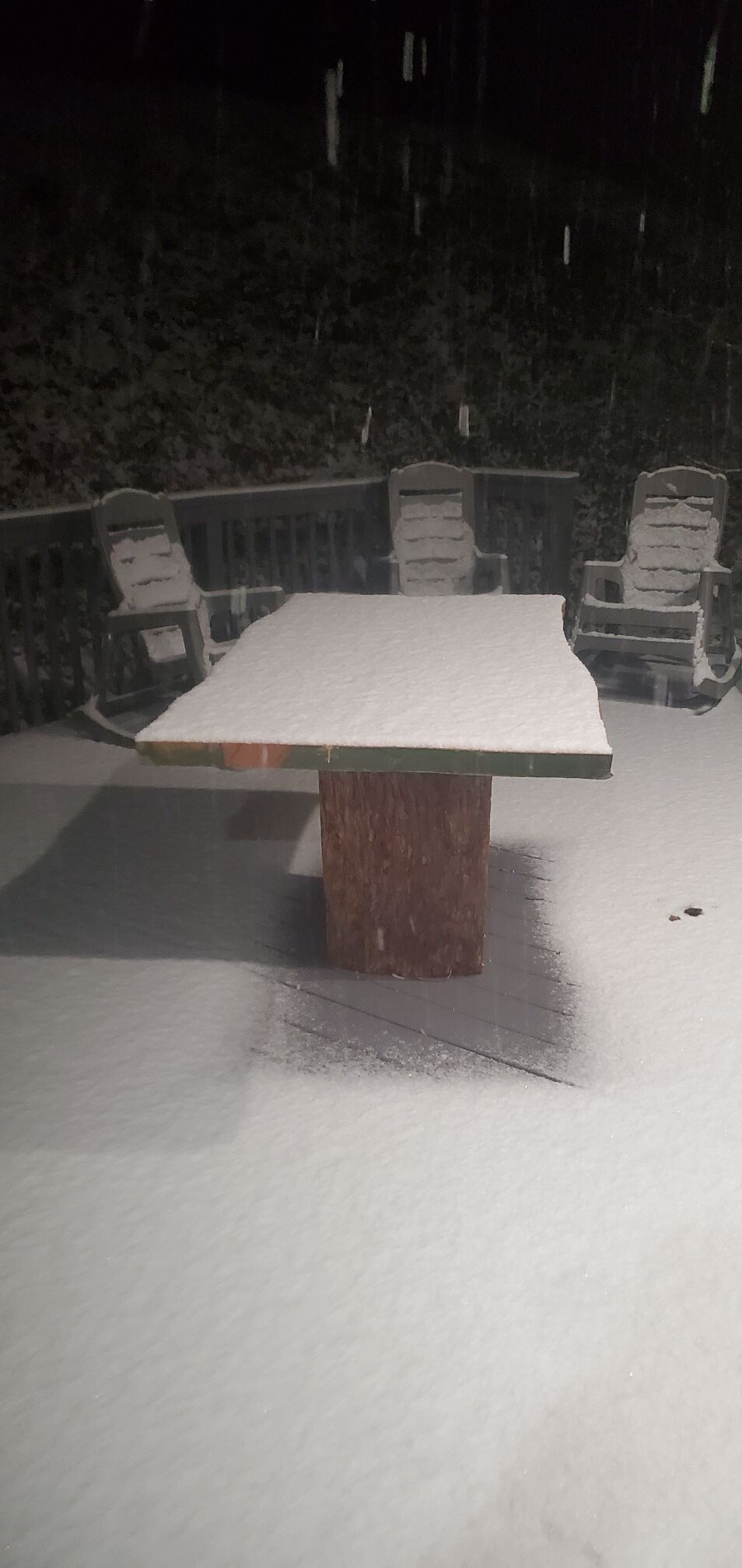
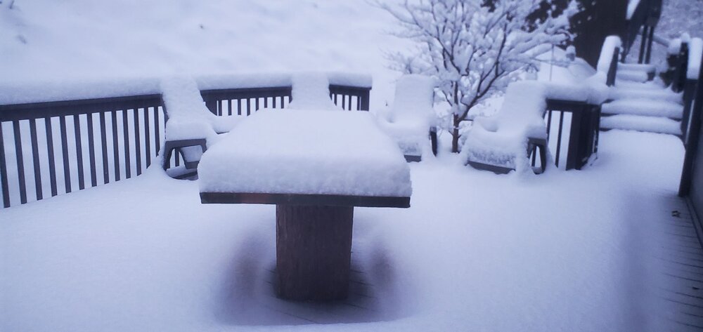
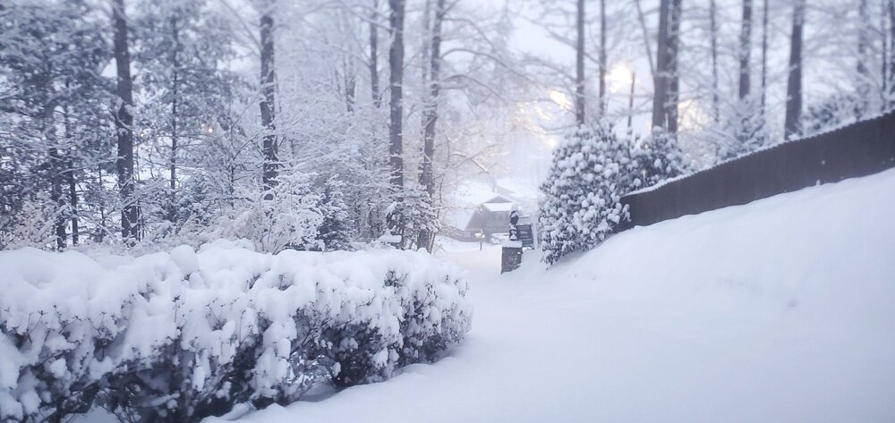
9 inches and counting here in Maggie Valley.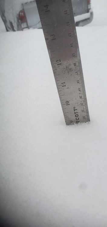

-
2025-2026 Fall/Winter Mountain Thread
Maggie Valley Steve replied to Buckethead's topic in Southeastern States
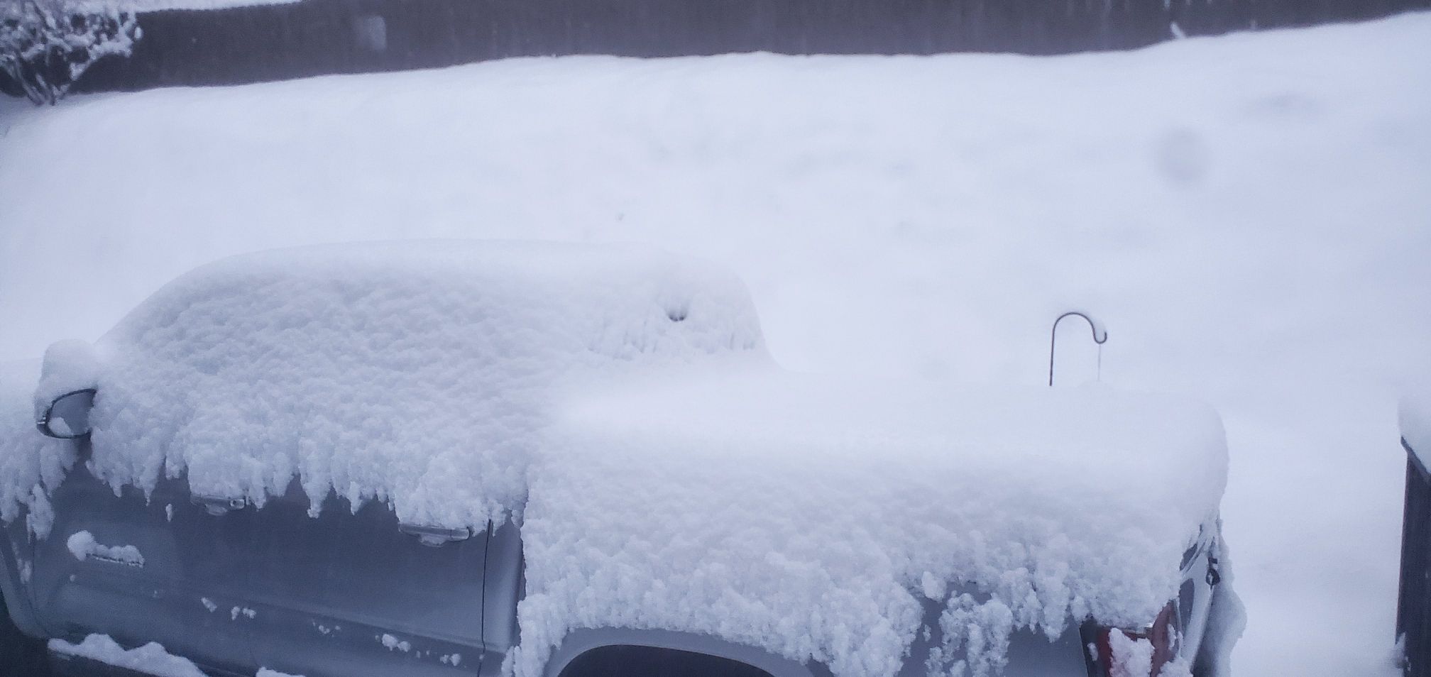
9 inches so far!
-
2025-2026 Fall/Winter Mountain Thread
Maggie Valley Steve replied to Buckethead's topic in Southeastern States
Down to 14 and heavy snow. The upper low is getting closer. Incredible rates now. -
2025-2026 Fall/Winter Mountain Thread
Maggie Valley Steve replied to Buckethead's topic in Southeastern States
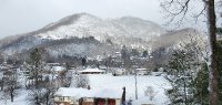
First morning shots. There was no hyping here in the Mountains that's for sure.


-
2025-2026 Fall/Winter Mountain Thread
Maggie Valley Steve replied to Buckethead's topic in Southeastern States
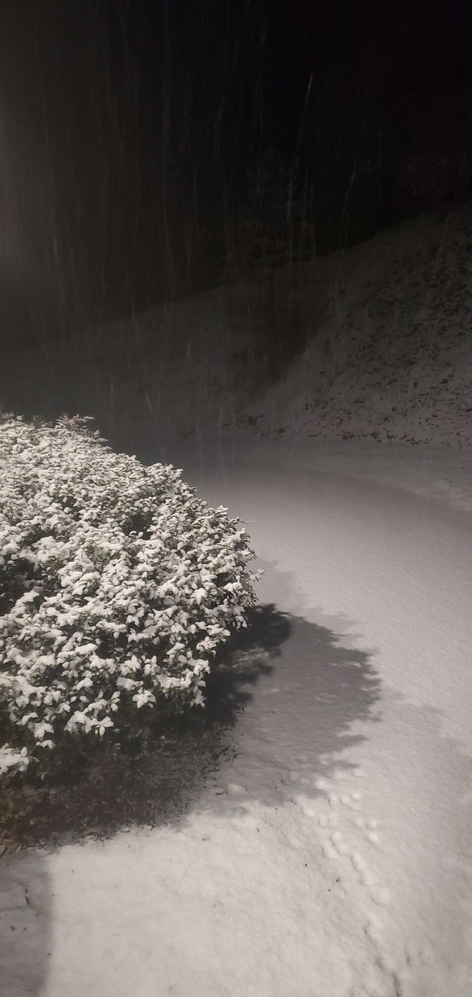
Eyeballing about an inch and counting. I'll measure tomorrow morning on my snowboard.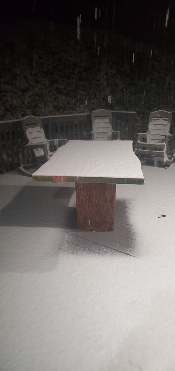
-
2025-2026 Fall/Winter Mountain Thread
Maggie Valley Steve replied to Buckethead's topic in Southeastern States
Same here! Very little wind at all. -
2025-2026 Fall/Winter Mountain Thread
Maggie Valley Steve replied to Buckethead's topic in Southeastern States
Light snow and 28. Already a dusting including the driveway. -
2025-2026 Fall/Winter Mountain Thread
Maggie Valley Steve replied to Buckethead's topic in Southeastern States
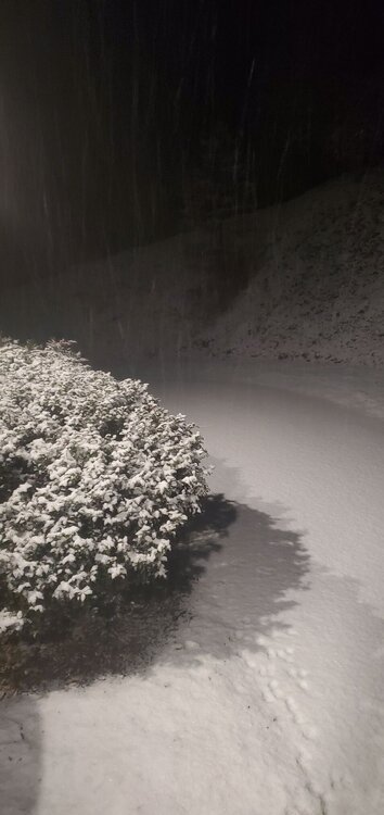
Flurries have started at Valley floor. It took a while to saturate enough. -
2025-2026 Fall/Winter Mountain Thread
Maggie Valley Steve replied to Buckethead's topic in Southeastern States
Light flurries on Hemphill Bald just above Cataloochee. It's that time folks. Enjoy! -
2025-2026 Fall/Winter Mountain Thread
Maggie Valley Steve replied to Buckethead's topic in Southeastern States
Folks in the Tennessee forum are reporting snow in Knoxville area now. -
2025-2026 Fall/Winter Mountain Thread
Maggie Valley Steve replied to Buckethead's topic in Southeastern States
Looks like our upper trough that will develop into a closed upper low is progressing nicely. That trough is currently located over Illinois dropping S. The shortwave to the W is dropping quickly through the Rockies. There are several surface waves riding along the Gulf Coast as well. I'm seeing signs of frontogenesis over Eastern Tennessee with rising clouds. Locally, some lower clouds are developing over the ridge tops. It is probably another 3 to 4 hours before flurries begin. -
2025-2026 Fall/Winter Mountain Thread
Maggie Valley Steve replied to Buckethead's topic in Southeastern States
Haywood County schools will let out at noon. -
2025-2026 Fall/Winter Mountain Thread
Maggie Valley Steve replied to Buckethead's topic in Southeastern States
20 and Cloudy at the house this morning. Humidity has risen overnight to 72. It 'feels' like snow. Good luck gang! -
I really hope you folks do well! You've suffered long enough.
-
2025-2026 Fall/Winter Mountain Thread
Maggie Valley Steve replied to Buckethead's topic in Southeastern States
The WPC stated in their afternoon disco that the Blue Ridge and the Smokies had a Moderate to High Risk to exceed 8 inches so that makes sense to me! -
2025-2026 Fall/Winter Mountain Thread
Maggie Valley Steve replied to Buckethead's topic in Southeastern States
It's going to fun to focus on small Mesoscale features that we just won't know until an hour or two prior. I'm beginning to see some ratio output suggesting 23:1 and a few approaching 25:1. Wherever a band sets up near the UL could drop a foot to 16 inches. We'll see. -
2025-2026 Fall/Winter Mountain Thread
Maggie Valley Steve replied to Buckethead's topic in Southeastern States
Surprised to see my point and click suggesting 4 to 8 inches possibly higher. The wind doesn't look like much of an issue until Saturday night. It's also interesting seeing another chance of snow Wednesday afternoon into Thursday in that point and click forecast as well. -
2025-2026 Fall/Winter Mountain Thread
Maggie Valley Steve replied to Buckethead's topic in Southeastern States
Thanks for everyone posting the models today! I've had a hectic day and you guys have allowed me to get updates quickly! -
2025-2026 Fall/Winter Mountain Thread
Maggie Valley Steve replied to Buckethead's topic in Southeastern States
Just got back from Asheville. Heavy brine being laid on I-40 in Haywood County. I'm not sure how much good it will do with the very cold temperatures we're expecting as the snow falls tomorrow afternoon into Saturday. The Ice Extravaganza in Maggie Valley has been canceled for Saturday. -
2025-2026 Fall/Winter Mountain Thread
Maggie Valley Steve replied to Buckethead's topic in Southeastern States
17 at the house this morning. So we are going to do this thing? It's been 4 years since more than 5 inches has fallen from one event in my yard. I believe we're going to see some dynamics that the models can't sniff out until a couple of hour out! -
2025-2026 Fall/Winter Mountain Thread
Maggie Valley Steve replied to Buckethead's topic in Southeastern States
The good thing is I'll be able to blow the snow off the driveway with the leaf blower! -
Differential Positive Vorticty Advection
-
GSP mentioned they were considering hoisting a Watch this afternoon, but opted to hold off until the overnight guidance came in. Seems to be a Storm totals concern more than the need a Watch/Warning issue.
-
2025-2026 Fall/Winter Mountain Thread
Maggie Valley Steve replied to Buckethead's topic in Southeastern States
Well, it certainly appears we will not be dealing with that old pesky warm nose this time! That said, I expect the discussion to ramp up with the WPC/NWS with the possibility of a Watch hoisted by tomorrow afternoon.