.jpeg.302c67143ea75c332053973bc310ec90.jpeg)
kazimirkai
-
Posts
174 -
Joined
-
Last visited
Content Type
Profiles
Blogs
Forums
American Weather
Media Demo
Store
Gallery
Everything posted by kazimirkai
-
.thumb.jpeg.406ecda2eec9e267302c22b9f128fe3c.jpeg)
Blowvember - and not named for wind potential
kazimirkai replied to Go Kart Mozart's topic in New England
This might help lol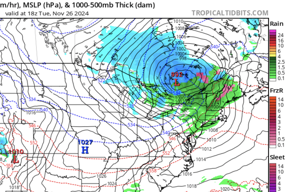
-
Blowvember - and not named for wind potential
kazimirkai replied to Go Kart Mozart's topic in New England
I almost more interested in December 3-4 time-frame for something snowy. Both ensembles like some sort of trough there and there seems more cold air in place for that one. -
Is this guy legit or does he just cherry pick indices to feed enthusiasm? https://www.severe-weather.eu/long-range-2/3-signs-for-colder-winter-2024-2025-united-states-canada-europe-fa/
-
What should I take away from data like this? Still somewhat new here
-
I know this is off topic but I'm somewhat new to this site, don't know the best place to ask, and this blog seemed active. Where can I find maps showing the amount of rainfall in the past year? Like for some reason its unreasonably difficult to find a "national 2023 total rainfall" map anywhere.
-
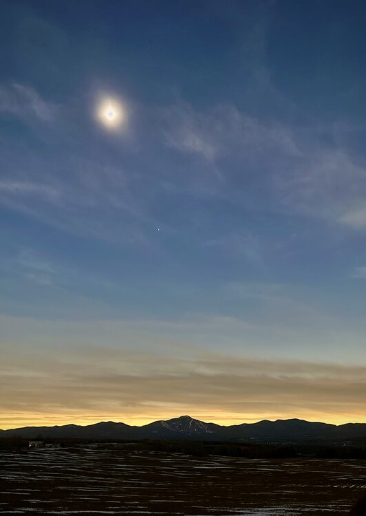
0.5 miles from the Canadian border Looking toward Jay peak near Newport center. Took about 3 hours and 40 minutes to get to Montpelier. Been better to Rutland. 3 hrs still to go
-
Have a map of 3 or 4 pm? Actual totality is at 3:30
-
I am planning on going up Rt 100 in Vt from Rochester tmrw morning towards a spot just nw of Newport. Thoughts on traffic, clouds?
-
Significant Miller B Nor'easter watch, Apr 3rd-4th
kazimirkai replied to Typhoon Tip's topic in New England
Weather is absolutely miserable in Long Island. 39 degrees with 30 degree wind chill and pouring rain -
It was a Flop... February 2024 Disco. Thread
kazimirkai replied to Prismshine Productions's topic in New England
Just kind of a random question: Do models take into consideration snow-cover enhanced radiational cooling when forecasting temperatures? Its hard to know which forecasts to pay attention that do. -
I'm sketched out about this storm living in northern long island. Good chance it could be the first big storm that turns all rain in the past three years of being at school here.
-
It was a Flop... February 2024 Disco. Thread
kazimirkai replied to Prismshine Productions's topic in New England
Yeah the most evident trend is definitely an increase in volatility -
It was a Flop... February 2024 Disco. Thread
kazimirkai replied to Prismshine Productions's topic in New England
How to you get it to plot the outputs? -
It was a Flop... February 2024 Disco. Thread
kazimirkai replied to Prismshine Productions's topic in New England
That type of statistical analysis shouldn't be too hard with some basic python code and relevent NCEI data. You could probably even get chatgpt to write everything for you. -
It was a Flop... February 2024 Disco. Thread
kazimirkai replied to Prismshine Productions's topic in New England
Do you think the window of opportunity of pulling snow out of these blocking patterns has slimmed in the last 10 or 20 years because of increasing temperatures? To the point that a favorable late February pattern is less likely to result in a storm than it used to be? -
Well i'm back at school in long island and its been nothing but rain and misery for the past week. Par for the course!
-
Is ZR freezing rain?
-
Wish me luck... Crossed fingers

-
Why does anyone even care about how good a winter overall is? Why can't we just hope for a good storm and if it doesn't happen move on to the next chance instead of reflecting on the season all the time? I just don't understand the function of consistently setting bars that must be met to keep the winter at an acceptable level and otherwise "giving up" on it. Its not like a winter season is an ill patient we must keep alive with snow and cold. It's just a happening that we're powerless against so it sort of begets depression and stress in my mind to think about it like something of value that can be lost or gained. I tend to look at the big picture only briefly after a season is over and then move onto the next one so as not to torture myself. Call me a stoic if you want but those are just my thoughts.
-
What kind of winter pattern shifts and upper-level stuff are being altered by climate change? I know the jet will speed up but I'm unsure how that affects the nature of large winter storms in general. Maybe someone can point me towards some studies on the subject?
-
I assume non-met people are referring to the fact that its not a real force per say and so call it an effect. It's only perceived from objects on a rotating frame to correct for that fact, like the centrifugal force. I presume it's referred to by atmospheric scientists as a force is because in drawing air parcel force diagrams, it makes it easier to understand the balances at work with pressure gradient, frictional, gravitational forces etc.
-
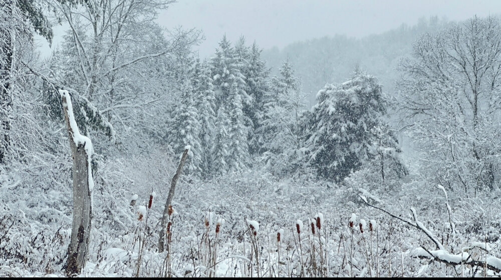
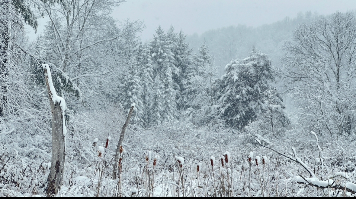
Alot of my snow from the Sunday storm is actually still here after the storm. If only we weren't getting two back to back rain storms in a row smh.
-
Seems like a carbon copy of the storm were in rn but with colder air after it
-
Do you guys have any hope for the 13th storm?
-
10.5 inches wet snow in stone ridge, NY. 4”/hr Band got me round midnight last night but was strongest south of me. Some areas down there got over a foot. Beautiful nonetheless