.jpeg.302c67143ea75c332053973bc310ec90.jpeg)
kazimirkai
-
Posts
174 -
Joined
-
Last visited
Content Type
Profiles
Blogs
Forums
American Weather
Media Demo
Store
Gallery
Everything posted by kazimirkai
-
.thumb.jpeg.406ecda2eec9e267302c22b9f128fe3c.jpeg)
Feb 10-11 Mid Week Minor Event - Ride the hot hand?
kazimirkai replied to HoarfrostHubb's topic in New England
Not great for Albany. Maybe I'll go skating if it doesn't snow -
Possible coastal storm centered on Feb 1 2026.
kazimirkai replied to Typhoon Tip's topic in New England
Interesting to see EPS and GEFS trending in opposite directions. GEPS sits pretty happily in the middle -
“Cory’s in LA! Let’s MECS!” Jan. 24-26 Disco
kazimirkai replied to TheSnowman's topic in New England
Are there ensemble members were not seeing that are weighting it this highly? -
“Cory’s in LA! Let’s MECS!” Jan. 24-26 Disco
kazimirkai replied to TheSnowman's topic in New England
Still one of the slowest approaches. Doesn't hit me till Sunday evening compared to morning/midday on other models -
“Cory’s in LA! Let’s MECS!” Jan. 24-26 Disco
kazimirkai replied to TheSnowman's topic in New England
This is getting ridiculous. Isn't the NBM supposed to be the most reasonable model?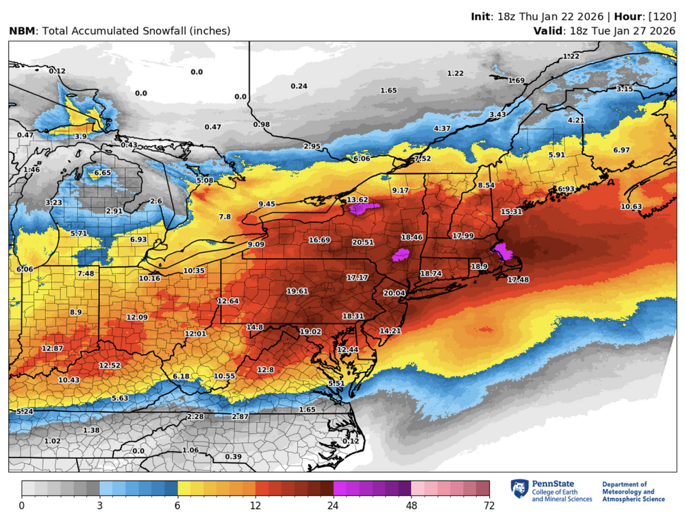
-
“Cory’s in LA! Let’s MECS!” Jan. 24-26 Disco
kazimirkai replied to TheSnowman's topic in New England
Just got some of that here in Albany -
“Cory’s in LA! Let’s MECS!” Jan. 24-26 Disco
kazimirkai replied to TheSnowman's topic in New England
Not Albany and New York yet, interestingly. Guess they're still less certain despite NBM outputs -
“Cory’s in LA! Let’s MECS!” Jan. 24-26 Disco
kazimirkai replied to TheSnowman's topic in New England
Seems like 12z models are much more confident abt inland snow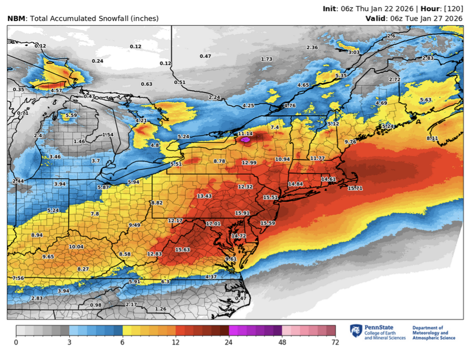
-
“Cory’s in LA! Let’s MECS!” Jan. 24-26 Disco
kazimirkai replied to TheSnowman's topic in New England
Didn't they send hurricane hunters out somewhere to take measurements? Or has that not happened yet -
“Cory’s in LA! Let’s MECS!” Jan. 24-26 Disco
kazimirkai replied to TheSnowman's topic in New England
certainly seems farther north than the gfs with a more eastern weighted shield. Waiting for reggie for comparison -
“Cory’s in LA! Let’s MECS!” Jan. 24-26 Disco
kazimirkai replied to TheSnowman's topic in New England
Alot of my weather friends from Stony brook and Albany are heading down to AMS this weekend and they're all hoping for ice there to at least see some winter precip out of this huge storm. Pretty tragic situation for them if its all rain -
December 2025 regional war/obs/disco thread
kazimirkai replied to Torch Tiger's topic in New England
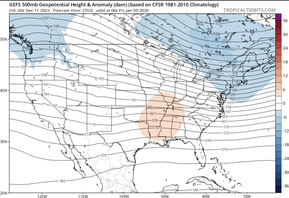
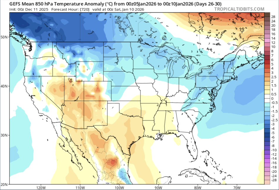
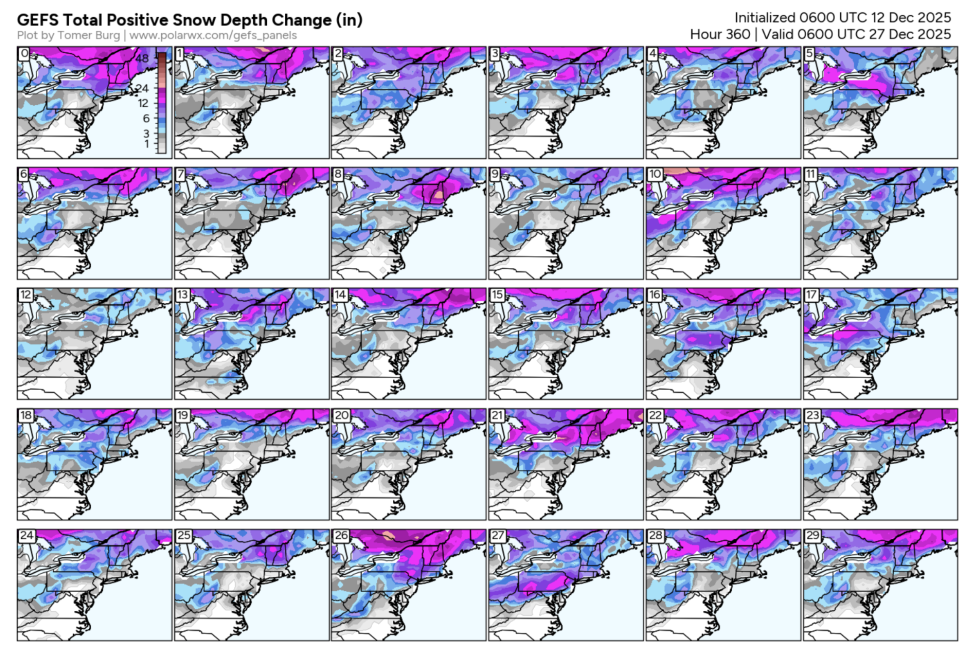
The extended GEFS seems to be picking up on this secondary SSW signal with the some winter in early January (mainly around the 4th-12th in today's run). I think there could def be some chances for snow in interior NE and especially mountains before that though (evidenced by snowfall on the 384hr ensemble suite). The central ridge seems to relax more westward following Christmas.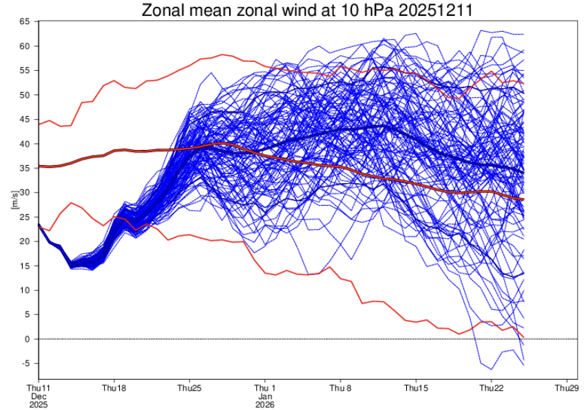
-
Idk bout the two months but the current state would suggest some effects in early January which are reflected in extended gefs guidance

-
I mean the MJO signal isn't progged to project much on to the midlat pattern for the foreseeable future beyond day 21 so I'm a little doubtful of it's predictive relevance in this case.
-
December 2025 regional war/obs/disco thread
kazimirkai replied to Torch Tiger's topic in New England
Probably will be a warm one this year but I don't expect that we'll see the worst of it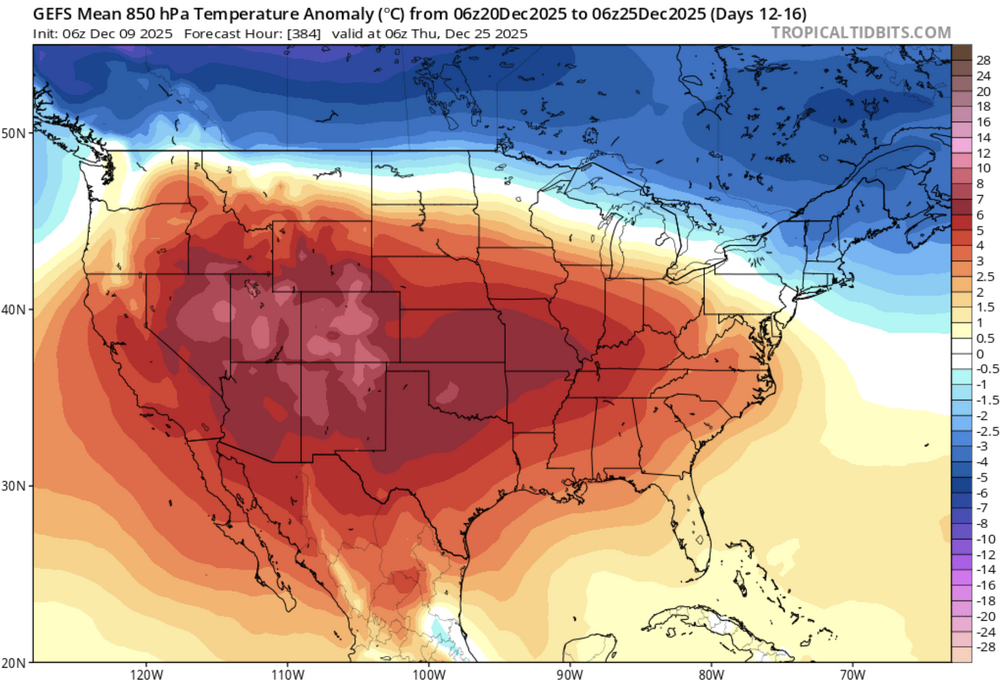
-
December 2025 regional war/obs/disco thread
kazimirkai replied to Torch Tiger's topic in New England
Personally I'd rather it be cold with no snow than warm with no snow. At least the ponds are frozen and I can visit the mountains to get a dose of winter when I need. -
First Winter Storm to kickoff 2025-26 Winter season
kazimirkai replied to Baroclinic Zone's topic in New England
For anyone curious abt the nbm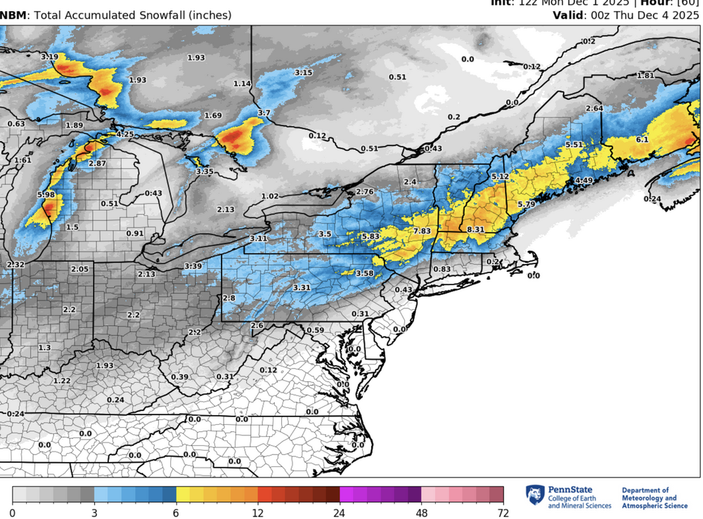
-
First Winter Storm to kickoff 2025-26 Winter season
kazimirkai replied to Baroclinic Zone's topic in New England
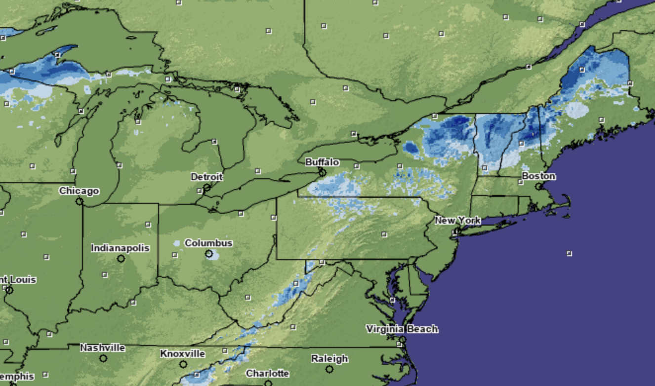
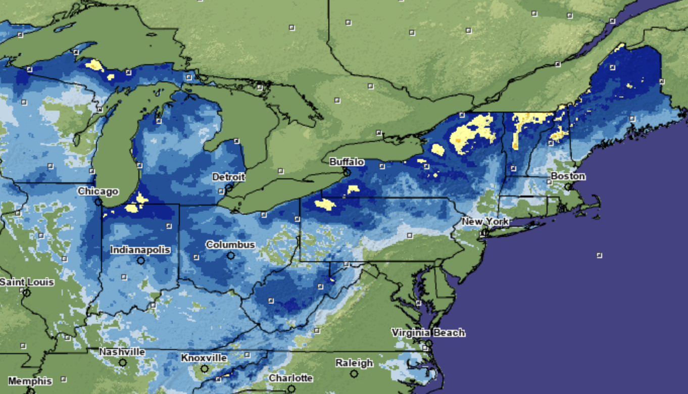
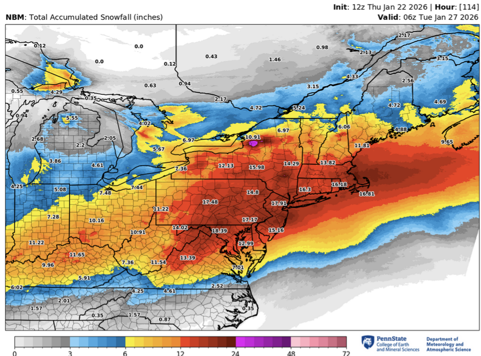
What's with the discrepancy here? These maps were released 15 minutes apart.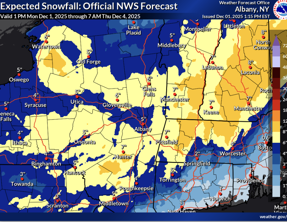

-
lotta spread though
-
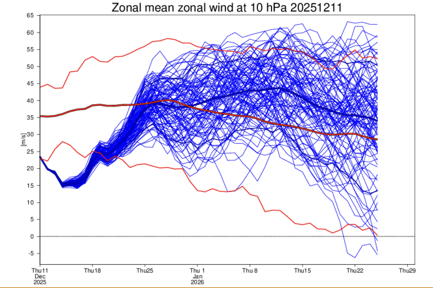
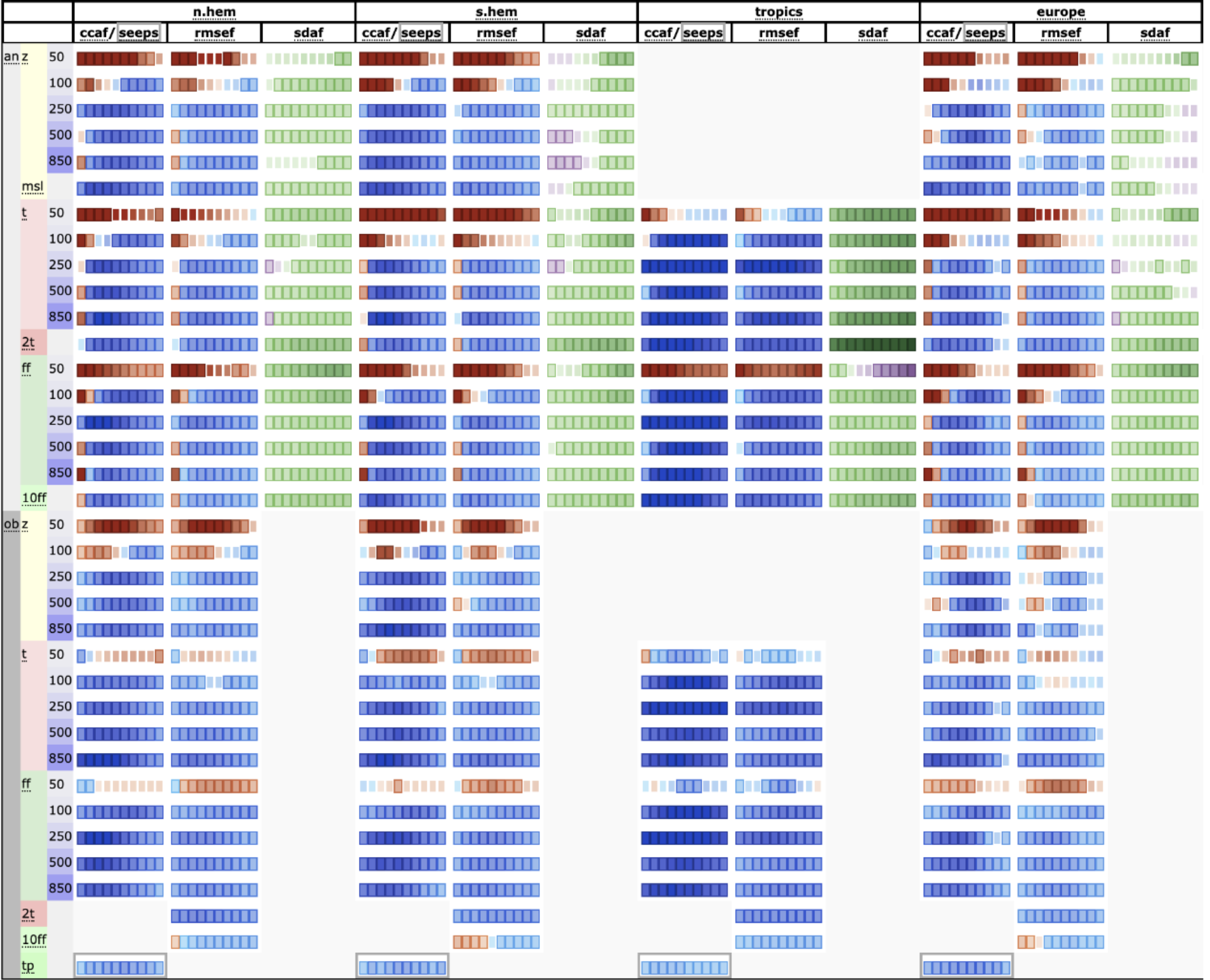
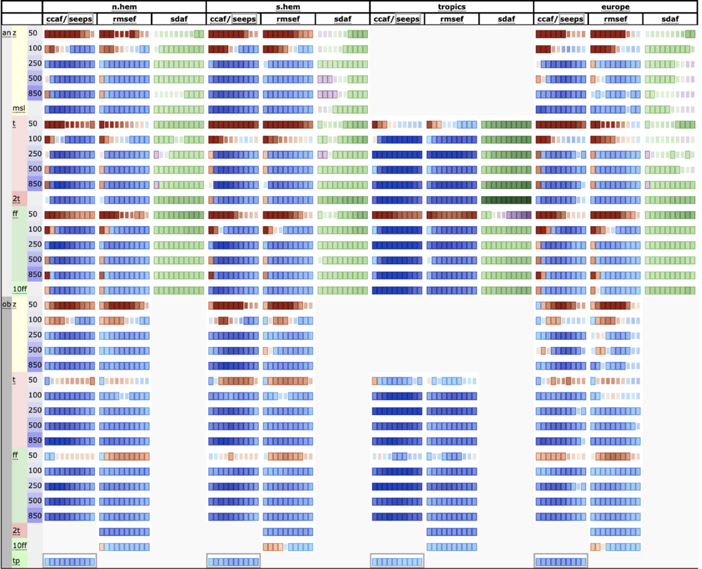
AIFS scorecard over operational (blue=improvement). Ryan Torn suggested that systematic under performance at 50mb was because the NWP models it's train on aren't actually very good at simulating the physics of the stratosphere, so it's learning incorrect conclusions and then applying them in full force.
-
I mean yeah, deriving the effect of an SSW is a much more complex problem, but no one's debating whether or not it will occur. That's what I find comical about this post.
-
Lol what's nail-biting about it? Every single ensemble member supports it and about 90% are on board for a full reversal. Seems a bit clickbaity
-
Well it's pretty normal to expect that the MJO wouldn't reach phase 8 in a la-niña situation with base easterlies, but forecasts change. Still tough to say if it'll stay there long but that seems to be the crux of the change in forecasts over the past week or so.
-
I mean this seems pretty reasonable. Was at stony brook for the last four years and we got literally one decent snowstorm during that whole period. I certainly related to this sentiment coming from upstate New York.
-
If you ask me we've already sufficiently met the criteria or an early winter in the east so some relative warmth over the next two or three weeks feels like an appropriate 'balance'. Here's a comparison of seasonal snowfall vs last year at this time. Only the coastal and mid-atlantic areas that have missed out so far.