
nvck
-
Posts
243 -
Joined
-
Last visited
Content Type
Profiles
Blogs
Forums
American Weather
Media Demo
Store
Gallery
Everything posted by nvck
-
Absolutely incredible day in store here, 10am and it's already up to 42 which feels like the 50s after the past few weeks. W/ the sunny skies and a nice SW breeze I'm thinking we top 50. Could not be more excited
-
I definitely haven't, only been to Lake Huron and mostly central/southern Lower. Yeah, lots of math w/ the MET major, after calc 2 comes diff eq/linear algebra, and then calc 3 after that. supposedly calc 2 is the hardest, which I'm really hoping is true.
-
No, the farthest north I've been in MI is Tawas City last March (which didn't have any snow at the time), but I'd like to go up to that area at some point if I can ever get some free time. met major classes are no joke, especially calc 2
-
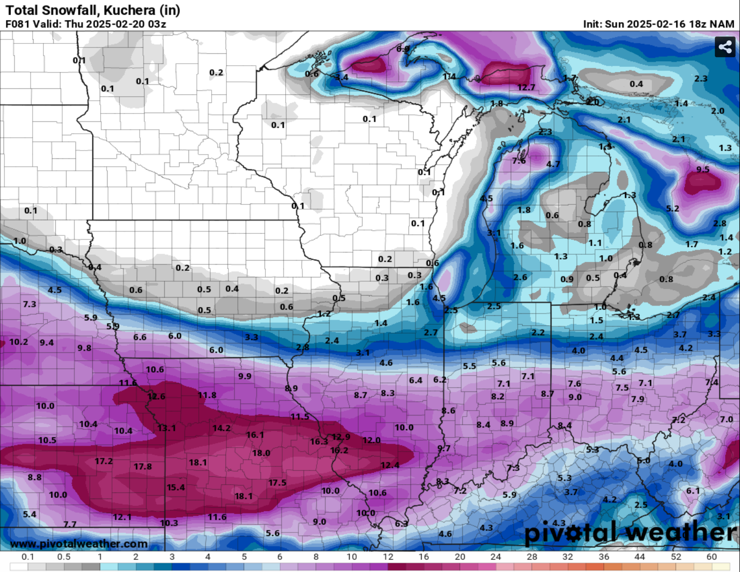
18z NAM didn't really back down, although it is a pretty significant outlier with this far north of a track

-
Yeah, foot otg is looking very unlikely with the depressing 12z runs. I've not measured, but maybe 6" rn? Again, that's a very rough estimate
-
Snows yet to start here, but looking forward to the potential for over a foot of snow OTG when this is all said and done, would easily be the most I can ever remember seeing.
-
agree, and i've gotten into arguments about this w/ people, at what point does making something clickbait with the premise of "more people will know about it" turn into people ignoring any threat because they are all this overhyped.
-
different system than the one everyone is hyped about, but ILN put up WS warnings for NC KY counties, with WWAs for NKY and the southern tier of ohio counties
-
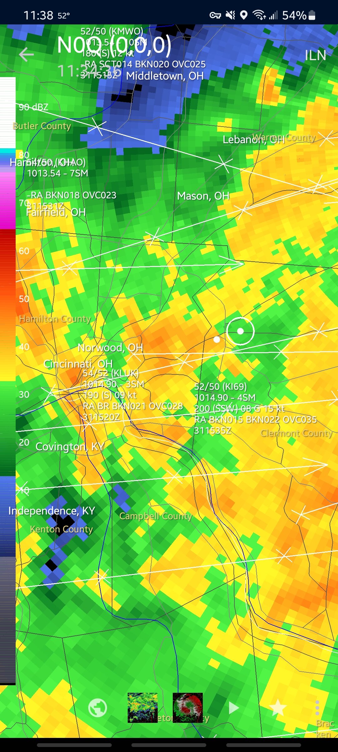
might explain why it's been so high on the OV storm tomorrow, and dumping 3-4" over cincy where other models have 1-2"
-
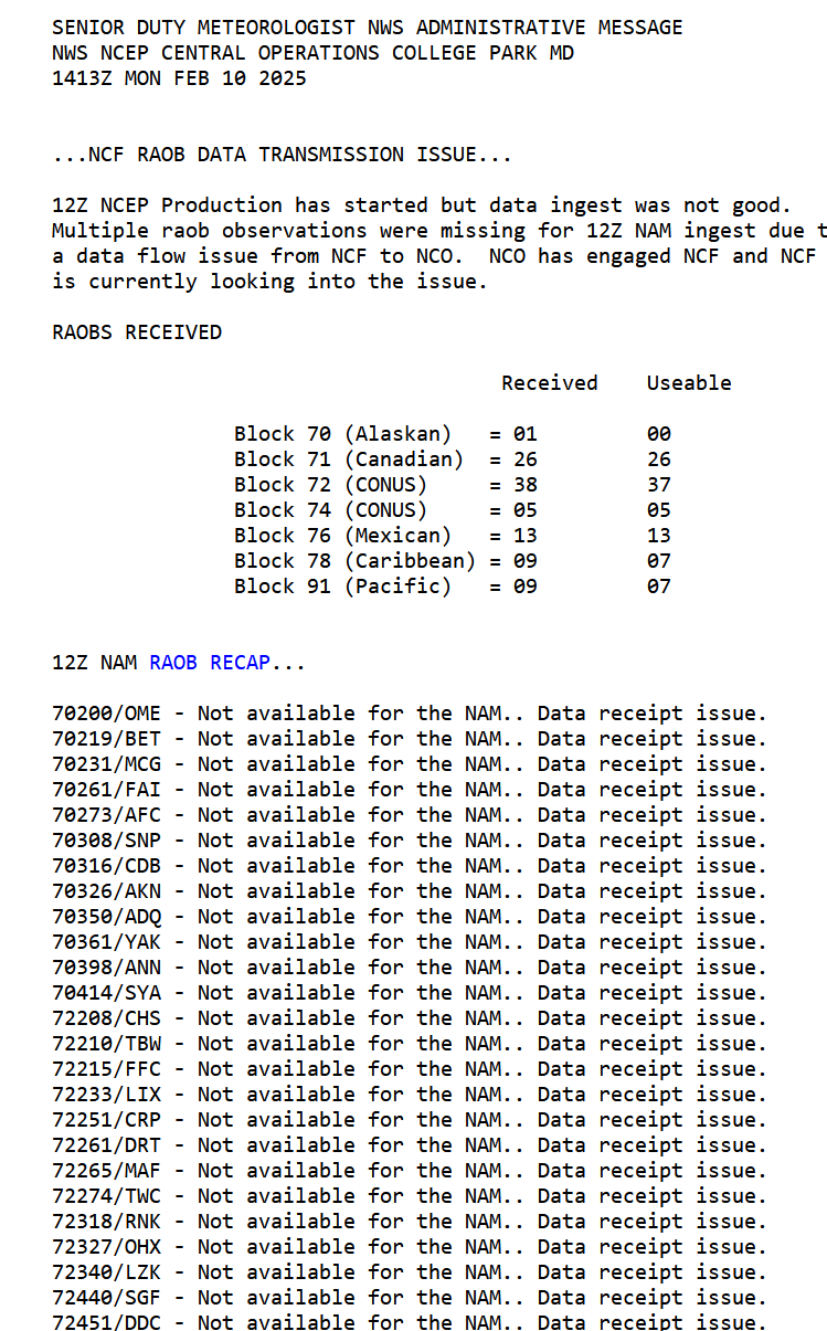
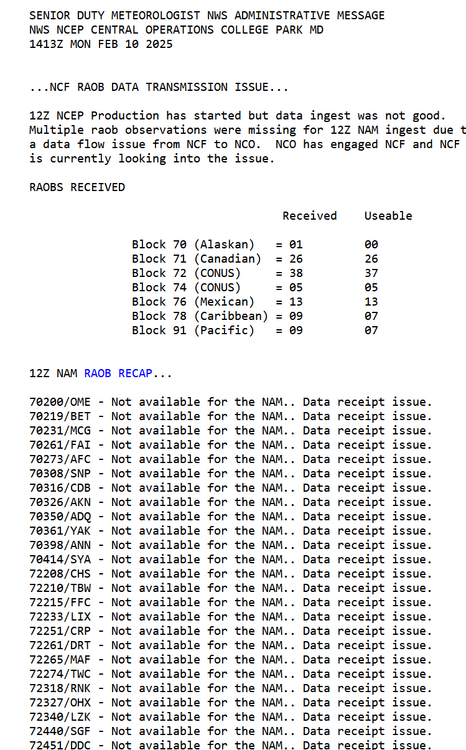
apparently the 12z run of the NAM did not ingest upper-air data properly, per https://www.nco.ncep.noaa.gov/status/. messages/ so I wouldn't put much stock in it.
-
huh, I guess it didn't last as long as I thought it did, thats pretty impressive then
-
Ended up with 2-3” I believe, didn't do any measurements but enough to cover the grass is a success in my book! That band slowly moving south this evening really saved us, with decent rates for a couple hours
-
Thanks man, yeah that heavier band finally ticked south a bit and we've actually got decent rates atm. i honestly just want the grass to get mostly covered, it makes the cold so much more palatable
-
pretty big bust so far here, most of the snow is just north of mt. pleasant. Had about 30min of light snow earlier, which laid down like 0.2", and I think we could get maybe 1" more with a slight south tick. GRR had us at 2-4" this morning.
-

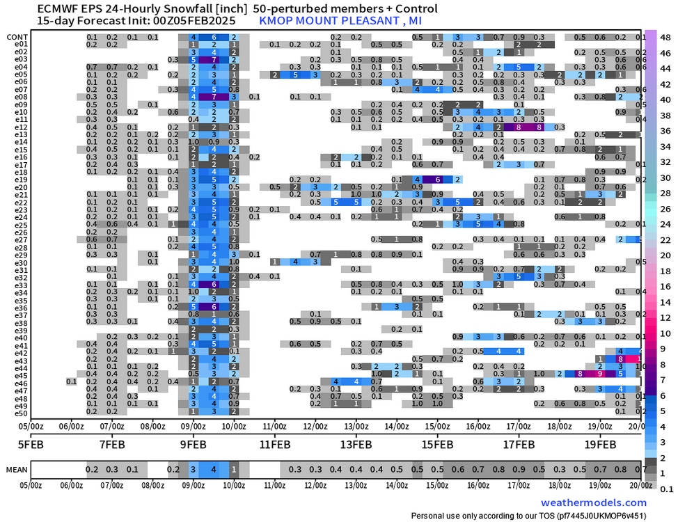
Winter 2024-25 Medium/Long Range Discussion
nvck replied to michsnowfreak's topic in Lakes/Ohio Valley
pretty surprisingly high agreement on temps over the next week or so, and then ensembles are all over the place after that. EPS is showing the biggest snow event of the year for mid-michigan, which would be nice.
-
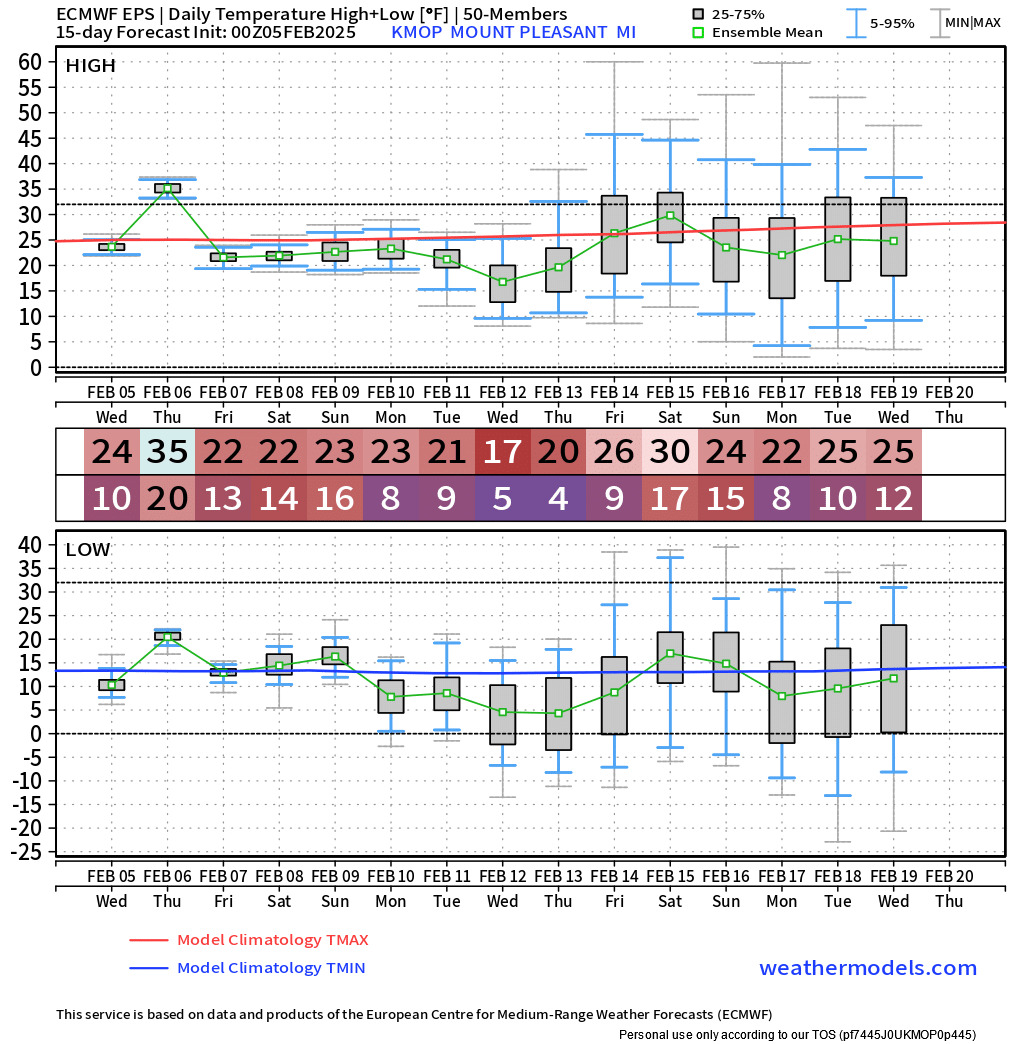
NAM3 is definitely an outlier in SW ohio, selling widespread 0.1-0.15", but idk if anyone's noticed that it's been way colder than other models these past few weeks. Like, it's got KLUK with a high of 42 on thursday, and the model avg is 50, with HRRR and NBM higher than that.
-
KLUK got up to 70° as of the 2pm obs. Would take that in a heartbeat over the 32° and gray here
-
Yeah, I was hoping that the grass would at least get re-covered, but it's still mostly bare. definitely underperformed
-
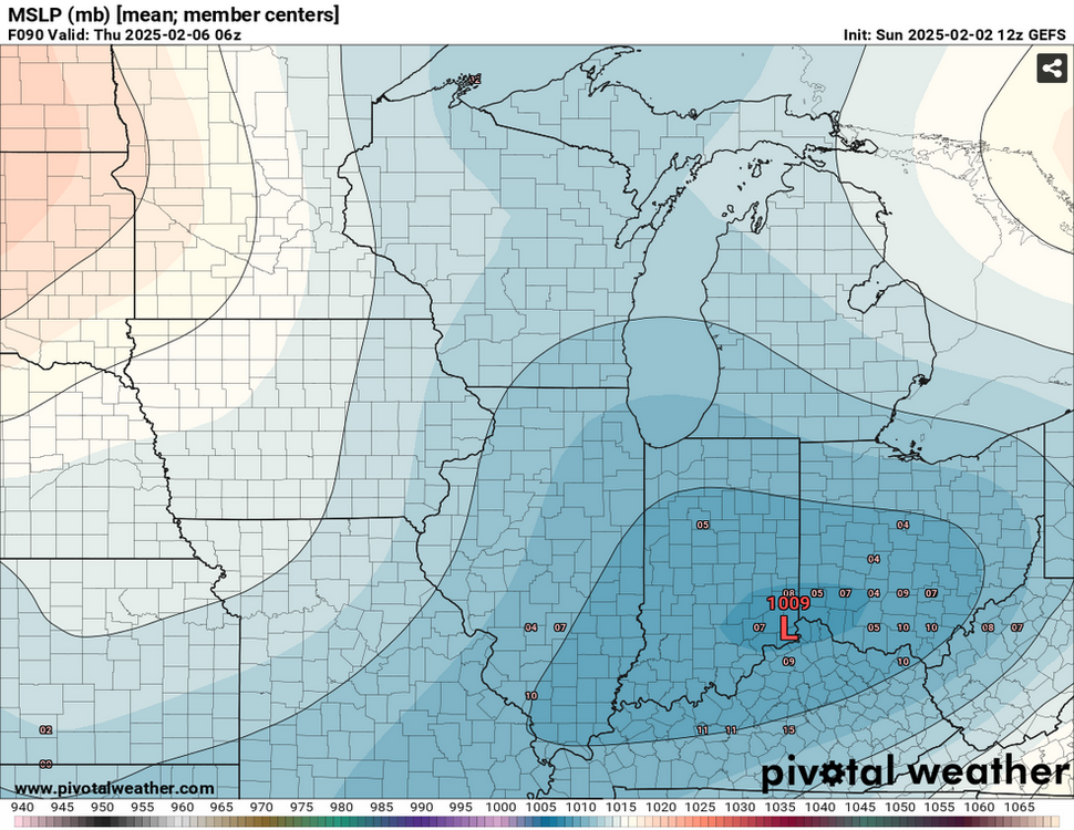
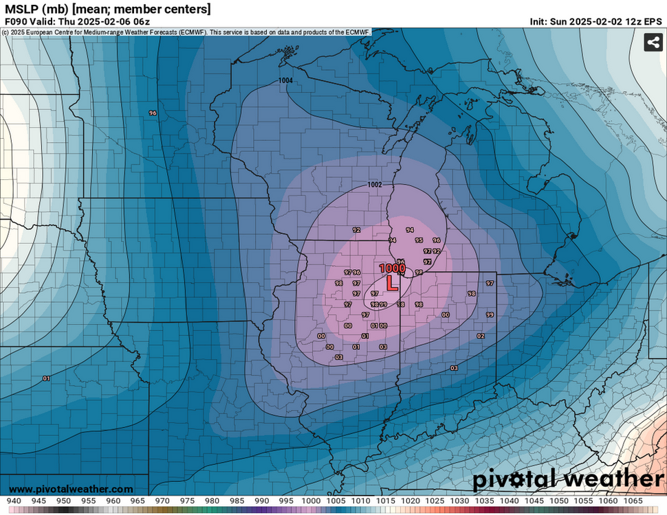
never started a topic before, but figured this storm could use one, as it's got the potential to be a significant event for our area... went ahead and x-posted the latest gefs/eps MSLP products from the other thread
-
Winter 2024-25 Medium/Long Range Discussion
nvck replied to michsnowfreak's topic in Lakes/Ohio Valley
GEFS has trended a little bit stronger, and maybe slightly farther north over the past couple runs, and the EPS has trended stronger, and clustering around Chicago the past several runs. Someone will have to cave soon.... 18z NAM should be interesting, with this system showing up at the end of the run.
-
Picked up maybe 0.5" this morning, drove to harrison yesterday, and it's wild how much more snow is otg up there compared to here.
-
Winter 2024-25 Medium/Long Range Discussion
nvck replied to michsnowfreak's topic in Lakes/Ohio Valley
Seeing some pretty interesting discrepancies with the Euro & GFS for the Weds night/Thurs morning system. Euro and it's ensembles bring a pretty significant ice-storm to most of Michigan, and have the low center around the IL/IN border at 6z on thursday. The gfs and gefs, on the other hand, have the low centered around OH/KY/IN at that same time, with not much precip making it up this way. The euro solution also appears to be significantly deeper as well. (1004mb compared to the gefs' 1012mb). fwiw, the CMC ensemble basically just goes between the other two, lol. -
Not sure if anyone else uses this site, but https://www.anyawos.com/metar/WeatherNexus is a pretty good resource for up-to-the-minute obs from a bunch of small airports around the midwest, but mostly in MI and MN.
-
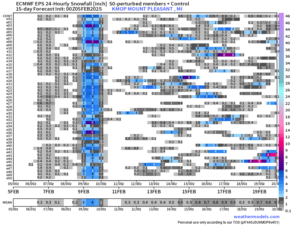
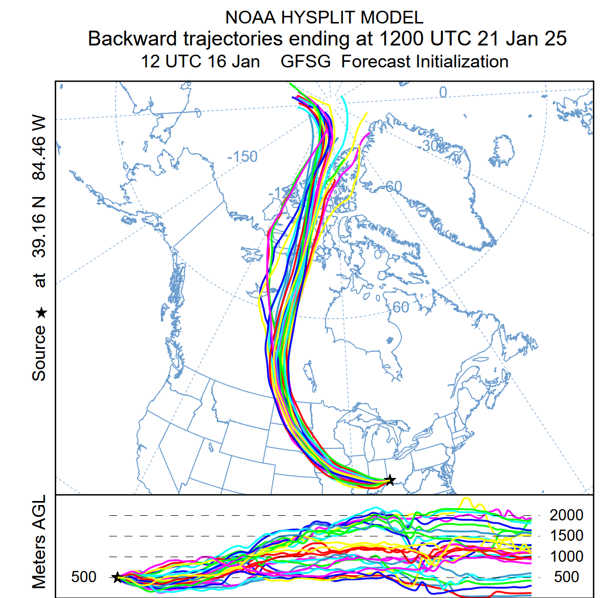
Appreciate it! Was gonna share this graphic but wanted to make sure I understood it completely first
-
If I'm understanding what this tool does correctly, this basically means that the air mass over cincinnati the morning of the 21st is coming from northern canada/the arctic, right?