

Bxstormwatcher360
-
Posts
780 -
Joined
-
Last visited
Content Type
Profiles
Blogs
Forums
American Weather
Media Demo
Store
Gallery
Everything posted by Bxstormwatcher360
-
Presidents' day Snow potential
Bxstormwatcher360 replied to WeatherGeek2025's topic in New York City Metro
The temps have def busted in the positive..its 29f..not 32 33..the snow is fluffy and piling up faster then I thought..its still snowing here..1.3 down. -
Presidents' day Snow potential
Bxstormwatcher360 replied to WeatherGeek2025's topic in New York City Metro
One can only wish but its snowing atleast. Radar looks good for the city in any case. -
Presidents' day Snow potential
Bxstormwatcher360 replied to WeatherGeek2025's topic in New York City Metro
A positive bust incoming. Temps keep dropping. Its 30 now with moderate snow . The radar is about to go boom before it ends. -
Presidents' day Snow potential
Bxstormwatcher360 replied to WeatherGeek2025's topic in New York City Metro
Temp dropped from 35 to 32 in 30 mins here. Winds are up and the snow went to nothing to boom. Steady lgt to mod snow here currently. -
Presidents' day Snow potential
Bxstormwatcher360 replied to WeatherGeek2025's topic in New York City Metro
Nice banding features starting to appear over li into the city. -
Presidents' day Snow potential
Bxstormwatcher360 replied to WeatherGeek2025's topic in New York City Metro
That fringe band is coming, looks good for us in the city,its a slow mover. No model had/has that feature which is interesting. -
Presidents' day Snow potential
Bxstormwatcher360 replied to WeatherGeek2025's topic in New York City Metro
Southerly winds now,temps up a degree to 35/28f. 73%rh. Air is juiced already. Precip is building towards nyc atm. -
Presidents' day Snow potential
Bxstormwatcher360 replied to WeatherGeek2025's topic in New York City Metro
Its coming bud. Also precip(virga) building east into nnj from pa. -
Presidents' day Snow potential
Bxstormwatcher360 replied to WeatherGeek2025's topic in New York City Metro
We gotta see where the northern fronto band sets up. Nyc is looking prime for that band rn,precip expanding east into nyc with heavier bands developing might give us a positive bust later. I expect more then the "inch" that everyone is harping about. 33/26f cloudy. -
Presidents' day Snow potential
Bxstormwatcher360 replied to WeatherGeek2025's topic in New York City Metro
Yeah the moisture is def north as well. -
Presidents' day Snow potential
Bxstormwatcher360 replied to WeatherGeek2025's topic in New York City Metro
Thats because actual real time atmospheric conditions are not being included in to these models. Everything is playing catchup rn. We snow!! -
Presidents' day Snow potential
Bxstormwatcher360 replied to WeatherGeek2025's topic in New York City Metro
The actual progression in real time is looking much better for us down stream then what the models are showing rn. Also alot of moisture pretty far north on radar. The suppression doesn't look as bad either since its moving out the way. -
February 2026 OBS & Discussion
Bxstormwatcher360 replied to Stormlover74's topic in New York City Metro
Its been snowing here for over an hour..nice recoat of white on everything. 26/lgt snow currently. -
You know i had to laugh at that,although there is precip where there shouldn't be. Lower Cloud deck should be moving in soon off the ocean.
-
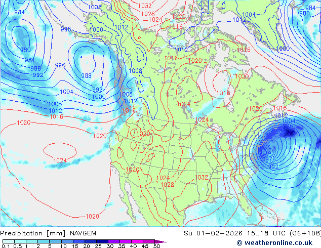
Yeah 2 models have trended west so far,we keep forgetting that a 30 to 60 mile swing northwest gets us in to the good snows.
-
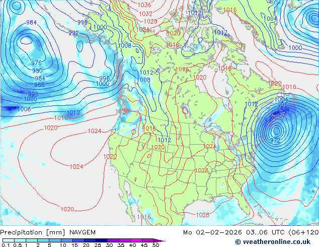
0z canadian def trended west. It gets us in to the light snow.
-
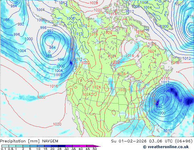
Only model with a hit is the 0z navgem so far. This model did pretty damn well in the last storm we had.
-
Lgt snow falling here. 19f.
-
I just wrote about the possibility of some more powder today. Good to see its snowing again.
-
Disturbance might bring us some fresh powder later on. The more the marrier I say.. its cold and snow grey outside rn.
-
So every model has this storm rn,that's a great start. Hatteras to to the benchmark incoming !!
-
By monte and north central. Im Still around the area.!
-
I mean that was expected or no??. These amounts towards the coast not so much..much love to the hudson valley though .
-
The bronx and upper manhattan are between 12 to 14 inches as of now. 8-12 became 12-14 up here,still going too.
-
By Woodlawn/norwood.


