

Wow
-
Posts
8,070 -
Joined
-
Last visited
Content Type
Profiles
Blogs
Forums
American Weather
Media Demo
Store
Gallery
Everything posted by Wow
-
..and pinned for some of the newcomers to read through.
-
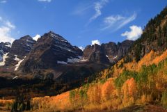 That's some killer color
 -
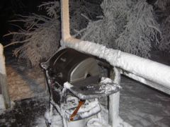 I have that same grill right now. It's about to fall apart though. Didn't take enough care of it.
 -
Welcome to our new content-managed, community-driven web site, powered by our online community of professional meteorlogists and weather enthusiasts alike. The creation of a true front page will help to showcase many of the well-written articles, blog entries, and forum posts which may have otherwise been buried deep in a long forum thread. This new design will really show how resourceful our growing online community can be.
-
Heard that the Washington Monument is "tilting" ? Confirm?
-
Devastating tornado strikes Joplin, Missouri
Wow replied to Hoosier's topic in Weather Forecasting and Discussion
Just heard the news. Glad to hear you're ok, JoMo. Based on your suspected location, we thought you'd be right on the fringe of the major damage area. -
If you're having a slow connection speed, I've heard that the WWBB skin loads fastest.
-
We're fixing to purchase a new skin (and customized in house)
-
Tapatalk is now activated.
-