Hurricane Agnes
-
Posts
9,271 -
Joined
Content Type
Profiles
Blogs
Forums
American Weather
Media Demo
Store
Gallery
Everything posted by Hurricane Agnes
-
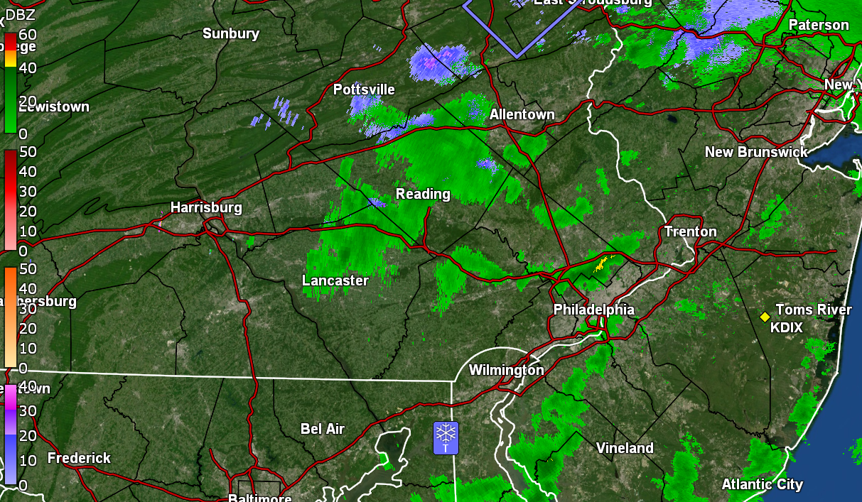
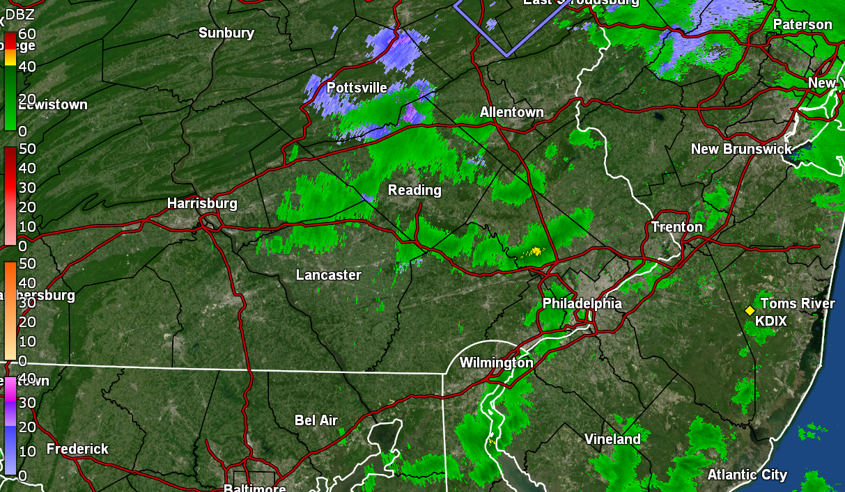
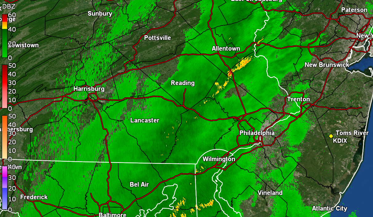
E PA/NJ/DE Spring 2024 OBS/Discussion
Hurricane Agnes replied to Hurricane Agnes's topic in Philadelphia Region
https://www.cpc.ncep.noaa.gov/products/analysis_monitoring/enso_advisory/ensodisc.shtml ENSO advisory notes a "La Nina Watch". Expectations to go ENSO neutral starting in April through to June and then La Nina reappearing over the summer. Will have to see if that pans out. Ended up with a high of 76 yesterday after a 47 low and it's currently a mild 56 with dp 47. -
E PA/NJ/DE Spring 2024 OBS/Discussion
Hurricane Agnes replied to Hurricane Agnes's topic in Philadelphia Region
LOL I remember as a senior in high school back in '79, my high school Physics class took a trip there while it was under construction (the cooling towers were just being built). The PECO tour guide told us that when it was completed, our electric bills would be reduced to $3 a month! Anyway, it was a gorgeous day today with daffodils in bloom and even some cherry trees. I ended up with a high/low of 66/37 yesterday, and 71/41 today. My last 70+ temp was Oct. 27 of last year. Currently 56 with dp 38. -
E PA/NJ/DE Spring 2024 OBS/Discussion
Hurricane Agnes replied to Hurricane Agnes's topic in Philadelphia Region
Under a light flurry shower. Temp at 39 with dp 30.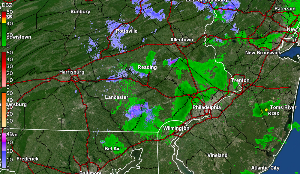
-
E PA/NJ/DE Spring 2024 OBS/Discussion
Hurricane Agnes replied to Hurricane Agnes's topic in Philadelphia Region
Actually gave me a 0.1" dusting of graupel and rimed flakes. Sun peaking out with some leftover flurries. ETA temp down to 36 with dp 32.. -
E PA/NJ/DE Spring 2024 OBS/Discussion
Hurricane Agnes replied to Hurricane Agnes's topic in Philadelphia Region
And it got me! Graupel-izzard! (or at least sideswiped)
-
E PA/NJ/DE Spring 2024 OBS/Discussion
Hurricane Agnes replied to Hurricane Agnes's topic in Philadelphia Region
Nothing here yet but sun and some dark clouds off to the west. My Upper Darby sis texted that she was under snow squall #2 where she is. Temp is down to 42 here with dp continuing to fall and at 28. ETA - will have to see if that cell makes it here.
-
E PA/NJ/DE Spring 2024 OBS/Discussion
Hurricane Agnes replied to Hurricane Agnes's topic in Philadelphia Region
It did something dramatic. Sun had come out here some time around 9:30 am and then before 11 am, it got dark (was thinking maybe a squall or something but it was too warm for that). Then had the brief light shower and temp drop. Sun is slowly coming out again and temp is back up to 47.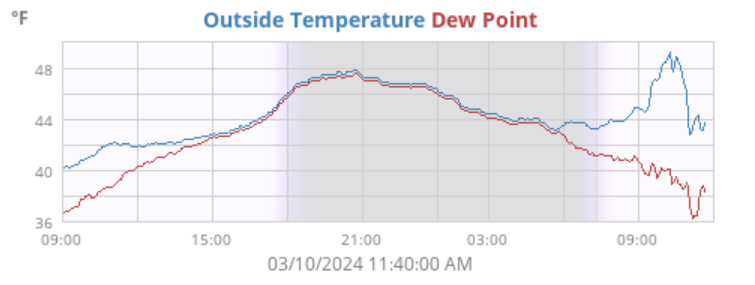
-
E PA/NJ/DE Spring 2024 OBS/Discussion
Hurricane Agnes replied to Hurricane Agnes's topic in Philadelphia Region
It was a "line" of something that came through. Had brief non-measurable rain here but it did drop the temp from 50 back down to 43.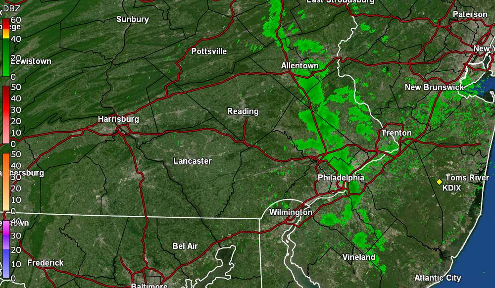
-
E PA/NJ/DE Spring 2024 OBS/Discussion
Hurricane Agnes replied to Hurricane Agnes's topic in Philadelphia Region
Finished up with 1.78" of rain yesterday and so far this morning, bottomed out at 43. Currently a misty 44 with dp 42. -
E PA/NJ/DE Spring 2024 OBS/Discussion
Hurricane Agnes replied to Hurricane Agnes's topic in Philadelphia Region
Bottomed out at 39 this morning and only made it up to 48 as a high with some light rain (once it started) much of the day. The rain has suddenly picked up here in the last hour or so and I'm now up to an 1.04" at post time with almost 1"/hr rates. Some winds are starting to kick in and am currently at 48 with dp 47. -
E PA/NJ/DE Spring 2024 OBS/Discussion
Hurricane Agnes replied to Hurricane Agnes's topic in Philadelphia Region
Ended up with lows/highs for Wed & Thurs. of 47/50 & 46/56, with 1.16" in the bucket Wed. & 0.04" yesterday (2-day total of 1.20"). My low this morning was cooler than the past couple days, at 39 and so far hit 55 for a high. Was able to get some fertilizer out on the plants this afternoon ahead of this weekend's rain. The sun has been out much of the day but the clouds are starting to roll in now so it's currently partly sunny and 54 with dp 34. -
E PA/NJ/DE Spring 2024 OBS/Discussion
Hurricane Agnes replied to Hurricane Agnes's topic in Philadelphia Region
Had a low of 42 this morning and it hasn't moved that much today with the rain. Currently have some light rain and a temp of 46 (the high so far) and 0.39" in the bucket. Can obviously see where the low is! lol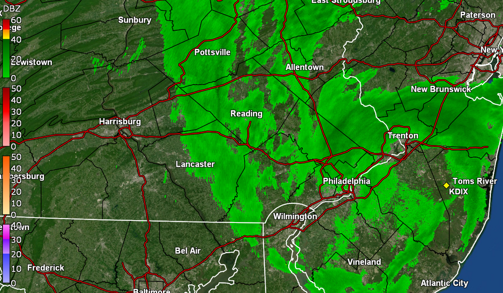
-
E PA/NJ/DE Spring 2024 OBS/Discussion
Hurricane Agnes replied to Hurricane Agnes's topic in Philadelphia Region
I eventually managed to tap 64 for a high yesterday and had a 44 low this morning. Something came through around 4 pm today and knocked the temps down a bit (it had already clouded up before then), where I hit 65 for a high but am now down to 59, with some stratocumulus overspreading the sky, and dp 50. -
E PA/NJ/DE Spring 2024 OBS/Discussion
Hurricane Agnes replied to Hurricane Agnes's topic in Philadelphia Region
Ended up hitting 54 yesterday after a low of 38 and picked up 1.50" of rain then. This morning's low was 44 and am currently at my high so far today of 63, with fluffy cumulus drifting in, and a dp of 51. -
E PA/NJ/DE Spring 2024 OBS/Discussion
Hurricane Agnes replied to Hurricane Agnes's topic in Philadelphia Region
Made it up to 49 for a high today and am watching the junk 'n stuff on the radar headed this way. Currently 40 with dp 28. -
Ended up hitting 41 for a high on that Feb. 29 leap day after a 30 low and finished up the month with 1.82" of rain/sleet/snow melt (which is probably low due to snow clogging the bucket). Currently 27 with dp 19.
-
E PA/NJ/DE Winter 2023-2024 OBS/Discussion
Hurricane Agnes replied to The Iceman's topic in Philadelphia Region
Drier air coming in now. Temp at 47 with dp 38. -
E PA/NJ/DE Winter 2023-2024 OBS/Discussion
Hurricane Agnes replied to The Iceman's topic in Philadelphia Region
Cooler air now filtering in. Am down to 48 and falling. Have 0.31" in the bucket (0.40" 2-day), with some light rain and with some kite-flying winds! -
E PA/NJ/DE Winter 2023-2024 OBS/Discussion
Hurricane Agnes replied to The Iceman's topic in Philadelphia Region
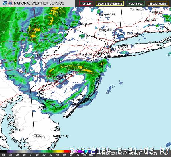
Finally heard something akin to a gust front come through, but the rain has been pretty minimal. Before the latest round, I had 0.23" (+ 0.09" from yesterday for 2-day 0.32). Currently have 0.29" in the bucket for today with some light rain. Temp is currently 53 with dp 50, so the colder air hasn't arrived yet.
-
E PA/NJ/DE Winter 2023-2024 OBS/Discussion
Hurricane Agnes replied to The Iceman's topic in Philadelphia Region
Made it up to 60 for a high today and see the line approaching. Currently 59 with dp 57.
-
E PA/NJ/DE Winter 2023-2024 OBS/Discussion
Hurricane Agnes replied to The Iceman's topic in Philadelphia Region
Made it up to 65 for a high yesterday and had a low of 53 this morning. And for the first time in 65 days, my lightning detector picked up a strike this morning between 11 am and noon (didn't hear any thunder that I recall although one of my neighbors was moving so with that noise, I might have missed the sound). So far have 0.18" in the bucket with the on and off rain (had 0.09" yesterday for a 2-day total at post time of 0.27"). Currently 57 and under moderate rain with dp 56. And my crocuses are blooming! Plus I had a fly come in the front door but luckily flew back out. -
E PA/NJ/DE Winter 2023-2024 OBS/Discussion
Hurricane Agnes replied to The Iceman's topic in Philadelphia Region
Made it up to 57 as a high yesterday and had a low of 37 this morning. Currently a mostly sunny 61, with cirrus starting to roll in, and a dp of 47 -
E PA/NJ/DE Winter 2023-2024 OBS/Discussion
Hurricane Agnes replied to The Iceman's topic in Philadelphia Region
My low/high for yesterday was 31 & 41 but what was significant was that the dps had dropped into the upper single digits at one point before finally recover as the day went on. My low this morning was a "warmer" 37 and it's currently a mostly sunny 53 with dp 37. -
E PA/NJ/DE Winter 2023-2024 OBS/Discussion
Hurricane Agnes replied to The Iceman's topic in Philadelphia Region
Ended up with 0.17" of rain this past Thursday and a low of high/low yesterday of 47/39. This morning was a little chillier for a low at 37 but that plus 0.04" of rain and a high of 41 today once the sun came out, pretty much finished off what snow was left on the open N/NE-facing grassy areas. It's currently partly cloudy and 37 with dp that has crashed down to 15. -
E PA/NJ/DE Winter 2023-2024 OBS/Discussion
Hurricane Agnes replied to The Iceman's topic in Philadelphia Region
Still have some persistent N/NE-facing grassy area snowpack that has helped in nighttime cooling. It has slowly eroded but is hanging in there. I expect the progged rain and warm up will do some damage to that. Had a low of 24 yesterday and finally made it to a high of 41 at almost 4 pm. Low (so far) this morning has been 25 and it's currently 26 with dp still in the teens at 19.