Hurricane Agnes
-
Posts
9,270 -
Joined
Content Type
Profiles
Blogs
Forums
American Weather
Media Demo
Store
Gallery
Everything posted by Hurricane Agnes
-
Wow. Some wild stuff here now. About 2/3rd graupel/sleet and 1/3rd pancake snowflakes. The graupel is almost getting to hail density the way it is hitting and bouncing and is loud as hell! It also briefly looked like there may have been some FZRA in there too. No changes in temp/dp.
-
Well technically I didn't have to go out to confirm but could hear the pingers over the sound of the humdifiers. Just came back in after another measurement before it compacted and have 5.5" along with it puking sleet.
-
Back to SN now. Not hearing any pingers. Temp still holding 24/dp 22.
-
Born and raised in "Mt." Airy and living in Chestnut "Hill". I think the highest elevation up in this area... not too far up the way from me to the west, is about 425 ft elevation. There are the little Montco towns literally about 4 - 5 miles to my north (and either west or east - Whitemarsh and Glenside) that have been reporting 8", so I am sortof on the southern fringe of the heavier band.
-
Welcome! There are a couple of us city-proper posters here. Seems we have issues beyond the snow/sleet line that have to do with what is going on in the upper atmosphere with warm noses and whatnot! I think this was pretty much expected - a "front end thump" followed by mixing and then when the coastal takes over, some possible additional, although it remains to be seen if more rain happens with that. If anything, it is interesting to see where the band of heaviest snow had/had set up and it's a pretty narrow gradient for that at the moment.
-
Getting rimed flakes along with some graupel mixed with pancakes now and am up to 5". Temp is 24/dp 22.
-
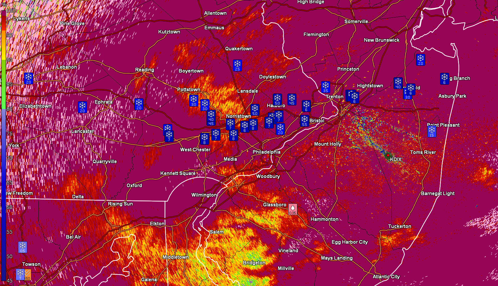
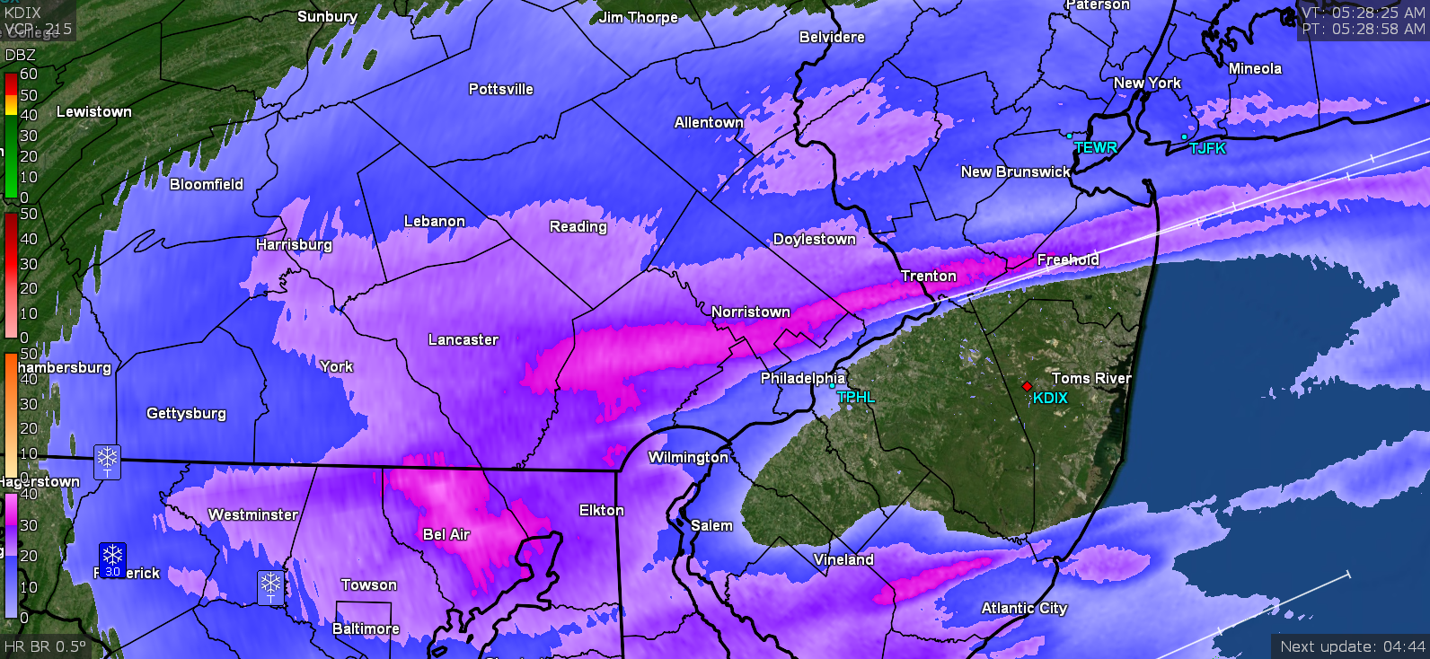
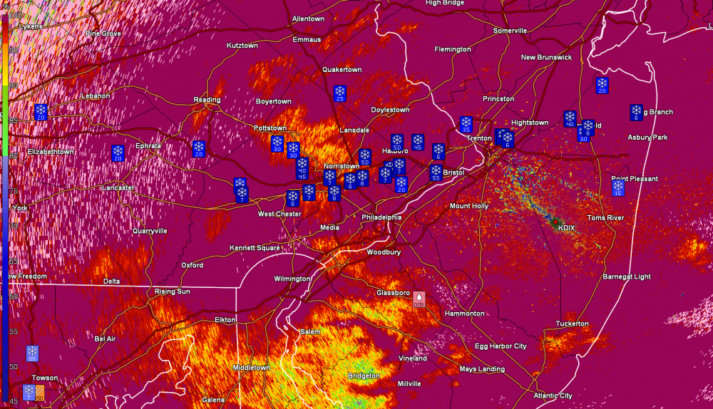
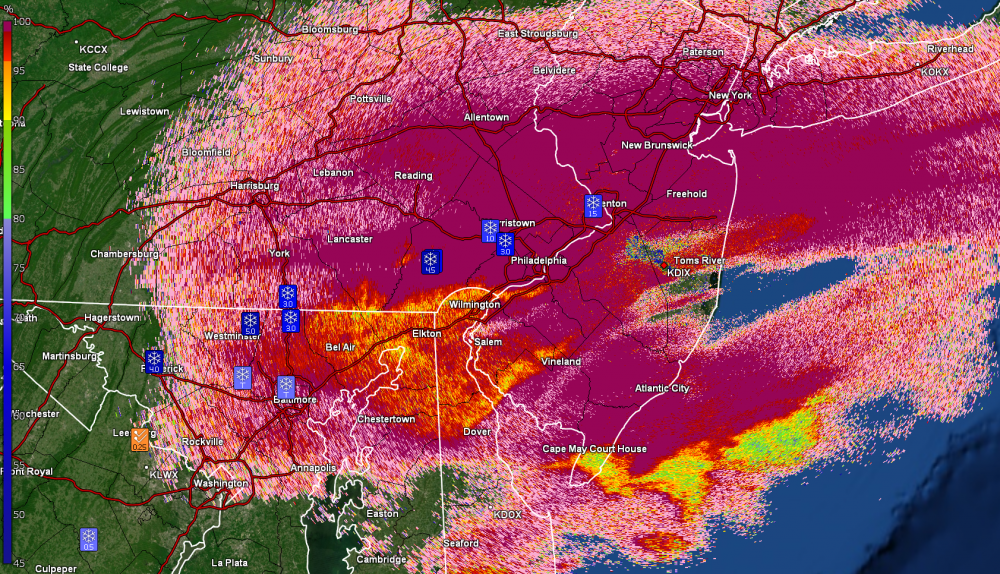
Narrow stripe of heavy snow still holding. CC radar of it -
-
Still steady snow here shifting between SN- and SN. Picked up at least another 1/2" of powdery stuff that is starting to blow around. Temp is 23 with dp 21. You can see a bit of the gradient for the band that seemed to dump on a relatively narrow strip...
-
IP has stopped and back to all snow but with pancake flakes.
-
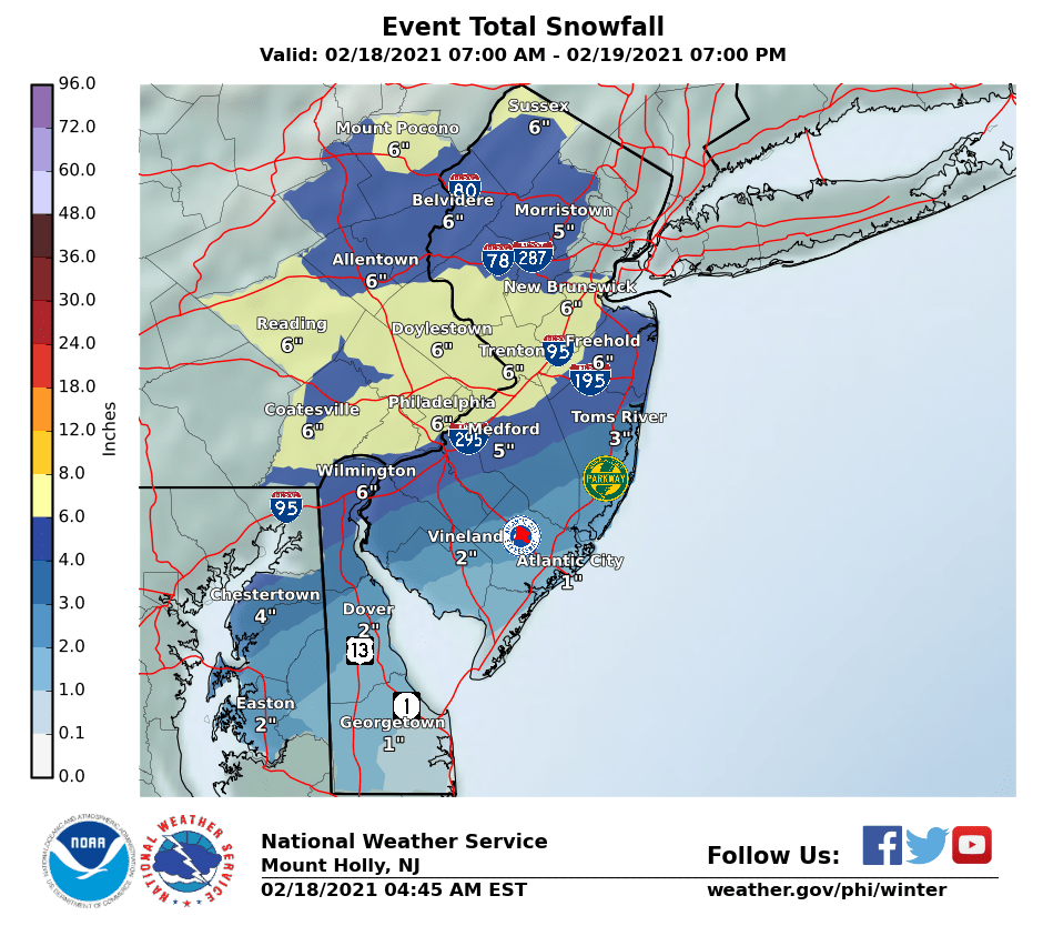
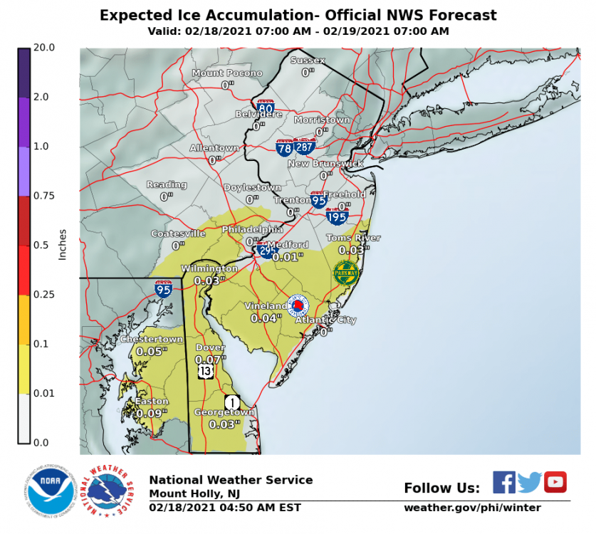
Mt. Holly's earlier snow & ice maps -

-
Threw on the boots and went to the board to measure. Real light fluffy snow and measured 4". BUT the pingers are here mixed in with the snow. There was no pancake flake transition to that. Temp is down to 23 with dp still 22.
-
Still getting normal flakes so far - SN to SN- (could be elevation). No change in temp/dp (24/22).
-
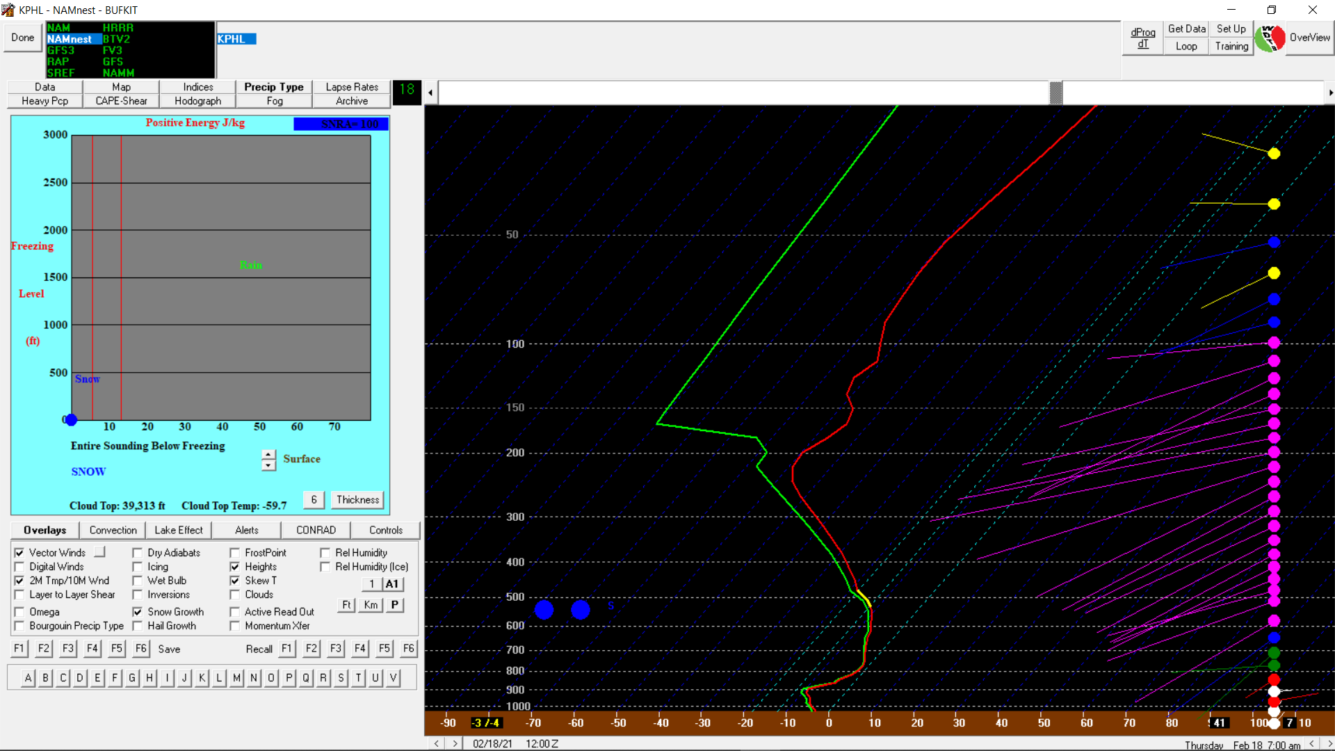
NAM nest sounding -

-
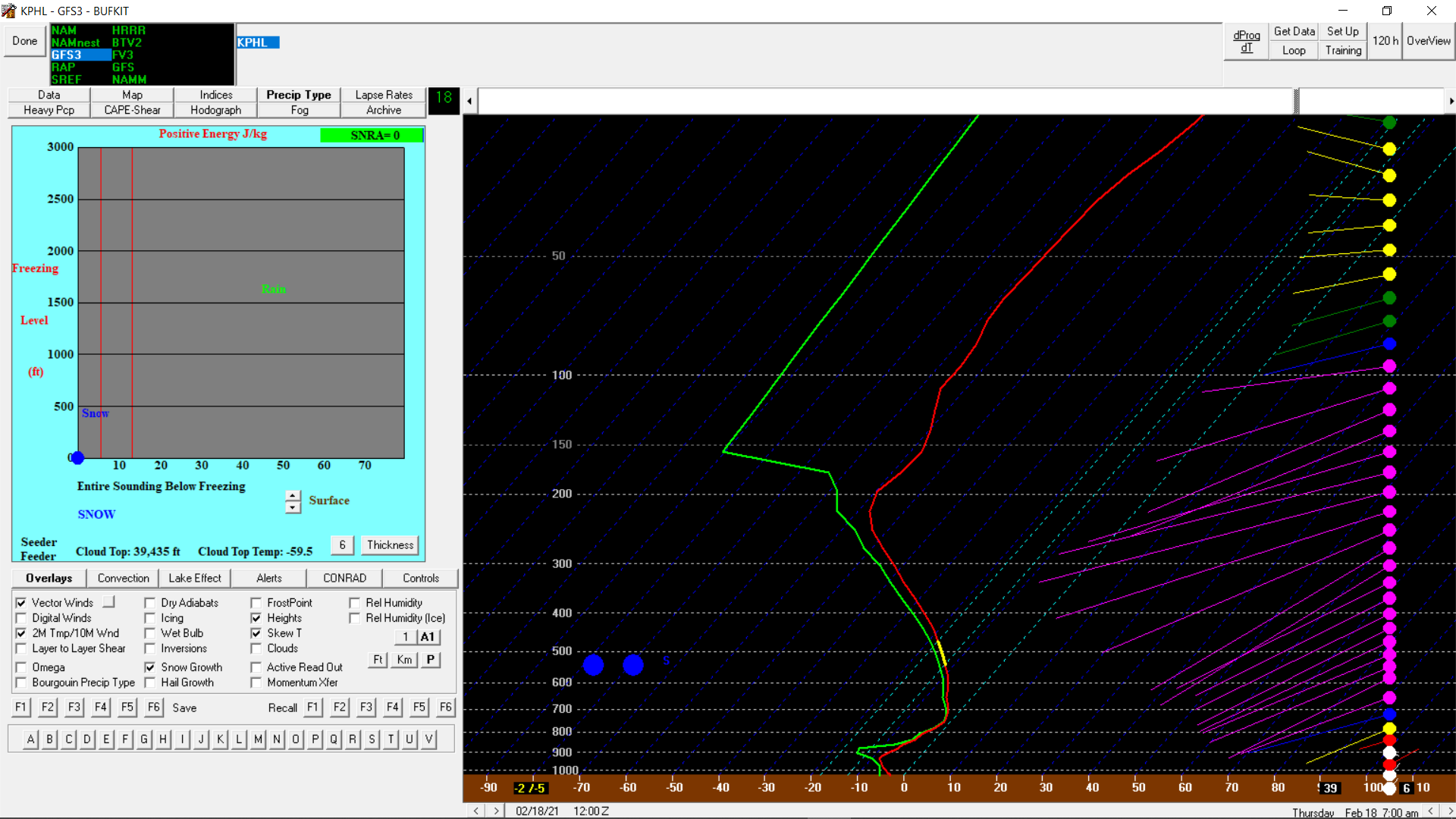
Fooling around with BufKit - GFS3 sounding (for 7 am) -

-
Have small flakes here but SN-. Temp still 24.
-
My sis in Upper Darby texted that it "sounded sleety" where she is.
-
Spotter reporting more than that for KOP!
-
Ball-parking 2" so far with SN and fog. Temp 24 & dp 22.
-
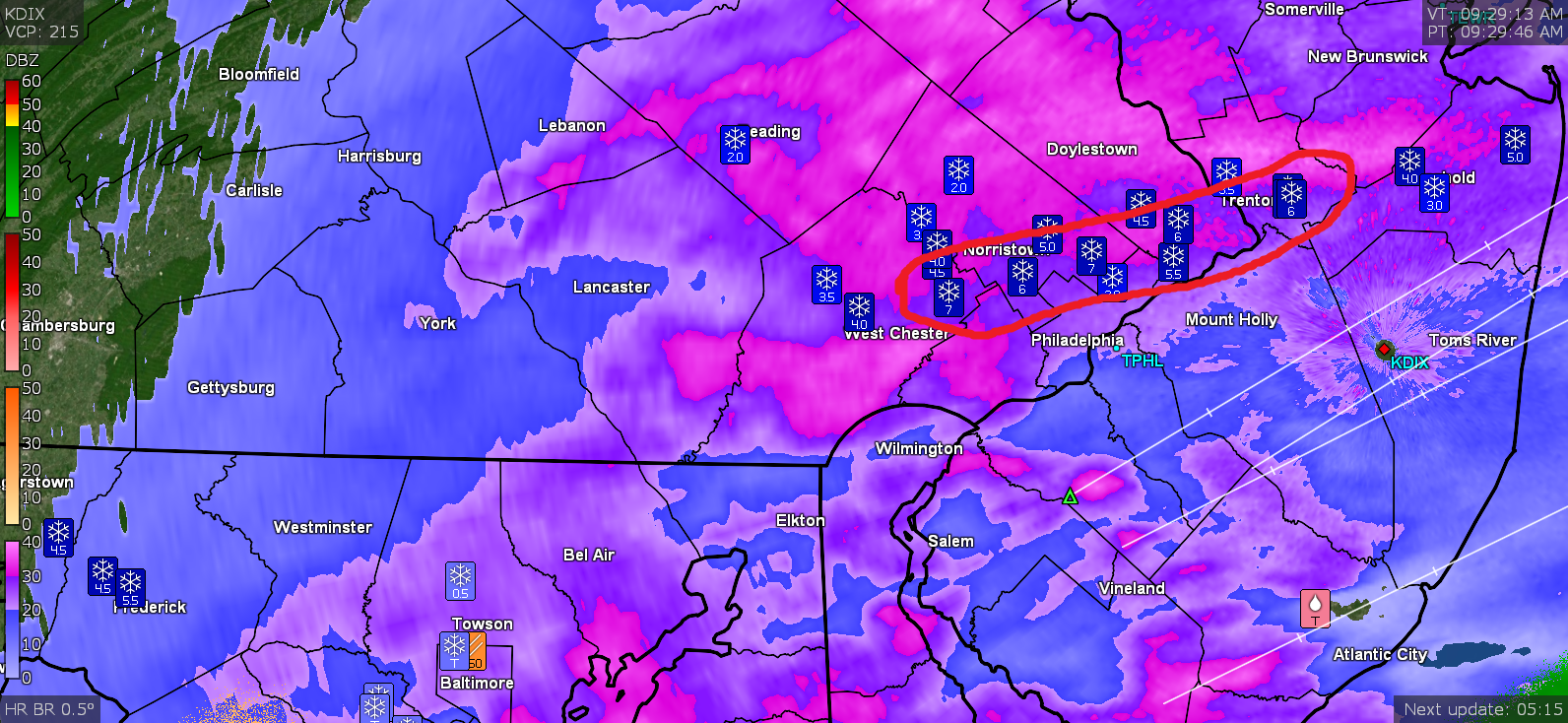
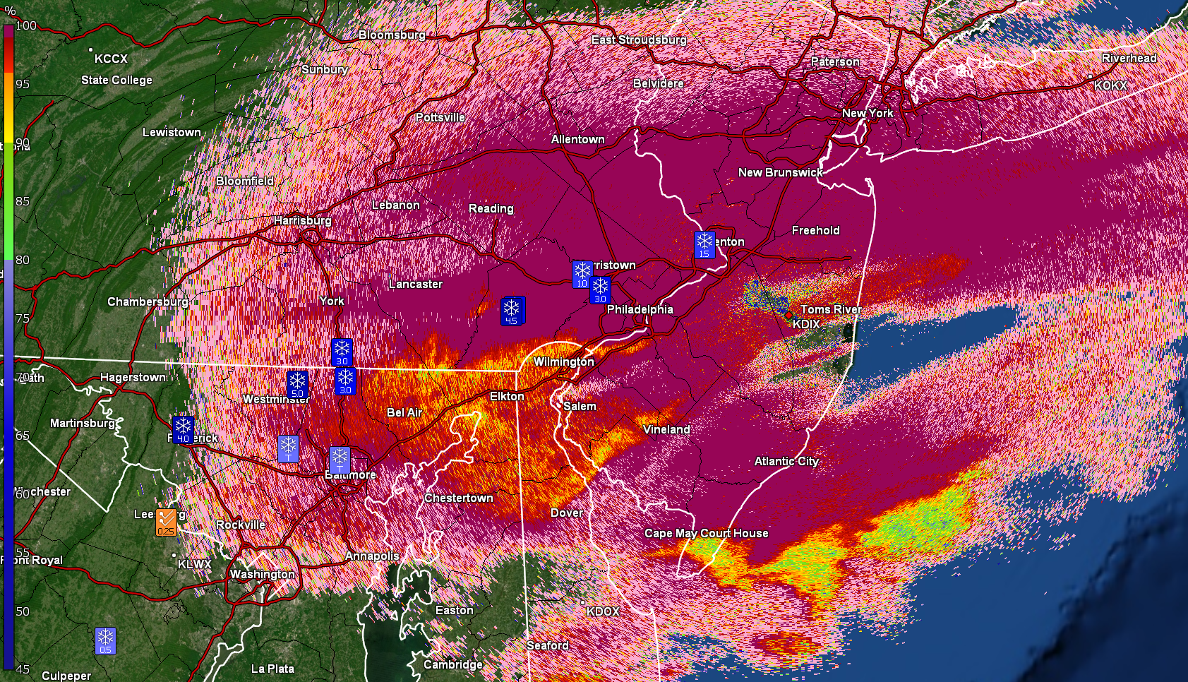
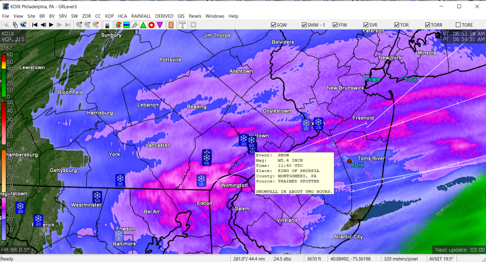
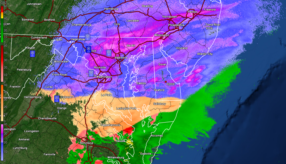
Have never had chance to play with the level 2 cc but here it is (KDIX data) --
-
IIRC from Mt. Holly's AFD yesterday, there was mention about this storm probably continually going back and forth with p-types - probably similar to what happened with the end of January storm, going back and forth between a sleet storm and snow/rain.
-
Looking at Sterling and there were reports of 3/4" sleet in WV. Wonder if BLT is getting graupel or rimmed flakes.
-
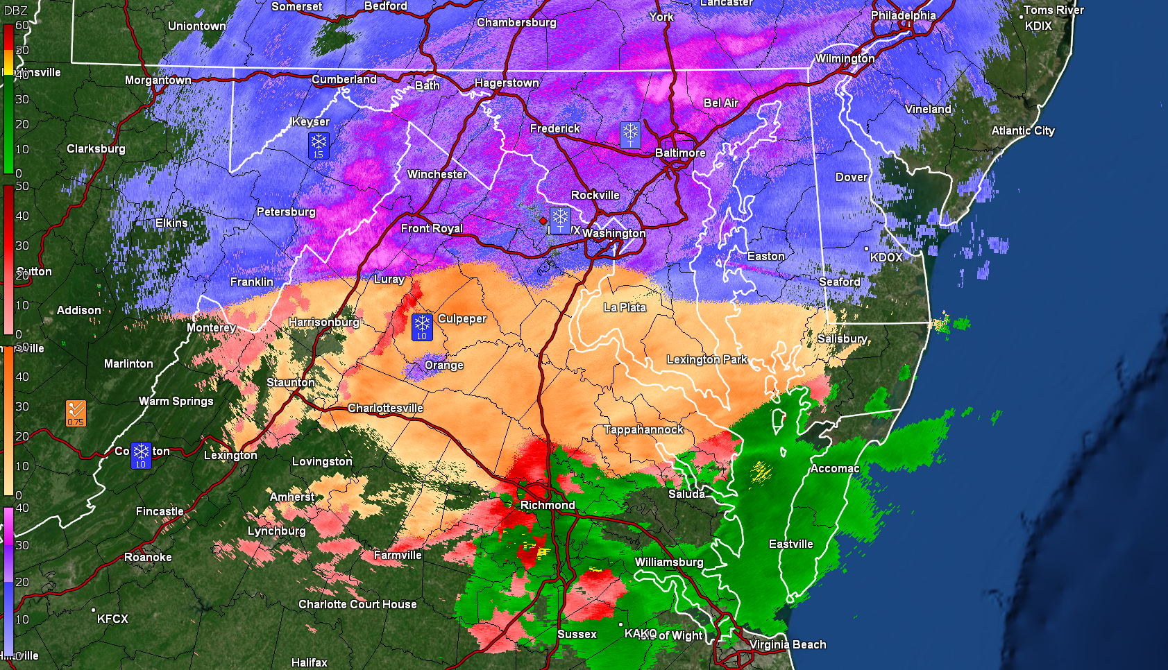
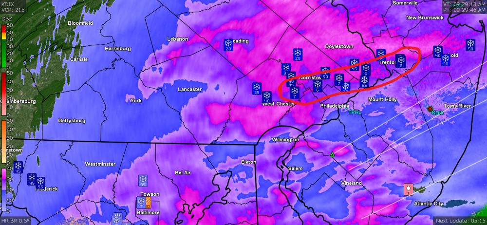
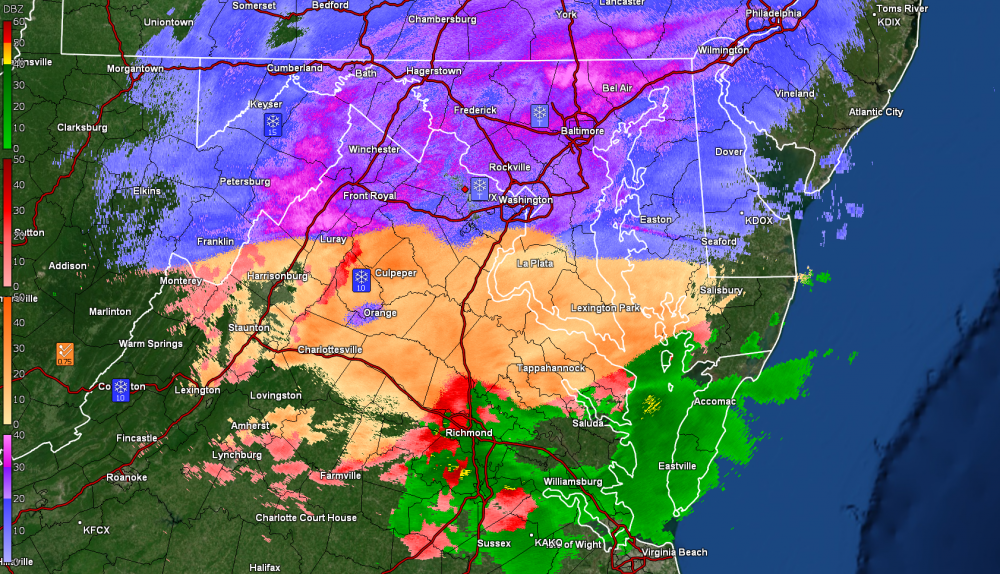
I may be wrong but I think - at least based on the level 2 data, that the sleet line is WAY south! ETA the below is from KDOX radar.
-
Went from virga to 1/2" in an hour here. Now getting SN+ with fog. Temp is a chilly 24 and dp 22 so probably relatively powdery stuff.

-
Looking Back: The Megalopolitan Storm of 1983
Hurricane Agnes replied to LVwxHistorian's topic in Philadelphia Region
I was a senior in college up at UMASS/Amherst at the time so a different dynamic for this storm being in what was a basically a "rural" area on a big university campus. We did get almost 2ft up there. There was a good little summary of the big storms up that way here - https://www.masslive.com/news/2015/01/top_western_massachusetts_snow.html A number of the articles from that link were referencing Bradley Airport, which was right across the MA/CT border from Springfield, MA (where Amherst is about 30 miles NE of Springfield). And I know many of us miss Jim O'Brien (not just from his "weather guy" career but on WFIL 560 doing Top 40 as a disk jockey). But in addition to him and "real" met Elliot Abrams on KYW, don't forget Herb Clarke, just "across the street" from Channel 6 on City Line Ave., - another who was doing the "weather man" role on TV at the time. (Below from 2008 - lots of "weathering" in the pic ) As a sidenote, my first thundersnow came a decade or so before 1983 - there was a storm that started as pouring rain and then the cold air came blasting in. I had actually made a mention in my little diary at the time complete with an illustration. It was either in '71 or '72. -
We had a couple of those flexible flyers (I guess nowadays they are worth a pretty penny) but only got chance to effectively use them one or two winters for just a few storms when the snowpack was just right for sledding. We were a few doors down from a 1-way cross street that dead-ended at the top of a hill so we could walk the sleds up and have at it down the hill. But if the snow was too powdery (and the sled blades were scraping asphalt) or the compacted snow was rutted (which resulted in a bucking bronco ride), it didn't work. But there were those magical times when there was the perfect smooth glacier under about an inch or two of snow that offered the perfect trip down the hill. That little street exited to ours, which was a main thoroughfare, but the plow trucks would shove big mounds near the corners leaving a narrow opening for a car to come out, so if we aimed towards the corners, we wouldn't end up out in the middle of the main street. Of course rolling off the sled before it slammed into those mini walls of plowed snow was a prudent requirement.