Hurricane Agnes
-
Posts
8,976 -
Joined
Content Type
Profiles
Blogs
Forums
American Weather
Media Demo
Store
Gallery
Everything posted by Hurricane Agnes
-
January 3 - 4 Snow Sleet ZR and Rain to Snow obs
Hurricane Agnes replied to ChescoWx's topic in Philadelphia Region
Done here and now in the dry slot. Got 0.05" precip (mix of snow/IP/rain). Temp is up to 35. -
January 3 - 4 Snow Sleet ZR and Rain to Snow obs
Hurricane Agnes replied to ChescoWx's topic in Philadelphia Region
Paul's report...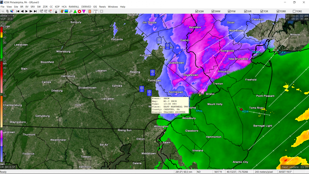
-
January 3 - 4 Snow Sleet ZR and Rain to Snow obs
Hurricane Agnes replied to ChescoWx's topic in Philadelphia Region
Getting drizzle here and the temp is still above freezing but down to 33. Am thinking any frozen is melting before getting to the ground here. Round one may be ending shortly.
-
January 3 - 4 Snow Sleet ZR and Rain to Snow obs
Hurricane Agnes replied to ChescoWx's topic in Philadelphia Region
Still have light rain here with some flakes mixed in. Temp still holding at 34. -
January 3 - 4 Snow Sleet ZR and Rain to Snow obs
Hurricane Agnes replied to ChescoWx's topic in Philadelphia Region
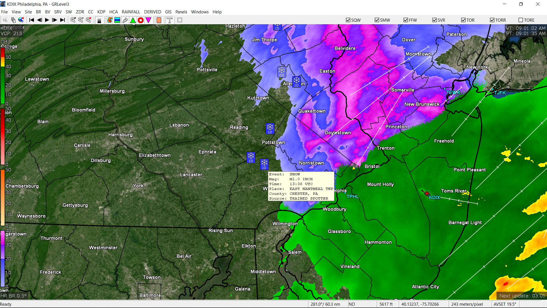
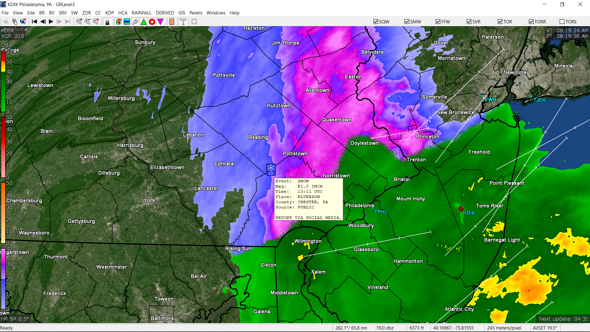
Somebody who is located near Paul (in Elverson, Chesco just adjacent to East Nantmeal) is reporting 1.0".
-
January 3 - 4 Snow Sleet ZR and Rain to Snow obs
Hurricane Agnes replied to ChescoWx's topic in Philadelphia Region
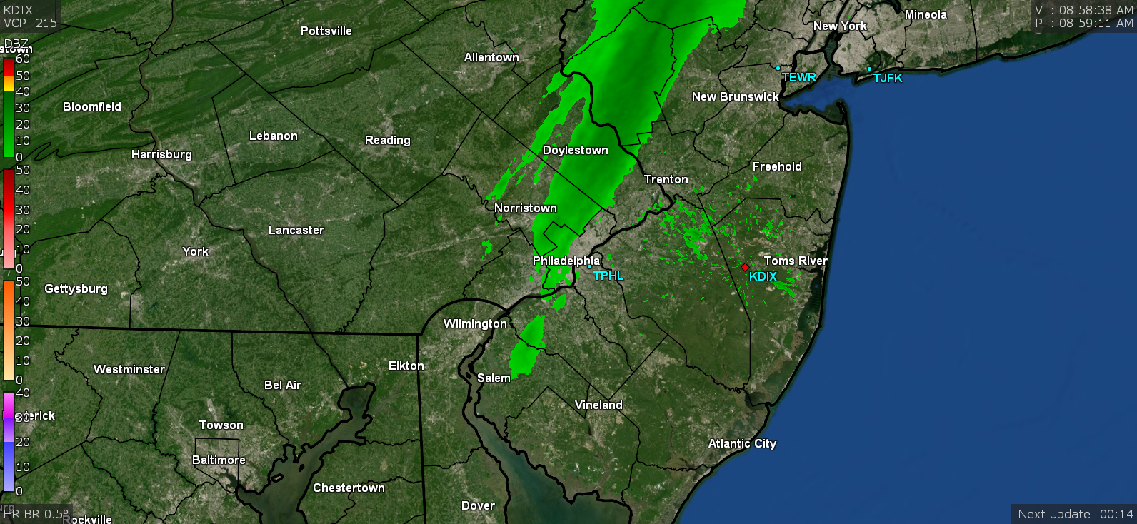
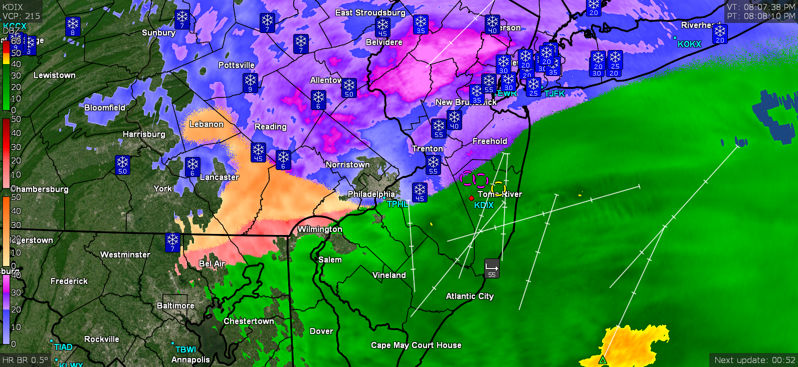
Started with some flurries, then it switched to IP (with little piles of it), then it switched to some white rain, and now currently raining. Temp here is marginal at 34. Radar about 5 - 10 minutes before 8 am and right around 8 am when it was starting to transition.

-
E PA/NJ/DE Winter 2020/2021 OBS Thread
Hurricane Agnes replied to Rtd208's topic in Philadelphia Region
Have been crazy busy the past few days but ended up with a 2.41" 2-day event total (1.84" + 0.57") Christmas Eve into early Christmas Day and then the temperature bottom fell out (a bit earlier than I expected), dropping from the low 60s down to the upper 30s and eventually to near 30 by late in the day. Ended up driving through the Christmas Eve rain and was thankfully able to not have to drive past where a tree went down during the squall when I was out the next day. Had pixie dust flakes Christmas Day afternoon but other than that, all the snow is completely gone including the plowed mounds at the store parking lots. Had a couple 22/23 mornings with low dps until this morning when some apparent virga (got no bucket tips or even wet walks) event came through. Otherwise currently 48 and not a cloud in the sky.
-
Anyone hate the new noaa radar interface?
Hurricane Agnes replied to freemenot's topic in Philadelphia Region
Firefox had announced that any versions after the version that they have been rolling out this week (v84.x), will no longer support Flash, so most browsers have been wrapping up their dropping of support for it it - https://www.mozilla.org/en-US/firefox/84.0/releasenotes/ And apparently Adobe itself is dropping support of it (it has been considered a big security risk and source of all kinds of malware, etc) - https://support.mozilla.org/en-US/kb/end-support-adobe-flash I remember when "Shockwave Flash" first came out not long after the graphical "web" was getting underway to replace the text-based early web that deployed in the early - mid '90s. There is still a lot of content out there (particularly training stuff) that is still using Flash and I expect it has been difficult for some of the hosts of that material to get it converted to HTML 5 video format (and/or considering whether it is even worth converting if the info has been deprecated and/or updated). One of the coolest Weather-related flash presentations was the depiction of the type of damage that one might expect with the various hurricane intensities. NHC had embedded it on one of their pages - https://www.nhc.noaa.gov/prepare/hazards.php Thankfully the creator had put it on YouTube about 5 years ago - -
December 16/17 Snow Wall Obs Thread
Hurricane Agnes replied to hazwoper's topic in Philadelphia Region
Final measurements out there (compacted from sleet/snow, average 5 spots including my little board) was 5.51". The big PITA was doing the liquid equivalent. Just trying to get the tube off the mount was a nuisance. I did both what had collected in the tube and then a core sample. What was interesting (other than my back door being drifted in ) was how powdery it was - even with all the sleet and the period of freezing rain. I expected a whole layer of crunch on top with soft stuff underneath and it wasn't like that at all. I think that is because it never got above freezing here the entire event duration, including antecedent conditions (literally stayed in the 26 - 28 range during the event) and the same was the case post-storm, where it eventually bottomed out to 23 after 3 am and didn't hit freezing or above until just before 11 am. So I didn't seem to get my expected "club sandwich layers" when I did a core. In any event, the "practice" (open tube accumulation) + the tube "core" sample gave me 1.13" and 1.16" liquid equivalent respectively (needed 2.00" hot water to get each attempt melted in a reasonable time). Edit to note I used my trusty "spiked" lanternfly/stinkbug swatter as a spatula - worked great! So with the 5.51" and 1.15" (rounded) water equivalent gives me about 4.8 : 1 ratio. This makes sense with the temps and the periods of pancake/dinner-plate sized flakes initially (plus the periods of sleet and ZR) and then very fine stuff from the wrap-around. Current obs - a surprising 34 degrees with dp 28 and cloudy. -
December 16/17 Snow Wall Obs Thread
Hurricane Agnes replied to hazwoper's topic in Philadelphia Region
Congrats to Allentown for breaking a record (doubled the amount) for the date (12/16 )- PREVIOUS -
December 16/17 Snow Wall Obs Thread
Hurricane Agnes replied to hazwoper's topic in Philadelphia Region
I remember way back when Randy and crew chased and live-blogged on here (when it was still Eastern Weather) a lake-effect event up on the Tug Hill Plateau. That was a wild thread. -
December 16/17 Snow Wall Obs Thread
Hurricane Agnes replied to hazwoper's topic in Philadelphia Region
Was just reading about Binghamton. I'll never forget 1996 and the record 2-day 30"+ dump around my birthday. The plows eventually made 5ft - 6ft walls of snow along the sidewalks. -
December 16/17 Snow Wall Obs Thread
Hurricane Agnes replied to hazwoper's topic in Philadelphia Region
I know there was some concern about whether anyone would have any jackpots that actually got anywhere near the early snow maps, so considering that there was some wrap-around overnight, it will be interesting to see the final numbers and if any did get close. -
December 16/17 Snow Wall Obs Thread
Hurricane Agnes replied to hazwoper's topic in Philadelphia Region
People were wondering where you went! -
December 16/17 Snow Wall Obs Thread
Hurricane Agnes replied to hazwoper's topic in Philadelphia Region
Getting very powdery light snow this morning plus some blowing and drifting. It dropped down to 23 earlier this morning but has crept up to 24 with dp 23 and fog.
-
December 16/17 Snow Wall Obs Thread
Hurricane Agnes replied to hazwoper's topic in Philadelphia Region
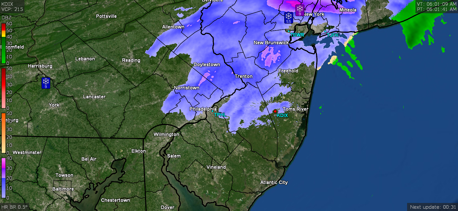
Some wild dynamics going on. Looks like the warm nose has pushed back to the west, I guess as the low approaches from the S. At one point, the rain line had moved up over 3/4 of the city.... Eventually as the low moves to the NE, the bands should pivot back to the east again. Currently back to all SN, blowing and drifting, and 26 (26.2) with dp 26 (25.7).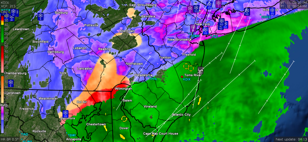
-
December 16/17 Snow Wall Obs Thread
Hurricane Agnes replied to hazwoper's topic in Philadelphia Region
Sounds like it's pouring sleet here again. Hearing the loud pings on the windows. A veritable club sandwich of p-types. -
December 16/17 Snow Wall Obs Thread
Hurricane Agnes replied to hazwoper's topic in Philadelphia Region
And I peeped out at a light and the snow is back. Cracked the door open and could hardly budge it due to the winds. Getting a snow/sleet mix at the moment that is really blowing around. Temp is still 27 w/dp 26. -
December 16/17 Snow Wall Obs Thread
Hurricane Agnes replied to hazwoper's topic in Philadelphia Region
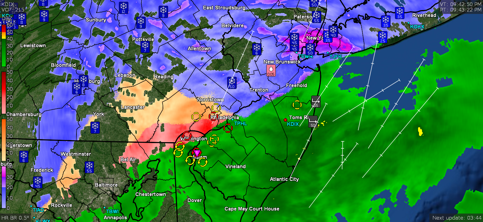
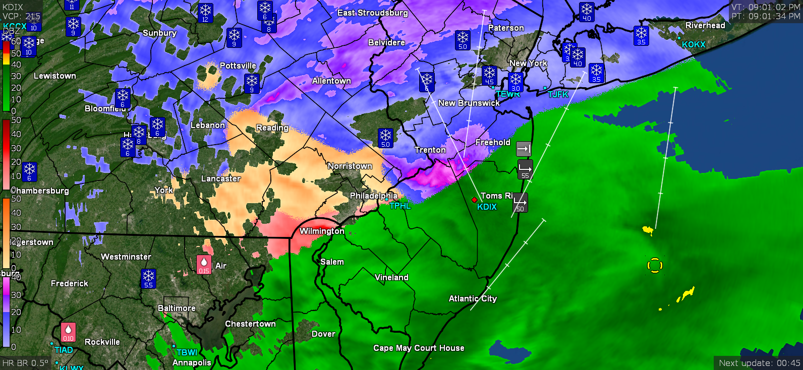
There's a band of snow back around Harrisburg but am not sure if that will warm as it moves east or what. There is a little battle going on between the "relatively" warm rain line and the "cold" ZR/sleet line that caused some convective cells to briefly fire.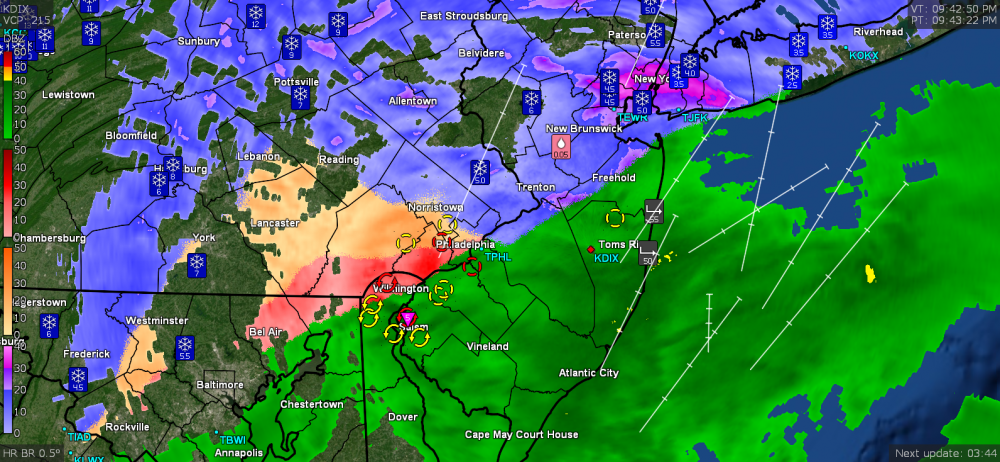
-
December 16/17 Snow Wall Obs Thread
Hurricane Agnes replied to hazwoper's topic in Philadelphia Region
Well I doubled in one storm, what I had all last season. -
December 16/17 Snow Wall Obs Thread
Hurricane Agnes replied to hazwoper's topic in Philadelphia Region
I'm guessing that is including sleet (it's an ASOS reading) since they would have changed over way before the rest of us in the city. -
December 16/17 Snow Wall Obs Thread
Hurricane Agnes replied to hazwoper's topic in Philadelphia Region
I think most of the calls for the city was 3" - 6" so it fell within that (assuming the wrap-around is minor. I think the models depicted the rain/snow line pretty well but the devil was in the sleet details (although as we got closer to the event, it was evident that there would be a good amount of sleet). I got about 5.3" of snow in IMBY before the sleetfest. Will have to see if I can core some tomorrow to approximate the sleet amounts before the ZR came (assuming it didn't completely soak through). I was going to practice getting a ratio (bought a Stratus gauge over the summer to try out). -
December 16/17 Snow Wall Obs Thread
Hurricane Agnes replied to hazwoper's topic in Philadelphia Region
The 8:34 pm PNS lists 5.7 at PHL - https://www.wrh.noaa.gov/total_forecast/getprod.php?new&prod=XXXPNSPHI&wfo=phi ETA - am guessing that is including IP. -
December 16/17 Snow Wall Obs Thread
Hurricane Agnes replied to hazwoper's topic in Philadelphia Region
I noticed the fog was back (vis. about 1/2 mile) and checked outside and am now getting ZR. Will have a crust of ice over the sleet over the snow - a real snow cone.. Temp is 27/dp 26.
-
December 16/17 Snow Wall Obs Thread
Hurricane Agnes replied to hazwoper's topic in Philadelphia Region
There's a big hole right over Philly.