Hurricane Agnes
-
Posts
8,976 -
Joined
Content Type
Profiles
Blogs
Forums
American Weather
Media Demo
Store
Gallery
Everything posted by Hurricane Agnes
-
Miller Bs are "2-part storms". This is finishing up "part 1". Part 2 will happen later today and supposedly overnight and into tomorrow morning.
-
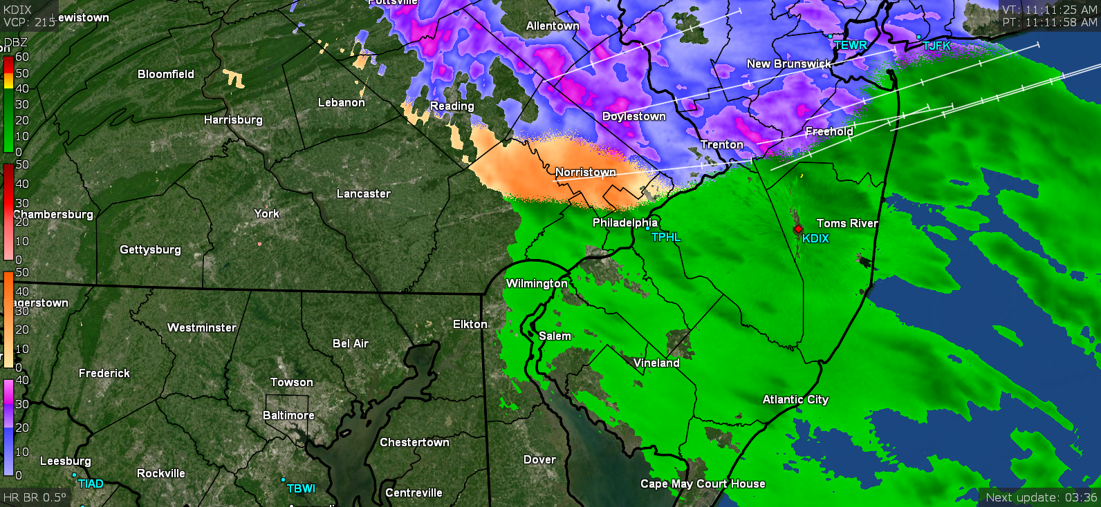
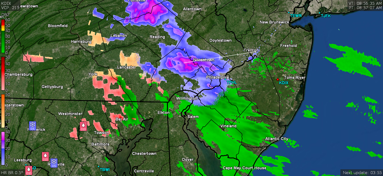
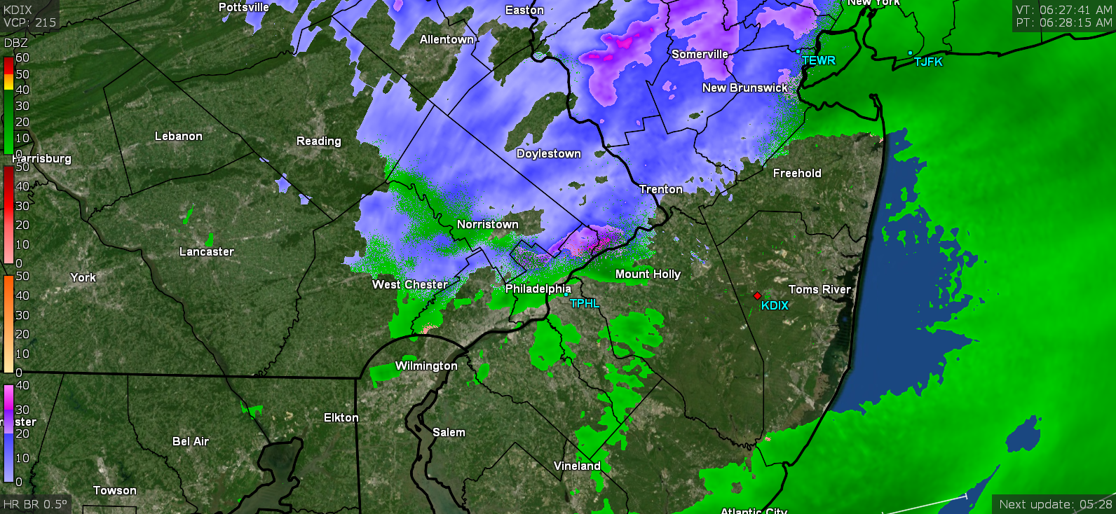
Still have the coastal to finish getting organized and do its thing. The fact that the winds have picked up means some kind of gradient is going now as the transfer is underway.
-
Now pouring sleet with snow mixing in and windy as hell.
-
Now ZR with some tiny barely visible flakes mixing in. Temp 28 and dp 25. Also echo others with the wind gusts coming out of the W.
-
ACK! Getting FZRA. (progged though). Temp 28 w/dp 24.
-
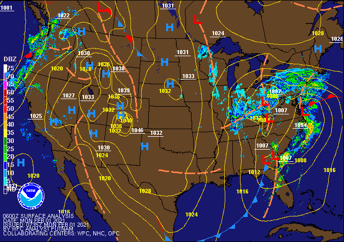
There's one storm slowly moving east and dying out while another is trying to get formed off the coast. The event is progged to go all day today, all night, and into tomorrow morning (and some models were saying possibly on and off much of the day tomorrow to boot).
-
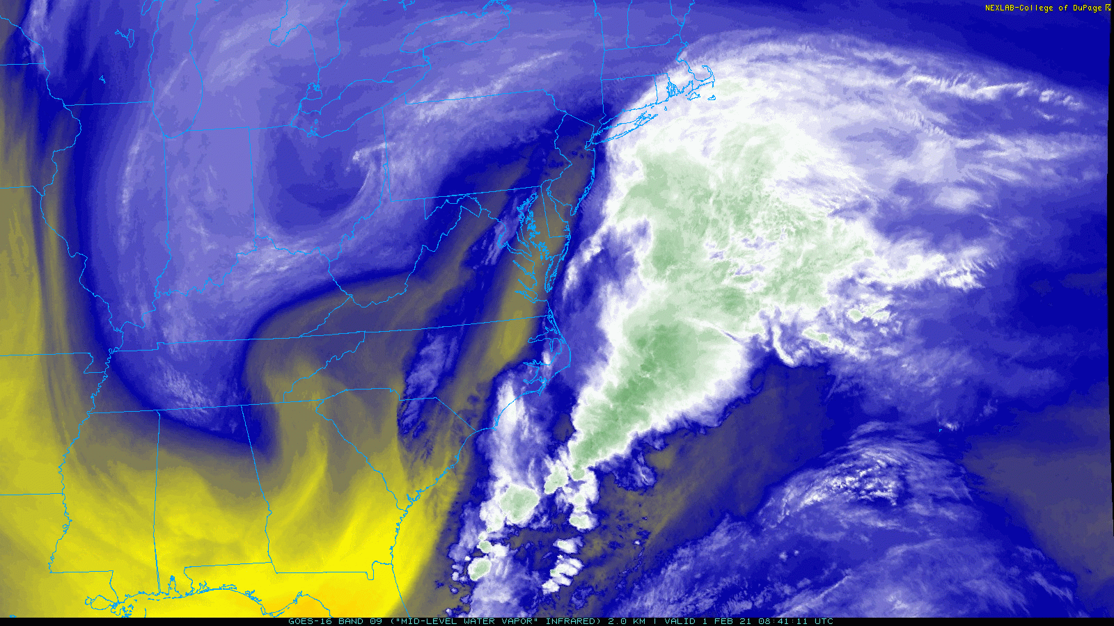
The low off the coast is still pretty weak and am not really seeing any circulation out of it - I expect that will strengthen later today. The midlevel WV looks interesting.

-
I literally heard pingers going most of the night after midnight and I'm now up to about 4.5" compacted with sleet. Just peeped out and it's mostly cloudy with a broken deck and actually have the moon showing through the breaks. The temp did creep up overnight and it's currently 27 with dp 24.
-
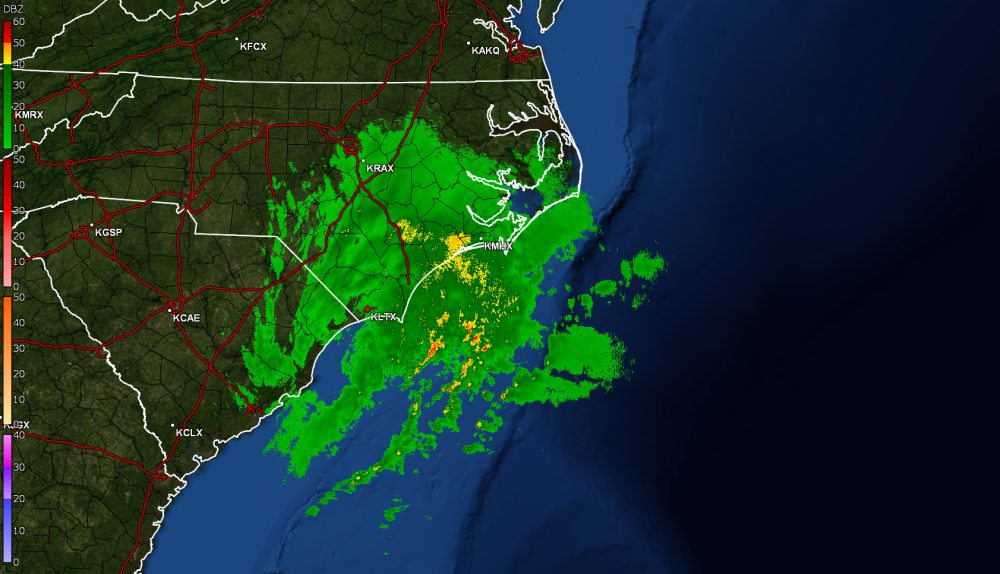
The coastal is just moving off the NC/SC coast.
-
I think you convinced me to go on and get it. Even being able to use it to "record" the GR programs' frames when set to "play" (both Level3 and GR2Analyst) and convert to an animated gif would also be worthwhile. As an obs, the snow has pretty much stopped so am dryslotted until the jump happens. Currently still 23 w/21 dp and cloudy.
-
I used to use Snagit at work all the time. Loved it (of course I didn't have to pay for it either )! I probably should just go on and buy it because it lets you do a "scrolling" screenshot which is what I miss the most and found the most useful.
-
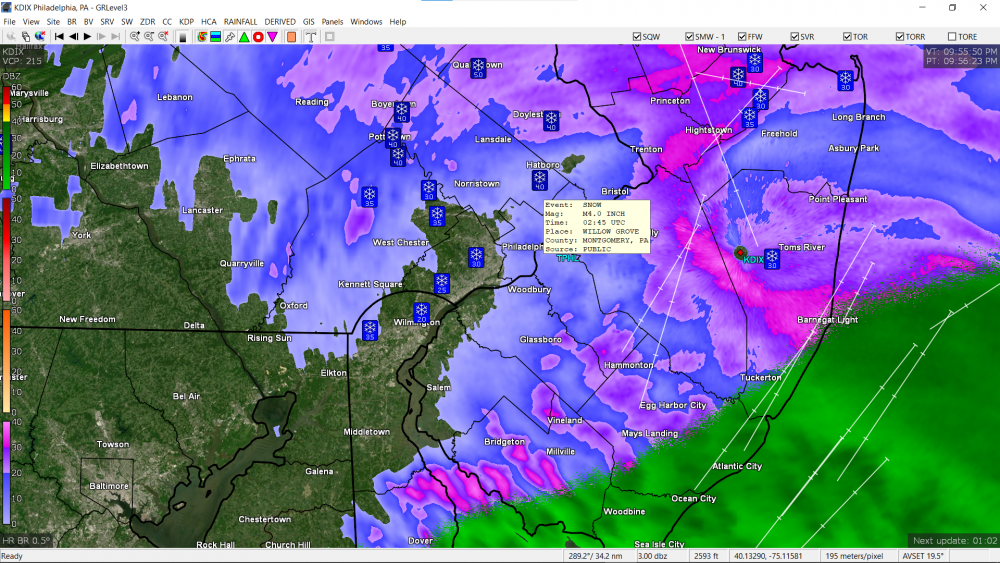
It's a shame that the program won't let you save the images with those values displayed so what I do is sortof position the mouse over one of the report icons until the report displays and then do a screenshot of the whole screen (with the program full screen) and then crop it and save that to post. For example here is one of the readings up near you -
-
If you hover the mouse over those snow readings, you'll see who submitted them. The program pulls them from the LSRs/CWOP, etc Looks like I'm down to very light snow at the moment with some blowing. Closing in on 3.5". Tempp is 23 w/dp 21.
-
Starting to see pancake flakes here and with the cold bottom layer, those can add up fast on the ground. Almost up to 3" here now. Temp is 23 w/dp 21 so may be some "warm" air intrusion starting to happen in the upper levels somewhere.
-
It has been SN- most of the day with fine flakes. The rate has picked up in the past hour or so to closer to SN with some fog. Have about 1.5" on the board so far with small flakes. The high made it up to 28 before the snow started. Currently 24 with dp 22.
-
Finally got flakes here. The dews were so low the past couple days (in single digits all yesterday) but finally got into the double digits within the past couple hours. Was out between 10 - 10:30 and there was nothing here. Temp is 28 with dp now 19, with light snow.
-
January 25-27 Light Wintry but Long Duration Event obs
Hurricane Agnes replied to ChescoWx's topic in Philadelphia Region
The sleet lasted about 5 minutes and went back to moderate rain (now sitting at 0.11" with about 0.1" of sleet). Temp hovering right around freezing (32.4/32.5). -
January 25-27 Light Wintry but Long Duration Event obs
Hurricane Agnes replied to ChescoWx's topic in Philadelphia Region
All moderate sleet now! Temp still barely holding at 33 (dp 31).
-
January 25-27 Light Wintry but Long Duration Event obs
Hurricane Agnes replied to ChescoWx's topic in Philadelphia Region
All light rain now (0.05" at post time) and temp at 33 (dp 31). -
January 25-27 Light Wintry but Long Duration Event obs
Hurricane Agnes replied to ChescoWx's topic in Philadelphia Region
Getting light rain with some IP mix (bucket tip of 0.01"). Temp is 33, dp up to 28. -
January 25-27 Light Wintry but Long Duration Event obs
Hurricane Agnes replied to ChescoWx's topic in Philadelphia Region
Getting some light drizzle. Temp is 34 with dp 24 (air has slooooowwwwwwlllllyyyy been moistening up after some arid air the past couple days). Not sure how this incoming will manifest...
-
E PA/NJ/DE Winter 2020/2021 OBS Thread
Hurricane Agnes replied to Rtd208's topic in Philadelphia Region
Another snow shower going on here. Temp is 35. -
E PA/NJ/DE Winter 2020/2021 OBS Thread
Hurricane Agnes replied to Rtd208's topic in Philadelphia Region
Getting some pancake flakes that have been coating the cars and grass. Temp just above freezing at 35.
-
January 3 - 4 Snow Sleet ZR and Rain to Snow obs
Hurricane Agnes replied to ChescoWx's topic in Philadelphia Region
Am up to 0.18" with round 2 and temp at 36 with some fog and drizzle. -
I have an older Ambient WS-1001 that I am about to retire (I've had it for almost 6 years and it is slowly dying). I bought an Ambient WS-2000 the past year as a replacement and have the 2 side-by-side. The main impetus was the ease of getting the data online and since I can't put anything up on my roof, I figured to just go with an all-in-one setup (so my wind readings are more for a "subjective" reading of direction than for speed accuracy). I did mount the two stations up on masts attached to my privacy fence's 4" wide posts so that the 1001 is about 6.5 ft up and the 2000 is about 7.5 ft up. I also bought a Stratus rain gauge that I mounted on a fence post across from them - about 3.5 ft away and about 6.5ft up, so I can get a rainfall comparison (manual vs tipping bucket). So far for rainfall, the readings have been pretty close, +/- a couple tenths (usually the Stratus has been more on the tenths "less" compared to the Ambients, when not getting matching amounts, which I believe is within the margin of error). As I delved into the station discussions on wxforum, since several Ambient items (including the station) are made by the hardware company "Fine Offset", that got me off onto other tangents like buying the mini Ecowitt GW-1000 indoor gateway/station to capture data from the WS-2000 as well as data transmissions from other Ambient and/or Ecowitt/Fine Offset add-ons (like a lightning detector, PM2.5 sensors, soil moisture probes, temp/humidity probes, etc). Ended up then buying a Raspberry Pi 4 (Cana kit) and getting weewx up and running on it to generate pages on a web server also set up on the Pi, so that I can look at the data stream formatted on a local webpage. I am still putzing around with that as I find time tweaking the code. I do like my lightning detector and once you get it sited/configured so it is sensitive enough to pick up strikes but not so sensitive that it experiences stray interference, it has been pretty spot on when I've compared the activity it picks up to that displayed on places like lightningmaps.org. I actually have it indoors a couple feet from a window pointed NW where the storms tend to blow in from. I know a number of people have them outside under eaves or somehow enclosed/protected outside, but I knew that would be tricky to do here (and that goes for my outdoor PM2.5 sensor that I have Macgyvered to sit under my Stratus with a tiny plastic seedling "greenhouse cover" over it to keep it mostly out of the weather and I know that model has a limited operating temp range too although they were supposed to also come out with a multiple particle size meter that I'm hoping expands the temp range). So I have lots of projects going! I believe the WS-5000 is basically a WS-2000 with an ultrasonic wind sensor.