-
Posts
8,978 -
Joined
Content Type
Profiles
Blogs
Forums
American Weather
Media Demo
Store
Gallery
Everything posted by Hurricane Agnes
-
-
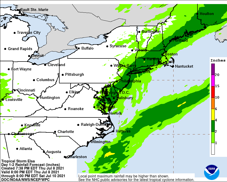
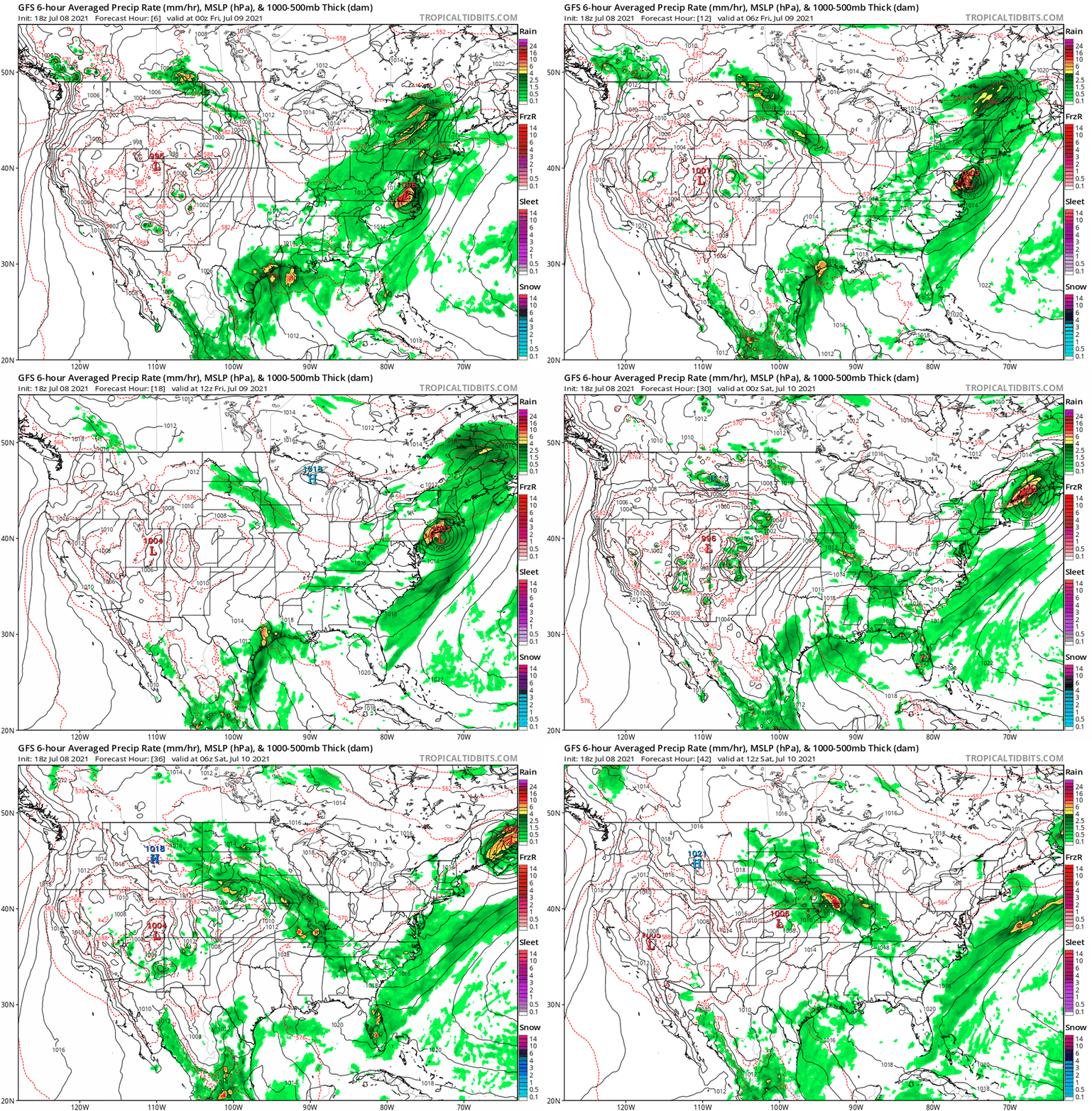
Temp has been slowly creeping up a bit here and is now back up to 76 with dp 72. 18z GFS has it scraping along I-95 with the precip.
-
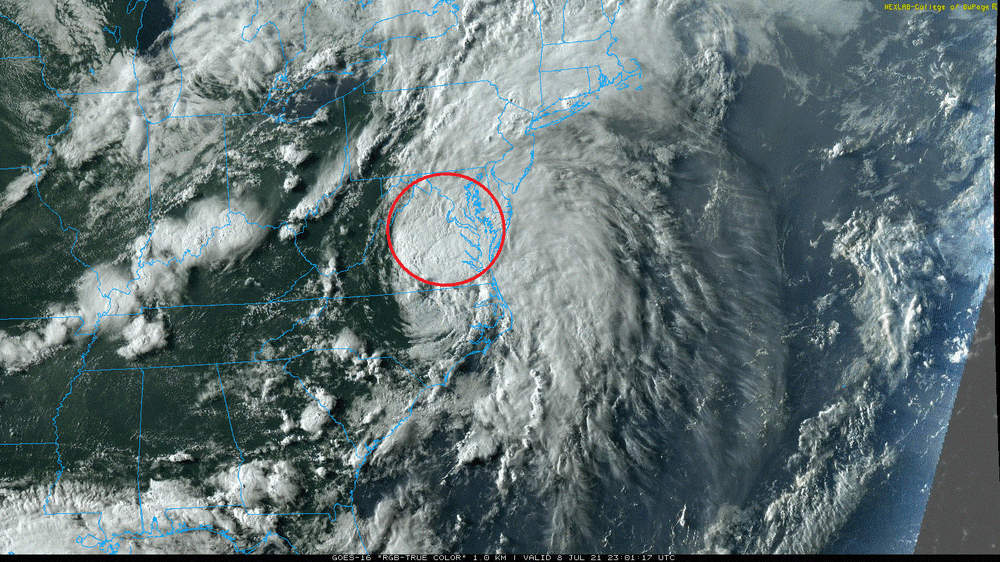
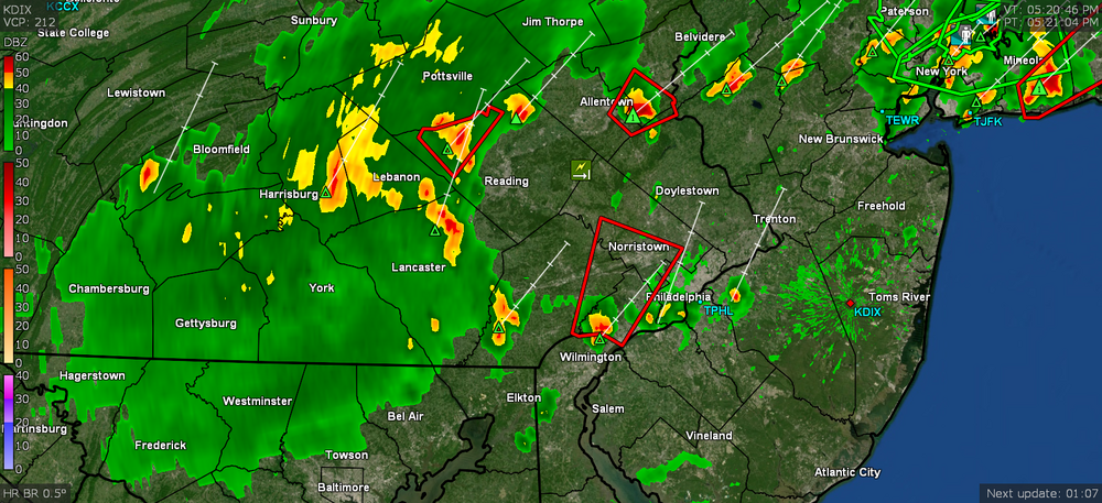
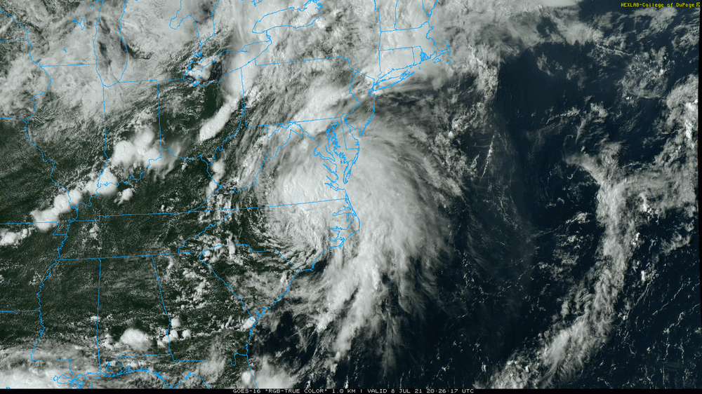
Yeah that cell was pretty intense and was moving fast too. I actually got clipped by it as it blasted its way north through the city, but it blew past pretty quick so I didn't get much more than a couple minute shower. The convection blob from Elsa is slowly pushing north so am seeing that "filling in" ahead of it too. Will have to see if any of that manages to pass over or near this area.
-
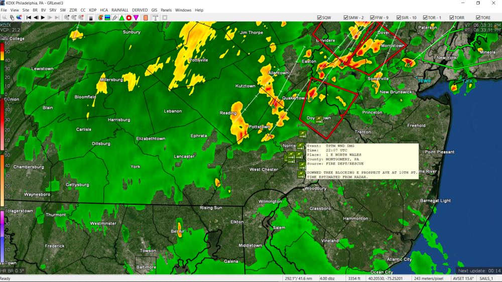
Looks like some damage reported up your way (tree down). Temp here is now down to 74 but dp is 71 so the steamy windows rulez...
-
My Upper Darby sis is under a blob and she texted that she is getting poured on and the temp dropped 10 degrees. Am getting rain here now (finally looked outside again after wondering why my temp here dropped down to 76). LOL Up to 0.04" so far.
-
Got a STS and the statement (weather radio too) mentioned it due to a storm located over "Concordville" (Kamu?).
-
The stuff to the west is coming from the outer bands. I would think as it moves NE, the main convective complex part of it that is moving ahead of the CoC would be pretty much on top of us, if not close unless the track really shifts east enough for it to clip the tip of south Jersey. I'm just surprised that it is still a TS having moved over land this long. The thing has been like a jalopy just flapping pieces of itself around as it moves. It's currently 86 here with overcast from tropical-looking clouds and a dp of 76. I did manage to make it to 90 just before 2pm today though.
-
Here we go... I did see a couple things starting to pop... Temp here has hit a partly sunny and hazy 90 with dp 77.
-
My low this morning was 74 but am currently up to 81 with dp bopping between 74 and 75. Had just popped out and it's not too bad yet... but then I guess that's because I apparently acclimatized to this a bit...
-
Made it to 95 as a high today and it's currently down to a hazy 89 with dp 76.
-
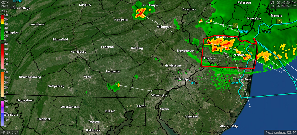
SPC threw up Severe Thunderstorm Watches in parts of the N/W/NE burbs in PA and NJ - Plus the tropical storm headlines are... ahem... interesting. Currently a partly cloudy and hazy 94 with dp 73.
-
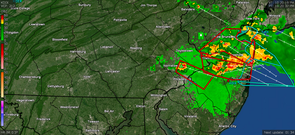
That was more fireworks than the 4th or even from the little blobs that fringed me earlier in the day. I was already in bed when it started so came down to see what the heck was going on and it was somewhat associated with that complex with the cool-looking outflow boundary that we were watching drop down from NY. It knocked out power here in Chestnut Hill and over in Wyndmoor (and I expect Wyncote and vicinity too). PECO's initial restoration estimate was 1 am, but then just as they were bringing it back up, they had sent out an estimate of 4:15 am, so I'm glad they got it up and running here by the original estimated time. But I have been having internet issues since as it started degrading this morning and then died (am posting from my cell hotspot at the moment). And with all that rock and rolling I only got 0.24" of rain from it. Current temp is now 89 (after it briefly touched 90) with dp 76 and it is pretty disgusting out there right now.
-
Power came back about 12:40 am (thankfully) but now have to get my weewx back up. I have all the stuff on UPSes but have also been in the middle of re-configuring my home network so... With all the sound and fury I was still side-swiped by the heaviest rain (will need to check the stratus to confirm either way). Currently clear and 72 with dp pretty much the same meaning steamy window alert.
-
Dammit. Power knocked out.
-
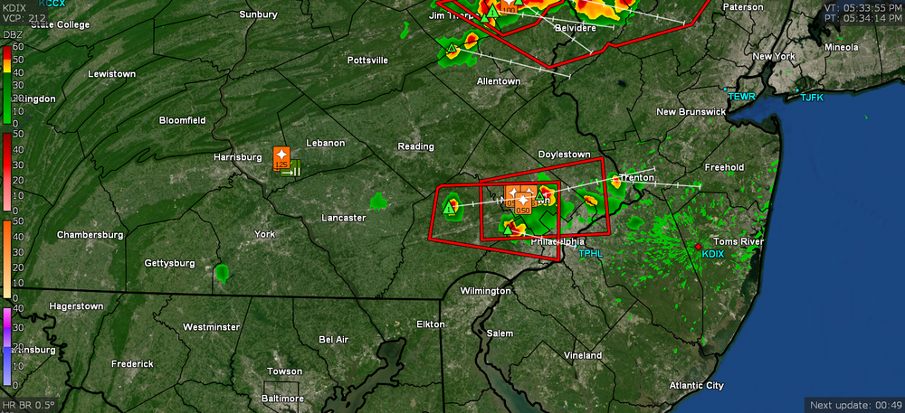
So that big complex that has been dropping down from NY seemed to develop some blips that are rocking and rolling me more than anything today. Temp is 80 and having a thunderbumper with all kinds of lightning. As I type this, the Warning is just being issued.
-
Still pushing that south so someone over here is gonna get a little blip of the cool air. My temp has recovered to 82 now with a juicy 76 dp again, but I think I can safely call my high for the day as 94.
-
The warned blob sortof rained itself out just as it was getting here and apparently found more stable air to run over, so I only got some light rain (am up to 0.04" total from the 2 hits today). But that has knocked the temp down again and I'm now at 77 with dp 72. These have been moving pretty quickly and the sky has brightened to the west, with the sun back out again. Doesn't look like anything imminent on radar either from the west or north at this point.
-
Talk about needle threading. That went to my north and the stuff to my south is hitting my Upper Darby sister pretty good. There's another pop-up heading due east so will see if any of that holds together to give me a little something. Temp has been knocked down to 82 in any case and dp got knocked down to 70 (at least for the moment).
-
-
I got a quick dowsing from that one that is sitting in Philly that drifted up form the south and cut across me. Took the temp down from around 92/93 to a current 84.
-
Wow - something bubbled up in southern Montco right on the Philly border, zoomed into Roxborough and then rose up over me so it's literally pouring over me with a southern blip while the sun is out to the west. Currently up to 0.02" and temp at 88 with dp 78.
-
Tapped 94 just before 3 pm. Seeing some hazy cumulus starting to appear to partially obscure the sun. It's currently partly cloudy, and 93 with dp 75. Am not seeing anything popping up on the radar that is nearby at the moment.
-
Thar she blows from SPC -
-
I know this is you -->
-
Hit 90 just after noon today and am now up to 92 at post time with dp 76. It's definitely hazy out and as a note that I forgot to mention, I finally heard my first cicada early this morning.


