Hurricane Agnes
-
Posts
9,268 -
Joined
Content Type
Profiles
Blogs
Forums
American Weather
Media Demo
Store
Gallery
Everything posted by Hurricane Agnes
-
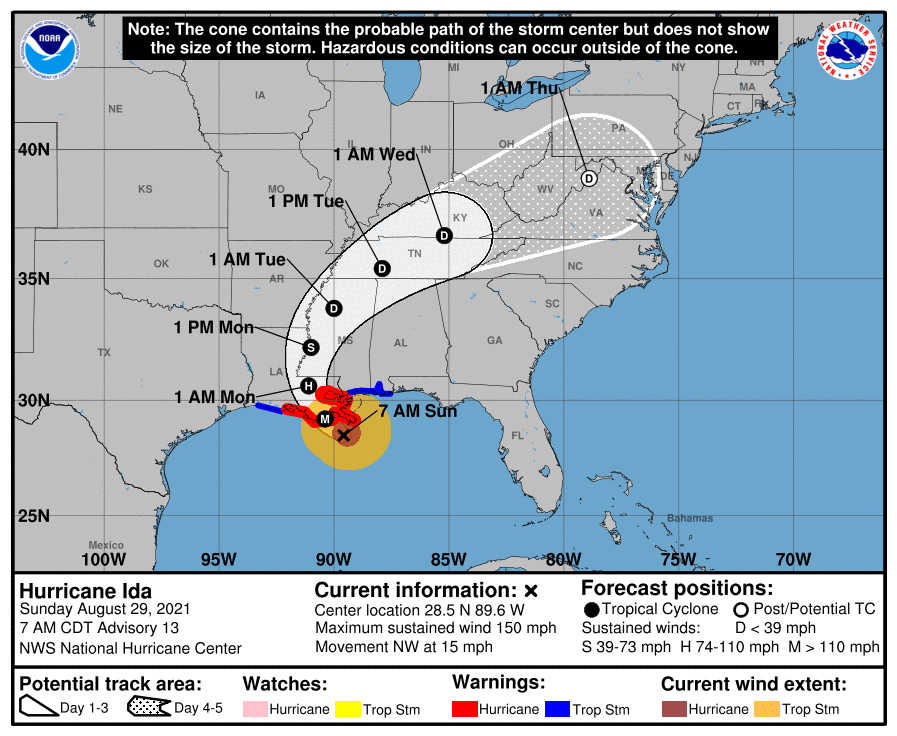
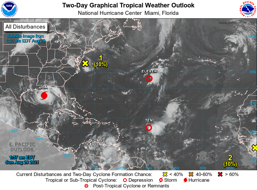
NHC 11 am update (slows to 13 mph NW, pressure 933, winds steady at 150 mph)
-
The eye looks like it has cleared quite a bit compared to earlier.
-
Yeah. I know some spots were in rain holes due to the scattered nature of the pop-ups the past couple days, but with the antecedent Henri rainfall and any place where pop-ups were slow-moving (or not moving and just rained themselves out), another couple inches will just send the creeks and even some of the larger rivers into overdrive. One difference though is that we won't have a Full Moon at the time of approach. The next New Moon is September 6th when this should be long gone. But depending on where the center tracks, parts of the CWA may end up on the right front quadrant. ETA - I went on and started a thread on it.
-
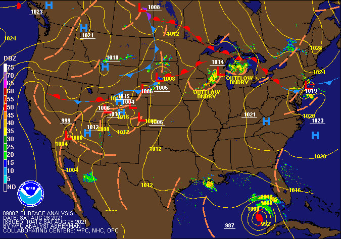
We also have this from NHC - Will need to watch if that holds and somehow interacts with the remnants of Ida, perhaps in a similar fashion as the ULL a week ago interacted with Henri.
-
Current temp here is 68 with overcast and dp 64. The earlier stratus seems to have mostly lifted. Mt. Holly getting ready for us for next week.
-

-
My low of 66 yesterday ended up happening just after 8:30 pm last night The air behind that front definitely continues to filter in. I also had some blow-by rain that added another 0.01" of rain last evening for a total of 1.97" for yesterday (and 11.02" for the month of August). It's currently 68 with stratus and some fog and a dp of 64.
-
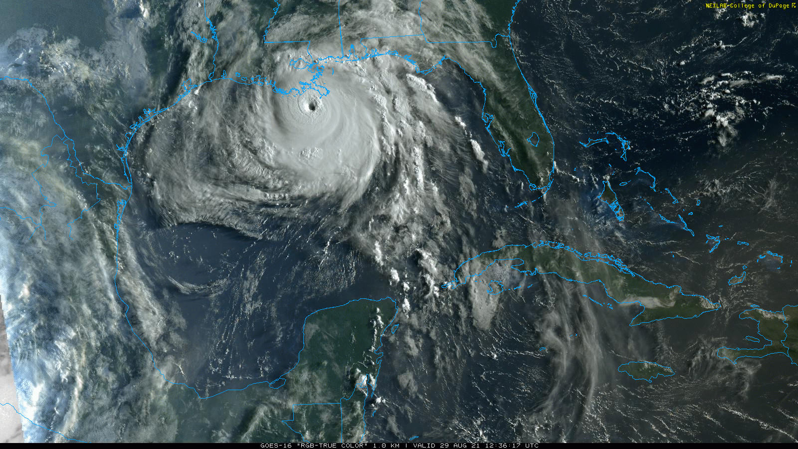
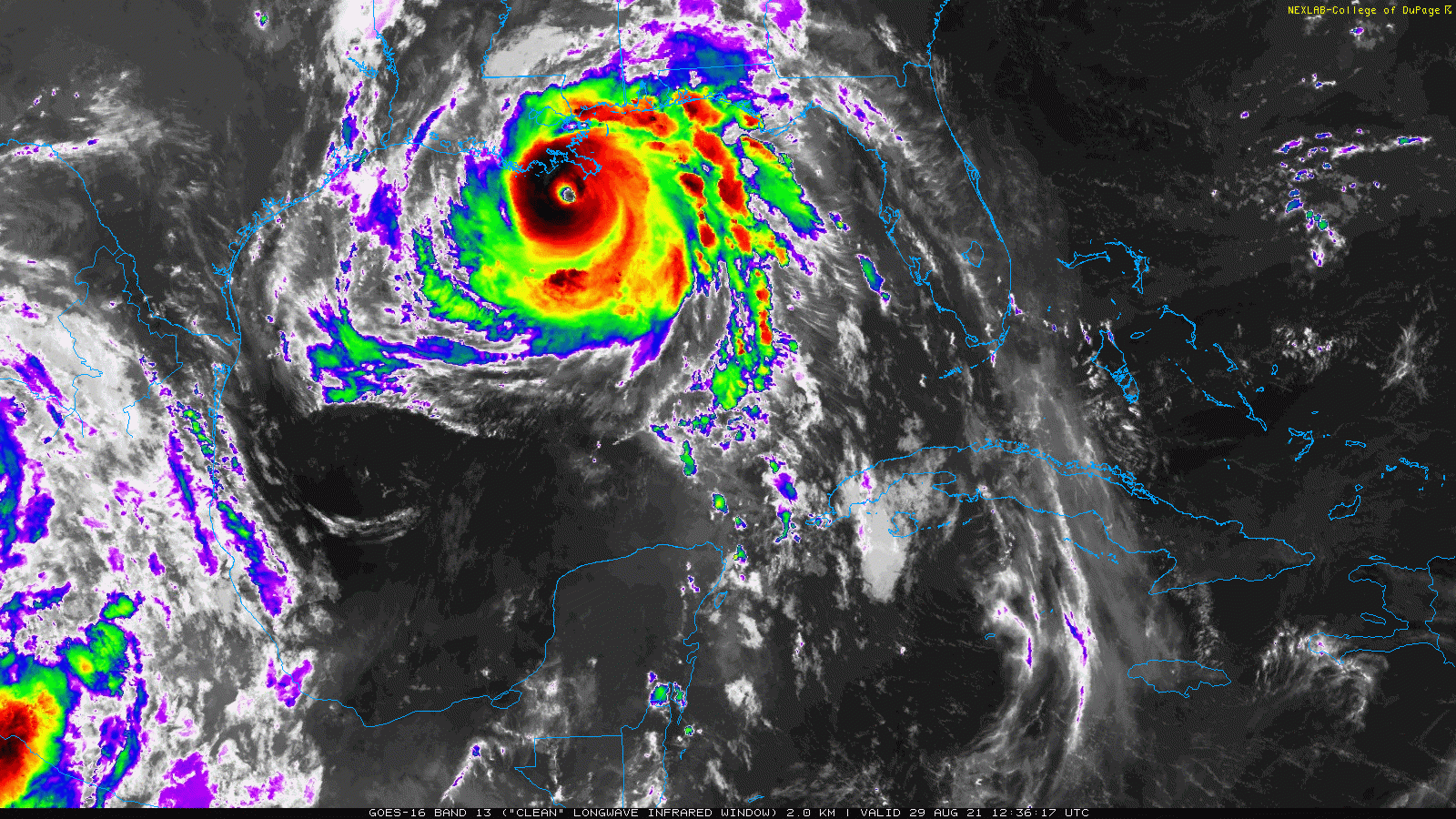
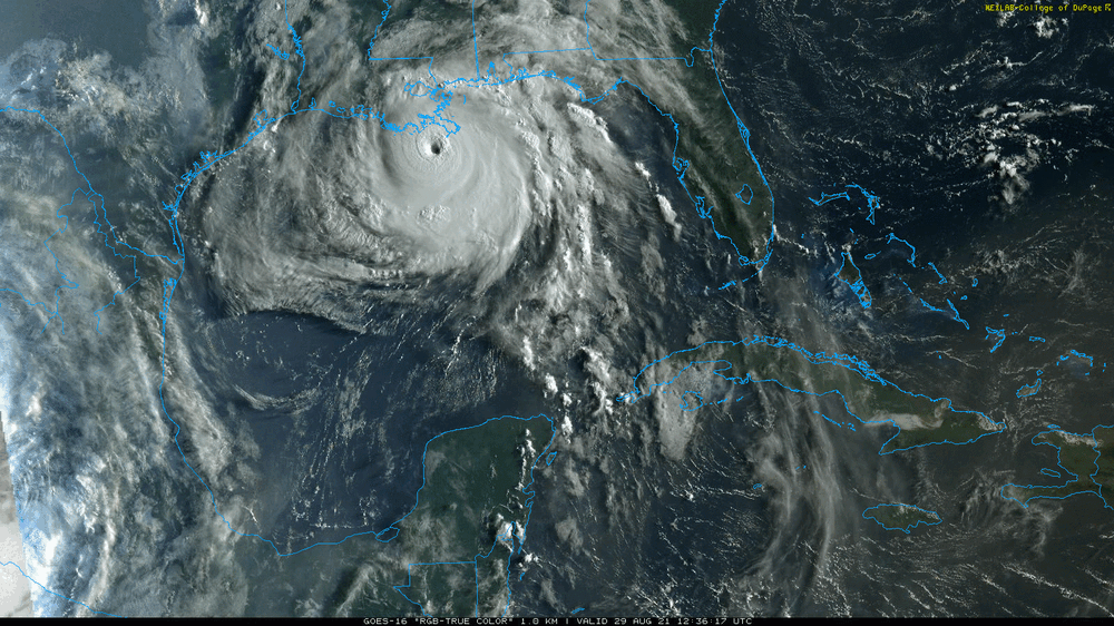
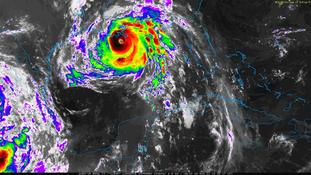
LOL and a single to 1st! Now if that is still there when Ida remnants get here, then it might be a Henri redux.... As a sidenote, Ida has been upgraded to a Cat 4 -
-
There's a line back west of Harrisburg but since it has sortof stabilized over in this area, that might not survive given we are a little over an hour from sunset, and it is fizzling as it moves east. I ended up with 1.96" today (so far assuming nothing else pops up) and my 78 high ended up about 45 minutes after midnight, with it mostly downhill since. The low was 69 and I'm currently overcast and 69 - with a dp of 66 that pretty much confirms the cold front is south of me.
-
Power came back on about 10 minutes ago and am hoping it will hold. My sis in Wyndmoor also got hers back too around the same time. We are a couple miles away from each other. My other sis in Upper Darby was unaffected. Am currently at 1.90" so far for the event with temp down to 69 and dp 68. Am glad that it is relatively cool and not a blast furnace regarding the power outage (been there done that).
-
Am up to 1.84" for the day so far with just over 1/2" per hour rates. The console to my main weather station is on a UPS although the Raspberry Pi's UPS is a different one that cut off now (it is running weewx). The GW-1000 that grabs stuff from the station to feed to the Pi is on the same UPS as the console (and is still on) so I probably should move the Pi off where it is at some point in the future (issue with plug distance). Temp is down to 69 with dp the same so I think that cool front continues to push through here.
-
My sis in Wyndmoor texted that she is out too. I have stuff on a couple big UPSes but they won't last forever. My Comcast router is on one and is still up at the moment (also have hot spots).
-
And... my power just went out.
-
Now under a FFW here. Rain has picked up a bit more and is more light to moderate. Currently at 1.52". Temp is 71 with dp 70.
-
The rain has started up here again and got another 0.12" for 1.43" so far today. Currently have some light rain and temp is down to 72 with dp 71, so am thinking the front is floating overhead.
-
May end up being like that through mid-week, although Tuesday may be the "dry" day before Ida. There's some weird flow going on - the bulk of the stuff backing in from the NE (I think there is a little low that formed) but then motion from the front coming out of the NW trying to push to the SE. The convergence is sparking that rain and keeping it from moving. I've been getting variable stratus and overcast with temp back down to 74 and a dp of 72, so something is trying to push into here.
-
Was just thinking about you. You are now under a FFW. Keep an eye out!
-
Mt. Holly just lofted a FFW for that area (just got it on my weather radio).
-
Bucks County is lighting up! I think it is due to the front that has been dropping in, with it sortof stalled around that area. The temp here has crept up and it is 75 now, after a low of 72, and dp 74.
-
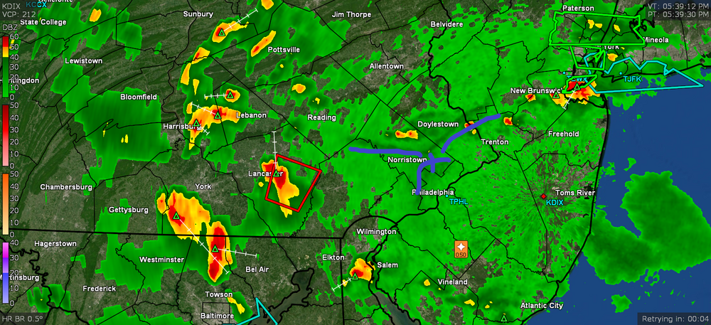
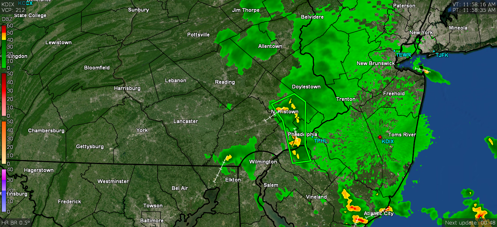
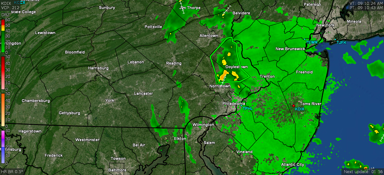
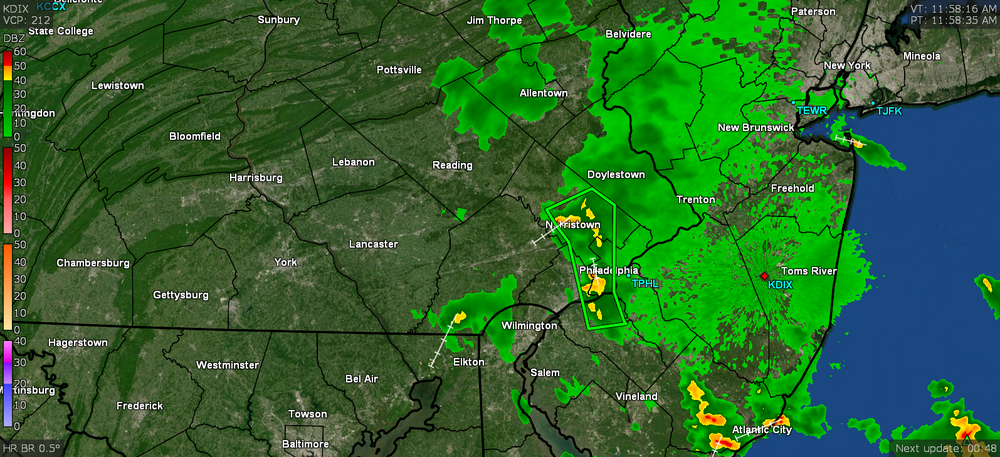
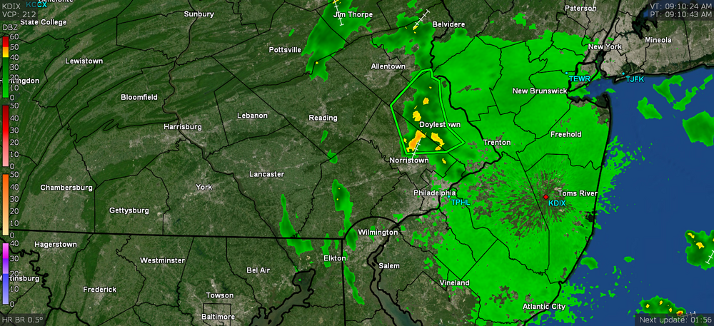
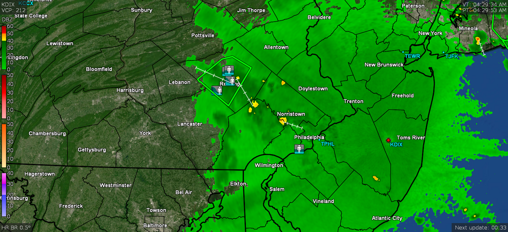
When I was looking at the radar returns the past couple hours, I saw all the flood reports all over and around the Reading metro area and after the earlier deluge (snapshot below from earlier), they still have the FFW up all around there.
-
OMG I had some mutant cell form, bubble up, and undulate right over my area between about 3 am and 4 am, depositing about 1.20" in that time. I am still getting light rain at post time (now at 1.31") and it's 73 with dp 73. This round has taken me to 10.36" of rain for the month of August and there is more possible over the next couple of days, not counting whatever Ida generates.
-
They probably are confused trying to shoe-horn a track in because there's no flow to move the storms around they just sit there and rain and thunder and lightning themselves out and fade... and the bubble up again a little ways away. I suppose that's why they call them "pulse" storms because when one pop up, it'll increase in intensity might suddenly decrease in intensity and then might swell up on one side and shrink on the other, and finally move around in place like an undulating blob.
-
Damn. Maybe it will back-build and morph. I have watched some these cells doing this. The temp has now recovered here and is up to 86 with dp 77. I did just see Mt. Holly's AFD and they did note all the "boundary" traffic in the area - sea breezes, bay breezes, and convection outflows, and the radar is showing them overlapping and intersecting. And then at the intersection points, stuff starts firing up.