Hurricane Agnes
-
Posts
9,264 -
Joined
Content Type
Profiles
Blogs
Forums
American Weather
Media Demo
Store
Gallery
Everything posted by Hurricane Agnes
-
E PA/NJ/ DE Winter 2021-22 OBS Thread
Hurricane Agnes replied to JTA66's topic in Philadelphia Region
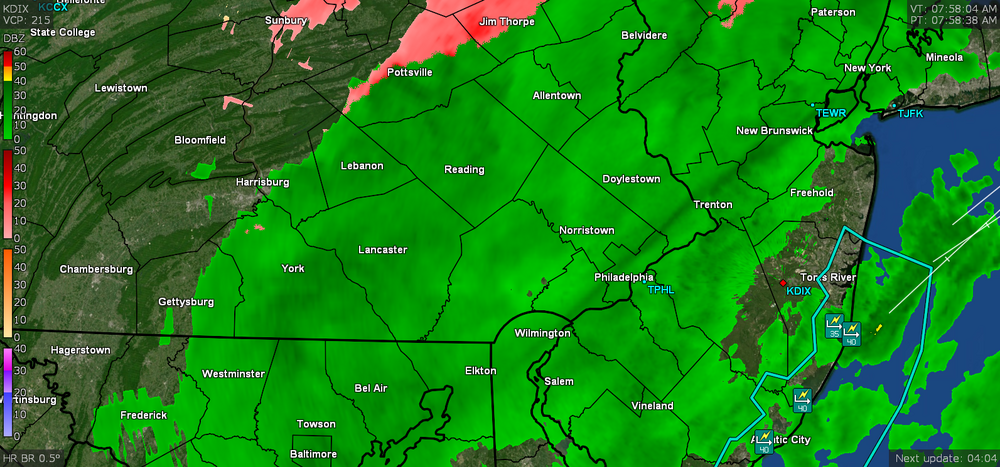
Was wondering if anyone under that got more snow/frozen than yesterday's storm! Looks like the blob is sitting over Chester County now. -
E PA/NJ/ DE Winter 2021-22 OBS Thread
Hurricane Agnes replied to JTA66's topic in Philadelphia Region
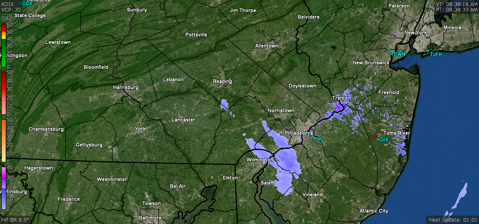
Just saw the box on the radar and was wondering what the heck? -
E PA/NJ/ DE Winter 2021-22 OBS Thread
Hurricane Agnes replied to JTA66's topic in Philadelphia Region
Just saw this from Mt. Holly (and a hat tip to the red-taggers on Amwx) - -
E PA/NJ/ DE Winter 2021-22 OBS Thread
Hurricane Agnes replied to JTA66's topic in Philadelphia Region
And look what is rolling around down there!
-
E PA/NJ/ DE Winter 2021-22 OBS Thread
Hurricane Agnes replied to JTA66's topic in Philadelphia Region
Thanks for that update!!!! I think I finally bottomed out at 23 (am currently 24 with dp 16), so that heat is needed to at least keep the pipes from freezing! -
E PA/NJ/ DE Winter 2021-22 OBS Thread
Hurricane Agnes replied to JTA66's topic in Philadelphia Region
Oh geez. Hope you get it back real soon!!! -
E PA/NJ/ DE Winter 2021-22 OBS Thread
Hurricane Agnes replied to JTA66's topic in Philadelphia Region
Looks like the radar pretty much cleared over me now, although there is still a cloud deck. Down to 29 with dp 26 and expect to keep on going down. -
E PA/NJ/ DE Winter 2021-22 OBS Thread
Hurricane Agnes replied to JTA66's topic in Philadelphia Region
Something should be sitting over your now! -
E PA/NJ/ DE Winter 2021-22 OBS Thread
Hurricane Agnes replied to JTA66's topic in Philadelphia Region
Heads up! Something may be headed your way!
-
E PA/NJ/ DE Winter 2021-22 OBS Thread
Hurricane Agnes replied to JTA66's topic in Philadelphia Region
Now finally getting some flakes. Also seeing frozen drips on some of the bare tree branches. I can add a T for snow now.
-
E PA/NJ/ DE Winter 2021-22 OBS Thread
Hurricane Agnes replied to JTA66's topic in Philadelphia Region
Well now down to 30 and sitting under a snow blob but am not seeing any flakage. Finished up with 1.07" for the day (1.50" 2 day).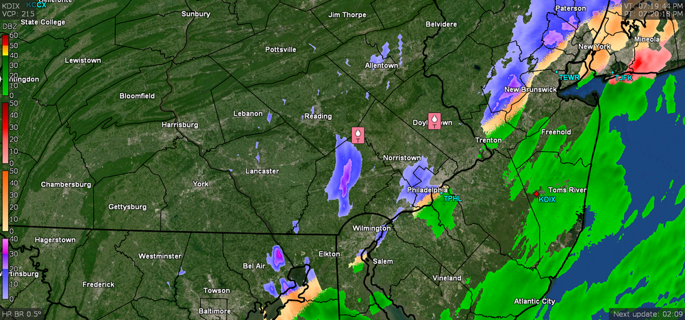
-
E PA/NJ/ DE Winter 2021-22 OBS Thread
Hurricane Agnes replied to JTA66's topic in Philadelphia Region
Now down to 31 and sitting under ZR. But it would take awhile to have any buildup since the surfaces should still be relatively warmish but anything wet will definitely be freezing over. Am up to 1.07" rain for the day.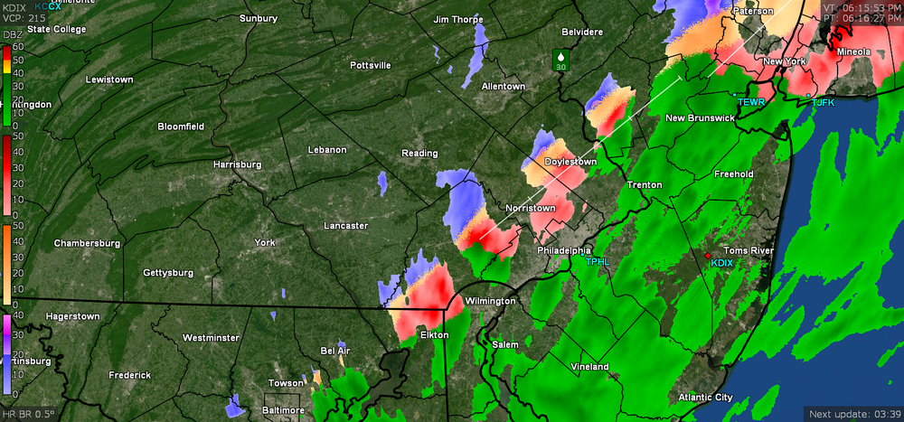
-
E PA/NJ/ DE Winter 2021-22 OBS Thread
Hurricane Agnes replied to JTA66's topic in Philadelphia Region
Now sitting at 32 and am a couple minutes from sunset (although obviously can't see any sun )... -
E PA/NJ/ DE Winter 2021-22 OBS Thread
Hurricane Agnes replied to JTA66's topic in Philadelphia Region
Western Chesco getting ZR'd. I'm sitting at 32.9 and am up to 1.05" of rain for the day so far.
-
E PA/NJ/ DE Winter 2021-22 OBS Thread
Hurricane Agnes replied to JTA66's topic in Philadelphia Region
Mt. Holly tweeted out some pics from Sussex County NJ with the ice accretion in NW NJ - -
E PA/NJ/ DE Winter 2021-22 OBS Thread
Hurricane Agnes replied to JTA66's topic in Philadelphia Region
Could be elevation. It's still raining lightly too. I put the cover on my car windshield Wednesday before the rain hit yesterday and flipped up the wipers. ZR line moving in...
-
E PA/NJ/ DE Winter 2021-22 OBS Thread
Hurricane Agnes replied to JTA66's topic in Philadelphia Region
Now at the precipice - currently 33 with dp 33, and still some intermittent light rain (0.99" today so far). -
E PA/NJ/ DE Winter 2021-22 OBS Thread
Hurricane Agnes replied to JTA66's topic in Philadelphia Region
Temp continues to drop here as the cold air oozes in. Am now down to 37 with continued light rain (0.79" so far today). -
E PA/NJ/ DE Winter 2021-22 OBS Thread
Hurricane Agnes replied to JTA66's topic in Philadelphia Region
Currently down to 41 and leveling there (a 15 degree drop from today's earlier high), with dp 40 and 0.57" in the bucket, with light rain still ongoing, that appears to be breaking up soon. I wouldn't be surprised if the rain is steadying the temps and once it's done, another drop will happen. -
E PA/NJ/ DE Winter 2021-22 OBS Thread
Hurricane Agnes replied to JTA66's topic in Philadelphia Region
Have leveled off at 42 and still getting light rain. Now up to 0.50" for today... -
E PA/NJ/ DE Winter 2021-22 OBS Thread
Hurricane Agnes replied to JTA66's topic in Philadelphia Region
Some recent Mt. Holly tweets as the front was moving - -
E PA/NJ/ DE Winter 2021-22 OBS Thread
Hurricane Agnes replied to JTA66's topic in Philadelphia Region
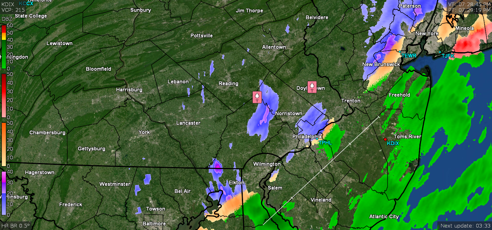
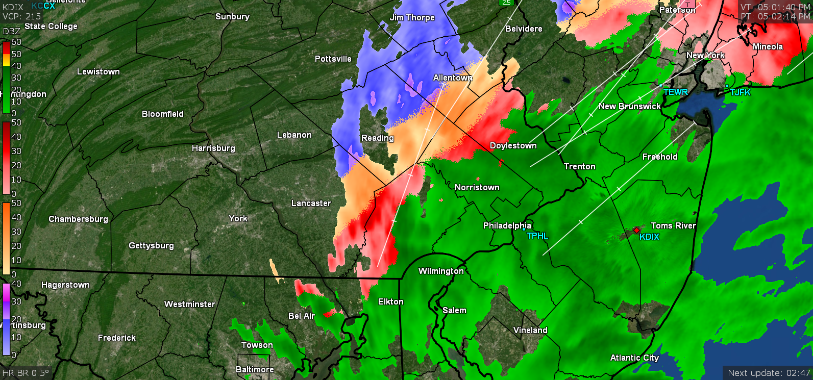
Pulled out view and you can see where things stand at the moment. There's a report (public) of 0.7" of sleet in Port Matilda Centre County PA. A spotter has 0.2" freezing rain up in Montoursville (Lycoming county), PA
-
E PA/NJ/ DE Winter 2021-22 OBS Thread
Hurricane Agnes replied to JTA66's topic in Philadelphia Region
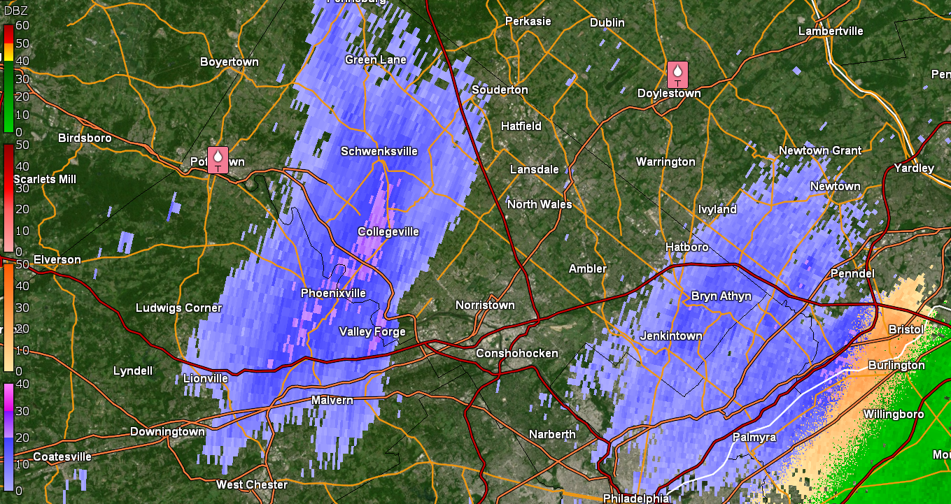
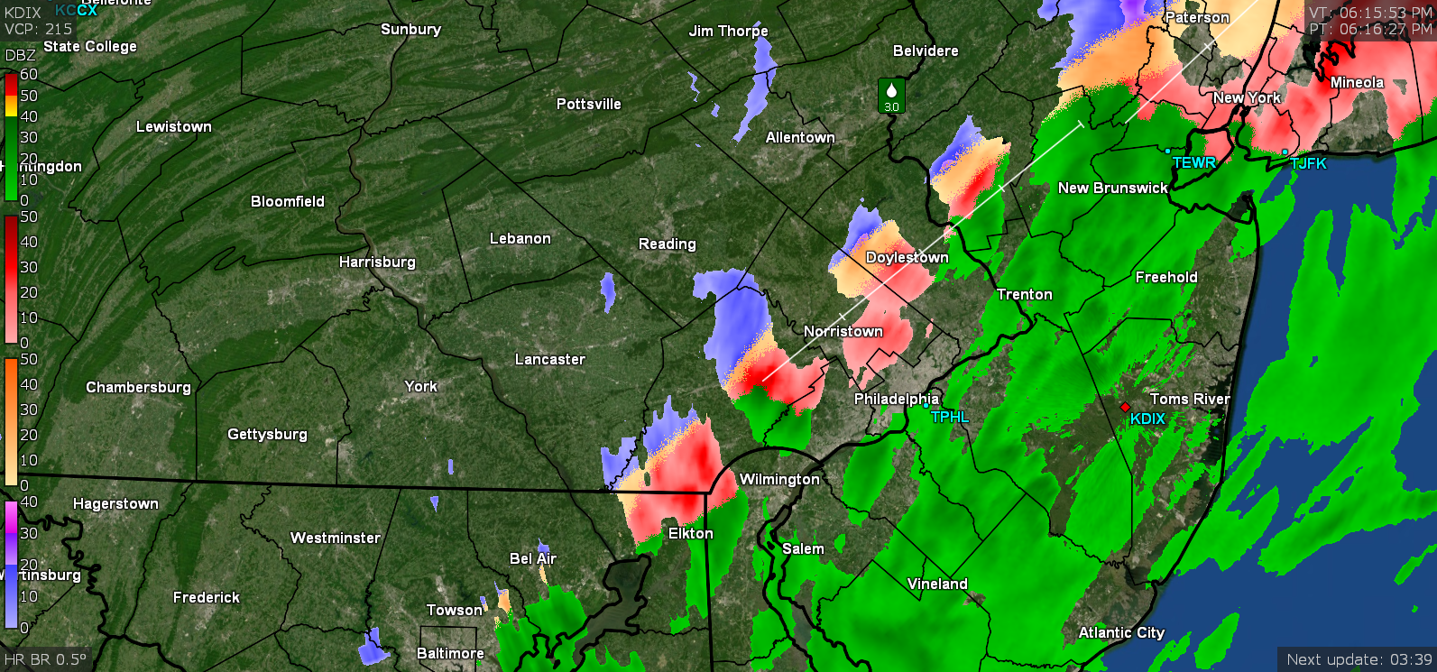
Down to 42 with some steady light rain and now at 0.39" (0.82" for the 2 days) and a fascinating doppler. You can definitely see where the freezing line is and there is that band now cutting through Jersey with the cold air behind it.
-
E PA/NJ/ DE Winter 2021-22 OBS Thread
Hurricane Agnes replied to JTA66's topic in Philadelphia Region
Now down to 43 and lol'ing. Up to 0.35" in the bucket at post time (total 0.78").
-
E PA/NJ/ DE Winter 2021-22 OBS Thread
Hurricane Agnes replied to JTA66's topic in Philadelphia Region
And just like that - BOOM - the passage of the precip line heralded an 8 degree temp drop. Now down to 47 with dp 46. Am up to 0.32" of rain so far (0.75" for the 2 days). EDIT - now down to 46 (9 degree drop) and winds have picked up.