Hurricane Agnes
-
Posts
9,264 -
Joined
Content Type
Profiles
Blogs
Forums
American Weather
Media Demo
Store
Gallery
Everything posted by Hurricane Agnes
-
E PA/NJ/ DE Winter 2021-22 OBS Thread
Hurricane Agnes replied to JTA66's topic in Philadelphia Region
The 6zs this morning (EC is still running) - GFS and a LOL @ the NAM.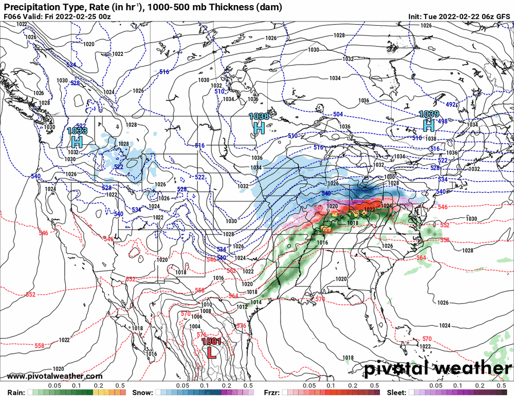
-
E PA/NJ/ DE Winter 2021-22 OBS Thread
Hurricane Agnes replied to JTA66's topic in Philadelphia Region
AND the 2nd day of "the week" (obviously depending on when you consider the start of a week). Heard the math-lovers are having a field day (citing that along with that day of the week's name, this is something like a 1 in 4 million occurrence... per a report I heard on KYW). Low this morning has so far been 38 and it's currently 41 with dp 39. -
E PA/NJ/ DE Winter 2021-22 OBS Thread
Hurricane Agnes replied to JTA66's topic in Philadelphia Region
18z GFS/EC - mix to rain in southern part of CWA (although the 18z for the EC does not go out far enough to show the end of it).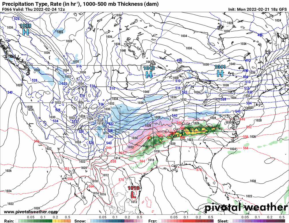
-
E PA/NJ/ DE Winter 2021-22 OBS Thread
Hurricane Agnes replied to JTA66's topic in Philadelphia Region
After a low of 26 this morning, made it up to 57. It's currently sunny and 56 with dp 28. -
E PA/NJ/ DE Winter 2021-22 OBS Thread
Hurricane Agnes replied to JTA66's topic in Philadelphia Region
18z NAM still showing 2 systems impacting part of the CWA where the GFS/Euro/CAN are sliding that first one to the south of here...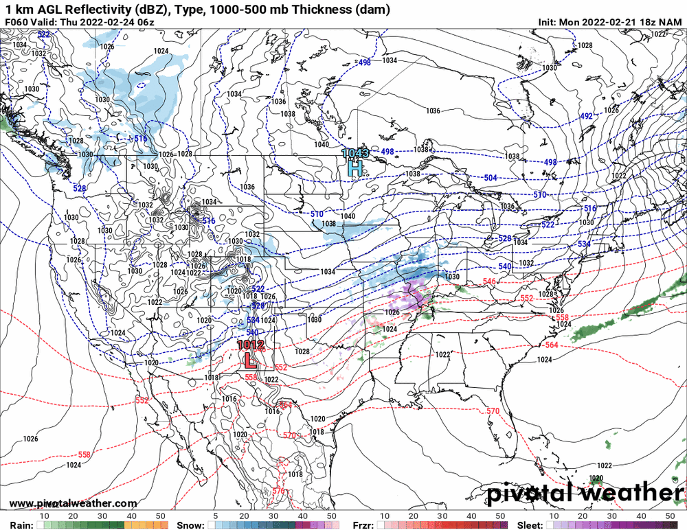
-
E PA/NJ/ DE Winter 2021-22 OBS Thread
Hurricane Agnes replied to JTA66's topic in Philadelphia Region
12z EC like the 12z GFS - rain to the south and frozen pushed to the north.
-
E PA/NJ/ DE Winter 2021-22 OBS Thread
Hurricane Agnes replied to JTA66's topic in Philadelphia Region
12z GFS holding as a mix/ZR to rain for the southern part of the CWA, keeping the sleet mostly north. ETA the 12z Canadian showing the same type of setup.
-
E PA/NJ/ DE Winter 2021-22 OBS Thread
Hurricane Agnes replied to JTA66's topic in Philadelphia Region
It has some odd antecedent thing going before it starts to align with the other models to show the main event going into the weekend (which mostly occurs outside of the NAM's range at the moment). ETA - the 6z hires EC is actually showing that antecedent feature too but it has it further south than the NAM so it slides below the CWA (and is all rain).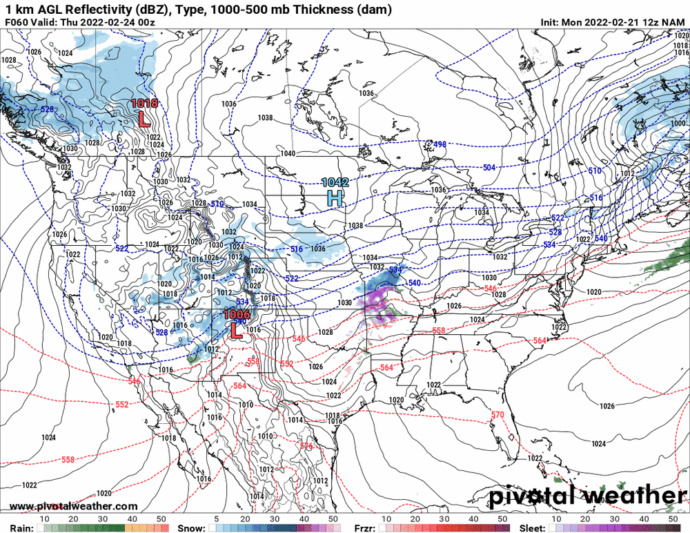
-
E PA/NJ/ DE Winter 2021-22 OBS Thread
Hurricane Agnes replied to JTA66's topic in Philadelphia Region
0z EC got its senses back and went with a non-phased slider for the end of month storm that it originally had (that GFS didn't).
-
E PA/NJ/ DE Winter 2021-22 OBS Thread
Hurricane Agnes replied to JTA66's topic in Philadelphia Region
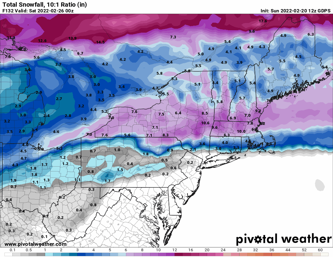
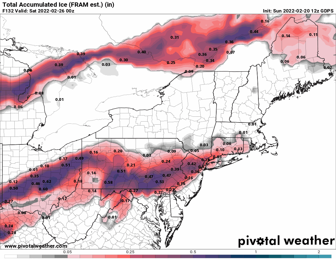
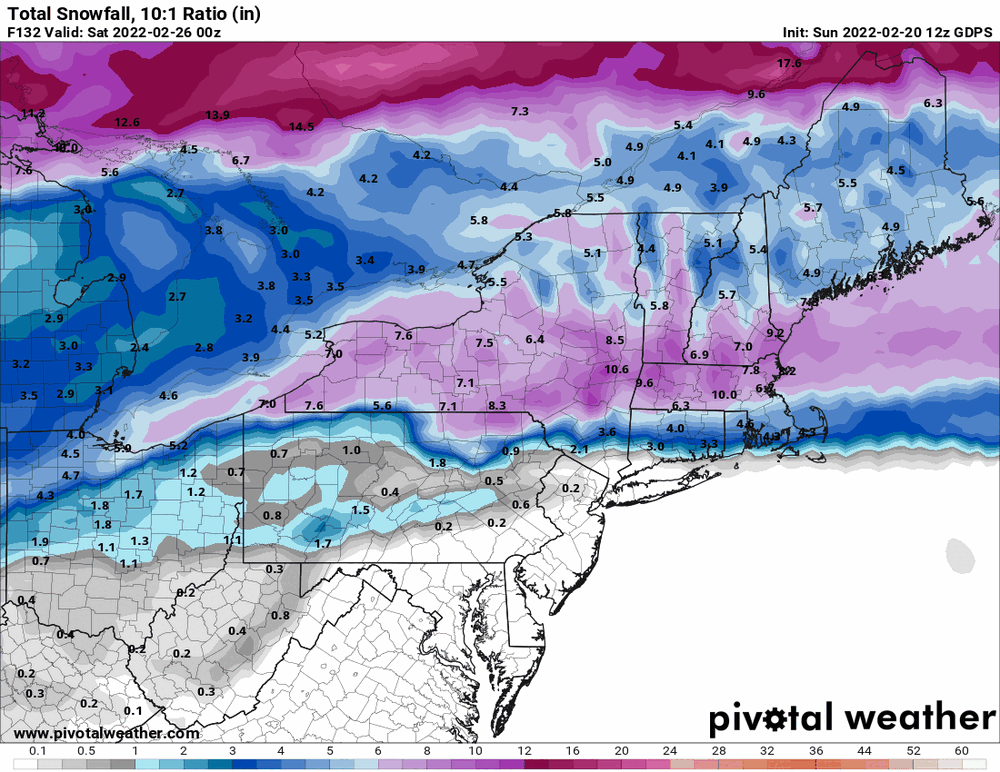
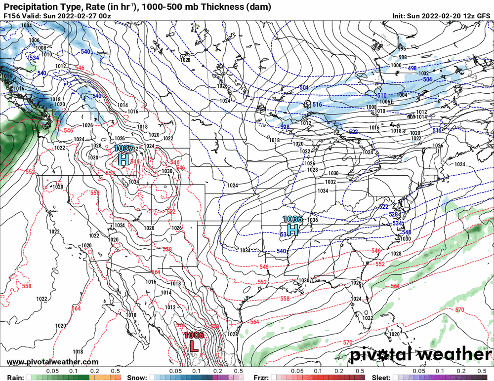
6z GFS continues the 0z trends (its own & EC's) mix to rain solution for the Feb 25 storm. The 0z Canadian also has a mix to rain but mirrored the earlier icier solutions from yesterday.
-
E PA/NJ/ DE Winter 2021-22 OBS Thread
Hurricane Agnes replied to JTA66's topic in Philadelphia Region
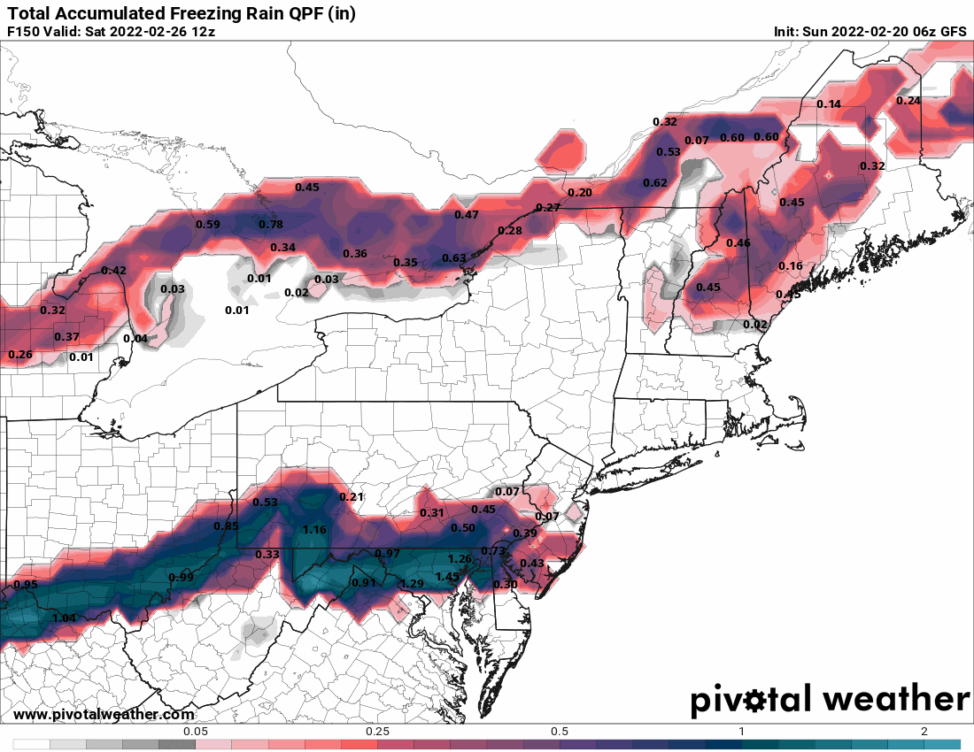
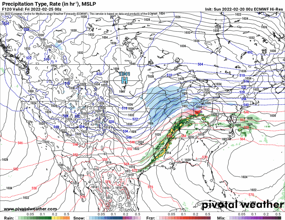
GFS 6z is still running but the 0z's change was to push most of the the ice further north and end as rain along Philly metro after an initial icing... The 0z Euro is generally mostly rain along the same southern part of the CWA through the event. It's all gonna depend on where the freezing line sets up.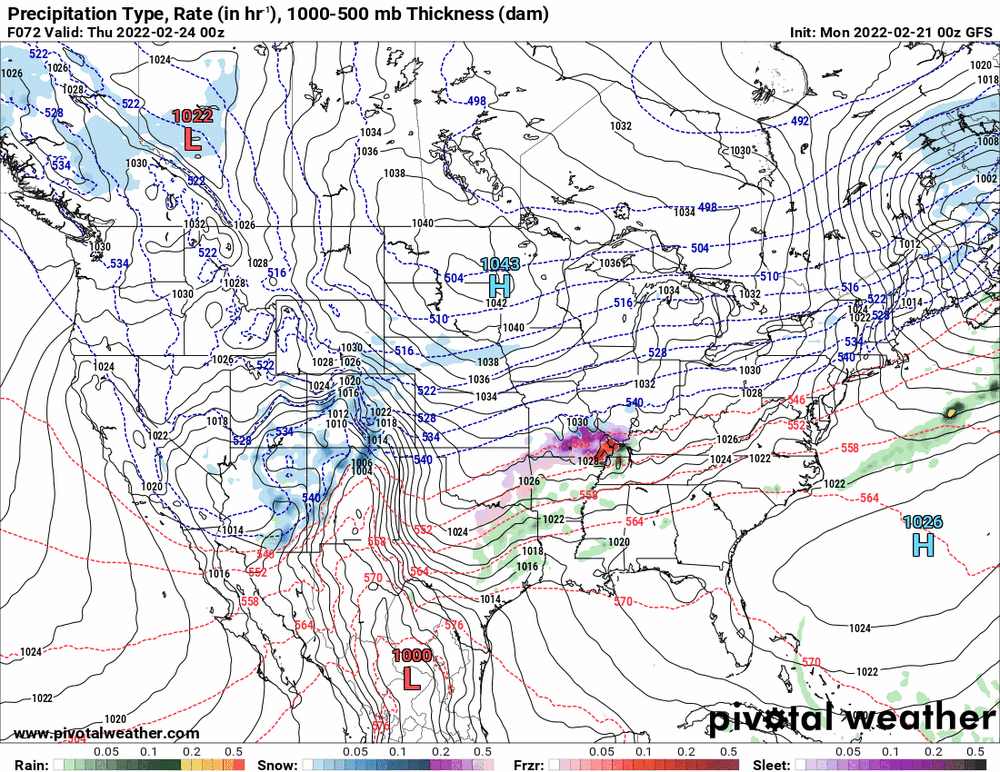
-
E PA/NJ/ DE Winter 2021-22 OBS Thread
Hurricane Agnes replied to JTA66's topic in Philadelphia Region
Some obs for today - after a low of 18 this morning, I made it up to 37 and it's currently 30 with dp 22. -
E PA/NJ/ DE Winter 2021-22 OBS Thread
Hurricane Agnes replied to JTA66's topic in Philadelphia Region
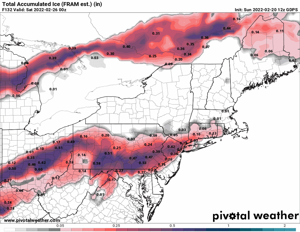
12z Canadian is showing a full on ice/ZR storm. (although snow up north)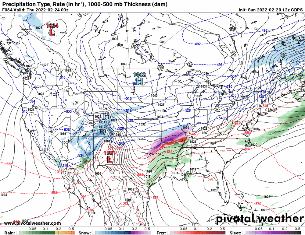
-
E PA/NJ/ DE Winter 2021-22 OBS Thread
Hurricane Agnes replied to JTA66's topic in Philadelphia Region
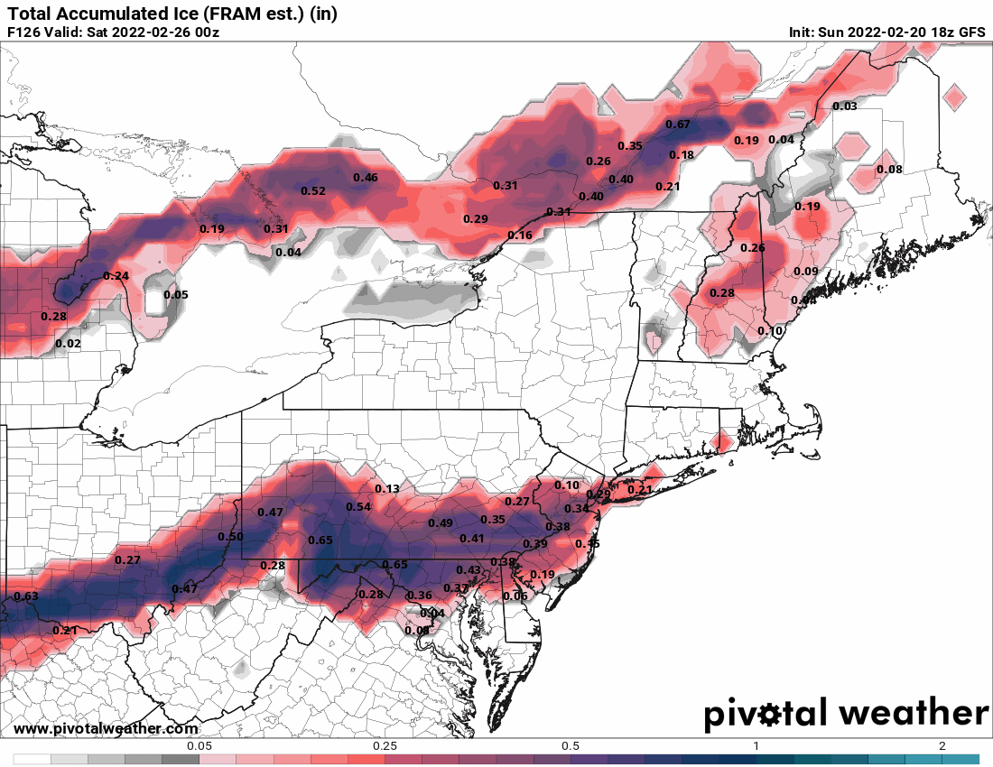
18z GFS ice and ZR snapshots.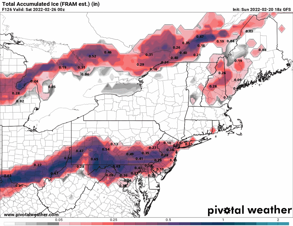

-
E PA/NJ/ DE Winter 2021-22 OBS Thread
Hurricane Agnes replied to JTA66's topic in Philadelphia Region
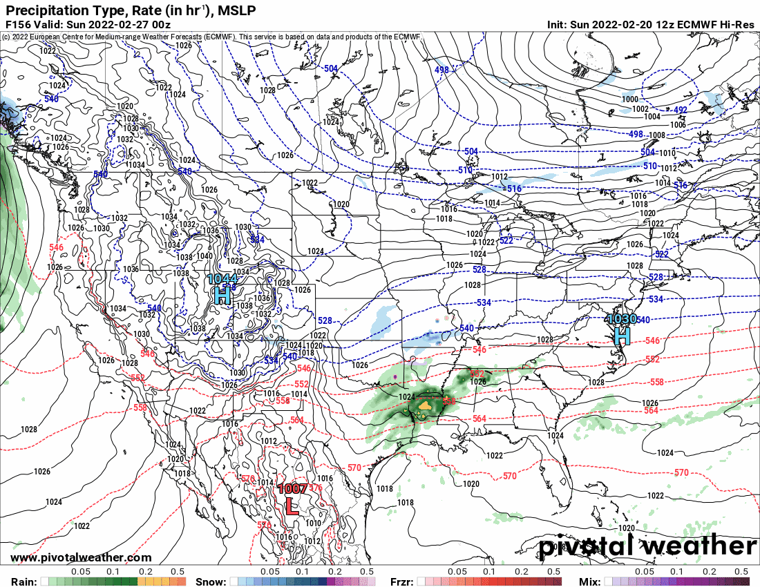
For the end of month (Feb. 28 - Mar. 1) storm - the 12z EC has an over-running storm with a cold front/LE-looking finish where the GFS has no such storm at all except as something that slides along the STJ and out to sea.
-
E PA/NJ/ DE Winter 2021-22 OBS Thread
Hurricane Agnes replied to JTA66's topic in Philadelphia Region
6z GFS ZR verbatum is ugly for I95 corridor vs 0z EC that throws that threat to the north.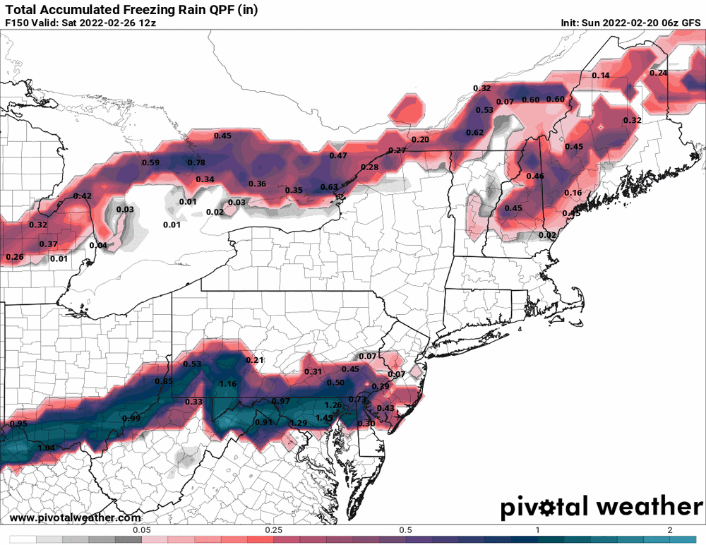
-
E PA/NJ/ DE Winter 2021-22 OBS Thread
Hurricane Agnes replied to JTA66's topic in Philadelphia Region
6z GFS still has the colder solution but the sleet/ZR bomb shows up on the 0z EC and Canadian.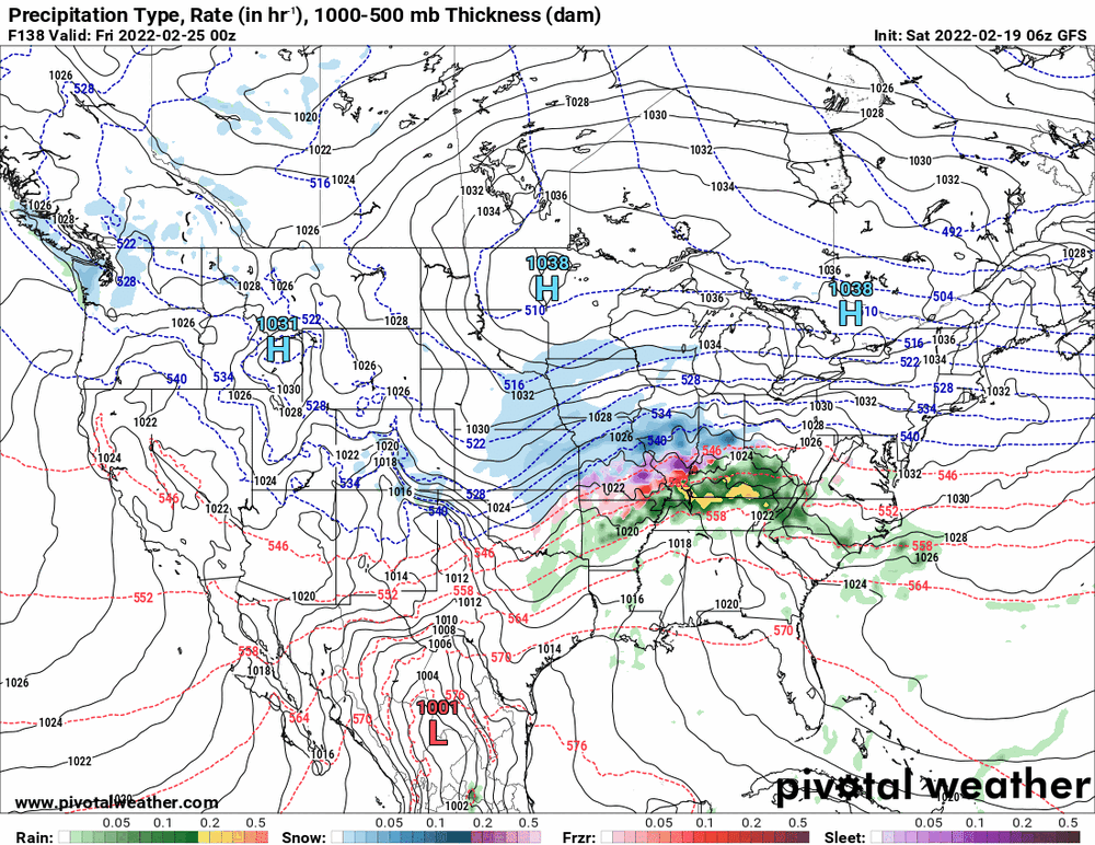
-
E PA/NJ/ DE Winter 2021-22 OBS Thread
Hurricane Agnes replied to JTA66's topic in Philadelphia Region
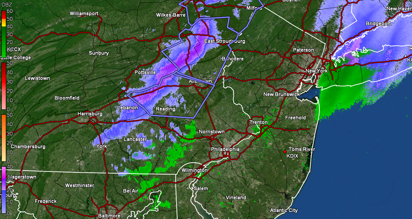
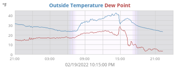
I was at my sister's house for my niece's bday party in Wyndmoor when it blew through down here between ~2:30 - 3 pm (I live a couple miles SE of her). My other niece was driving down from N. Jersey and said she got caught in it up there coming down 95 and almost pulled over. There was no accumulation in this area but a definite flizzard nonetheless. The temps appeared to crash to ~32 or so IMBY (after a high of 43), before recovering to about 36 or so and then went on with a regular diurnal cooling as the colder air trickled in and the sun set. The dp started dropping just before the temp crash and did its own crash during the brief temporary temp recovery. Currently 23 and clear (saw the big just-past-full-moon rising on the way home) with dp 4.
-
E PA/NJ/ DE Winter 2021-22 OBS Thread
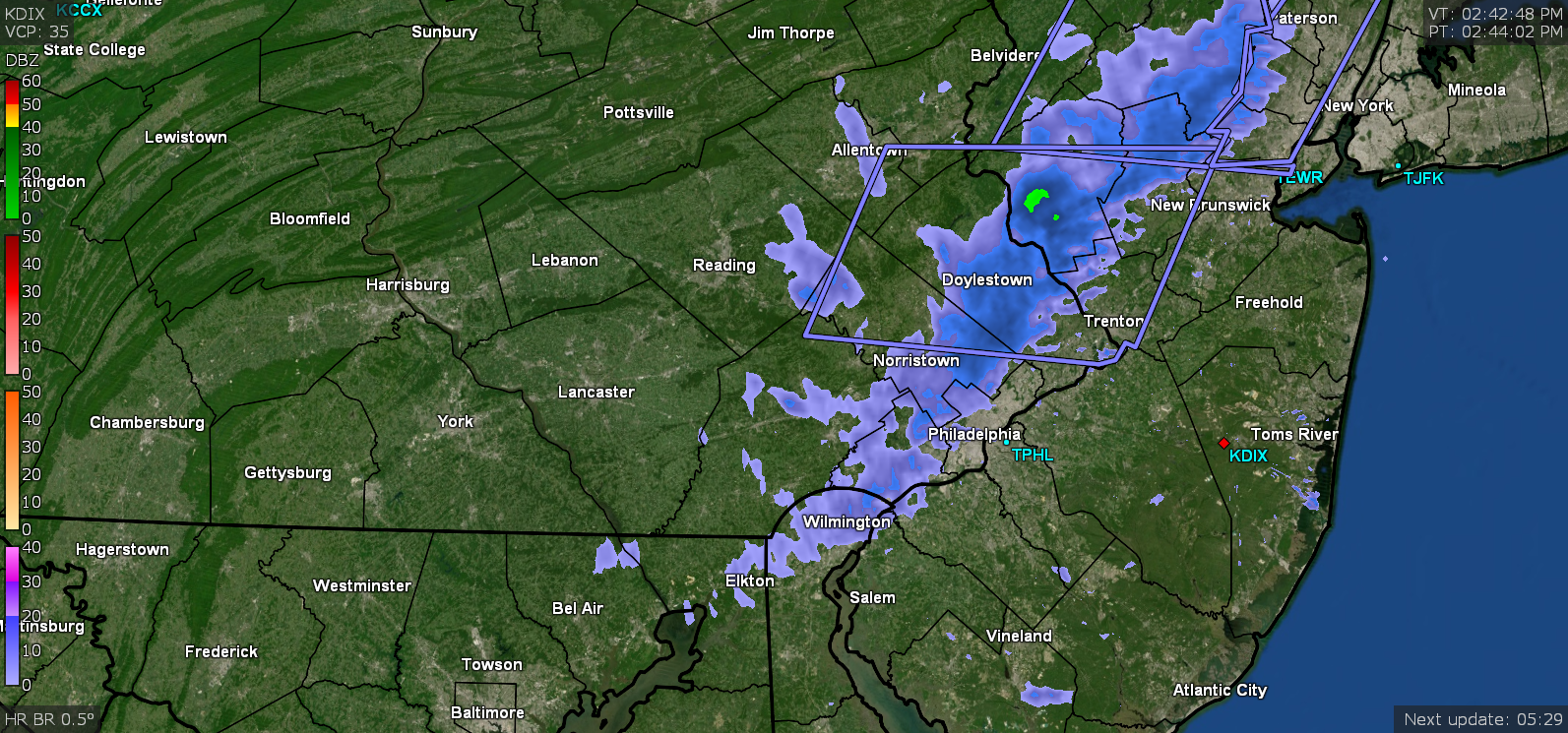
Hurricane Agnes replied to JTA66's topic in Philadelphia Region
Looks pretty intense on radar! It was dark briefly here between noon and 1 pm but at the time the temp was bopping between 39 and 40. Didn't see any precip. during that time. It's currently 41 here.
-
E PA/NJ/ DE Winter 2021-22 OBS Thread
Hurricane Agnes replied to JTA66's topic in Philadelphia Region
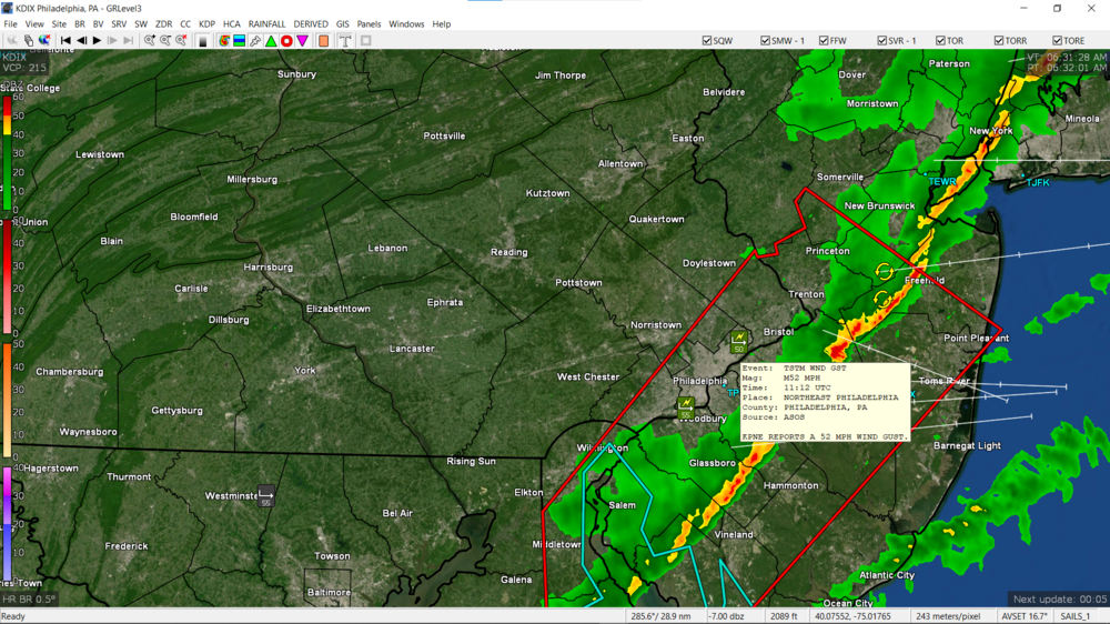
Snow Squall Warning in Berks/N. Montco - -
E PA/NJ/ DE Winter 2021-22 OBS Thread
Hurricane Agnes replied to JTA66's topic in Philadelphia Region
My final low yesterday was 28 just before midnight after a high of 62. This morning I bottomed out at 23 and am currently mostly sunny and up to 31 with dp 21. -
E PA/NJ/ DE Winter 2021-22 OBS Thread
Hurricane Agnes replied to JTA66's topic in Philadelphia Region
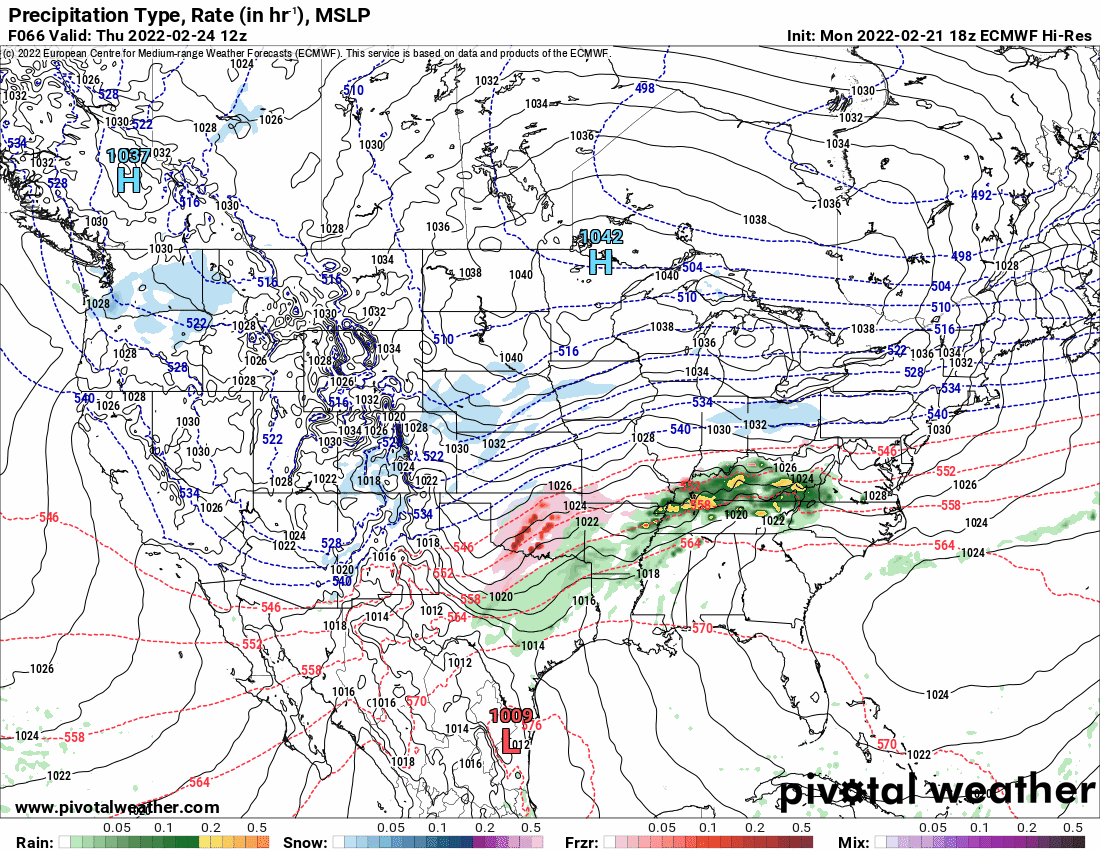
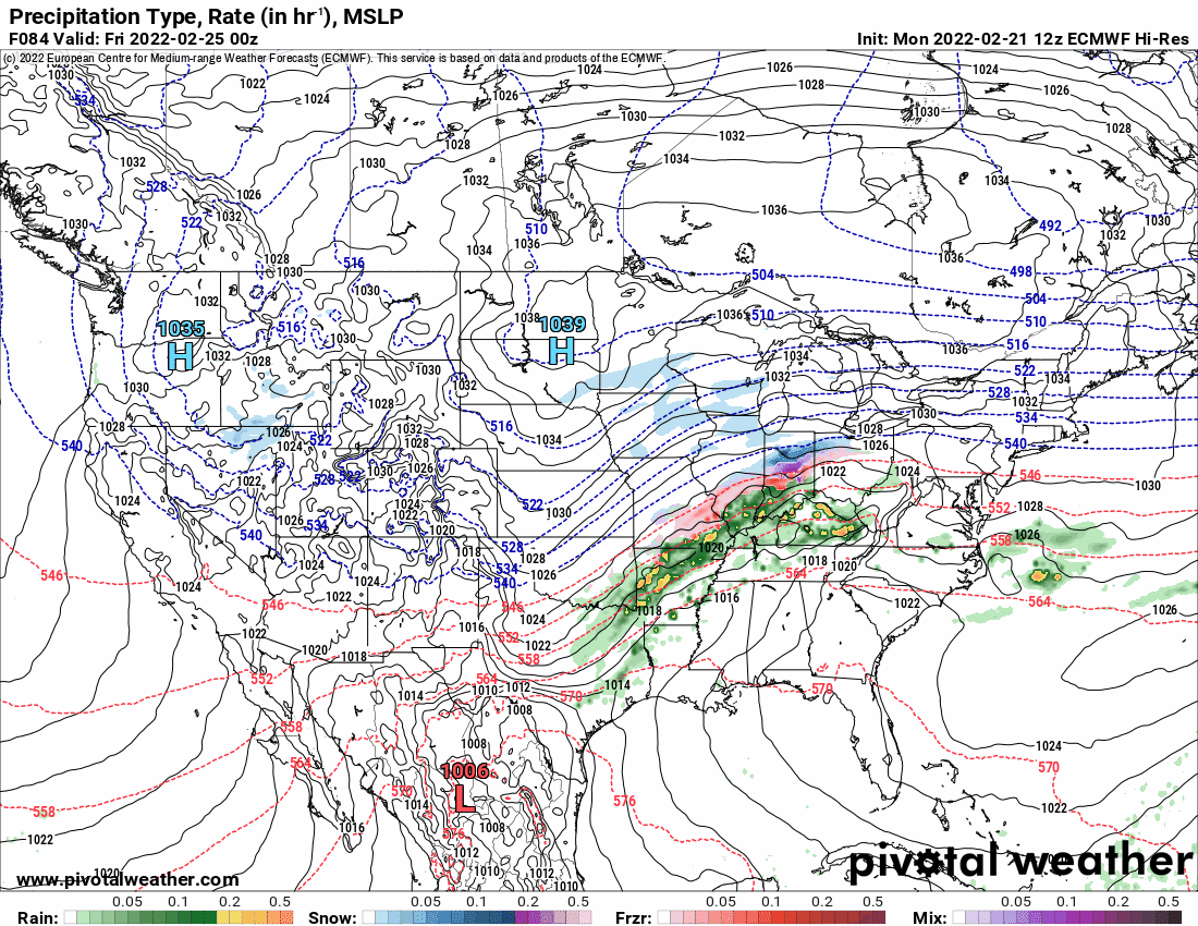
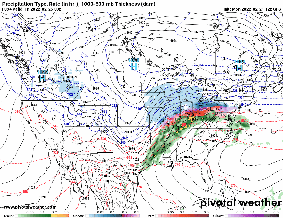
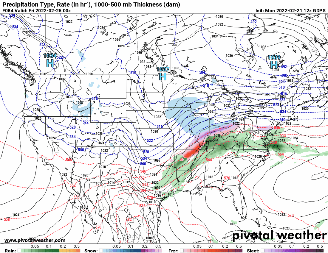
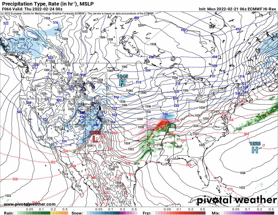
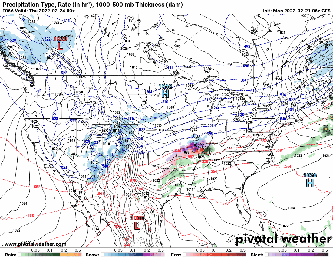
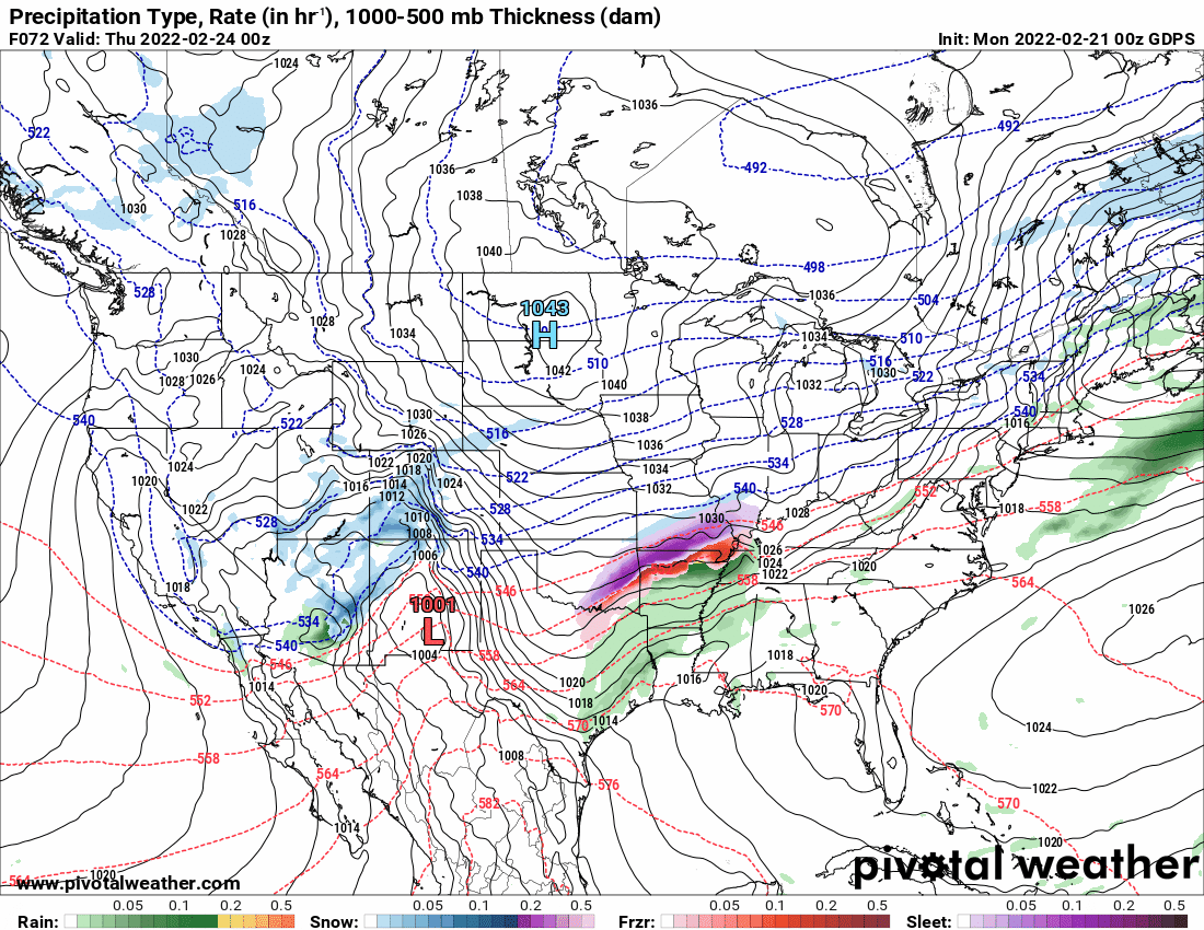
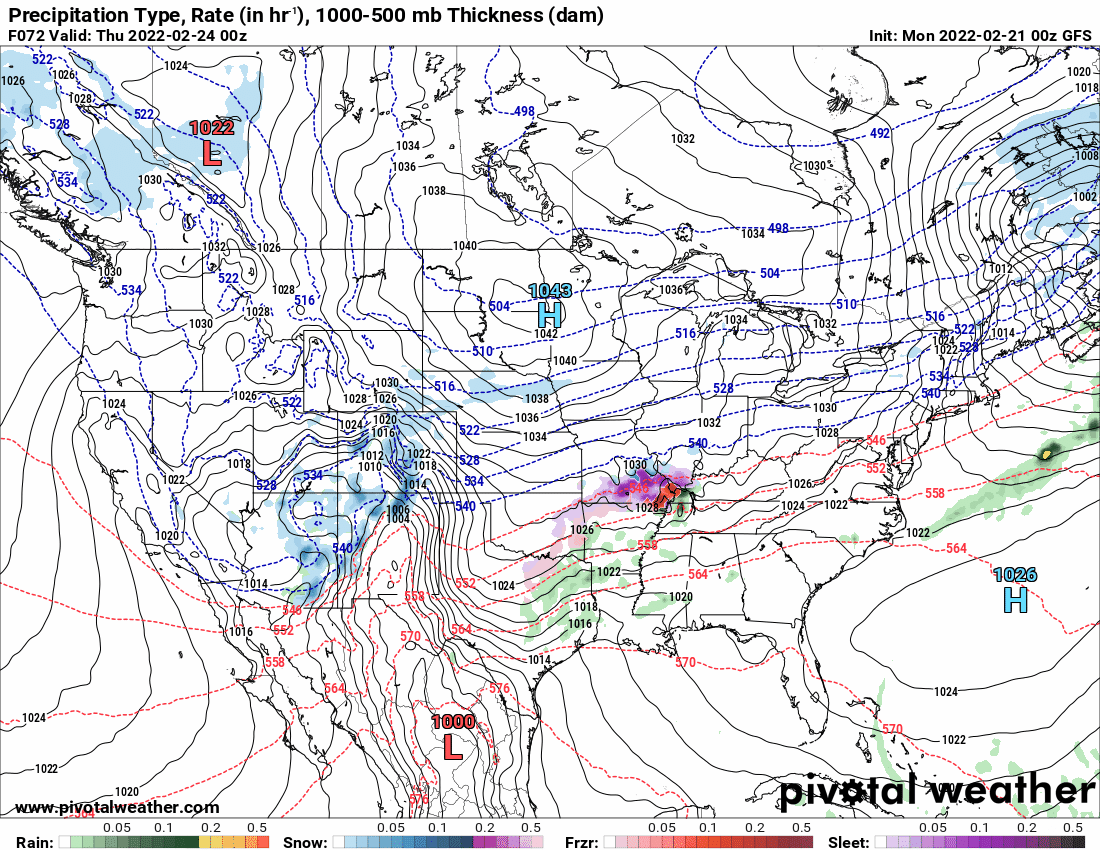
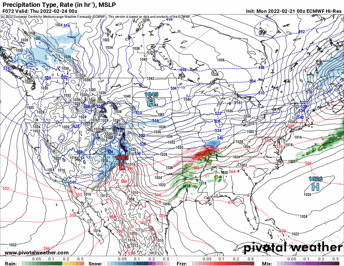
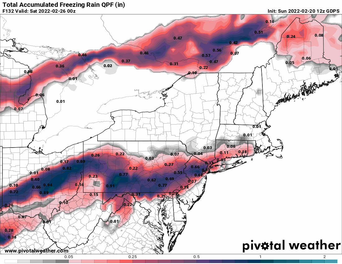
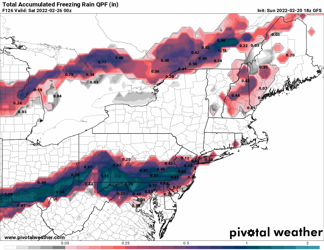
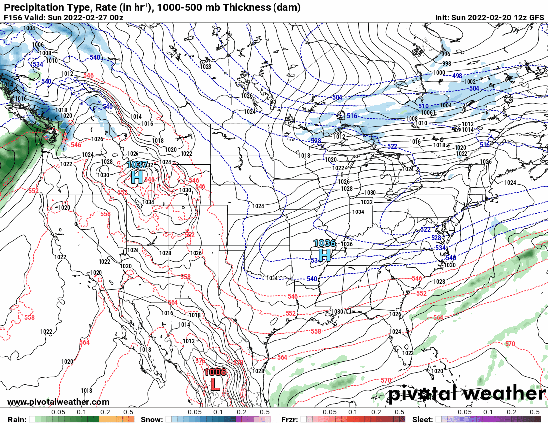
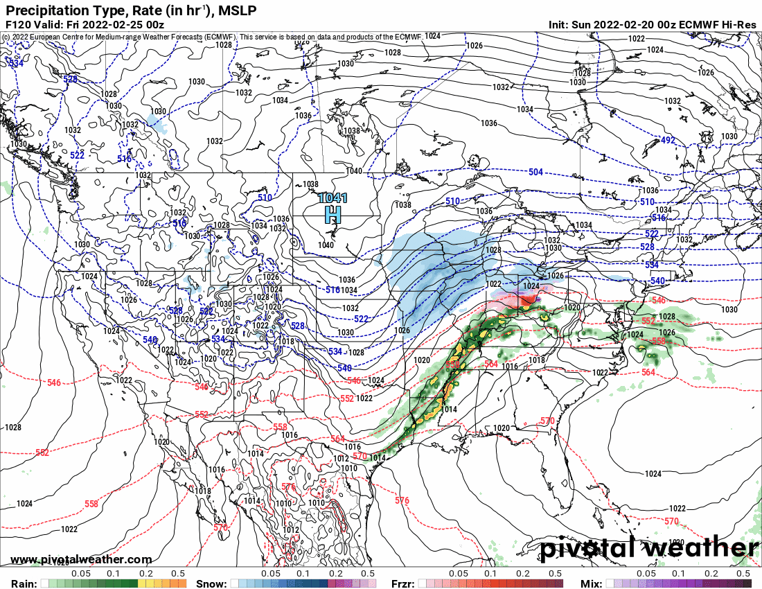
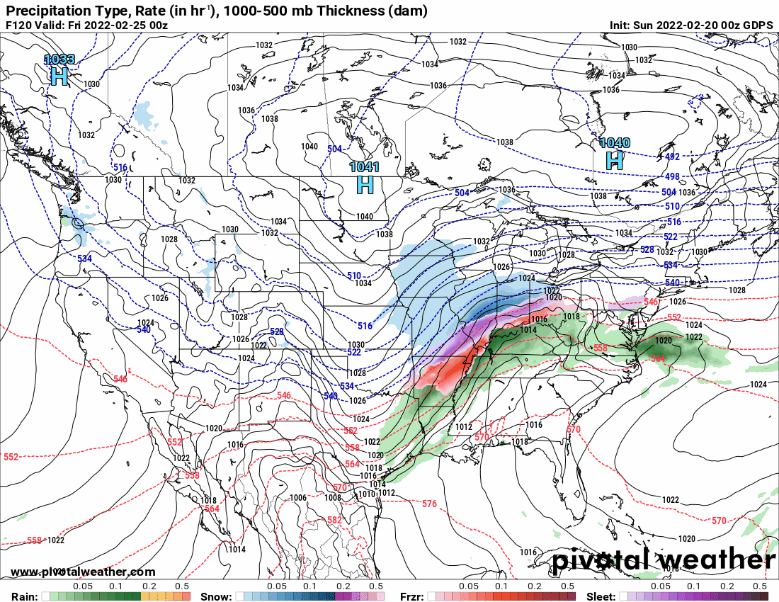
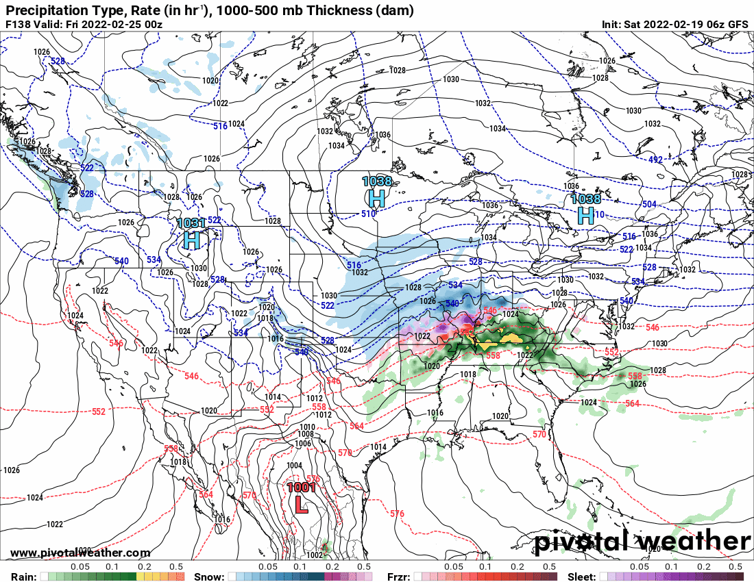
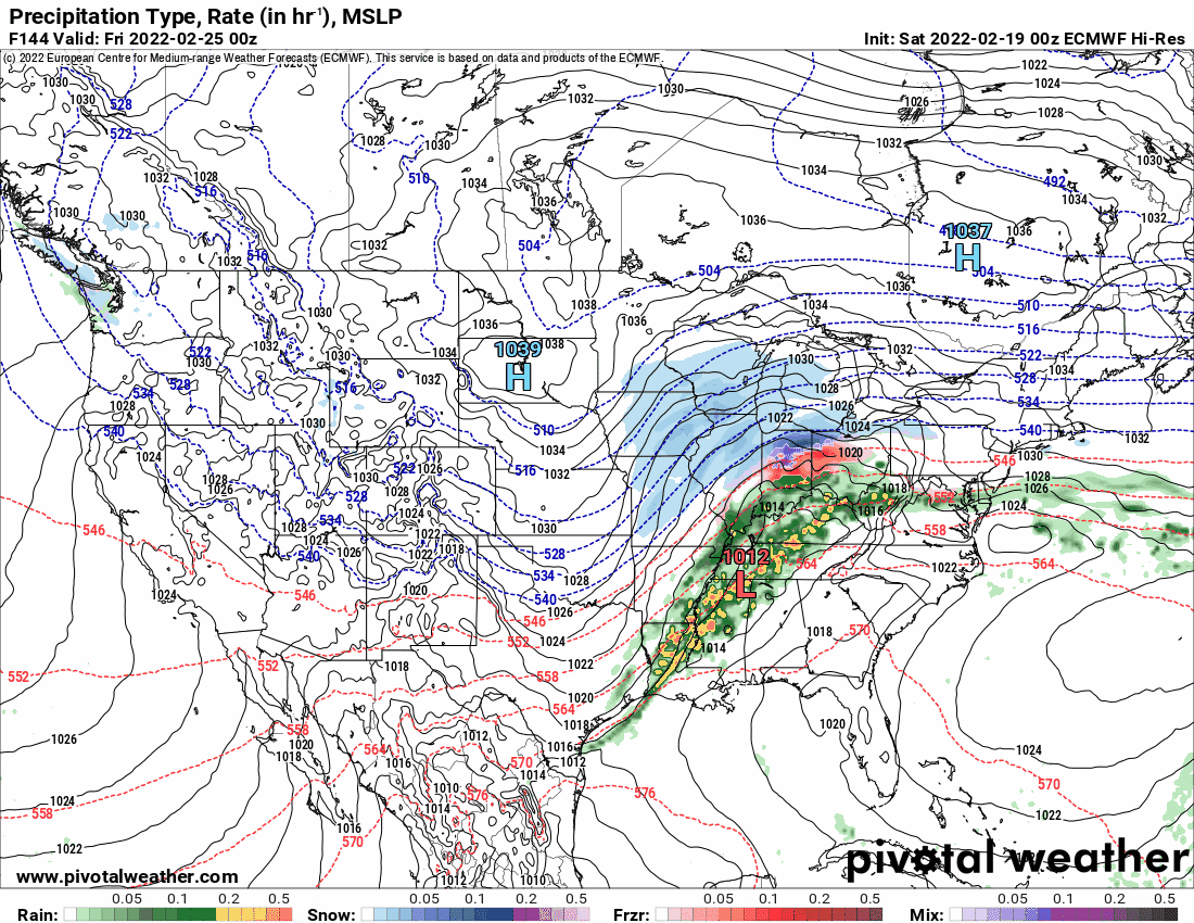
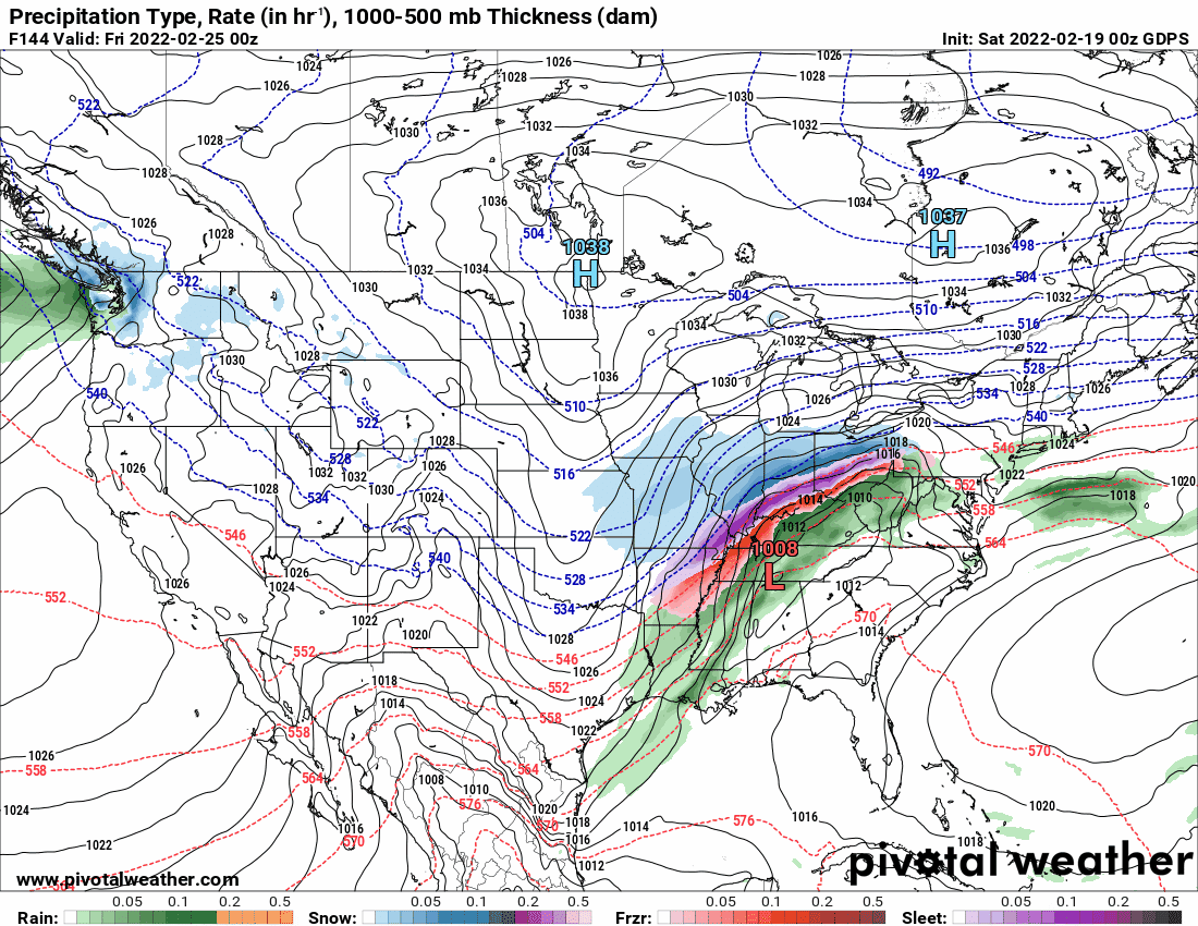
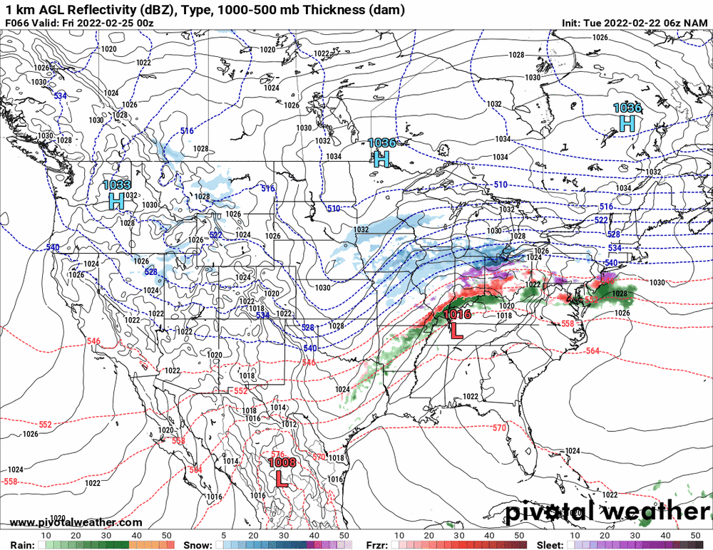
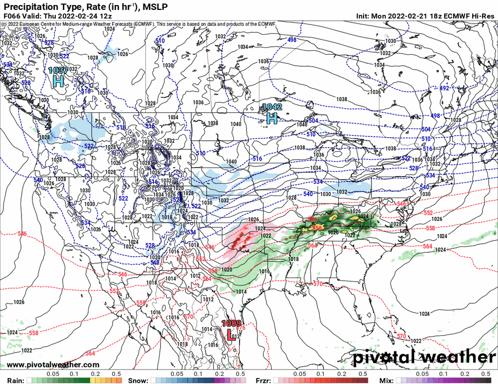
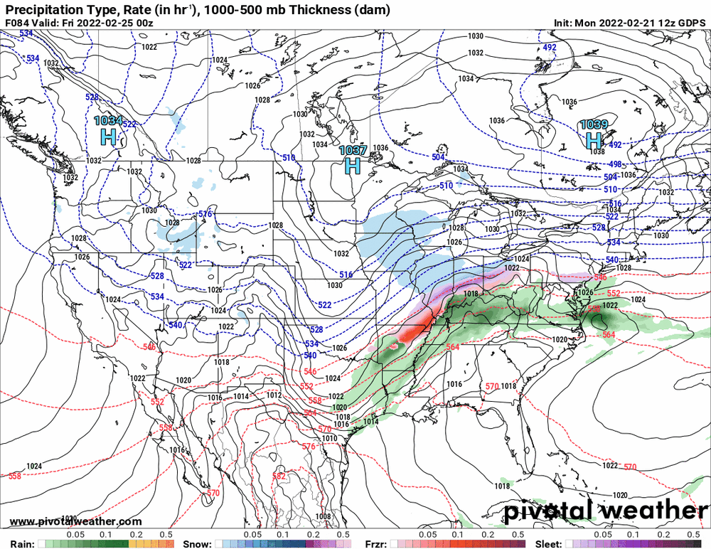
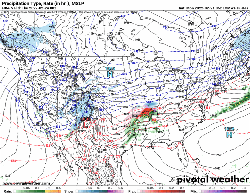
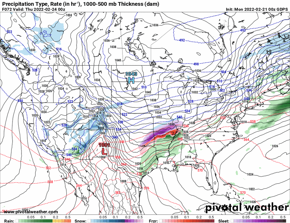
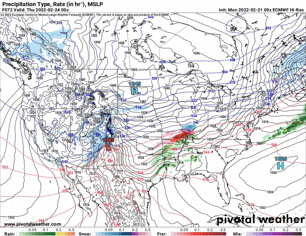
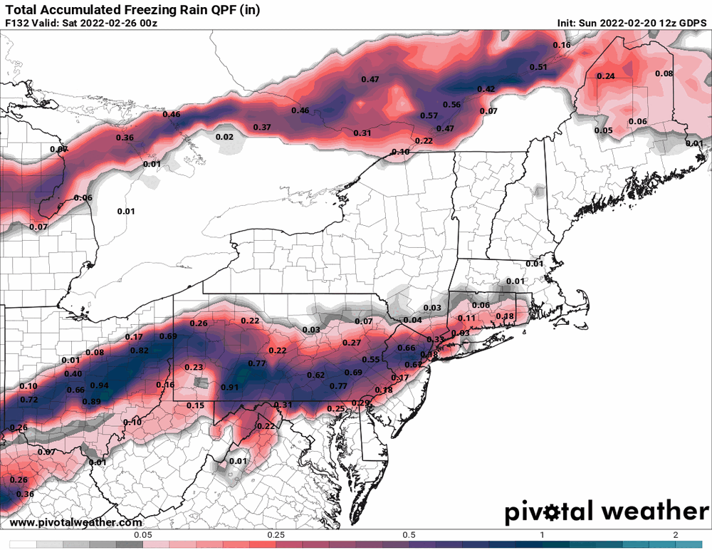
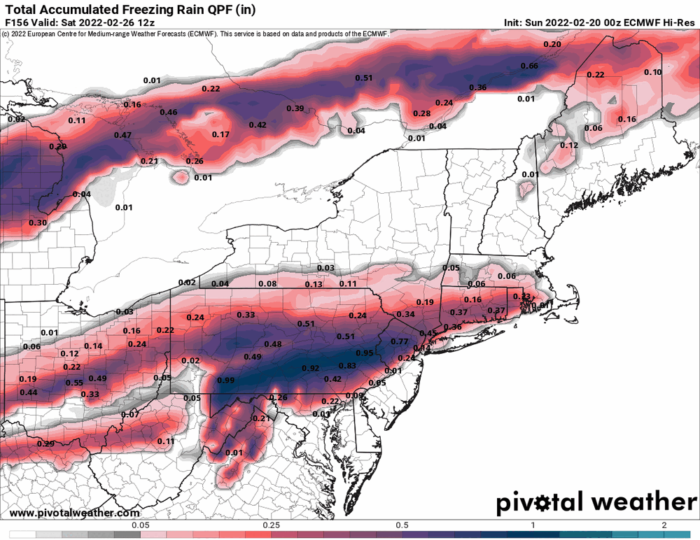
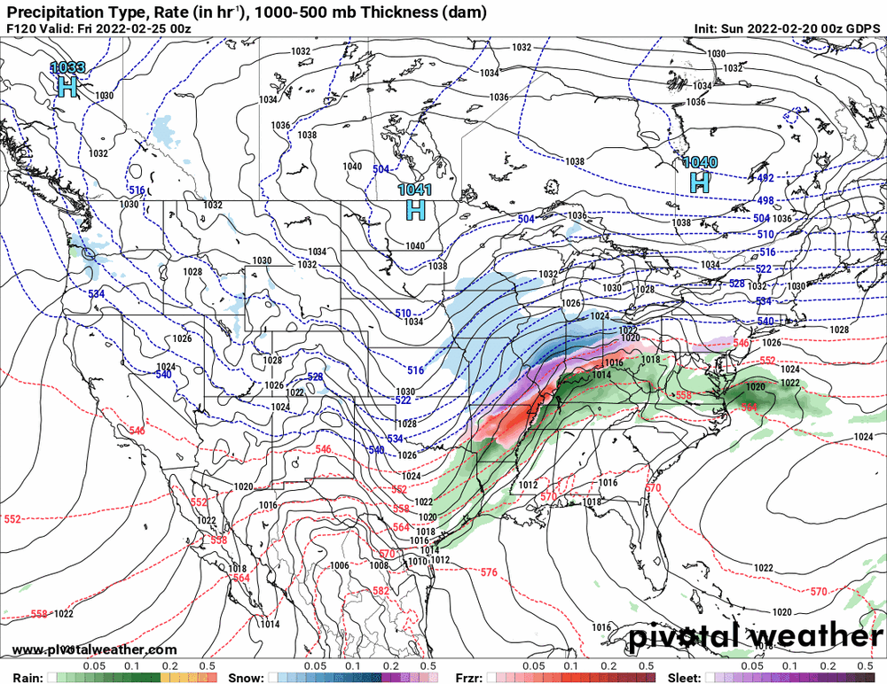
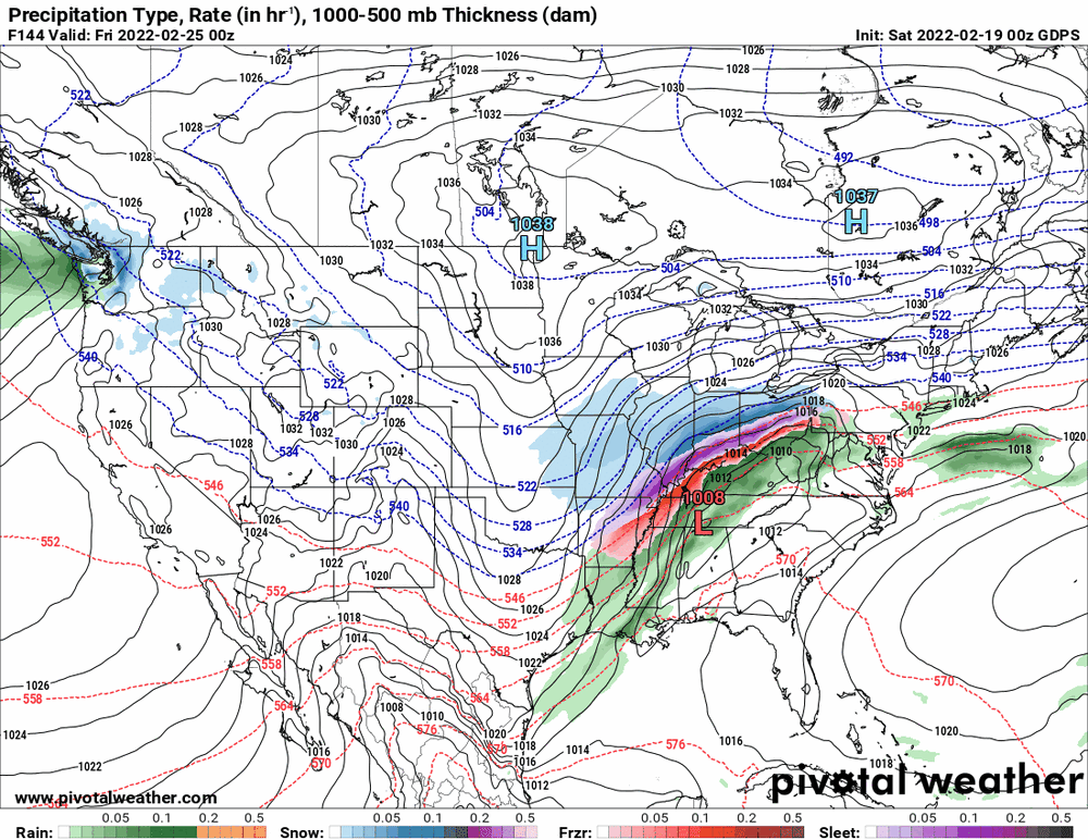
6z GFS and 0z EC for the potential mix storm Feb. 25 - 26 (edited to add the Canadian).

-
E PA/NJ/ DE Winter 2021-22 OBS Thread
Hurricane Agnes replied to JTA66's topic in Philadelphia Region
Temp has dropped further to 42, dp 33, a changeable sky with the sun trying to poke out, and gusty winds. -
E PA/NJ/ DE Winter 2021-22 OBS Thread
Hurricane Agnes replied to JTA66's topic in Philadelphia Region
Now down to 48 but what took the faster hit was the dp, which is now down to 37. -
E PA/NJ/ DE Winter 2021-22 OBS Thread
Hurricane Agnes replied to JTA66's topic in Philadelphia Region
KPNE had a 52 mph gust too! I had an initial drop from 62 to 57 and it has sortof leveled out at 57.