WxSynopsisDavid
-
Posts
563 -
Joined
-
Last visited
Content Type
Profiles
Blogs
Forums
American Weather
Media Demo
Store
Gallery
Everything posted by WxSynopsisDavid
-
 I too request pdf, you are not alone in that department.
 -
Beryl to be in the middle of an EWRC and maintaining its intensity and wind speeds is impressive. The case studies on Beryl will be great reads.
-
Honestly, with Beryl being so small it’s growing highly unlikely that an EWRC begins before striking the islands. With the dry air preventing expansion of the windfield, it will take land interaction with the islands to induce an EWRC. This is where my concern grows. If Beryl waits until land interaction with the islands to induce an EWRC, than it’s possible that completes before entering the Caribbean near Jamaica. Smaller storms are more resilient to shear. If Beryl maintains this small compact size than those intensity forecast showing weakening approaching the Yucatan could be wrong. It’s very possible that Beryl achieves a second peak on approach to the Yucatan. Really believe this is what Josh Morgerman is banking on. Reason why he did not play Island Roulette. Interesting enough, I heard that some in-house data at the NHC is starting to show this potential 2nd peak scenario.
-
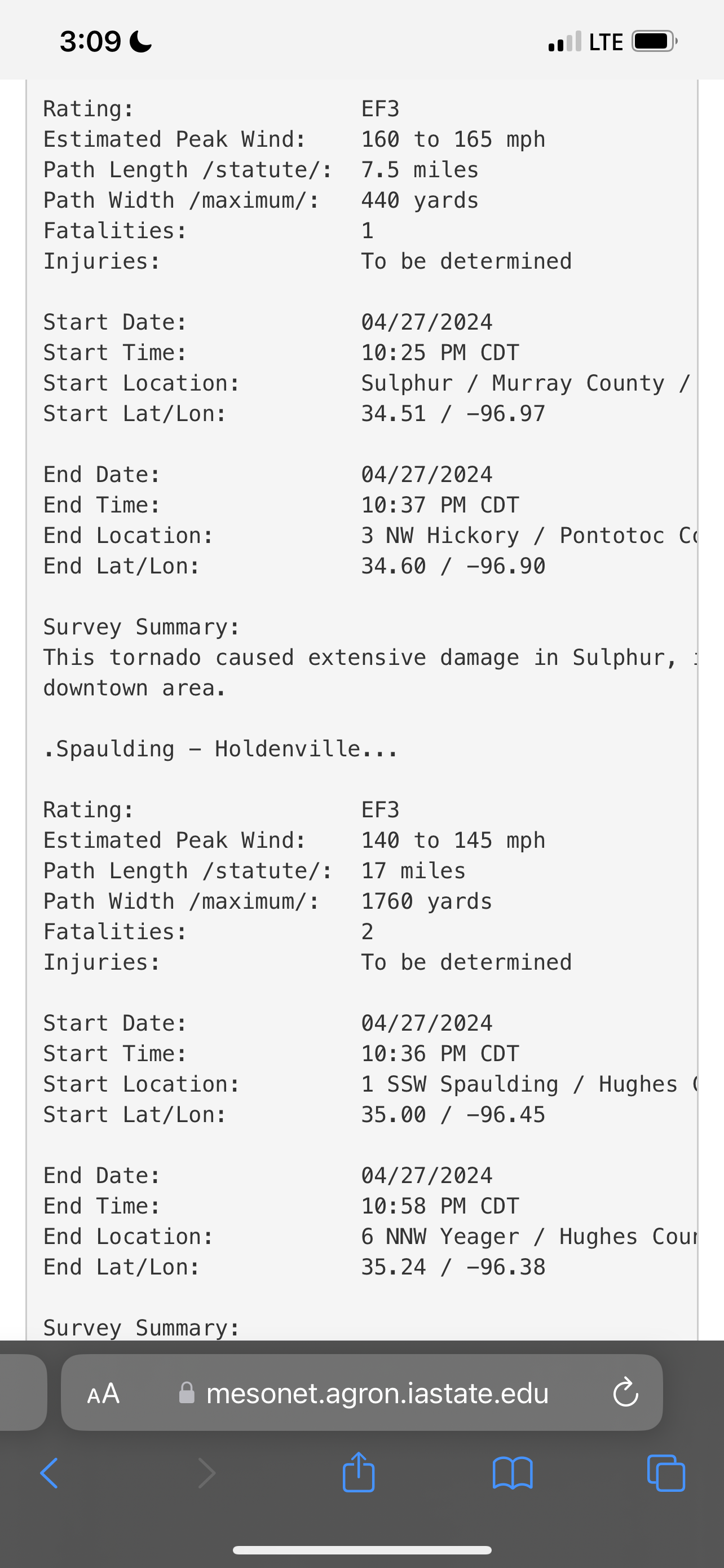
I agree with that statement. 2 sections of that damage path warranted EF5. The subdivision near the water (can’t remember if he exact location) featured numerous well built homes wiped clean.
-
Reading was 215mph and 600ft off the surface. So plausible to say 190-200mph.
-
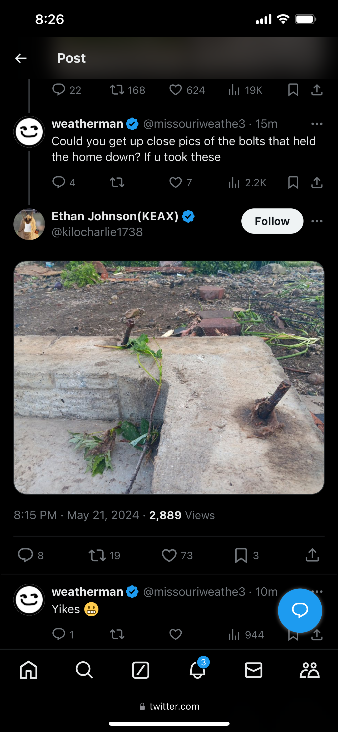
Numerous slabs wiped clean have bent anchor bolts. Tim has rated past tornadoes EF5 (ex: the 2011 EF5’s) off of this sole indicator. That and/or missing anchor bolts, but there’s no reports of any missing anchor bolts, as of yet.

-
Greenfield, IA tornado will be “at least EF4”. Pretty significant damage indicators being found. Of significant, the asphalt scouring and how the debris looks granulated. Typically these are trademarks of upper echelon high end tornadoes, along with debris lofting 40k feet into the atmosphere. I would venture to say preliminary rated 190mph or 200mph until engineers get on site to conduct their analysis. Engineers such as Tim Marshall.
-
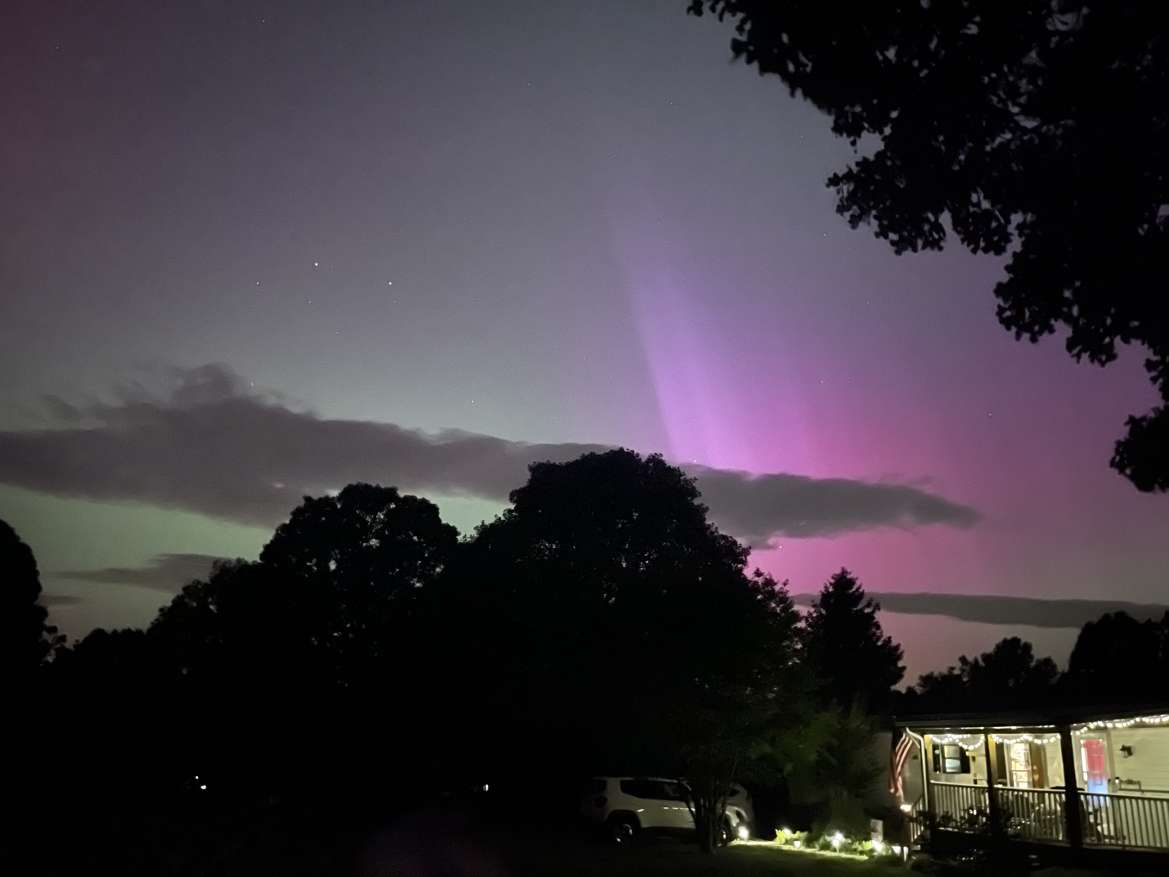
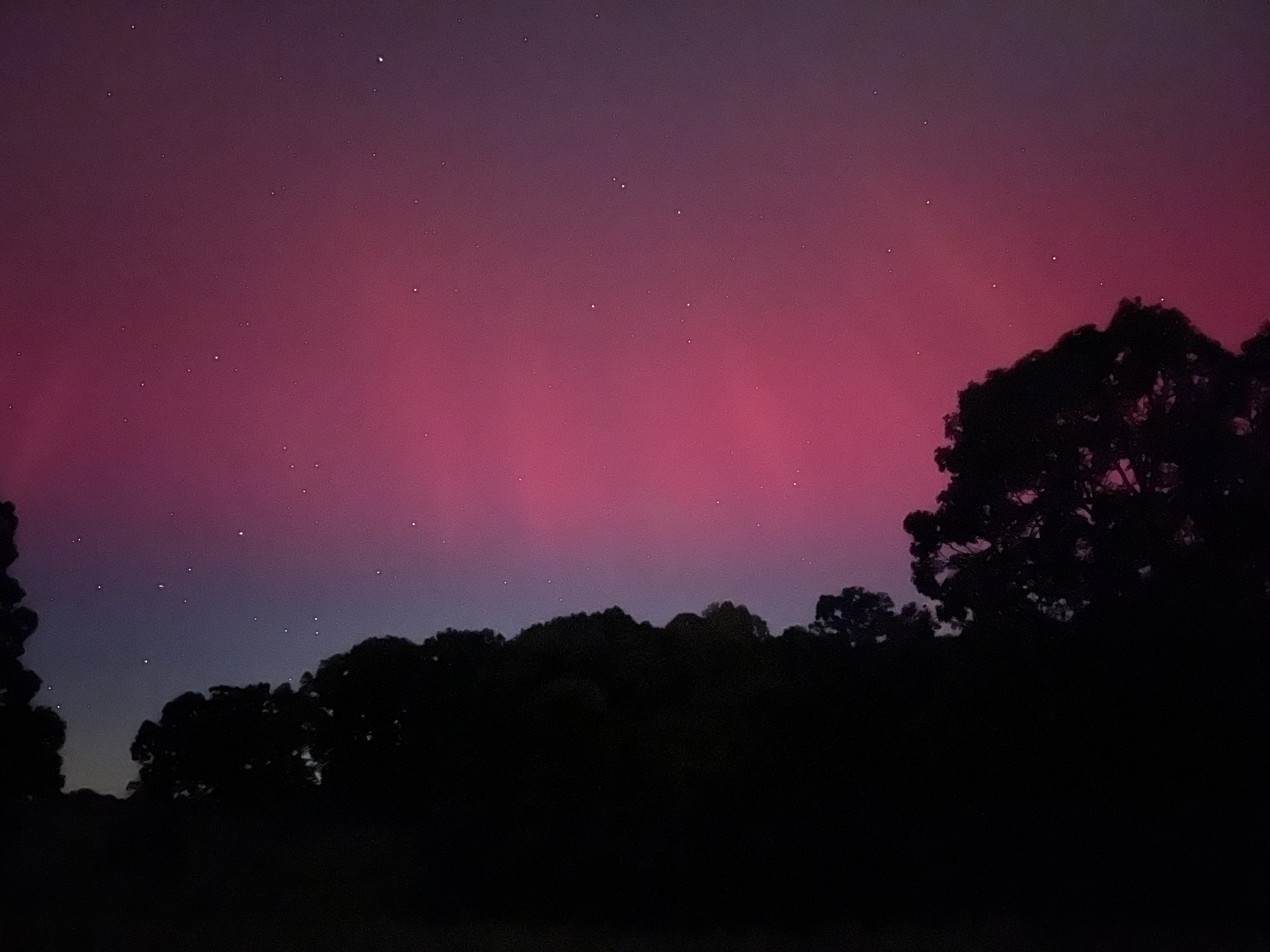
Got a decent view in Huddleston, VA

-
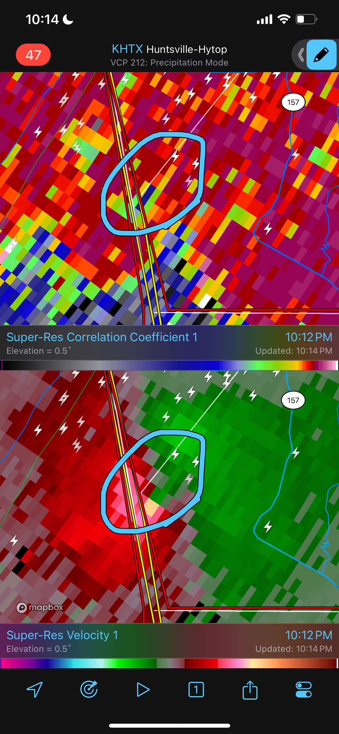
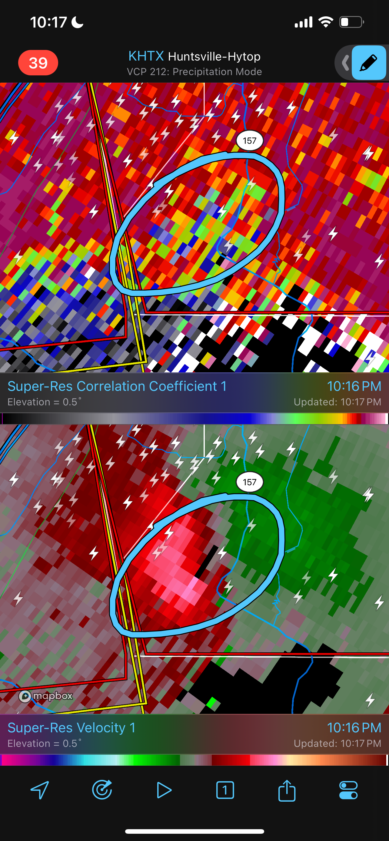
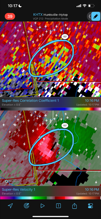
Significant Tornado just tracked out of Alabama into Georgia.
-
Looks like a potential meso-vortex with a satellite.

-
-
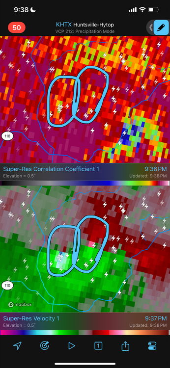
Severe Weather 5-6 through 5-9-24
WxSynopsisDavid replied to cheese007's topic in Central/Western States
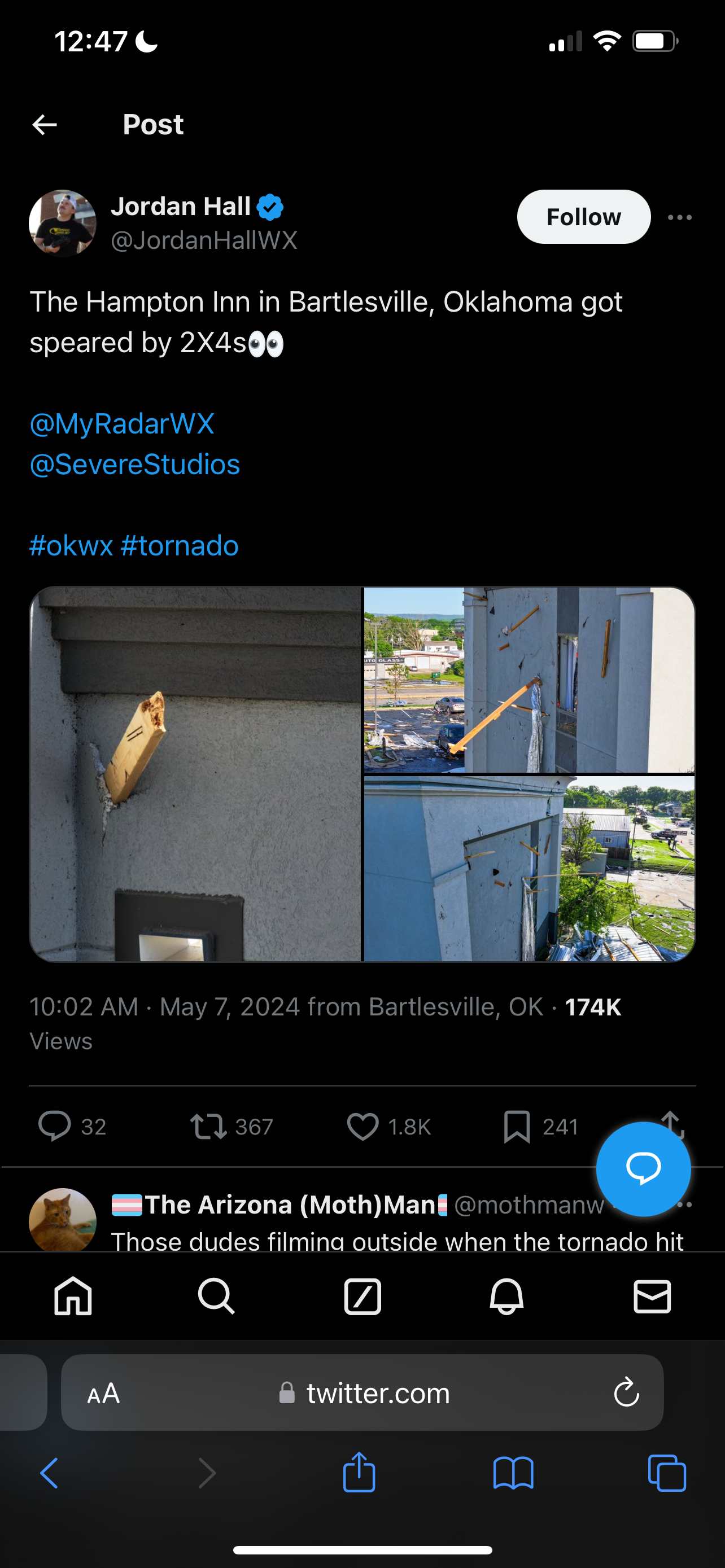
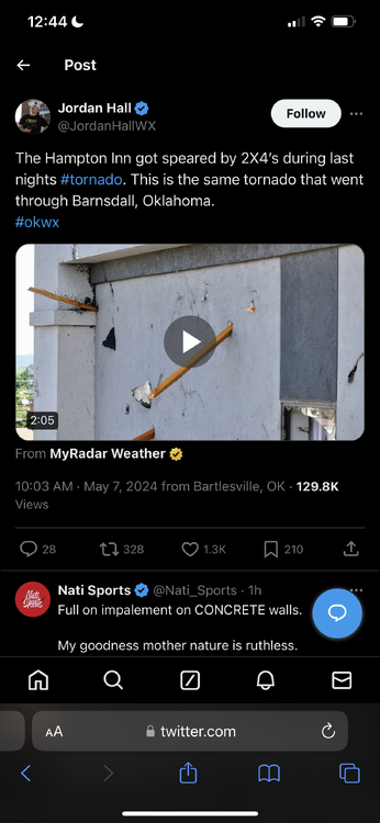
I know Bartlesville, OK is getting engineers on-site to further survey the 2x4’s impaled into a concrete wall at the Hampton Inn. Concerning Barnsdall, there’s questions regarding the few structures wiped clean to the slab. A few of them were mobile homes, but one was thrown a good distance away. One of the structures reduced to slab was not a mobile home though.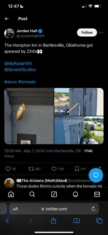
-
Severe Weather 5-6 through 5-9-24
WxSynopsisDavid replied to cheese007's topic in Central/Western States
Still immature and premature at this point to be screaming bust. It’s very possible the survey teams find additional tornado paths. At this point it makes no sense why some are still screaming bust when a town was destroyed with known fatalities. -
Severe Weather 5-6 through 5-9-24
WxSynopsisDavid replied to cheese007's topic in Central/Western States
I would like to see a side angle of that. That view is not conclusive, very possible it’s propped up behind the tree. TWC and major news outlets have been caught in the past staging/propping up debris to make the scene appear for catastrophic. -
Severe Weather 5-6 through 5-9-24
WxSynopsisDavid replied to cheese007's topic in Central/Western States
Isolated supercell going up SW of OKC near Hobart. -
Severe Weather 5-6 through 5-9-24
WxSynopsisDavid replied to cheese007's topic in Central/Western States
First wave initiated early, before LLJ cranked and helicity values peaked. Those things are happening as I type this….reason why I will say, yet again, the forecast was for 9pm-4am. Midnight is the sweet spot in the timing. -
Severe Weather 5-6 through 5-9-24
WxSynopsisDavid replied to cheese007's topic in Central/Western States
No, not everyone. Just certain people who scream bust before they actually read the forecast details. -
Severe Weather 5-6 through 5-9-24
WxSynopsisDavid replied to cheese007's topic in Central/Western States
Again…come back and scream bust at 4am-5am. Bulk of this threat was forecasted to be nocturnal, around midnight. Some people need to learn basic reading skills and comprehension before posting. -
Severe Weather 5-6 through 5-9-24
WxSynopsisDavid replied to cheese007's topic in Central/Western States
No, it does not. There’s 2 waves of supercells. First wave blows through, second wave overnight is what this whole forecast entices. This High Risk is for overnight/nocturnal activity. Scream bust if there’s no tornadoes in central OK by 5am. Really, the timeframe is looking to be 9pm-4am. -
Severe Weather 5-6 through 5-9-24
WxSynopsisDavid replied to cheese007's topic in Central/Western States
Shouldn’t the thread headline read “5-6-24” instead of “4-6-24”? -
Severe Weather 4-30-24 through 5-2-24
WxSynopsisDavid replied to cstrunk's topic in Central/Western States
This might be the single most violent motion I’ve ever seen documented. -
Severe Weather 4-30-24 through 5-2-24
WxSynopsisDavid replied to cstrunk's topic in Central/Western States
https://www.facebook.com/share/v/4Rkder71fihzG6BF/?mibextid=WC7FNe Reed Timmer intercepted a large tornado just north of Topeka -
Severe Weather 4-25 through 4-28-24
WxSynopsisDavid replied to cheese007's topic in Central/Western States
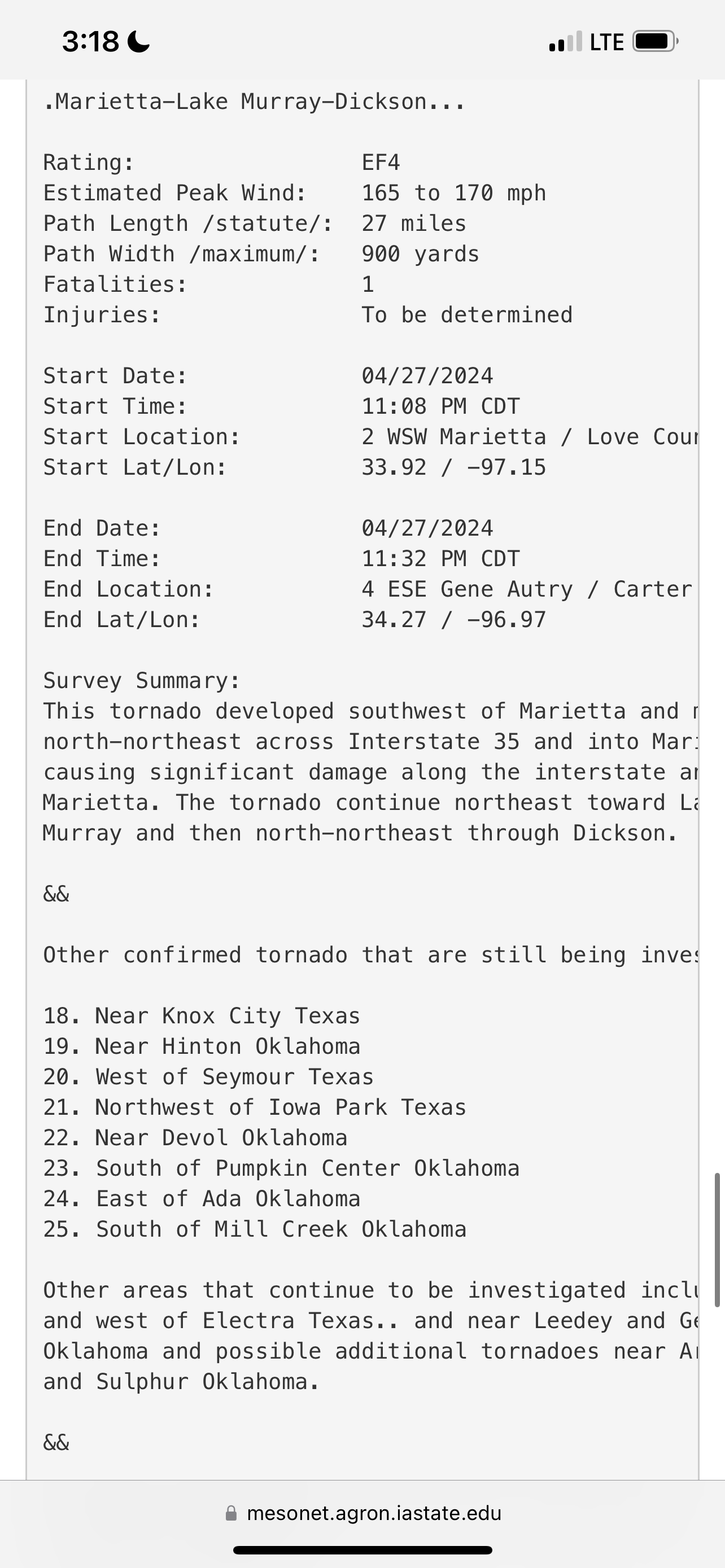
My understanding is that it is still preliminary. I believe Tim Marshall is going to Elkhorn tomorrow to survey. He was in Marietta today and his findings at the Dollar Tree Distribution Center was the reason that tornado got upgraded to EF4. -
Severe Weather 4-25 through 4-28-24
WxSynopsisDavid replied to cheese007's topic in Central/Western States
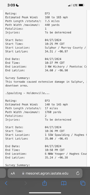

-
Severe Weather 4-25 through 4-28-24
WxSynopsisDavid replied to cheese007's topic in Central/Western States
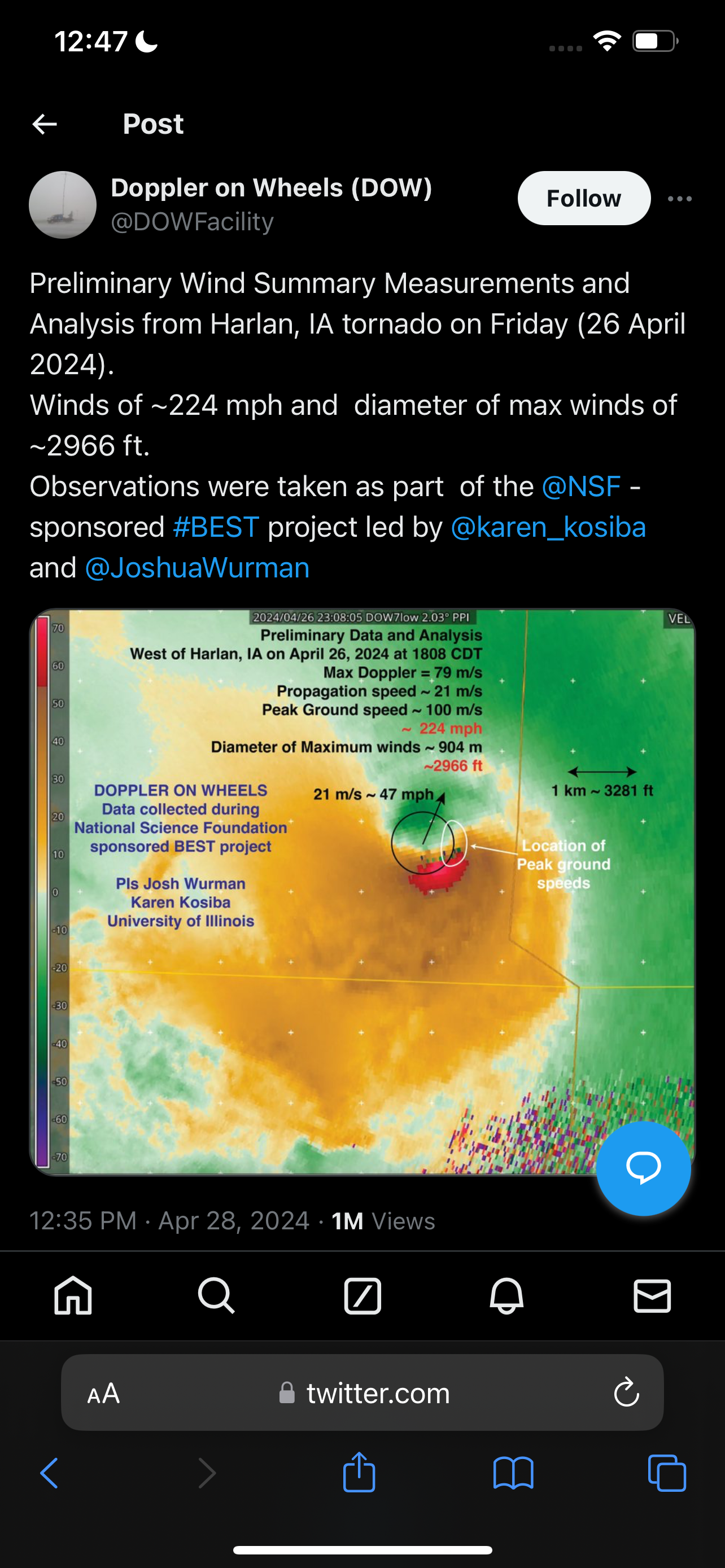
Though DOW measurements are not used in the surveys, this is a pretty impressive measurement. DOW measured 224mph winds inside the Harlan, Iowa tornado at its peak Friday night when crossing 59. Seems plausible surface winds were between 170mph-190mph.