WxSynopsisDavid
-
Posts
563 -
Joined
-
Last visited
Content Type
Profiles
Blogs
Forums
American Weather
Media Demo
Store
Gallery
Everything posted by WxSynopsisDavid
-
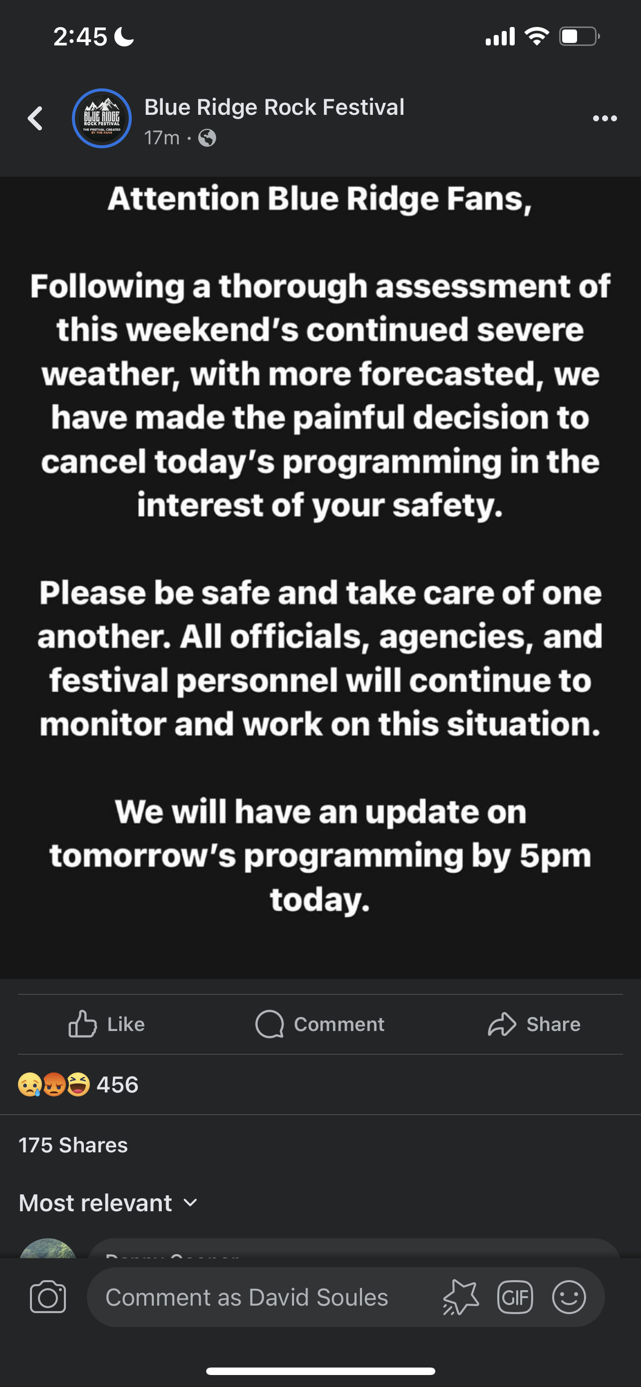
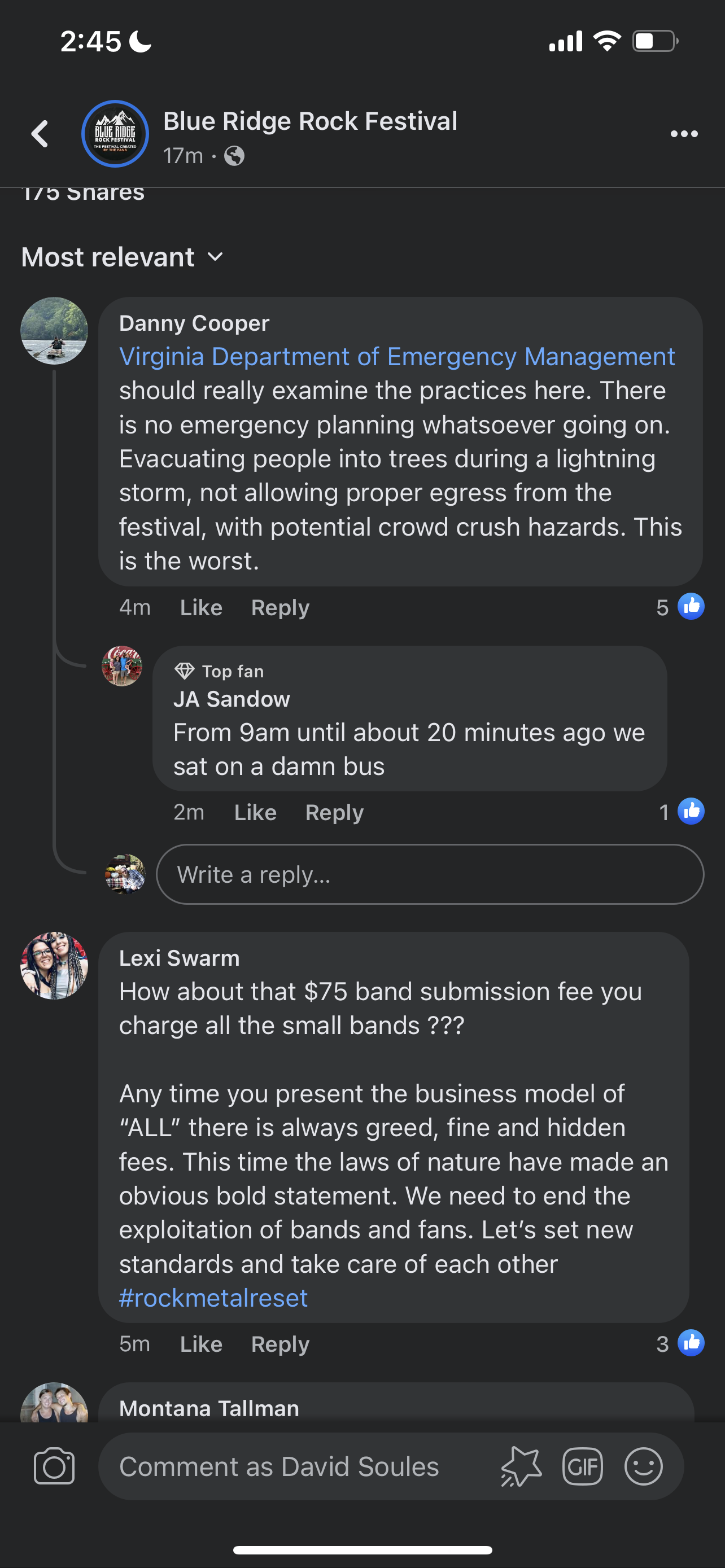
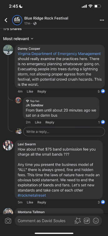
 Since this is weather related, I wanted to make this post and get everyone’s opinion here. How do you logically have a 4 day rock festival, with 200,00+ people attending and have zero plans in place? I get there are risks and you get what you paid for. The other night, 75mph winds and hail struck the venue. They of course waited last minute to do anything about it and people were stuck. People were in lines, waiting for shuttle buses, 3+ hour wait because they oversold the event and did not have enough buses running. People showed up yesterday, and were turned around at the gate…ticket purchasers…because they oversold the event. Now today, a severe thunderstorm with lightning impacted the venue. Last minute decisions were made and people were instructed to shelter in the woods underneath trees. How do you not have logistics and emergency planning in place?
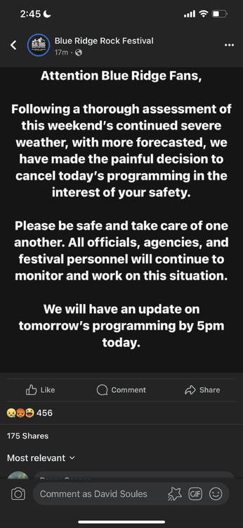
-
Category Five Hurricane Lee
WxSynopsisDavid replied to WxWatcher007's topic in Tropical Headquarters
Lee might very well surpass Wilma as my favorite cyclone. This is truly remarkable and special, a very rare meteorological event that we all got to witness. -
Category Five Hurricane Lee
WxSynopsisDavid replied to WxWatcher007's topic in Tropical Headquarters
Have to disagree and say Wilma is the upper echelon of RI cyclones in the Atlantic Basin. Nothing Lee is doing surpasses what Wilma achieved. It’s impressive, no doubt. -
Category Five Hurricane Lee
WxSynopsisDavid replied to WxWatcher007's topic in Tropical Headquarters
Endeavors? Nah, I’m staying put. Now, on to the next topic of discussion. Big slow down as Lee gets north of the islands. Very little progress in 2+ days time.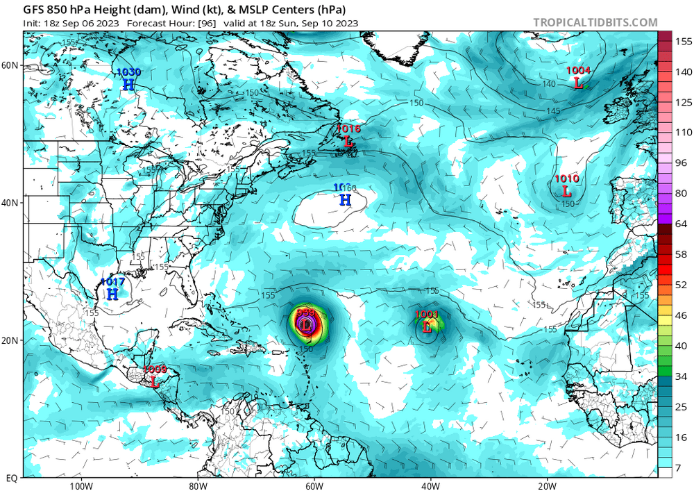

-
Category Five Hurricane Lee
WxSynopsisDavid replied to WxWatcher007's topic in Tropical Headquarters
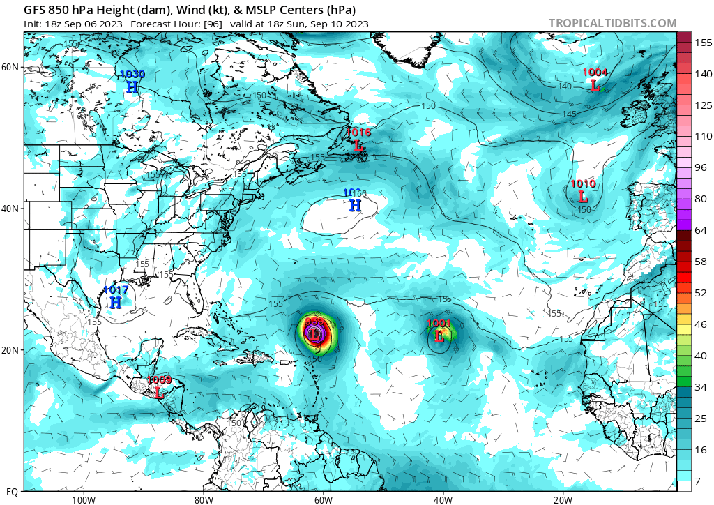
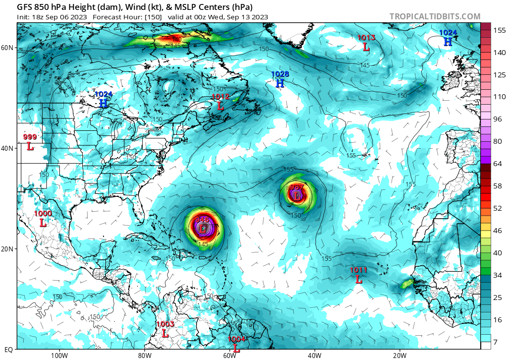
And there’s a clear and evident SW shift, both the forward speed and track to the islands will have implications for areas west of 60W. -
Category Five Hurricane Lee
WxSynopsisDavid replied to WxWatcher007's topic in Tropical Headquarters
There was no wishcasting in that post. And no, they are not virtually identical. You can clearly see the SW shift in location on tropicaltidbits when switching frames. This is an important trend to follow for numerous reasons. Any shift, in any direction, will have repercussions on Lee and his eventual track. More importantly, the farther south Lee tracks it opens the possibility to Lee tracking underneath the trough and potentially stalling. -
2023 Atlantic Hurricane season
WxSynopsisDavid replied to Stormchaserchuck1's topic in Tropical Headquarters
Make sense, thank you for the clarification on that. -
2023 Atlantic Hurricane season
WxSynopsisDavid replied to Stormchaserchuck1's topic in Tropical Headquarters
Thanks for the help on this, you could be right and if so that would make sense about weaker storm staying south. -
2023 Atlantic Hurricane season
WxSynopsisDavid replied to Stormchaserchuck1's topic in Tropical Headquarters
If my memory serves me correct, Cape Verde storms that intensify quicker and much sooner before getting to the Lesser Antilles typically track more to the south. If I'm wrong, someone correct me please. -
2023 Atlantic Hurricane season
WxSynopsisDavid replied to Stormchaserchuck1's topic in Tropical Headquarters
WTH going on with the Euro Ensembles? Did it get a virus or malware? 898mb……hate to be any aquatic life form in that general area. Or a bird really, I mean imagine being a bird and flying into that thing. Geez. -
That explicit rhetoric is not used often by NHC so that should aid in peoples doubts concerning if Idalia has time for additional intensification.
-
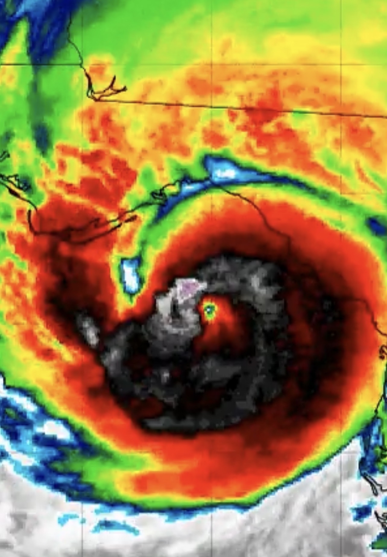
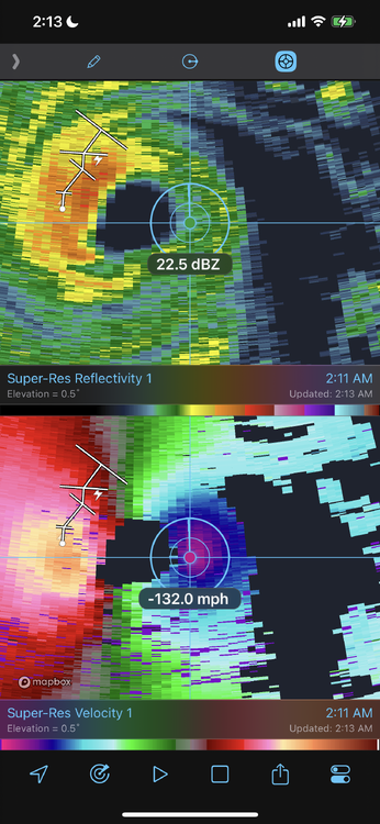
Negative, lopsided appearance is due to the hot towers rapidly going up. They are so big they are blocking the eye and causing a distorted appearance. You also got mesovortices inside the eye too.
-
That’s exactly what happened, but you also have a jet streak up top enhancing the RI along with the trough. This frictional-induced RI is going to be incredible to witness.
-
The rapid burst of -90c in NW eyewall with new convection going up in NE eyewall is indicative of frictional-induced RI.

-
And just like that, you can see velocities spiking on radar again. Also, the eye is ragged looking due to mesovortices rotating around the eye, if anyone was interested.
-
I don’t think I’m staying awake for that lol. Reason I got antsy and cross eyed, with the quickness I fired that post out. Really hoping Idalia would be a Cat 4, now the suspense and intrigue is killing me. Curious to see just how much more Idalia can go. With this jet streak setting up shop, it could supply one last rapid intensification phase on landfall.
-
I deleted the post, I was reading too fast. I need some sleep lol.
-
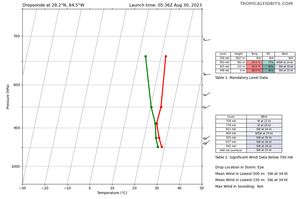
Yeah this is a classic textbook example of a hurricane that featured steep pressure falls and winds lagged, took several hours to catch up. Unfortunately, the timing is not great as winds are catching up as Idalia sets up for a landfall.
-
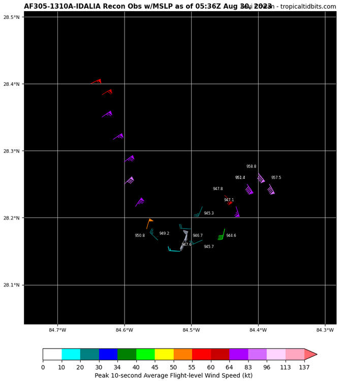
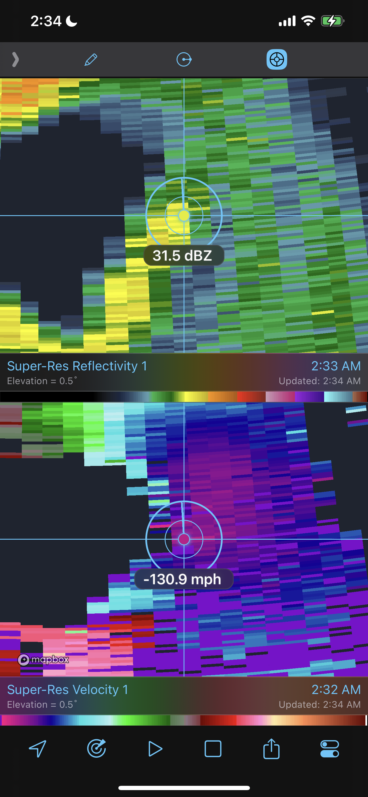
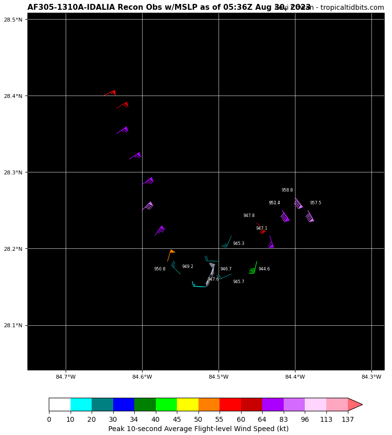
Looks like latest recon pass has 123kt FL wind and SFMR of 116kt. Idalia is most definitely a Category 4, 130mph cane.
-
Wow….textbook and classic feature of high-end canes. Idalia still has a high ceiling for intensity through landfall.
-
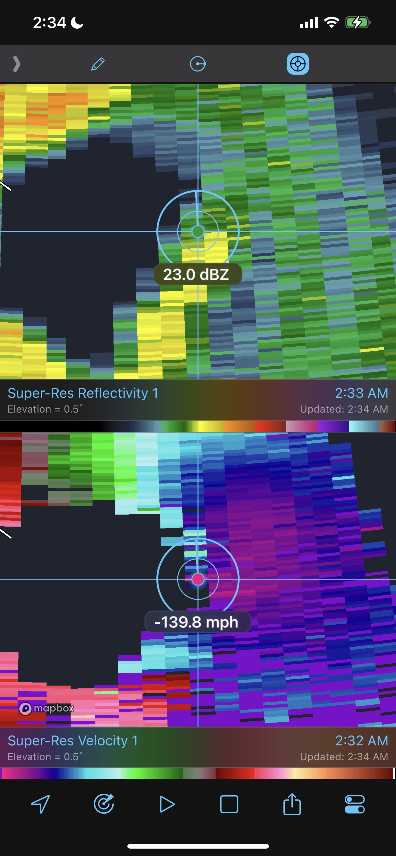
Radar, no indication of dry air
-
Appearing highly likely that winds are roughly 130mph at the surface in the east quad of the eyewall. Seen a few spikes in excess of 140mph, so it’s plausible Idalia is now a Category 4. Velocities are spiking as the core is tightening up. Frictional-induced RI looks to be occurring.


-
Using radar, the east quad is where the fastest winds are. Velocities are also spiking in that region.
-
Not certain that’s what is happening. Beam height of the radars is my main question. Also appears the left side (east side) is undergoing frictional interference. So far not seeing any indications of what you mentioned in the recon data.
-