WxSynopsisDavid
-
Posts
563 -
Joined
-
Last visited
Content Type
Profiles
Blogs
Forums
American Weather
Media Demo
Store
Gallery
Everything posted by WxSynopsisDavid
-

Severe Weather 3-23-23 through 3-26-23
WxSynopsisDavid replied to cheese007's topic in Central/Western States
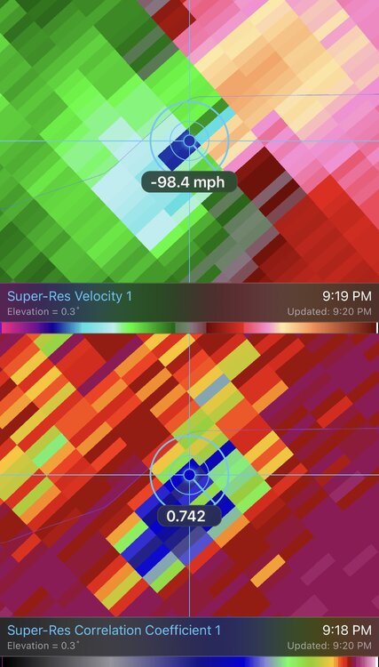
The fact it was close to the radar yet still getting 260mph+ velocities is ridiculous. -
Severe Weather 3-23-23 through 3-26-23
WxSynopsisDavid replied to cheese007's topic in Central/Western States
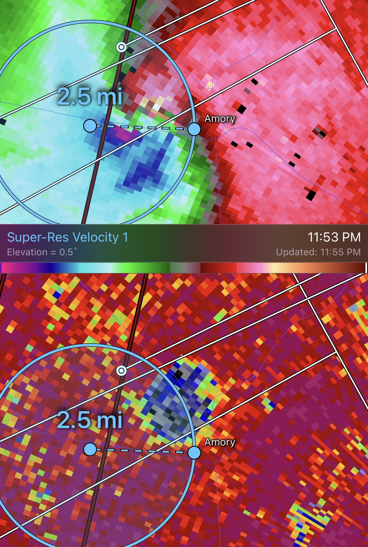
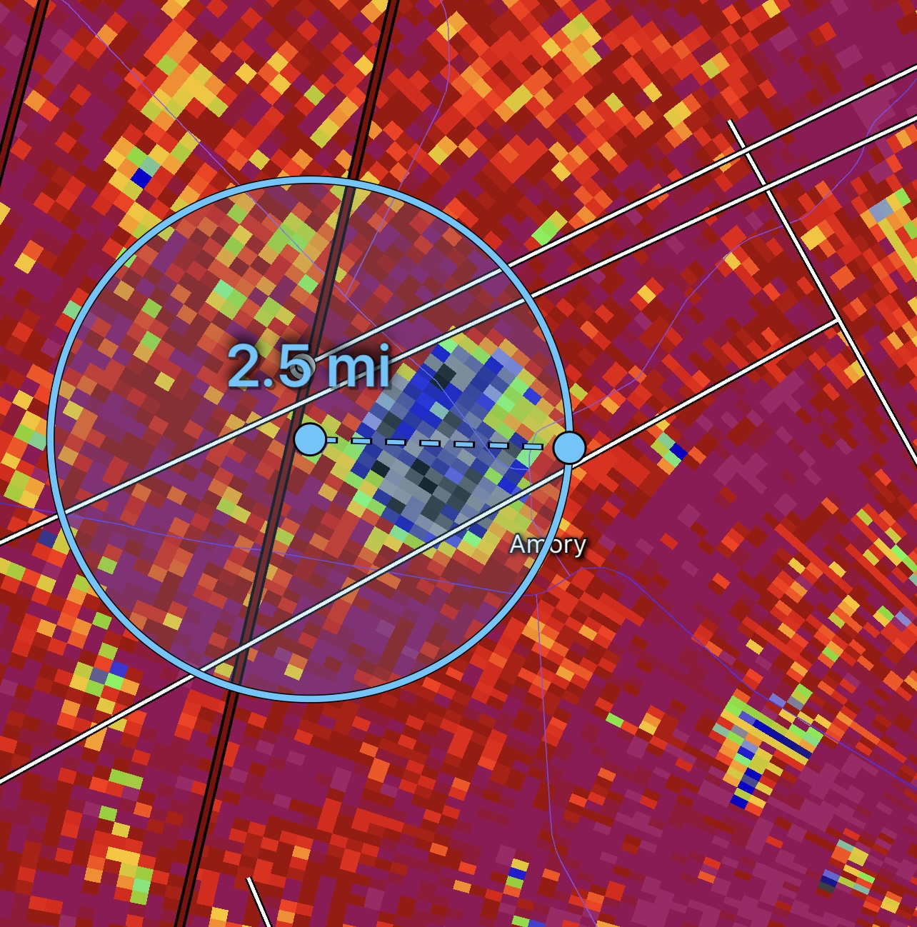
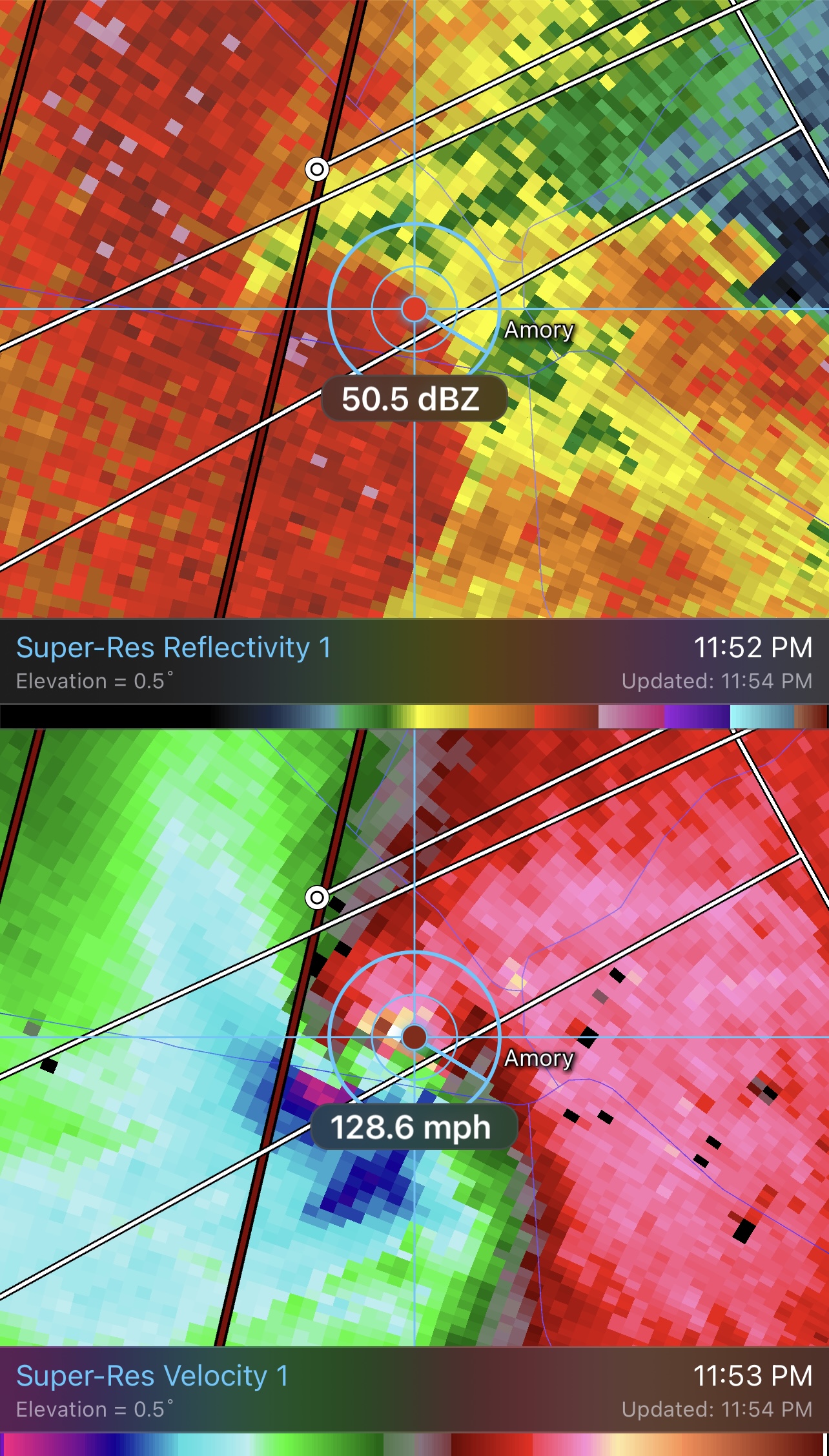
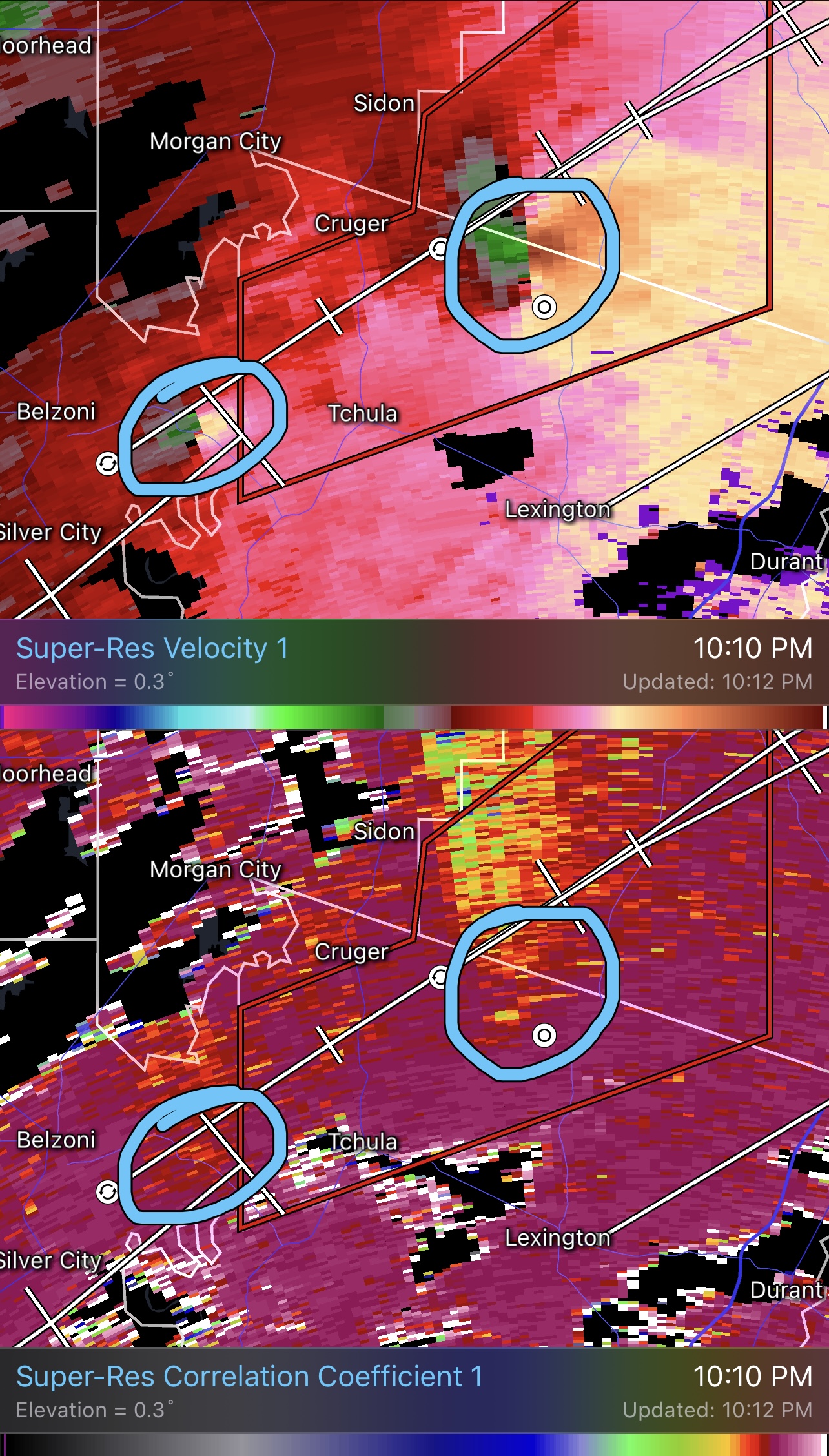
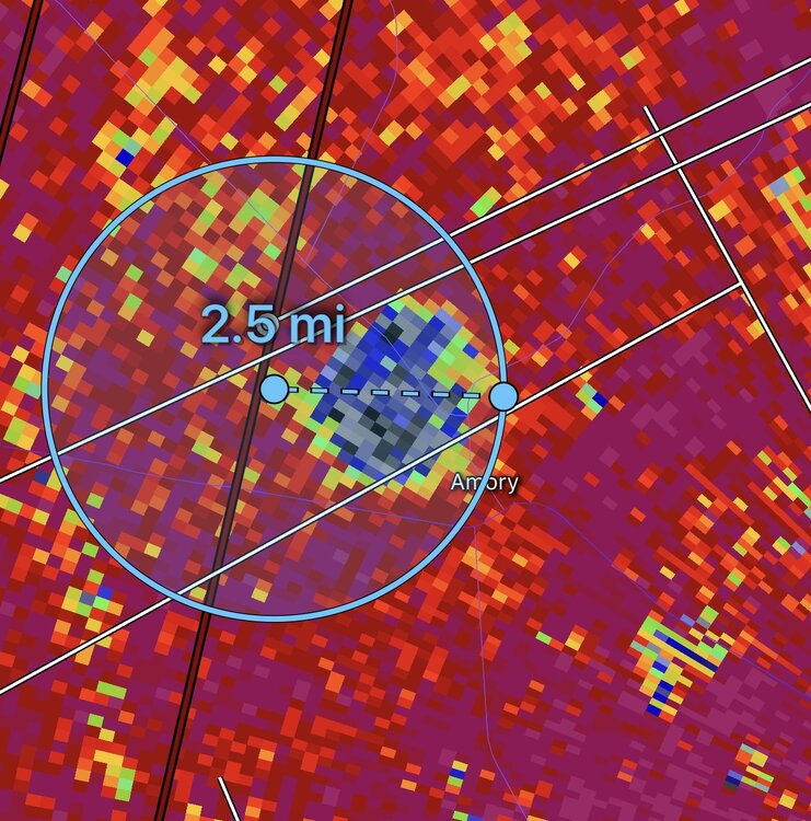
Both the debris ball and couplet exceed 2.5mi in width. This is a potential record tornado in progress for width and a potential top-5 violent tornado in terms for velocity. Really hope this isn’t mixing to the surface but given debris is exceeding 40,000ft it’s likely this is an EF5.
-
Severe Weather 3-23-23 through 3-26-23
WxSynopsisDavid replied to cheese007's topic in Central/Western States
Wow….260mph+ gate to gate. It’s been a very long time (since Moore and El Reno 2013 EF5’s) that Ive seen radar velocities this extreme.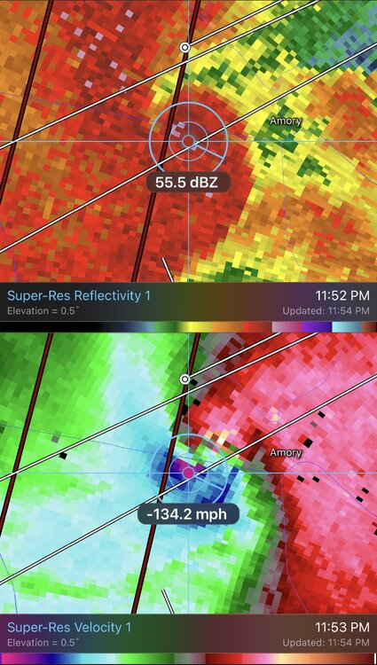
-
Severe Weather 3-23-23 through 3-26-23
WxSynopsisDavid replied to cheese007's topic in Central/Western States
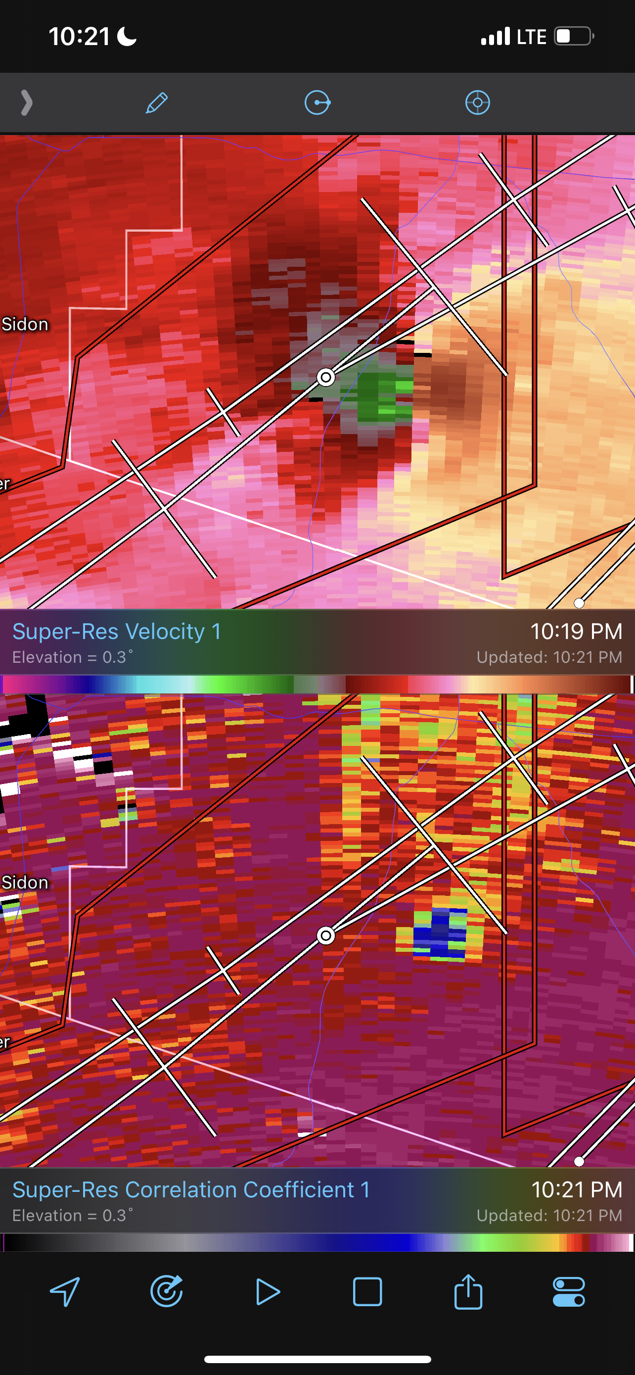
Starting to see velocities increase with a tighter gate to gate. Debris ball back on radar now. Don’t think the main/parent violent tornado ever weakened, it obviously moved into a rural area and now beginning to move into a more populated area. This tornado now has a historic feel to it, for all the wrong reasons.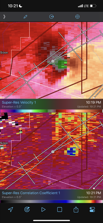
-
Severe Weather 3-23-23 through 3-26-23
WxSynopsisDavid replied to cheese007's topic in Central/Western States
As of what has already happened wasn’t enough, new tornado now going up 30mi back to the SW behind the long tracked violent tornado. Following the same path as the main tornado we been tracking. Debris signature and gate to gate signatures evident.
-
Severe Weather 3-23-23 through 3-26-23
WxSynopsisDavid replied to cheese007's topic in Central/Western States
Very impressive that this tornado been on the ground as long as it has. Definitely a textbook situation to teach concerning what happens when a supercell matures and can get surface based/rooted.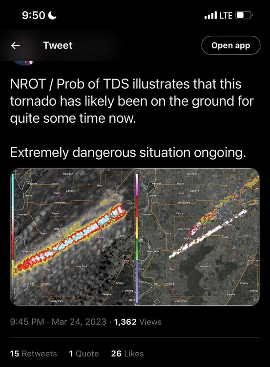
-
Severe Weather 3-23-23 through 3-26-23
WxSynopsisDavid replied to cheese007's topic in Central/Western States
Yeah the duration of this TORE is approaching rare territory. -
Severe Weather 3-23-23 through 3-26-23
WxSynopsisDavid replied to cheese007's topic in Central/Western States
Very indicative of a EF4+. Not a good thing to see on radar. -
Severe Weather 3-23-23 through 3-26-23
WxSynopsisDavid replied to cheese007's topic in Central/Western States
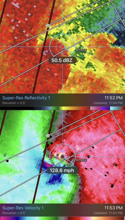
Gate to Gate is 185+. Well into the EF4 range with velocities still increasing. This supercell is surface based and rooted, this will likely be a cyclic long tracked long lived violent tornado.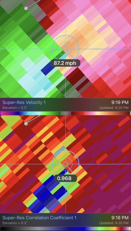
-
Severe Weather 3-23-23 through 3-26-23
WxSynopsisDavid replied to cheese007's topic in Central/Western States
-
Severe Weather 3-23-23 through 3-26-23
WxSynopsisDavid replied to cheese007's topic in Central/Western States
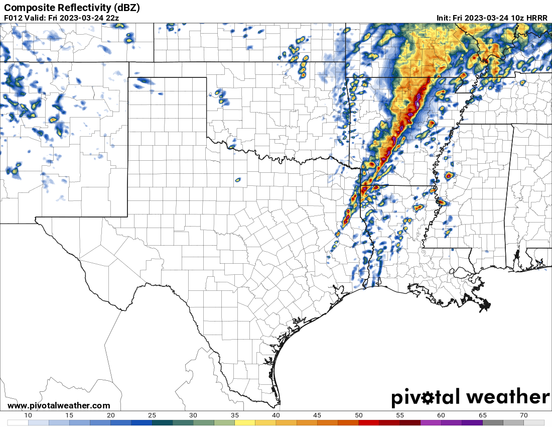
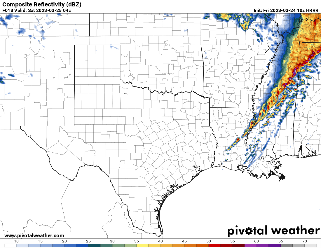
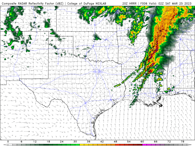
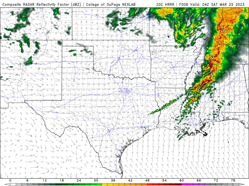
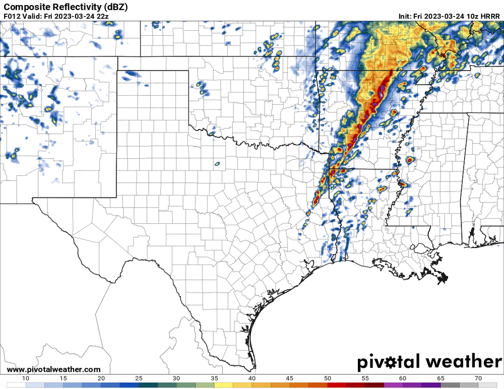
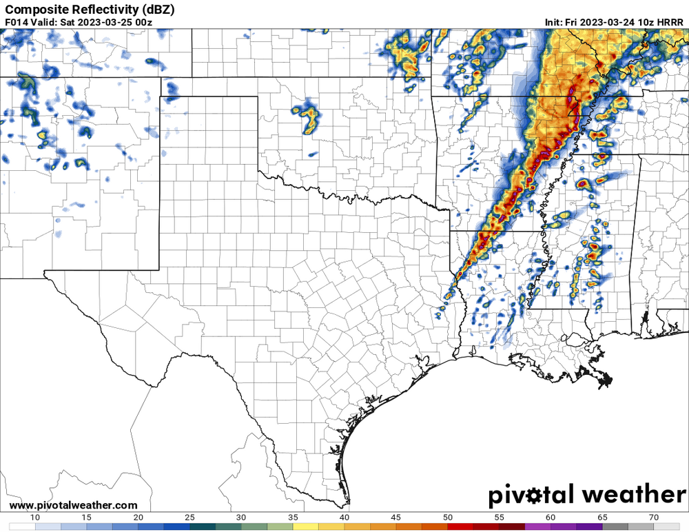
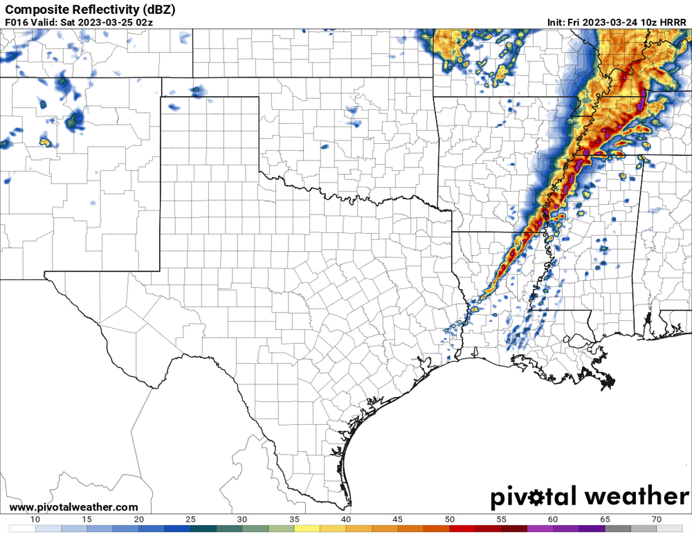
7pm-11pm looks to be the best window for significant severe weather. QLCS looks to be a broken line with some discrete supercells.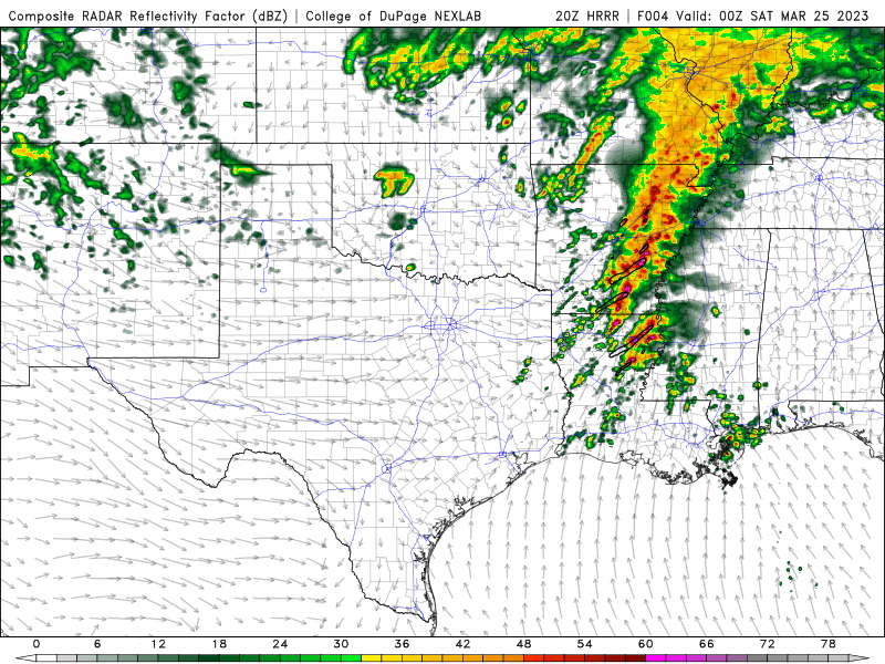
-
Severe Weather 3-23-23 through 3-26-23
WxSynopsisDavid replied to cheese007's topic in Central/Western States
Latest HRRR run suggests that this might be a nocturnal outbreak. Best parameters look to be after 7pm, right about when the LLJ gets cranking. -
Severe Weather 3-23-23 through 3-26-23
WxSynopsisDavid replied to cheese007's topic in Central/Western States
One noticeable thing to point out, 2 waves of isolated ahead of the QLCS. Previous runs only had 1 wave but there’s a 2nd wave at the end of the 10z run. Another thing to mention is the separation between the discrete supercells is improving.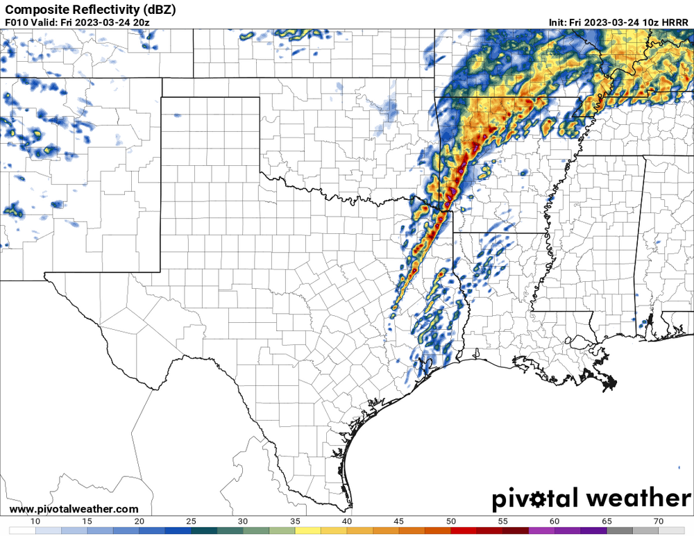
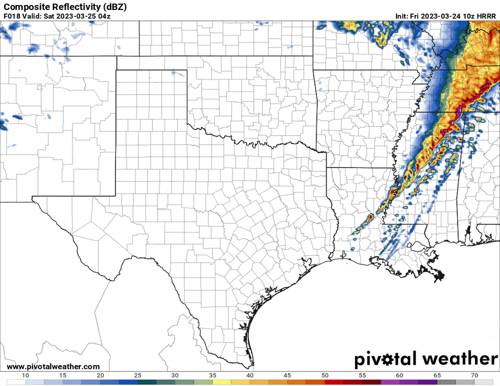
-
Severe Weather 3-23-23 through 3-26-23
WxSynopsisDavid replied to cheese007's topic in Central/Western States
Northeast Louisiana
-
Severe Weather 3-23-23 through 3-26-23
WxSynopsisDavid replied to cheese007's topic in Central/Western States
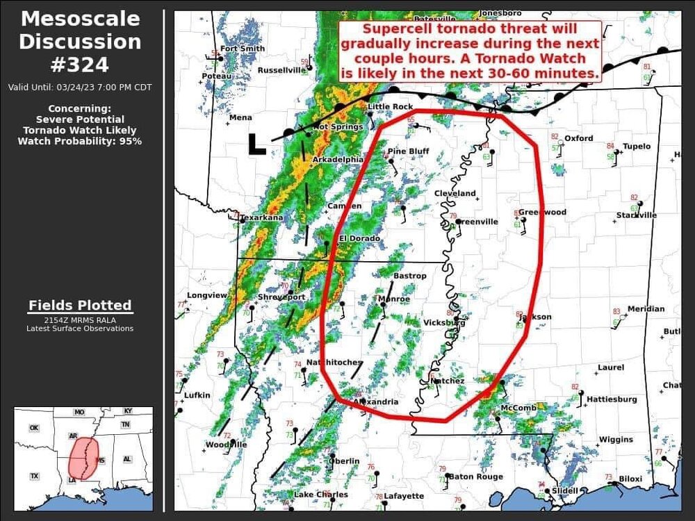
From 6z to 9z, there are rather large significant improvements in the low level thermos on the HRRR. Not a great sign, as it further indicates a loaded gun environment is evolving. I would venture to say if trends continue we see a High Risk issuance for LA and MS. -
January 12th 2023 Enhanced Severe Threat
WxSynopsisDavid replied to kayman's topic in Southeastern States
Exactly, I didn’t mean to take away from that perspective. That was one of the issues during the 2011 Super Outbreak that was noted by the survey teams and engineers. The construction throughout MS, AL, GA was weak and poorly constructed. Sad when you think about it. But of course, what isn’t demolished or completely destroyed will have to be bulldozed. The only point I noted was that I thought the terminology “catastrophic” was too much. It seems like every outbreak that happens now the media and enthusiasts through that terminology around frequently. Should be reserved terminology, only used for the Joplin/Moore/Birmingham type tornado events. -
January 12th 2023 Enhanced Severe Threat
WxSynopsisDavid replied to kayman's topic in Southeastern States
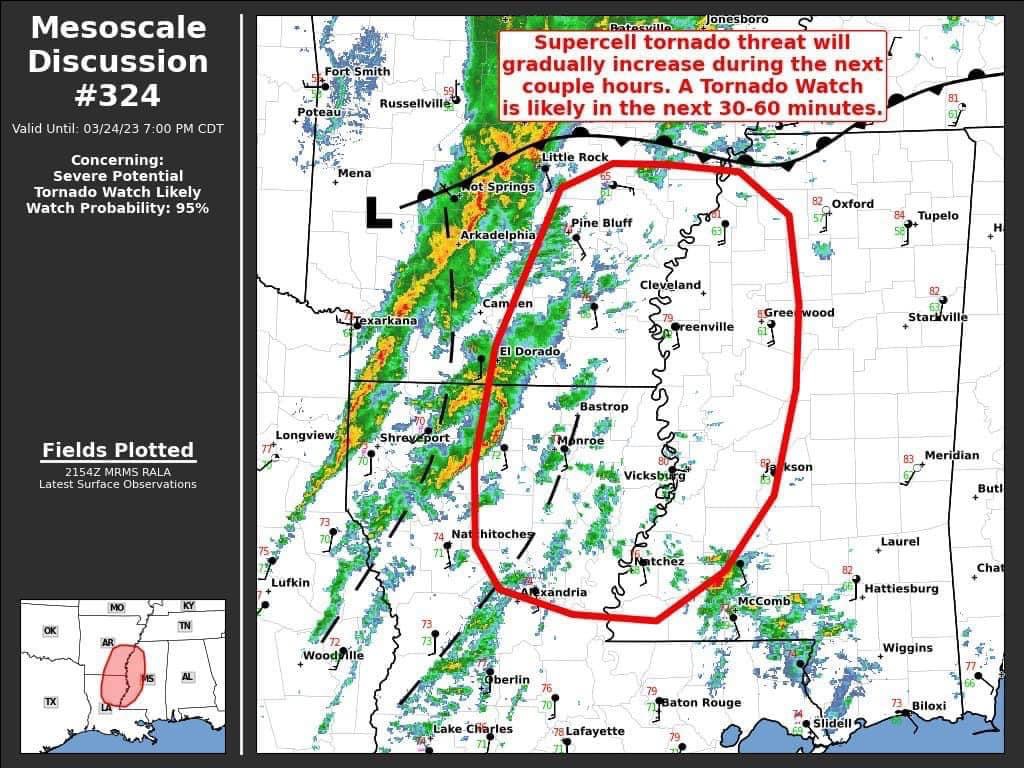
I remember back during the 2020 Easter Outbreak they posted one of these for the Bassfield, MS violent tornado. It gave me goosebumps/chills to read it. “Confirmed large, deadly violent tornado. Likely ongoing EF5 in progress” For me that was the first time seeing a Mesoscale Discussion used in that manor for a violent tornado. They actually noted in the text for the MD that the gate-to-gate signature on radar was maxing out with velocities on the higher-end spectrum well exceeding 200mph. -
January 12th 2023 Enhanced Severe Threat
WxSynopsisDavid replied to kayman's topic in Southeastern States
Definitely a very bad situation for Selma. I wouldn’t use “catastrophic” to describe that damage though. Appears to be EF2/EF3 as there’s a lack of completely destroyed and slabbed buildings. A lot of interior/exterior walls still standing. For that reason I highly doubt it gets higher than a weak EF3 when survey teams assess the damage. Very fortunate this thing didn’t hit in April with a more amplified jet and rich gulf moisture. -
That's hilarious
-
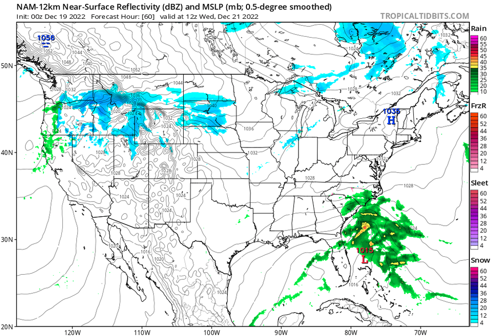
Exactly. I never use the NAM for the clown maps but rather to look for small changes and track deviations like what I indicated above. During past winter storms the NAM had a habit of sniffing out such things that the globals eventually picked up on in later runs. The NAM model is a tool, like the other models, and has its use. However, most people fail to realize that and only strictly use the NAM to glamour over the clown maps without understanding that the NAM has bias's like the other models.
-
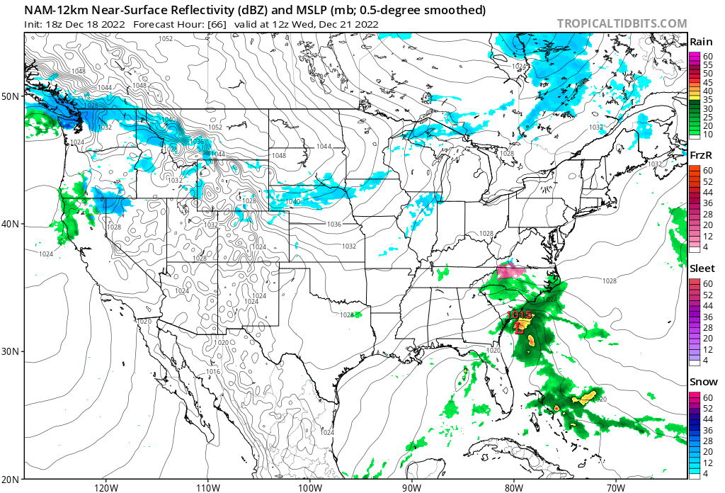
Comparing the 18z and 00z NAM runs for 12z Wednesday

-
Interesting to note, so far the 00z NAM has the center of low pressure farther to the east of 18z runs through hour 57. Much weaker system and a lack of moisture overall, appears to be suppressed as the precip field struggles to get north of the SC/NC line where as 18z the precip field was up to the VA/NC line. Just a few significant trends I'm noticing with tonights 00z NAM.
-
The answer I believe is more complex and includes multiple different aspects. I do believe, so far this season, SST's are playing more of a part in the issues up north with trying to get an established block.
-
How was the jebwalk after that particular storm...compared to past storms? Was it a top-10, top-5, top-3, or #1 Jebwalk event?
-
There are other issues like the warm ocean temps, that I fell are playing a part in this. Also like CAPE just said, this being a Nina year presents its own set of issues as well.