Iceresistance
-
Posts
4,190 -
Joined
-
Last visited
Content Type
Profiles
Blogs
Forums
American Weather
Media Demo
Store
Gallery
Everything posted by Iceresistance
-

November 2021 Chilly Blast (1st Wave)
Iceresistance replied to Iceresistance's topic in Weather Forecasting and Discussion
What does that mean? -
Southern Plains Winter 2021-2022
Iceresistance replied to Iceresistance's topic in Central/Western States
Ryan Maue has put this concerning tweet (twit), mostly for Texas though I do believe that this Double Dip La Nina has caused the Polar Vortex to become unstable & spill somewhere in the Northern Hemisphere, but where is the question. -
MO/KS/AR/OK 2021-2022 Winter Discussion
Iceresistance replied to JoMo's topic in Central/Western States
My Southern Plains Winter Forum: -
Wanda is now Tropical
-
November 2021 Chilly Blast (1st Wave)
Iceresistance replied to Iceresistance's topic in Weather Forecasting and Discussion
Long-Range models showing Wave #2 by Mid-November, this is only getting started . . . O_O -
The NHC is back with the funny advisories again ...WANDA WANDERING ACROSS THE NORTH ATLANTIC WEST OF THE AZORES...
-
A literal Spooky Scary Advisory from the NHC on SS Wanda (50 mph & 999 MB) ...WANDA CREEPING OVER THE CENTRAL ATLANTIC WATERS... ...MAY TRANSFORM INTO A TROPICAL CYCLONE SOON...
-
Texas/Oklahoma Discussion & Obs Thread 2021
Iceresistance replied to It's Always Sunny's topic in Central/Western States
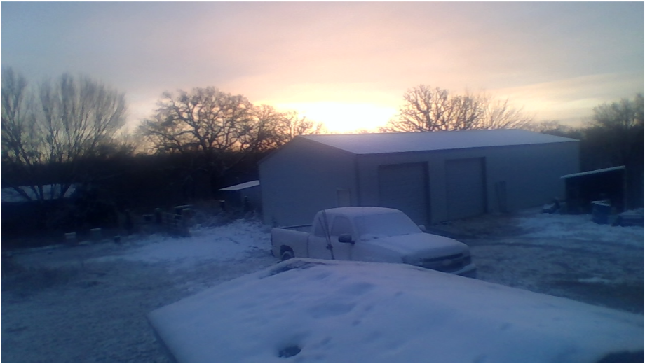
Frosty this morning, fell to 37°F -
2021 Atlantic Hurricane season
Iceresistance replied to StormchaserChuck!'s topic in Tropical Headquarters
ASCAT posted on S2K Proved it's still connected to a front right now. -
2021 Atlantic Hurricane season
Iceresistance replied to StormchaserChuck!'s topic in Tropical Headquarters
It's the Hurricane Trackers that have been waiting for possibly the LONGEST time EVER! I've never seen this before, But all it takes is one storm to change this trend . . . -
2021 Atlantic Hurricane season
Iceresistance replied to StormchaserChuck!'s topic in Tropical Headquarters
If October 2020 has been crazy with the Atlantic in terms of named storms, then 2021 would be the Flip Side, Literally! -
2021 Atlantic Hurricane season
Iceresistance replied to StormchaserChuck!'s topic in Tropical Headquarters
That's basically the Atlantic Basin in a La Nina! XD -
MO/KS/AR/OK 2021-2022 Winter Discussion
Iceresistance replied to JoMo's topic in Central/Western States
My prediction for Winter starting in December: -
November 2021 Chilly Blast (1st Wave)
Iceresistance replied to Iceresistance's topic in Weather Forecasting and Discussion
Winter is going to start with a BANG! -
Severe Weather event October 23rd-27th 2021
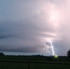
Iceresistance replied to weatherextreme's topic in Central/Western States
@nwohweatherNote an Inflow Notch north of Lake Charles, LA, that may be Tornado-Warned. -
Severe Weather event October 23rd-27th 2021
Iceresistance replied to weatherextreme's topic in Central/Western States
PDS Tornado Warning for TX/LA -
November 2021 Chilly Blast (1st Wave)
Iceresistance replied to Iceresistance's topic in Weather Forecasting and Discussion
0z Euro also showing this as well! O_O -
Severe Weather event October 23rd-27th 2021
Iceresistance replied to weatherextreme's topic in Central/Western States
My house got 1", but it's likely higher because the rain gauge was partly knocked off of it's holder because of the wind. -
November 2021 Chilly Blast (1st Wave)
Iceresistance replied to Iceresistance's topic in Weather Forecasting and Discussion
0z CMC is even crazier, even colder across the CONUS Also want to mention a Major Winter Storm is also in the model as well from Western Texas to most of Oklahoma to Kansas & Missouri -
Southern Plains Winter 2021-2022
Iceresistance replied to Iceresistance's topic in Central/Western States
All I can say for the 0z CMC is OH MY GOODNESS! -
Severe Weather event October 23rd-27th 2021
Iceresistance replied to weatherextreme's topic in Central/Western States
SPC Storm report indicate possible tornado at 36th & Franklin in Norman -
November 2021 Chilly Blast (1st Wave)
Iceresistance replied to Iceresistance's topic in Weather Forecasting and Discussion
The CMC is BRUTALLY COLD for most of the USA for November! -
There is a solid chance for really cold Temperatures across the Northern, Central, & parts of the Southern Plains before shoving eastward towards the East Coast to Start November.
-
This may form into a Tropical Cyclone later this week & into this weekend, this is the major Nor'Easter right now.
-
Texas/Oklahoma Discussion & Obs Thread 2021
Iceresistance replied to It's Always Sunny's topic in Central/Western States
Extreme Wind is expected in Oklahoma on Thursday, wind speeds 30-50 mph & gusts up to 65 mph


