TimB
-
Posts
17,206 -
Joined
Content Type
Profiles
Blogs
Forums
American Weather
Media Demo
Store
Gallery
Everything posted by TimB
-
 Think we might have to cash in on our one opportunity.
 -
Euro’s gonna be bad.
-
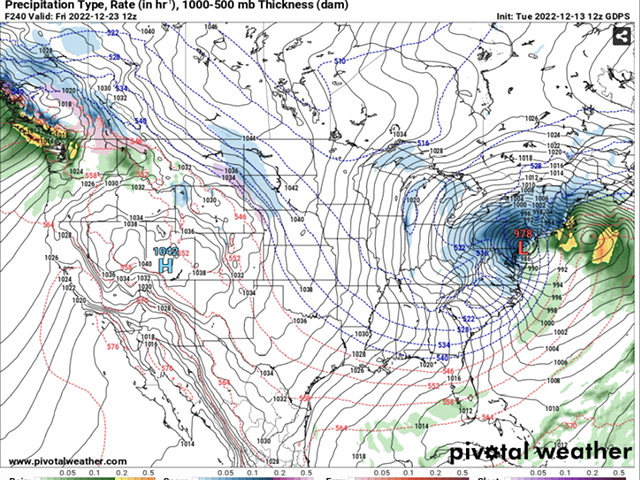
Compare and contrast TWC with the shitty new Apple weather app. One is very obviously leaning on the GFS and the other is very obviously leaning on the cutter/Arctic front solutions.
-
Almost identical. Scary. Maybe an even sharper temp gradient on the ICON.
-
CMC has that stupid cutter/Arctic front solution. Spits out a scenario where it’s 0 here and 60 in Philly on Friday morning.
-
Borderline cutter doesn’t sound too bad as long as it doesn’t cut too hard.
-
I’m starting to get the impression that it’s going to be, at best, kinda cold and kinda snowy for a brief period. Probably won’t be particularly memorable 5 years from now in extent or duration of cold or snow.
-
Liking the trend toward an extreme cold outbreak sometime during the weekend. Hope it comes with a little snow.
-
Just look at us precariously sitting near the edge of the risk area.
-
For the most part, I can live with that Euro run. It’s a path to victory. It shows that we can get the cold air to pour into the US somewhere and work out the details of when and where later.
-
Sends near all time record lows into the desert southwest. Everything we need to know for our weather here.
-
If the Euro is the tiebreaker on what that time period looks like, well…
-
Phases a clipper out of the Midwest with a storm running up the coast.
-
Verbatim, the GFS gives us enough snow on the back end of that storm to have a kinda white Christmas. CMC has a monster of a snowstorm in the same timeframe.
-
This is Feb 2021 all over again.
-
Seems even d6-10 might be trending closer to normal temps, at least with the models that ran overnight, and the push of Arctic air might be closer to Christmas. We’ll see what 12z brings.
-
NAM continues to be out on its ridiculous major ice storm island. I’d bank on this being nearly all, if not completely, plain rain.
-
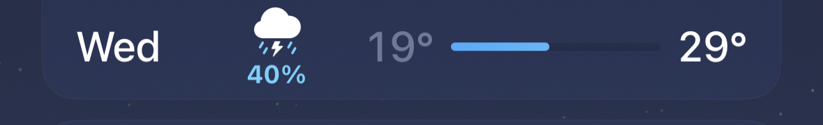
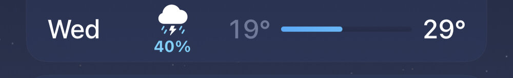
Apple bought Dark Sky and is now using that as its data source instead of TWC. It’s garbage. Here’s the pic.
-
What do you mean? The NAM jackpots us for that storm.
-
Would think if a major Arctic invasion were to actually occur, and it seems to pop up on a number of model runs, it would be ushered in with a small amount of snow. That seems to be fairly typical. Seems like the timing of that would coincide pretty well with Christmas if it did happen.
-
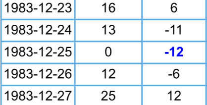
Look up 1983. I’d take something like that. Long and short of it is this happened with no more than 1” on the ground on the front end of the Arctic blast.
-
Seems to be a pretty strong signal for some good cold around Christmas but a long way to go and probably suppression anyway.
-
EC makes it warm again by early next week. This is unreal.
-
Our chances still look better than they did a day or two ago. But the only run that really gave us a good snow total was the 18z yesterday.
-
Did someone say sports?