Northof78
-
Posts
574 -
Joined
-
Last visited
Content Type
Profiles
Blogs
Forums
American Weather
Media Demo
Store
Gallery
Everything posted by Northof78
-
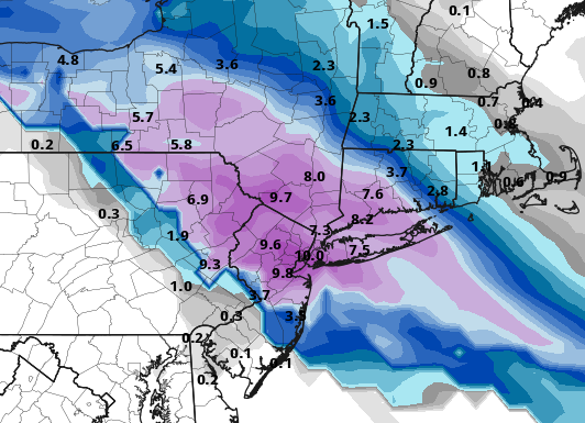
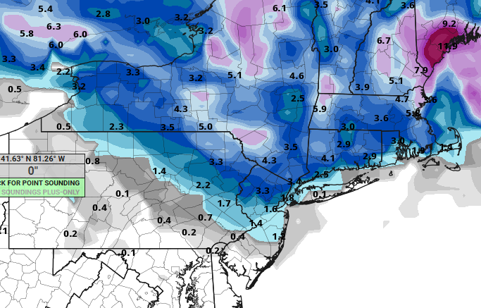
Could be a general depiction i see hear across most models of a general 5" - 7", but someone in that NW to SE band (roughly 50 miles wide)will get near 10"
-
Wow, NAM now has -9C @ 850 during height of precipitation and low exiting southern tip of Delmarva….casual 100s of mile shift south. This being said, I would not out too much faith in this model getting any details right…trend is obvious though, back towards GFS/Euro
-
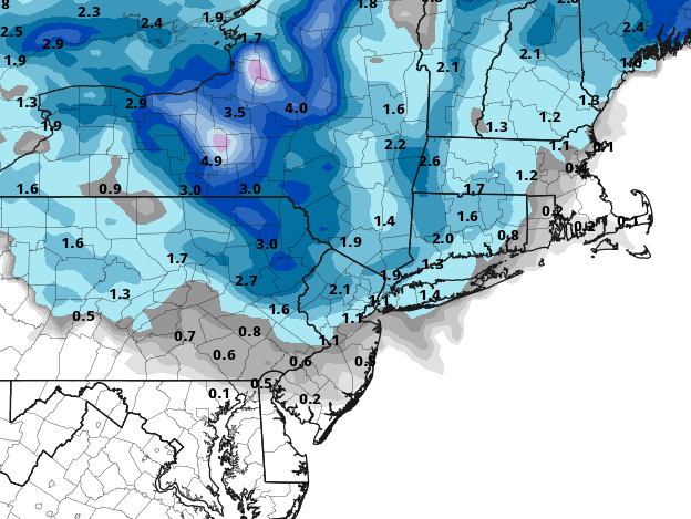
GFS @ 10:1 is 6" - 10" for all, with NYC the bullseye
-
feels real good on Christmas eve....
-
Man, this is the thinnest bonus stripe of snow I remember seeing in a long time, like 50 mile wide band of good snows
-
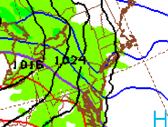
I would be cautious N or E of NYC and N of NJ/NY border, extreme sharp cut-off on NE shield with the block
-
 I anyone is SE Morris, SW Essex, or N Union...looks like heavy band in there now...
 -
Huge flakes now...1.5" OTG
-
Moderate snow, 1" OTG in Paramus, Bergen County
-
Steady light snow, dusting on all surfaces
-
NAM continues to come south/colder/wetter with more than 2" now for CPK.
-
NWS hiking amounts slightly, I was at 1" or less, now @ 1" - 2"...getting there.
-
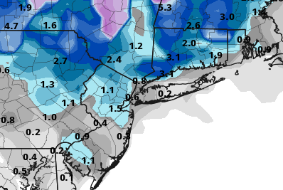
Even NAM verbatim is 1" down to TTN, with a fresh cold arimass in place, pattern always supported a nice light snowfall and all models now show that.
-
All models colder/south @ 12Z and NAM with very large shift to join the others, on track for most here to get a nice 1" - 3" event.
-
1" - 3" nice little storm coming with temps in 20s for almost all, enjoy it!
-
The snow will not be wet, temps in mid to upper 20s for most of accumulating snow time
-
Nice trends over past day or so, of south/colder, TTN N looks good for 1-3"
-
Not sure the surface will be a problem generally, but for city itself heat island always an issue unless really cold.
-
6z GFS ups the ante, more moisture and a more robust system seems to be the trend. 2-4" for much of the forum
-
Seperate thread on this storm potential...
-
Most models have a light overrunning signal for Tuesday December 23rd for N NJ/NYC/S NY State/CT. New GFS signals a chance for 1" - 3" for most of the subforum.
-
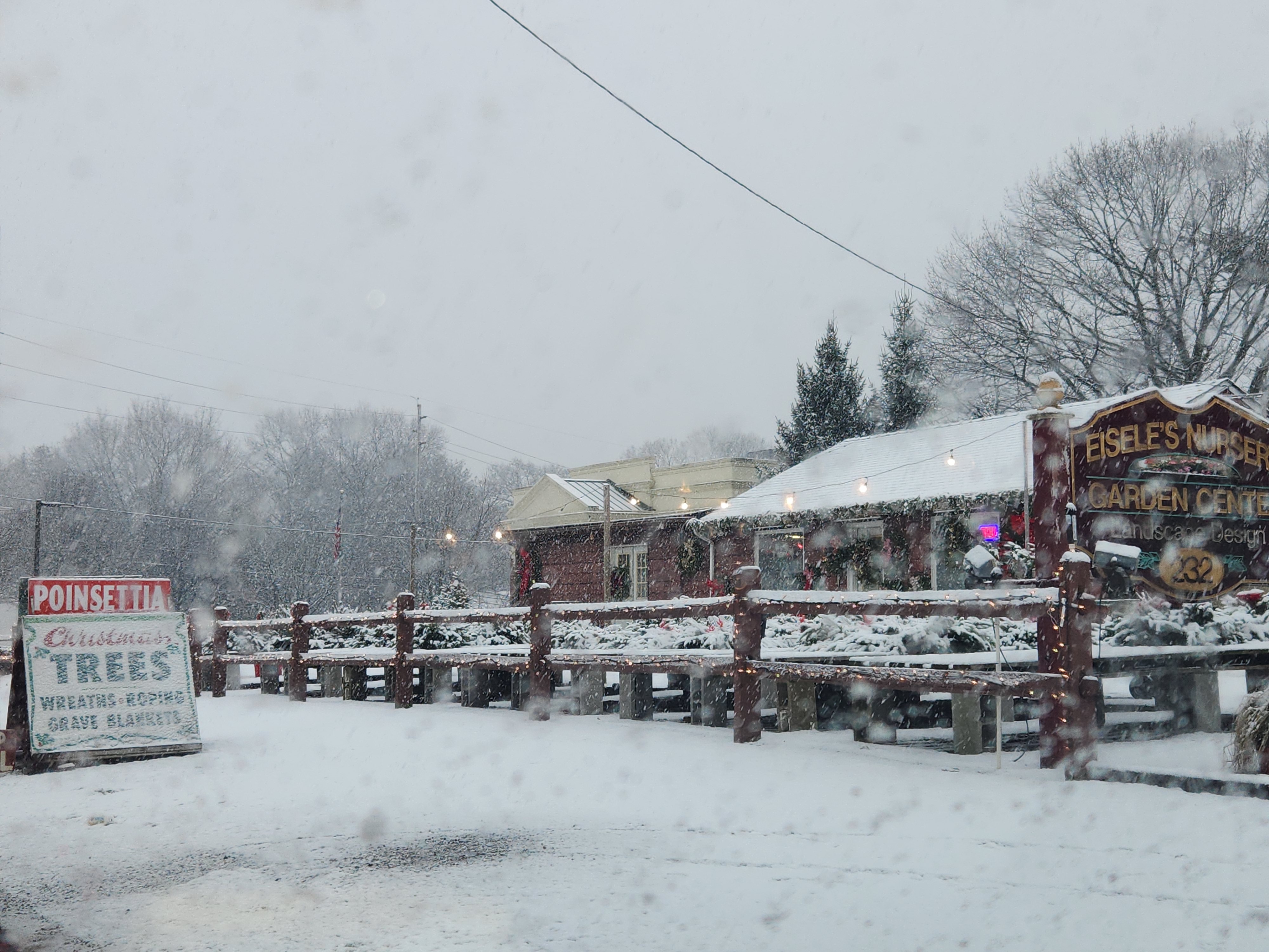
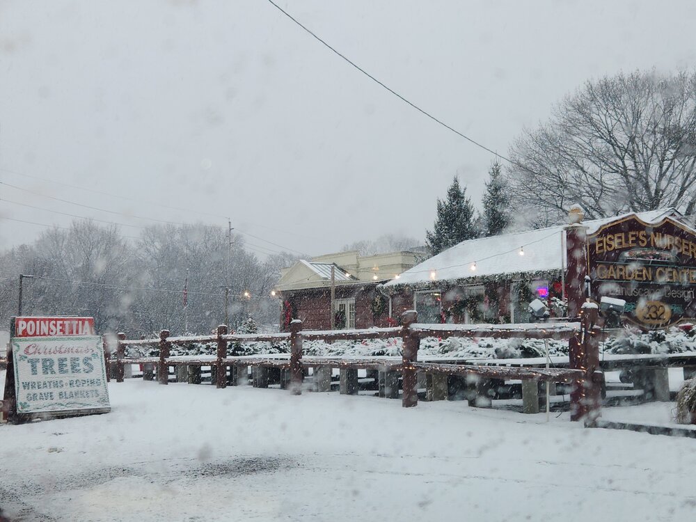
7.0" storm total, Millburn, NJ Essex County
-
What is your location?
-
Actually now that I looked at the PHL reporting observations as well, basically everyone in NJ will be in the 5" - 8" range north of AC to Highpoint.
-
7.0" of snow on the ground with light snow/flurries still falling and storm total in S/W Essex County, huge overperformer! Biggest storm since 2021 here and can't remember the last 2X outperformer. Beautiful outside, and love December snows pre-Christmas... Looks like Somerset, Hunterdon, N/W Middlesex, W Essex, W Union, Passaic, Warren, Morris, C/N Bergen, and Sussex will all end up with 5" - 8"...