Northof78
-
Posts
574 -
Joined
-
Last visited
Content Type
Profiles
Blogs
Forums
American Weather
Media Demo
Store
Gallery
Everything posted by Northof78
-
 Very light 50/50 mix here...
 -
First flakes for many, accumulating snow for the north, rain for others…latest models looking more robust with precipitation amounts…norlun also possible between C NJ and CT
-
Light snow, between 1 -1.5” OTG
-
very quick transition to light/mod snow now, windy, no accumulation yet
-
Now light snow/sleet mix
-
Mostly sleet now in W Essex, seems changeover is ahead of schedule by an hour or so
-
Change line coming in hot, snow/sleet now east of 287 along 78 in Somerset Cnty
-
Heavy rain, winds stating to pick up from N/W
-
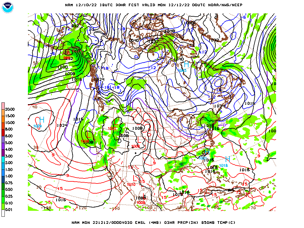
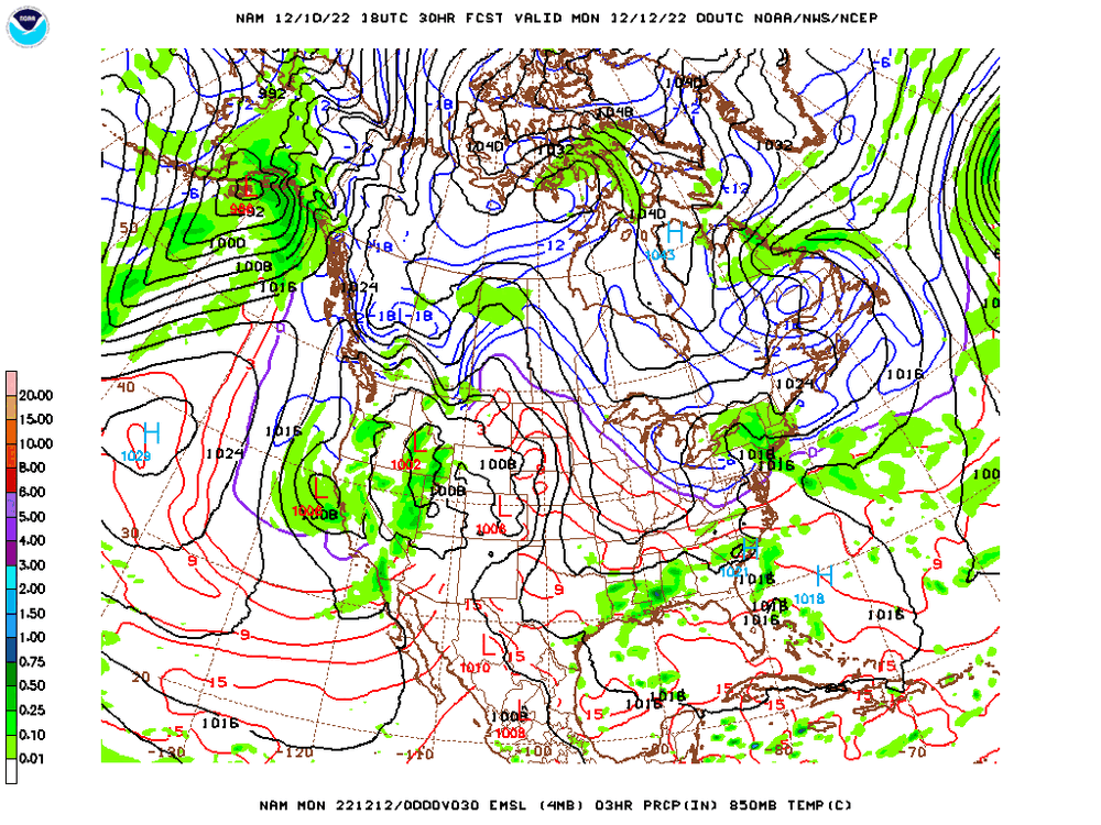
Much colder than previous run
-
2/13 Light/Moderate Snowfall Nowcasting & Observations
Northof78 replied to Northof78's topic in New York City Metro
Measured 2.0” OTG with moderate snow, some roads covered, some not -
2/13 Light/Moderate Snowfall Nowcasting & Observations
Northof78 replied to Northof78's topic in New York City Metro
This is looking quite potent and slow moving on radar at the moment... -
2/13 Light/Moderate Snowfall Nowcasting & Observations
Northof78 replied to Northof78's topic in New York City Metro
New NAM snows till Super Bowl starts -
2/13 Light/Moderate Snowfall Nowcasting & Observations
Northof78 replied to Northof78's topic in New York City Metro
Might not be till late afternoon/early evening -
2/13 Light/Moderate Snowfall Nowcasting & Observations
Northof78 replied to Northof78's topic in New York City Metro
1-3”, isolated 4/5” amounts a few places where bands set up -
2/13 Light/Moderate Snowfall Nowcasting & Observations
Northof78 replied to Northof78's topic in New York City Metro
NAM looks to put highest amounts in interior N NJ -
2/13 Light/Moderate Snowfall Nowcasting & Observations
Northof78 replied to Northof78's topic in New York City Metro
GFS finally coming around with a 1-2" snowfall in N/C NJ and NYC, more in C/S NJ -
2/13 Light/Moderate Snowfall Nowcasting & Observations
Northof78 replied to Northof78's topic in New York City Metro
EURO anything? -
thread started for this storm
-
Most 12z Models now have at least a notable winter storm hitting the area on 2/13-2/14.
-
Arctic boundary now clearly visible on radar cutting across Somerset, Essex, Union, Bergen, and NYC, about a 20-25F difference in a matter of 10 miles or so
-
Looks like a net 'pack-add' storm rather than a net melt...
-
I would be surprised now with colder/south trends if anyone (outside maybe coastal SI/LI) will not be above mid/upper 30s during storm, while 95 N&W probably a large amount of frozen/freezing.
-
GFS increase amounts nicely from 1-3/2-4" to around 6" (still much ice/sleet, etc.)
-
Got to use the Kuchera formula, does a great job of separating ice, sleet, and snow, that has about 1-3"/2-4" of snow for most of metro along with much sleet, some ice
-
Looks like mostly frozen/snow N/C NJ and north with this arctic high pressing and a less wound up storm