ineedsnow
-
Posts
22,753 -
Joined
-
Last visited
1 Follower

About ineedsnow

- Birthday 02/02/1986
Recent Profile Visitors
44,324 profile views


-
 Euro also has something just not as robust.. ICON also faintly seeing it
 -
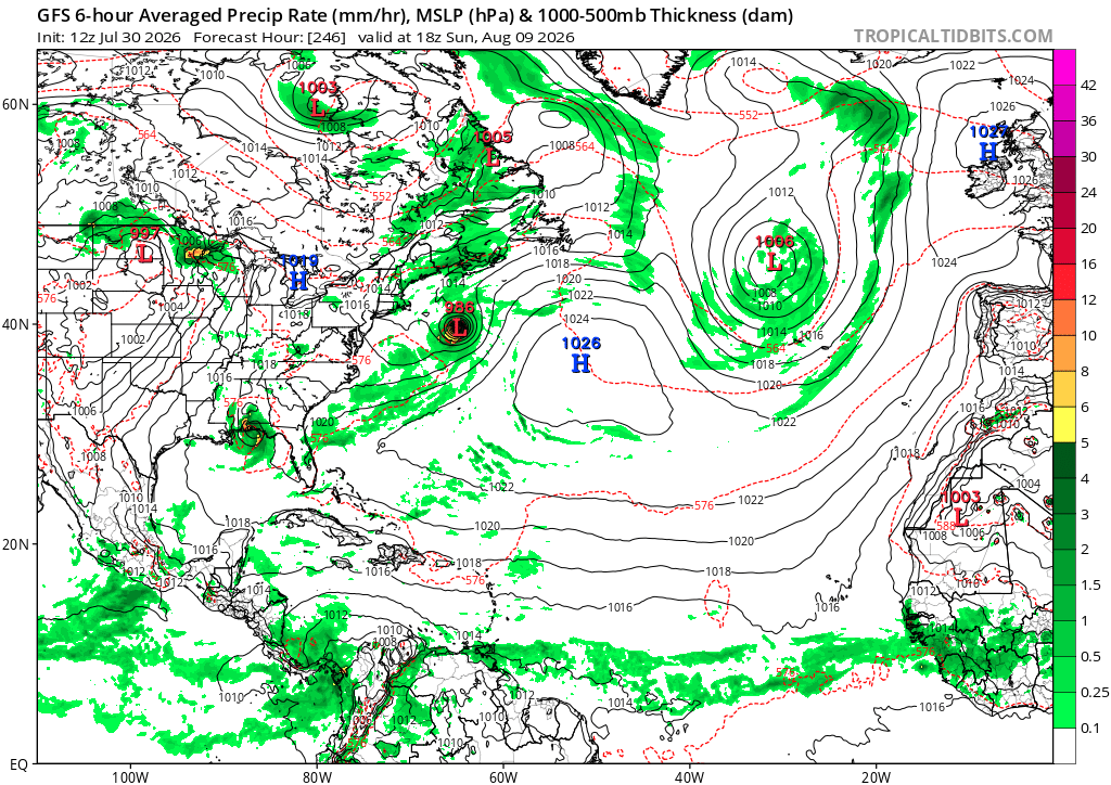
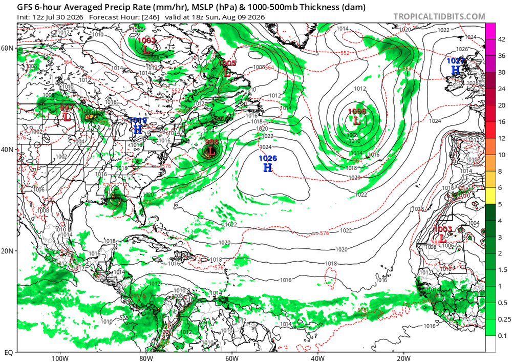
6z GFS says congrats NC
-
Pattern would really have to change to bring something up.. but I wouldn't mind a NC trip
-
I would be fine without Summer ever again Really looking forward to cooler days and nights
-
we shorten
-
Euro also trying for something.. but heads ots which is expected
-
IDK some models have hints of it besides the GFS.. would be OTS anyways but I'm going on a 3 hour fishing trip out of Seabrook NH next Saturday so would be rough
-
never fails
-
sucks its not a cane pattern.. 12zGFS scoots that cat 1 OTS
-
Trust me it was tempting to drive right into it
-
This.is true.. when I saw the springfield tornado I could of got closer.. my heart was like do it.. but my brain was saying your close enough and try to live another day to see another one
-
Close to 5 so far... hoping for more today
-
Should be some good downpours again later on..
-
HRRR liking tomorrow also..
-
pouring again.. ground is saturated with new ponds forming.. probably still be in severe drought next week though..