MN Transplant
-
Posts
17,625 -
Joined
-
Last visited
Content Type
Profiles
Blogs
Forums
American Weather
Media Demo
Store
Gallery
Everything posted by MN Transplant
-
2021 Atlantic Hurricane Season Tracking Thread
MN Transplant replied to WxWatcher007's topic in Mid Atlantic
Looks like a washing machine right now. -
2021 Atlantic Hurricane Season Tracking Thread
MN Transplant replied to WxWatcher007's topic in Mid Atlantic
Excellent craftsmanship on the house in the background! -
2021 Atlantic Hurricane Season Tracking Thread
MN Transplant replied to WxWatcher007's topic in Mid Atlantic
Watching the tops of the waves flying past by the camera is insane. -
2021 Atlantic Hurricane Season Tracking Thread
MN Transplant replied to WxWatcher007's topic in Mid Atlantic
I just commented in the Tropical thread that there is trash floating by now. I'm amazed that the feed is staying up. -
Some trash floating by on the severestudios feed from Grand Isle. Could identify a cooler.
-
2021 Atlantic Hurricane Season Tracking Thread
MN Transplant replied to WxWatcher007's topic in Mid Atlantic
The lightning in the eyewall right up to landfall is amazing. -
2021 Atlantic Hurricane Season Tracking Thread
MN Transplant replied to WxWatcher007's topic in Mid Atlantic
I know that we all know not to use the 3km NAM for tropical, but here’s why -
Oh yeah.
-
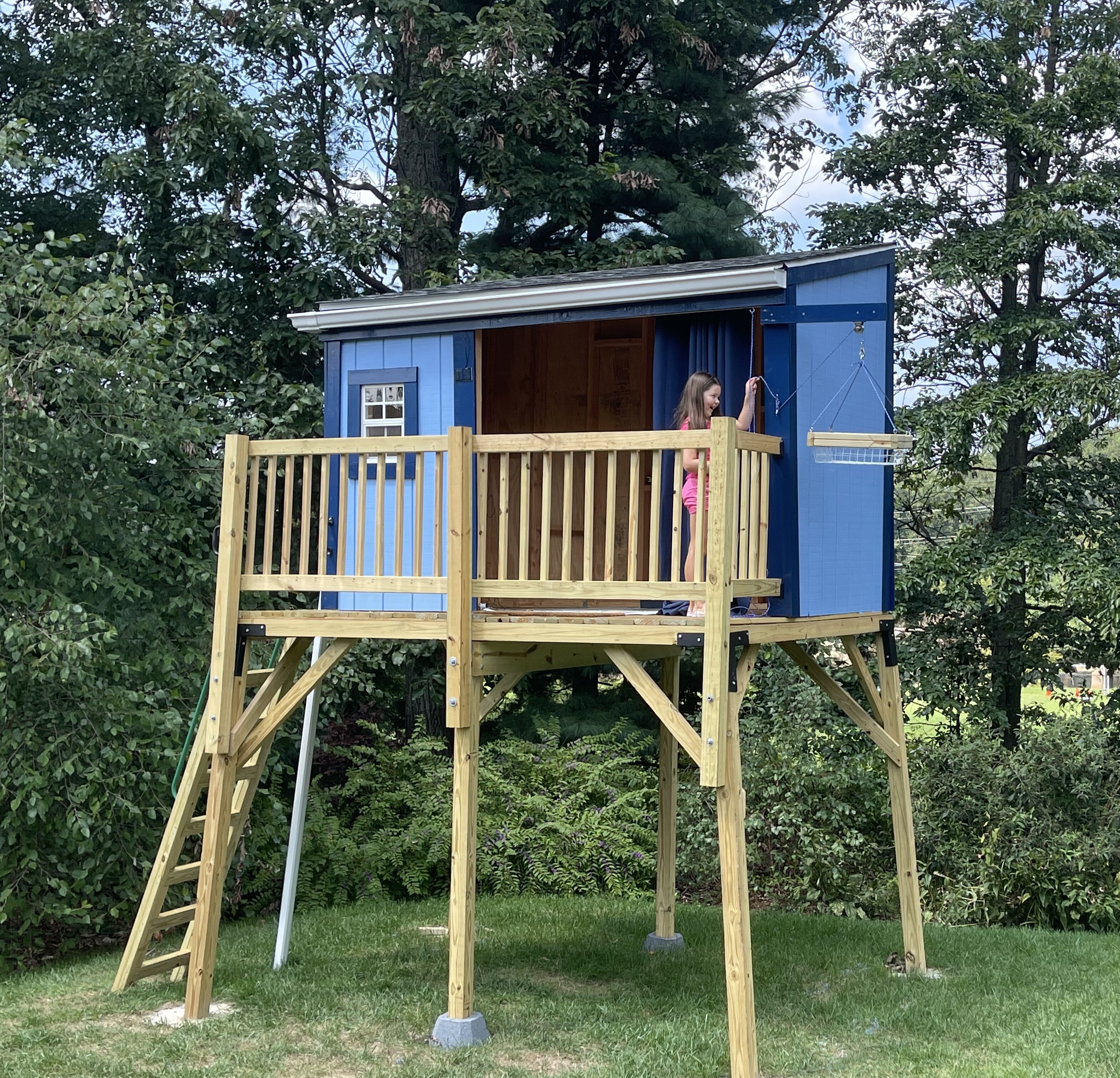
Thanks! She wanted a tree fort, but we had cut down all the good trees. So, I started with the idea of a deer stand and then it got more elaborate.
-
My magnum opus. All by hand. A couple of months and so, so many trips to Home Depot.

-
2021 Atlantic Hurricane Season Tracking Thread
MN Transplant replied to WxWatcher007's topic in Mid Atlantic
There is a national refuge between Lafayette and Baton Rouge. If the right eyewall can thread that needle, it’ll really keep the damage down. -
Nice light show to the south.
-
About 0.5”. These are moving more quickly than some in recent weeks. No wind here.
-
If that line extends SW somebody is going to get trained on a bit. Probably Annandale, because they get hit a lot.
-
First STW of the day goes to MoCo.
-
It has definitely had too little coverage over the past month of storms.
-
2021 Atlantic Hurricane Season Tracking Thread
MN Transplant replied to WxWatcher007's topic in Mid Atlantic
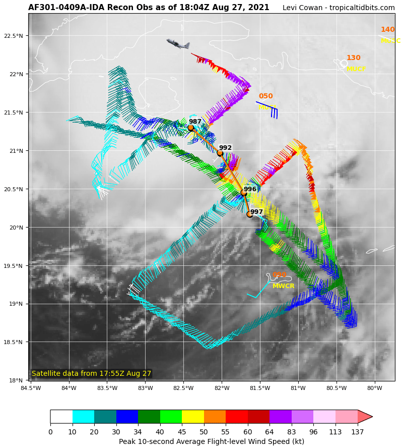
From 997mb to 987mb during the AF flight. Definite bend to the NW.
-
HRRR continues to favor north of the Potomac today. NAM is more widespread. Storms are starting to bubble.
-
2021 Atlantic Hurricane Season Tracking Thread
MN Transplant replied to WxWatcher007's topic in Mid Atlantic
992mb. Down 5mb while in recon. -
2021 Atlantic Hurricane Season Tracking Thread
MN Transplant replied to WxWatcher007's topic in Mid Atlantic
Western Cuba offers little resistance for most storms that have themselves together. It is so narrow and most storms (like Ida) move roughly perpendicular to the island. -
2021 Atlantic Hurricane Season Tracking Thread
MN Transplant replied to WxWatcher007's topic in Mid Atlantic
Next center fix from recon is going to be interesting. -
2021 Atlantic Hurricane Season Tracking Thread
MN Transplant replied to WxWatcher007's topic in Mid Atlantic
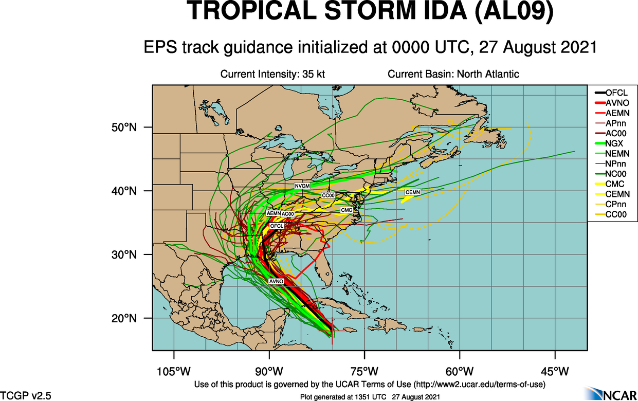
For EJ, the ensemble guidance from last night has the GFS with weaker steering, keeping it away. CMC and Navy are more interesting. That said, we don’t usually do that well with a looping track like this from the gulf. For impacts here we generally want a FL panhandle hit (Ivan).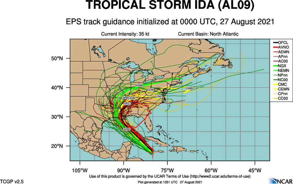
-
Looks like 5 more days of truly disgusting weather, then we get a break. After that we are into September and while it’ll get gross again, it’ll probably be in shorter spurts.
-
That’s wild. I never had more than one on me.
-
Amazing to see a storm almost completely within the borders of Arlington.