MN Transplant
-
Posts
17,625 -
Joined
-
Last visited
Content Type
Profiles
Blogs
Forums
American Weather
Media Demo
Store
Gallery
Everything posted by MN Transplant
-
-
Ida delivered from landfall to exit.
-
The radar in Jersey and NYC this evening is something.
-
66 and a breeze. Legit shivered a bit. Tomorrow is going to be awesome.
-
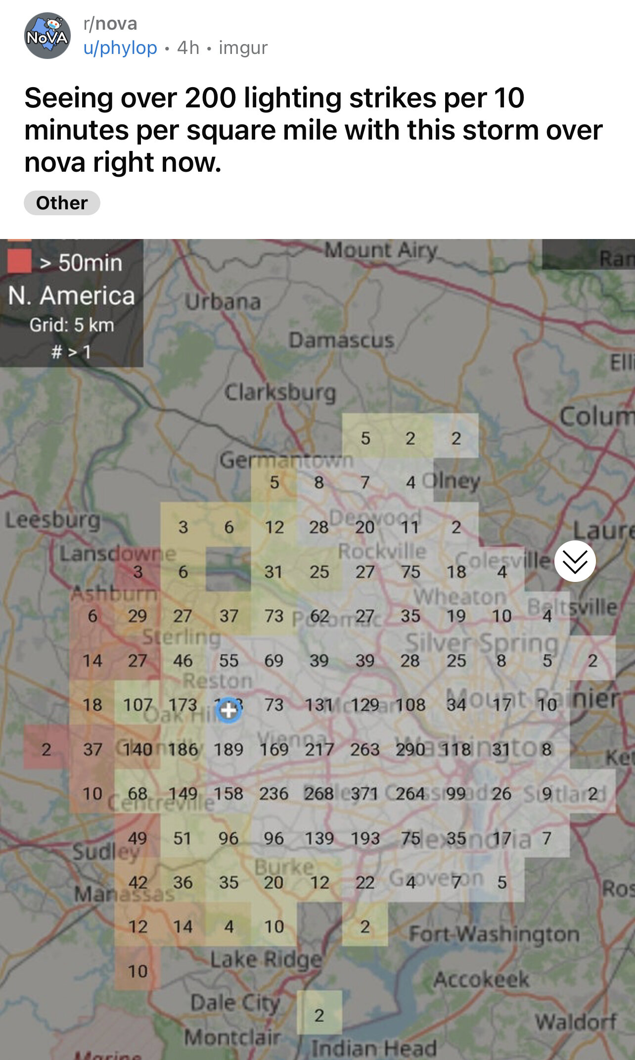
Interesting seeing the lightning signatures pop up on several of the warned cells.
-
Keeping an eye on that one. In a meeting right now with a coworker who is in Oakton. I’ll get ground truth!
-
From Reddit

-
1.90” total. Beautiful storm.
-
Constant CG hits. Top tier electrical storm. Not much wind here, but a little max is showing up on TDCA south of me at the beltway and 50.
-
Quite the light show.
-
2021 Mid-Atlantic Severe Weather - General Discussion
MN Transplant replied to Kmlwx's topic in Mid Atlantic
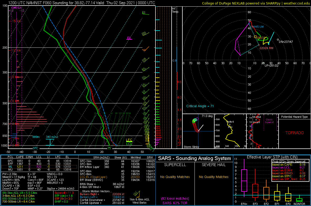
12z HRRR and NAM Nest get surface based CAPE >2000 tomorrow afternoon. -
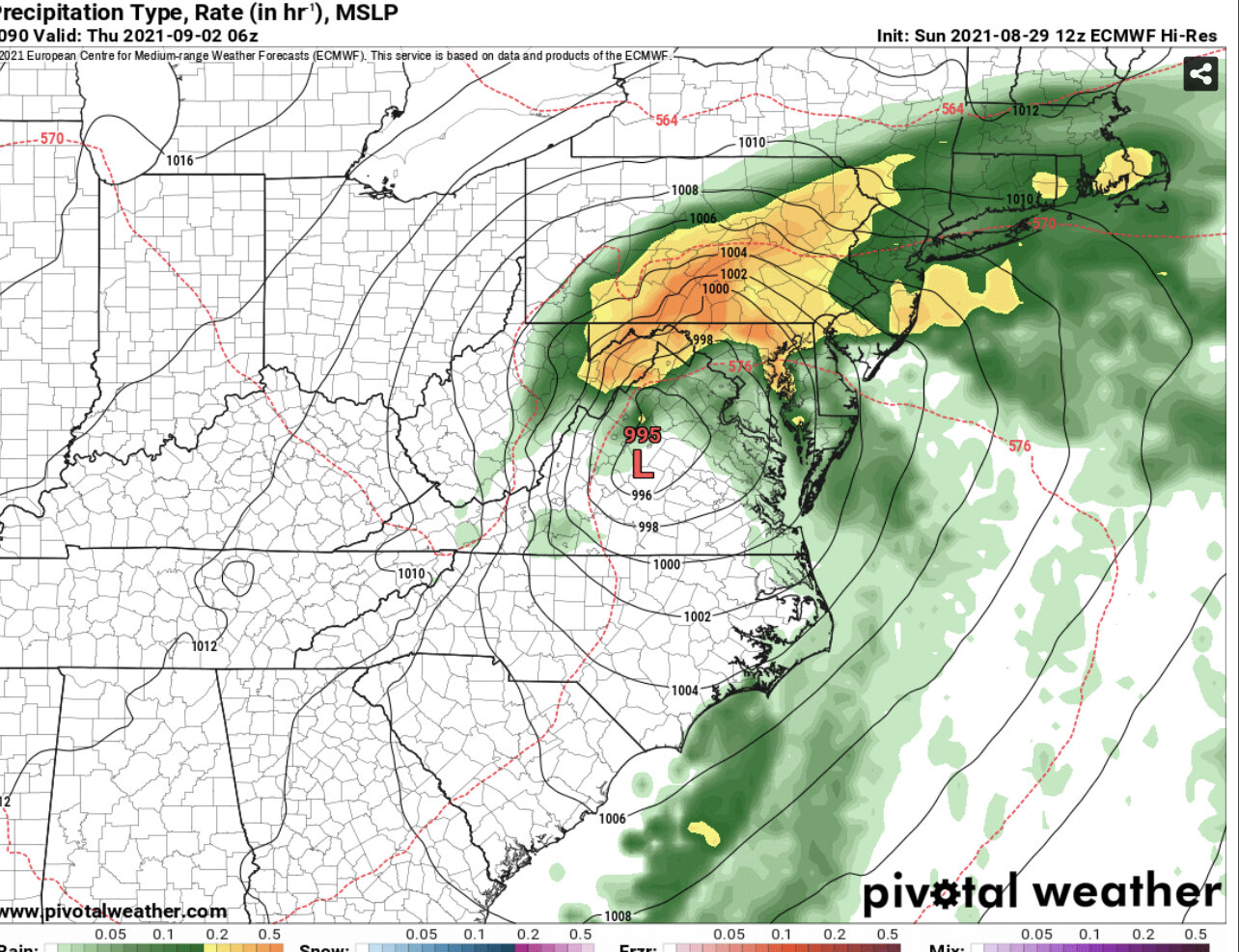
I mean, look at that stupid map and tell me it isn’t a perfect winter representation. Even NYC and BOS jackpot.
-
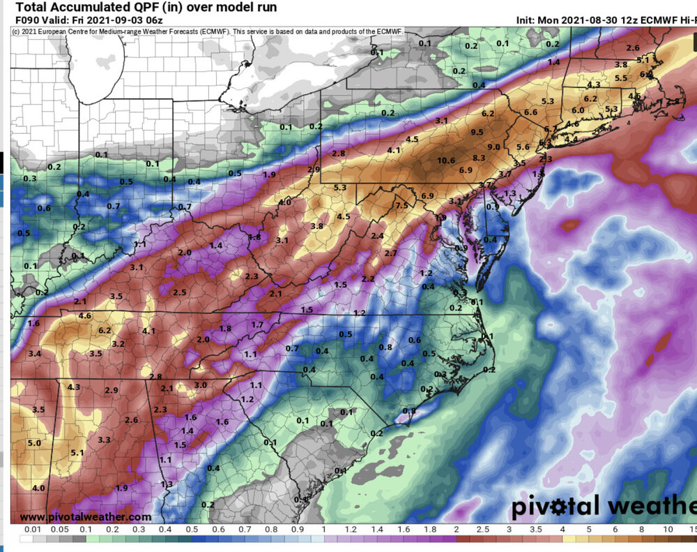
The 1.9” at DCA is mostly sleet anyway
-
-
2021 Mid-Atlantic Severe Weather - General Discussion
MN Transplant replied to Kmlwx's topic in Mid Atlantic
I’m intrigued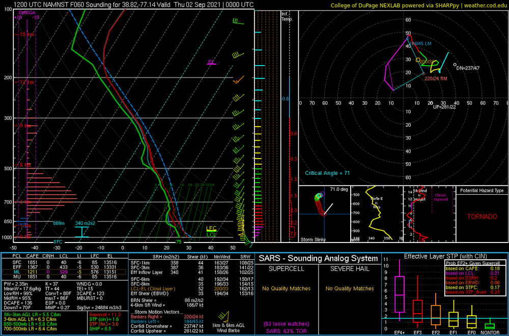
-
If you look at the satellite maps, Laplace is the only area west of the Lake where they built into the swamp and connected the river and I10.
-
Tweets aren’t reliable, but I’ve run across several of these just using Laplace as a search term.
-
Sounds like flooding is bad in the eastern neighborhoods of Laplace. People posting on FB/Twitter for rescues. I checked some of the addresses and they are all in the same area just south of 10.
-
Hoping all is well here. In the eyewall just outside Laplace.

-
One thing on the rainfall is that even when Ida moves north overnight, somebody is going to be stuck with the feeder bands training over them.
-
Did we lose the anemometer at MSY?
-
2021 Atlantic Hurricane Season Tracking Thread
MN Transplant replied to WxWatcher007's topic in Mid Atlantic
Raining on @EastCoast NPZand not on @PrinceFrederickWx. Nah.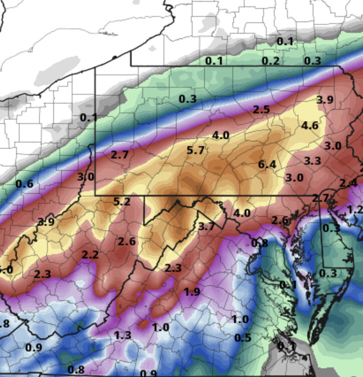
-
2021 Atlantic Hurricane Season Tracking Thread
MN Transplant replied to WxWatcher007's topic in Mid Atlantic
Euro
-
2021 Atlantic Hurricane Season Tracking Thread
MN Transplant replied to WxWatcher007's topic in Mid Atlantic
The Grand Isle camera is back and the house appears to be minus a porch. -
2021 Atlantic Hurricane Season Tracking Thread
MN Transplant replied to WxWatcher007's topic in Mid Atlantic
With apologies to Josh, this might be the most compelling hurricane footage I've ever seen.