Modfan2
-
Posts
3,465 -
Joined
-
Last visited
Content Type
Profiles
Blogs
Forums
American Weather
Media Demo
Store
Gallery
Everything posted by Modfan2
-
 Nice line in E Ct
 -
I’m good with that, I close down here on the 7th and that the last thing I need!
-
There were quite a few members taking this into the Yucatán
-
This appears to be a reasonable track this early; a lot can and will change.
-
Not going to happen, you may see 940-945
-
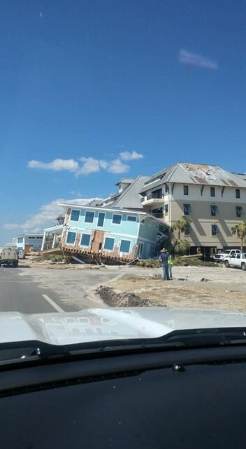
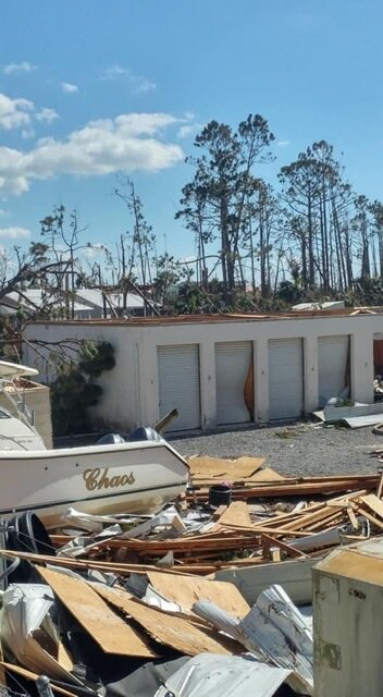
I spent 2 1/2 weeks in the FL Pan Handle for Michael and was enough for me to see.
-
Looks like many members into the Yucatán
-
Wondering how far west this comes; initially heading into NF now Nova Scotia, is Downeast Maine in play?
-
Keeps ticking west, Downeast Maine still in the game
-
I mean, a storm of that magnitude I wouldn’t want in New England; have said it before with the tree growth over the last 30 years two week power outages will the minimum.
-
Let’s see if it holds together in the next 48 hours
-
Lock it Lol! That’s a James storm if I ever saw one!
-
Always looking towards trends with weather I wonder how the FL east coast cities from Vero to West Palm being very dry (13-15”) for the year correlates to any analogs years for Hurricane season. This has been as dry a rainy season we have had in the last 10 years along the I 95 corridor and we are 3/4 of the way through.
-
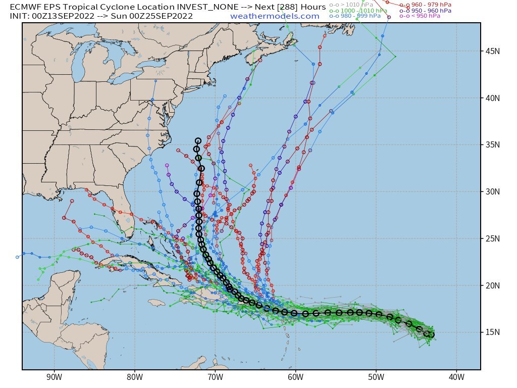
ECMWF suite appears to support recurve north; something to watch for here?

-
ECMWF suite appears to support recurve north; something to watch for the East Coast? Maybe discounting strength of ridge and allowing for a turn north.

-
2022 Atlantic Hurricane season
Modfan2 replied to StormchaserChuck!'s topic in Tropical Headquarters
ECMWF suite appears to support recurve north; something to watch for the East Coast? Maybe discounting strength of ridge and allowing for a turn north.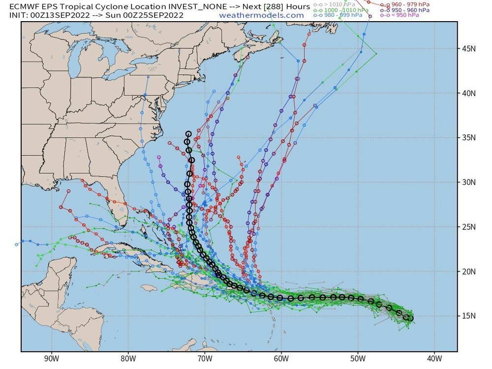
-
Rotation down on S RI coast with that cell?
-
Meanwhile here in S FL it’s non stop torch!

-
Define furnace?? It’s been 92-94 here every day for a few months now with limited rain. Looking forward to NE “furnace” weather in about a month!
-
Do any of you heat with Propane? Purchasing a house that is propane heated and looking for feedback.
-
I’m just north of you in Attawaugen section of Killingly and not doing much
-
Don’t see many pics of 395 flooding, 95 in Providence is a mess
-
Some decent flooding pics out of Providence; RI could be ground zero
-
Any Seabreeze enhancement or is it a CF?
-
Congrats RI and Se Ma?