Gino27
-
Posts
556 -
Joined
-
Last visited
Content Type
Profiles
Blogs
Forums
American Weather
Media Demo
Store
Gallery
Everything posted by Gino27
-
8:30am, 40 degrees, sun is out... gonna lose a lot of snow and really feel like spring today.
-
I can't think of a better winter than this year realistically. Early start, Christmas storm, some awesome squalls, 2-3 big storms to track, 12" depth, and no extreme cold. Now add an early-ish warmup (not torch) with a slower snow melt to avoid flooding concerns, we're in a good spot. Big busts will happen, especially with our location/climate. Learn from them and move on. Edit: we also never had an all out mid-winter torch
-
My last HS baseball season gets underway tomorrow. 40s are greatly appreciated compared to some of the crap we've had in previous years.
-
You're not wrong about the storm track. It's VERY rare for SE michigan to be the jackpot, much like Central OH. We just haven't had ours in 6-7 years now, while you guys have had a few in recent years.
-
Idk about that. I don't know how one system could depress the SE ridge (that will inevitably show up) for the whole month of march. By mid month we should be looking at close to 50 for highs. That would be an epic cold outbreak to keep us that cold for the whole month.
-
The next few days look like end of winter's death grip that we've been seeing the last few weeks. Next week will feel really warm as we could tap into the upper 40s. With that taste of early spring we'll prob have snow in April and freezing temps in to mid-May like last year lol.
-
Ain't that the truth... Eastern Ohio was crushing it early on. Two weeks ago most of Northern OH was burried. Then last week Cincinnati got their big one. I'm still gonna end up right around or above average this season, and we broke our "no WSW streak" even though none of them verified.
-
Yeah mines is about 12" and only 1/2 of it is powedery snow, mostly concrete at this point. It's going to be a month before some of these plow piles are gone.
-
I think 3" is the total high end for Thursday barring a big NW shift. I'm starting wonder what the snow melt over the next few weeks will look like. I'm hoping it's more gradual and without any heavy rain so we don't have flooding issues.
-
Don’t even wanna think about it lol. We overperformed on QPF so might’ve been double digits. I lucked out and got snow/sleet total of 5”
-
Absolute insanity. After 2-3 inches of sleet this darn thing decided to rip snow. Let's see if it lasts.

-
I think you'll get it! Hang in there!
-
99% sure I’m the luckiest guy on the planet right now. Sorry guys!
-
Mostly snowing now. Wow
-
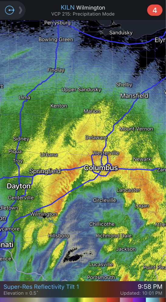
It’s hard not to sit back and imagine if was all snow. Definitely going to pound town to the west. Man... those gravity waves
-
I do think we might switch back to snow at least for a little. Running out of room though.
-
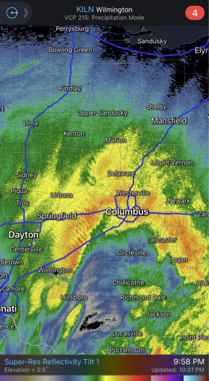
Pushing 3" of sleet now. This has been crazy. What a powerful system.
-
Yeah there's no right or wrong on this one. I track these things out of fun and try and see how accurate I can be, but when the NWS has a big forecast blow up on them I feel a lot better.
-
I wonder how far a 2 stage snowblower can toss 2" of sleet?
-
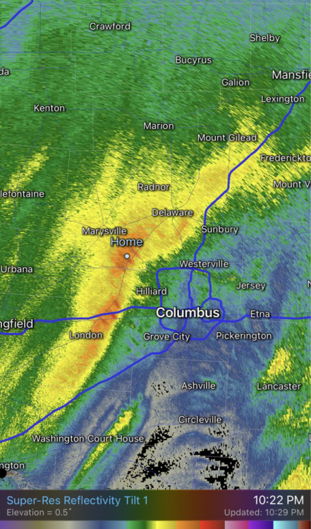
Looks like the sleet has made it all the way up to Akron. This is an outrage.
-
I think we might need to look into the icing concern as the big warm push isn't even here yet.
-
Also if anyone is looking into the Thursday system newest euro is totally squashed. Maybe the NW trend will benefit us for once.
-
It's sleet almost up to marion. We all got screwed.
-
I’m just gonna call this “loud snow” it’s white but mostly sleet.
-
Back to sleet/snow. I’ve had it all in the last 15 mins!