

NorthHillsWx
-
Posts
7,653 -
Joined
-
Last visited
Content Type
Profiles
Blogs
Forums
American Weather
Media Demo
Store
Gallery
Everything posted by NorthHillsWx
-
Agreed. If this convective flare up persists, it seems it will, those pressures will come down quick. That’s a large amount of heat being expelled into the atmosphere
-
Pretty amazing we’re looking at our 6th US hurricane landfall this season. I know they haven’t all been blockbusters but Laura, delta, Isaias, sally, and now probably zeta would be bonafide headliners by themselves in any season on this forum. We’re spoiled
-
New, stronger convection is beginning to fire near and around the center. The next 8-10 hours should give us a good idea where the intensity bar is set, though I still think there are enough positive factors going for this to be a stronger system than what these show. I like 70-80kts
-
Zeta has developed an extremely impressive outflow pattern since last night. However, convection is struggling mightily near the core and a large moat has developed between the central convection and a cyclonically curved outer band. I believe we’ll see the outer band structure decay over the next 12 hours and an increase in convection over the center as that occurs. SST are sufficient and with the outflow pattern, I do expect strengthening to occur. However, the system took more of a hit over land than it seemed while over land. This spread out structure will take much longer to coalesce and see a quick uptick in intensity. I predict a slowly organizing system to peak and then stay at similar intensity through landfall. Probably on the order of 70-80kts. If this had a better structure I would be concerned of a stronger system but it will take considerable time to reorganize in its current state
-
Getting in the eyes of both delta and zeta in Mexico with no radar, no well defined eye on satellite, and both being small eyes, is extremely impressive. This storm was ramping up it just ran out of water. GFS is interesting, it deepens the system through landfall. I’m wondering if the increased forward speed will mitigate the time zeta spends in the cooler water/higher shear environment thus negating those weakening factors. The shear vector also is in line with forward motion which could mitigate that impact as well. This to me looks like a “solid” cat 1 landfall in Louisiana
-
It would not surprise me at all if sally was upgraded due to the large amount of damage to use as evidence. Plenty to judge max wind speeds with.
-
Gotta hand it to the GFS if this system develops in the western Caribbean, it’s been showing it in long range, now medium range for endless runs now
-
2020 is determined to paint every mile of coast from brownsville to Massachusetts in some sort of tropical watch/warning
-
I was about to say... that’s one of the most Wilma-like runs we’ve had since... Wilma. Think the moral of the story is there is an increasing signal for development in the place you’d expect it this time of year. I didn’t think 2020 would let the season end without a bang! Ensembles have been holding onto the idea of development in the W Caribbean for a few days now so seeing it show on the ops for several runs is not unexpected. I don’t think we’re done yet...
-
I’d say you’ve been consistent in pointing out the gradual organizational trend of the storm today. Your posts have been bookended multiple times in the exact opposite observation by someone else thinking the storm is weakening after strengthening for 3 frames. Haha. Point is- we’re seeing a gradually strengthening system. Pressure falls and winds gradually responding. I think NHC forecast is on point though I can also see the storm failing to attain major again but barely. Large Ike-like storm at landfall so exact intensity is not that important anyways, other than for us weenies.
-
Loving the frame by frame analysis of the IR appearance of the storm here... looks great... looks like crap... looks great again taking off now... it fell apart lol
-
Got a friend who just got to Cancun yesterday for his honeymoon. Why he went, I have no clue. He is reporting they have evacuated his entire resort inland.
-
This is going to be an awesome pass
-
This is likely a hurricane. If this had another 24 hours over water this system would be a beast, has “the look”
-
And.... the basin’s dead
-
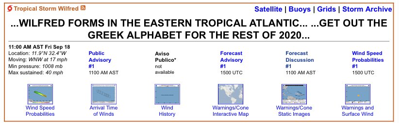
Looks like a wild race to the W storm. 22 had a lead but 98L is rounding turn 4 with momentum. Going to be down to the wire As I said that, 98L wins! Wilfred is born
-
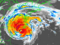
Haven’t even looked at this. Judging by that sat shot the race may already be won...
-
ACE is a useful tool but it certainly doesn’t tell the whole story. We’ve had extremely high ACE years with barely any impacts and low ace years that we’re high impact. It also doesn’t do late blooming storms justice, like Laura. Also, you can have 1 or 2 storms produce basically an entire seasons worth of ace and then have a slow rest of the season.
-
Well I don’t think anyone can complain about this hurricane season, 2020 has literally had something for everyone. If you’re a numbers person, we’re going on the “w” storm halfway through September. You like high end hurricane landfalls? Laura. You like disorganized spinny thingies with names? You’ll be set for 3 years. East coast metro hit? Isaias produced hurricane force gusts from N.C. to MA. Long track MDR storms? Paulette and Teddy. High end fish storm, watch teddy this week. Hurricane landfalls? Every single hurricane has hit land. Teddy may too. Rapid Intensification? Check. Survivalist storms? We’ve had two hit the tallest peaks in the Caribbean and STRENGTHEN after doing so. You a person who loves strengthening systems on approach? Check check check check check check. Preseason named storm? Yep. Needle in a haystack storm? Paulette making landfall on Bermuda. Slow moving epic rain producer? Sally. Ridiculous storm surge, thank you Laura. I mean, we’ve had everything for everyone!
-
I’m going all in on 90L. Bathtub water, decreasing shear, unstable air mass, and location location location. SW gulf is a hotspot for quick spin ups (orientation of geography?). Given the well organized look seen this morning would not surprise me that any additional increase would lead to formation of a TD by tonight. I think 90L wins the race for “W” and I think it could also become our next hurricane. Going to be a painfully slow mover and since no vortex exists yet models have taken up almost every inch of the western gulf for possible tracks. I personally think a long northward trek into Texas is most likely, but will need a defined coc before we know anything on that front
-
Yes, it’s a good thing we cancelled this season halfway through August because the globals weren’t picking up on development. I can’t imagine if this had actually turned out to be an active season!
-
Teddy should get us there alone
-
Honestly we may need a thread for 90L. Looks robust this morning. Models have slowly been picking up on it, albeit weak, but as we just learned: never trust a gulf system. Another slow mover that may eventually work towards the Texas coast
-
Hits a brick wall
-
The crazy thing about that run, well besides 3 hurricanes lined up in a row, is it doesn’t landfall any of them haha





