NorthHillsWx
-
Posts
7,653 -
Joined
-
Last visited
Content Type
Profiles
Blogs
Forums
American Weather
Media Demo
Store
Gallery
Everything posted by NorthHillsWx
-
Feel for you guys. That’s a gut punch
-
It’ll be funny when we get a 60 page storm thread that devolves into observations including the terms “ripping” “fatties” then actually seeing pics of someone’s car topped and white trash cans and someone claiming they got an inch somewhere in the sub forum, ahh winter in the SE page
-
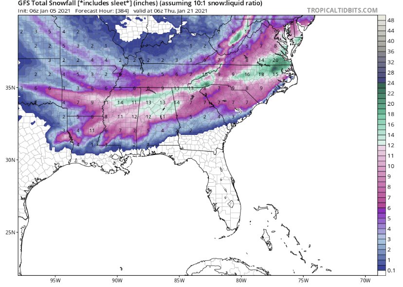
I know posting long range snow maps is a lesson in futility but this highlights the upcoming potential to have multiple storms through the period. Looks to be an exciting couple of weeks ahead
-
Love when this board comes alive. I’m still skeptical about this coming fridays system given the lack of cold air around but looks like we may have several shots down the road. I’ll let the experts continue and I love the discussion. Thanks everyone!
-
Another over producer in the rainfall department. Just under an inch and a half, 1.44” in the bucket
-
No cold air source. No threat outside of mountains for significant accumulation imo. Verbatim models showing snow only in heaviest returns. Upper levels decent but rate driven snow this far out is just something to cut out the boredom
-
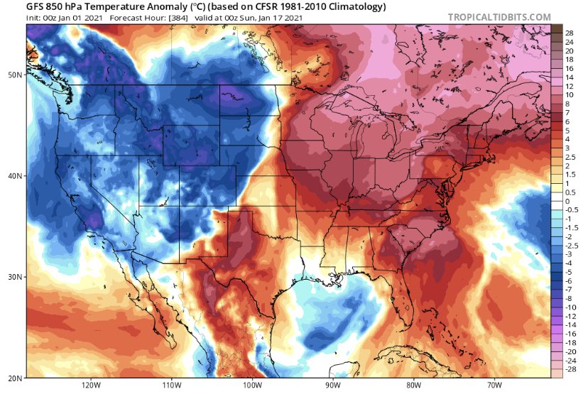
Pattern better hurry up
-
Yep, I’m convinced Raleigh zeroes out on snow this year
-
12z GFS keeps a shred of hope alive for the 3-4th storm. Euro has it too. Poor HP placement means no arctic cold source but ULL overhead provides a cool pool with decent 850’s. Storm would have to generate its own cold air, in other words. We know how that usually ends up. But the track is favorable and the upper levels aren’t bad so there is a chance... this isn’t way out in fantasy land either. At least something to watch other than cutter city in the near future. Sucks to have a favorable LP track but no cold air but alas so is life in the south
-
This thread is better than this winter
-
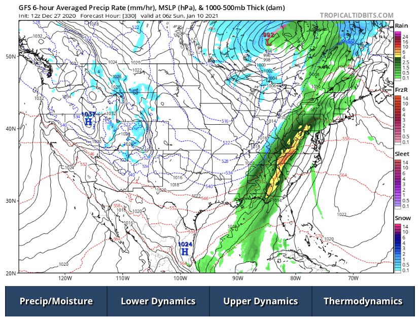
Is it a good thing for snow in the South when the rain/snow line storm is halfway through Hudson Bay in mid-January?
-
Cold without snow is wasted cold
-
I’ve tried to stay optimistic but I am out of reasons to do so for the foreseeable future.
-
Last 2 winters probably had something to do with it...
-
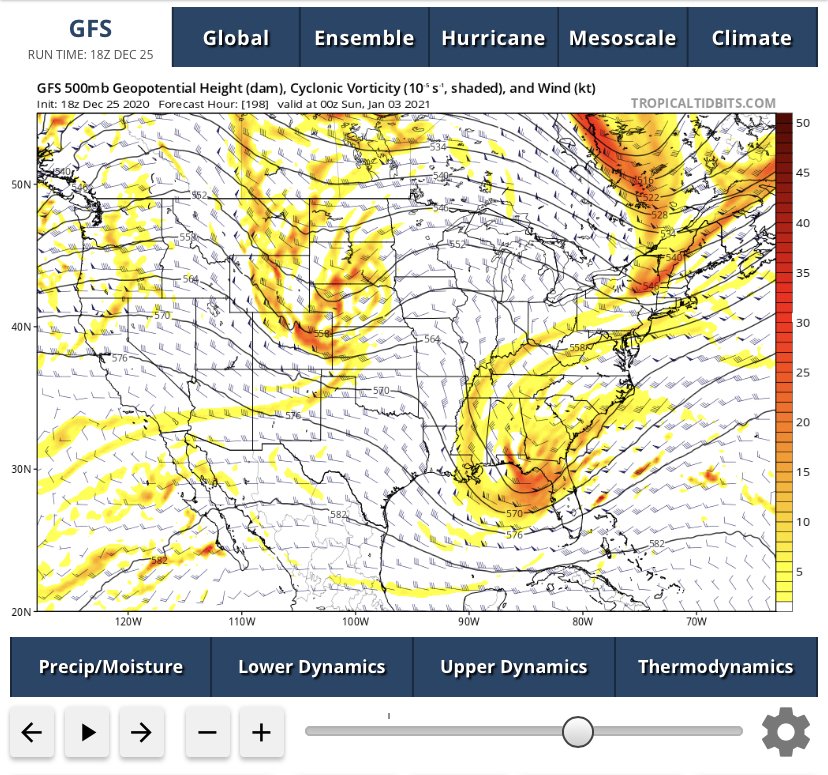
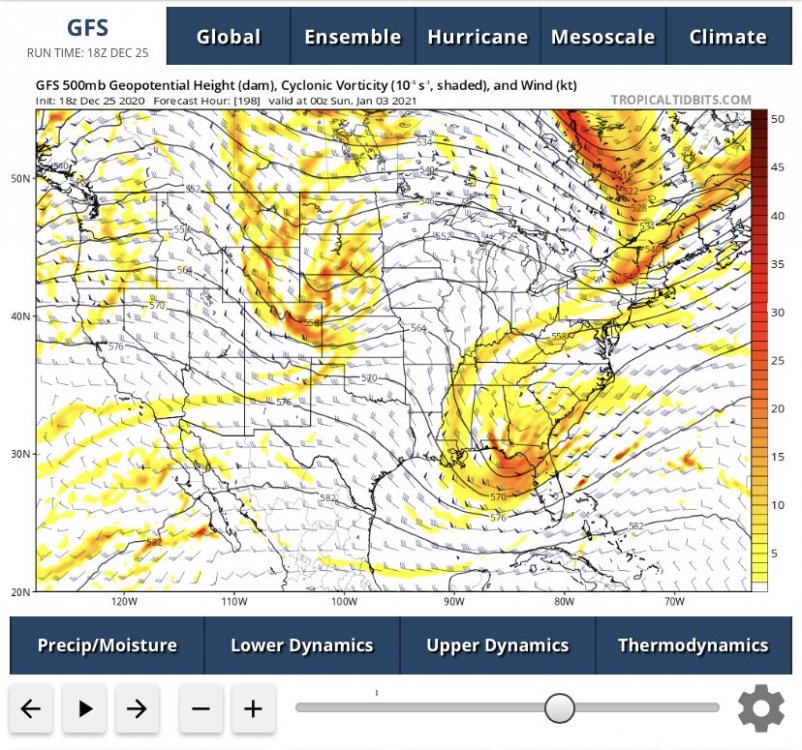
Piece of southern stream energy looks interesting a few days after New Years. In this run the phase occurs about 12 hours too late for widespread snow in the south, but it’s very close
-
I sure do love winter storms here and know the pain first hand of a near miss, but a very small terrible part of me does enjoy reading the MA forum when the inevitable inside the beltway screw job sets up for DCA... I can relate to those emotions too well
-
Eta is now the second highest ACE producing storm of the season. Pretty respectable for November 11
-
Convection has really collapsed on IR looks to be short lived at hurricane intensity
-
Any recon scheduled for Eta? Looks like the H word on sat even with the slight displacement of the center
-
There should be a pinned thread at the end of the year and awards given out for posts that aged the worst. Some of the ones from August complaining that the long range GFS not showing development meant 2020 was going to be a dud of a tropical season belong there as well
-
Some pretty decent footage from key largo last night. As I mentioned before this is evidence the system was very near a cat 1 when that core briefly wrapped up last night. Some of these winds certainly seem to be close hurricane strength. Doesn’t really matter but would’ve made for yet another hurricane landfall in the US during this crazy season. Certainly came close
-
Radar looks like the storm ramped up right at landfall and probably was near hurricane strength. Given the low topped storms, it’s unlikely sustained hurricane force winds occurred or mixed down effectively but it was probably close. Some gusts to near hurricane force were recorded. Key largo looks to have taken the brunt of that. Since then dry air choked off the core that had formed, a process we will likely see play out over and over again next couple days. Beyond that, guidance has definitely trended towards the storm missing the connection with the passing trough and in turn meandering and winding down harmlessly in the gulf as it feels the influence of dry continental air, shear, and decreasing SSTs. Still not certain but that’s been the trend overnight
-
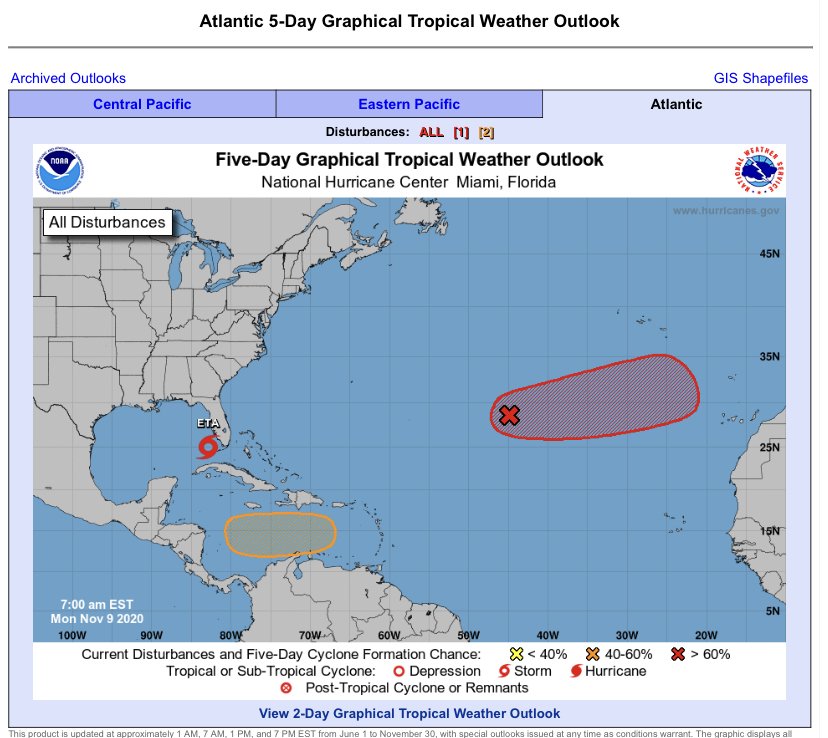
11/9 looking more like a mid-season tropical outlook
-
Resilient system aided by upper level divergence. Not bad for having dealt with 30kt of shear and having just crossed Cuba’s midsection. It seems reasonably vertically stacked. Might be extending our high number of US hurricane landfalls on the year
-
Now forecast to become a hurricane. Certainly seems reasonable. I am skeptical of the deepening shown on some of the models given the proximity to extremely high shear and dry air. It would really have to thread the needle