NorthHillsWx
-
Posts
7,653 -
Joined
-
Last visited
Content Type
Profiles
Blogs
Forums
American Weather
Media Demo
Store
Gallery
Everything posted by NorthHillsWx
-
I was in NE Georgia in Cumming for an ice storm 5-6 years ago and it didn’t get above freezing for two days afterward. I was working for Sawnee EMC at the time and we kept having trees falling in lines we’d just re-hung as the ice wasn’t melting. Trees probably fell for 48 hours straight. Some places up there were in the dark for 10 days. It was bad
-
Long duration overrunning events are my favorite tbh
-
Would be absurd to get a gigantic ice storm then cover everything in deep snow before we go into the freezer for a few days
-
Might have to add this to the archives of most ridiculous freezing rain maps I’ve ever seen. That’s lights out for 90% of the Carolinas
-
Map is too low for NE NC. I was there 2 days after the storm and there was still more than 4 inches easy in the shade after 2 days of melting and compacting
-
Honestly it can’t jinx me bc I’m out of it but someone should start a thread for this weekends storm since so much talk will be focused around next week’s threats. Statements like “Euro coming in more amped” are getting lost in translation as to which threat we’re referring to
-
EURO is a SW VA/foothills/mountains special Should clarify- for this weekend’s system
-
The more progressive solution is the game changer. If this trend continues, expect to see a less amplified system and the 850 line progressing nw. Wouldn’t call this a a NW trend, per se, but more of a weaker system and different setup
-
You may be in a good spot for this weekend. Definitely trending that way
-
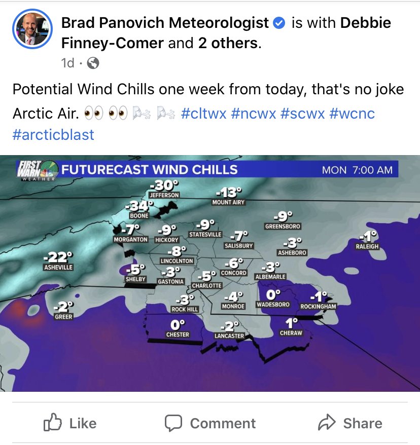
In wake county, during a period in which we were more or less guaranteed a below normal stretch with many Mets hinting at pure arctic air, our 850’s do not cool below freezing between Tuesday and and Saturday, February 13
-
You, sir, deserve a permanent front row seat in the whining (winning) thread after the last few years. Rough times down there my friend
-
They lied
-
Your positivity is appreciated but misplaced. No hope here, move along now
-
When ILM needs a cigarette, buckeye is speechless, and both grit and eyewall have something not depressing to say about this winter, something amazing has happened during happy hour. Only thing crazier would be Mack to jump back in this thread
-
I guess the GFS decided to reward us for sacrificing the three systems before
-
Need to save this run for the archives. Agreed, might be the best I’ve ever seen
-
And that is a big dog
-
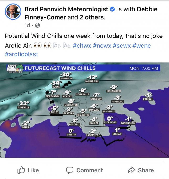
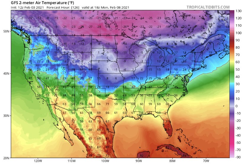
Almost always HP seems to be over modeled at this range. Still, even if it lowers 10mb that’s still a stout high. I doubt 1050+ actually happens. I bet this trends north. I’ll take the cold look though. That’s pure arctic ice air floating around Canada and spilling into the lower 48, geeze
-
Life comes at you fast
-
Can’t go much longer with the 8-10 day range threats staying that far out. We’re literally running out of winter unless we want to add sun angle and poor climatology to the list of factors working against us. Has the now or never feel this time
-
Average HP...
-
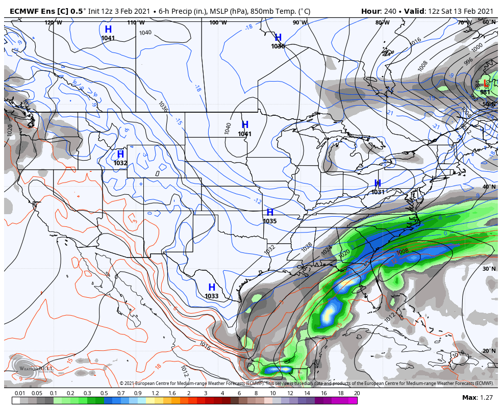
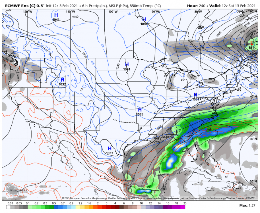
Feb 13-15 on the GFS looks like that one wild ensemble run from a couple days ago. Long duration overrunning event capped by the development of a NE GOM low and a 1055 banana high from the MW to the east coast. Sign me up! Only problem is the storm is more than a week away (insert laughs)
-
No cold air source for Sunday’s system. The issue exists in the mid and upper levels. That trough passing through the GL at that times keeps mid and upper level flow west to East, thus bottling up cold air from infiltrating. Storm track is good but it would need to slow down a lot for anything to happen frozen. Essentially, it would need to phase with that mid level energy or allow it to pass by for us to have any shot of cold air becoming involved. And that would need to be a situation of the storm producing its own cold air in the best case scenario. There is no high to force lower level cold into the area. I hate to say it but Sunday’s system is DOA even if it tracks perfect with the mid and upper levels so screwed up
-
27 for the low. Sitting at 30 with brilliant sunshine currently
-
Yep. Par for the course here. Pretty crazy to go from a high below freezing on Monday to a high in the 50’s. Hell the low on Monday may not even get below freezing. GFS is special