NW_of_GYX
-
Posts
1,025 -
Joined
Content Type
Profiles
Blogs
Forums
American Weather
Media Demo
Store
Gallery
Everything posted by NW_of_GYX
-
I guess I’ll out myself as a flatlander. I grew up in central CT a good long while ago and learned to ski after school at powder ridge when the night skiing scene was strong there. I still get down that way for friends/family and for the annual ESC enduro mountain bike race at powder ridge. It’s great to see that place thriving again. I’ll never leave NNE but central CT gets an unfair reputation. It was a great place to grow up, had some good winters there during my childhood. Have many friends who are raising kids in that area and it’s still a great place for that. And the food and cultural diversity is on another level. The food in NNE sucks so bad outside of a few isolated spots. I also happened to be back in that part of CT for Nemo while I was helping my dad with a move. Still one of the top 3 craziest weather events of my life. We don’t get snowstorms like that here.
-
And yes, having a hill that’s really for “locals” is fantastic. So many kids on the hill etc.
-
Ya this one’s a bit bigger than mt southington or powder ridge but those are great local spots for central CT folks. It’s not really that “little” just in comparison to our neighbor at Sunday river. It’s bigger than cranmore.
-
Yes it’s been changed back to its original name. Great little hill, especially when it’s 10 min from the front door. This is a great area year round.
-
2”. Puts me at about 83” for the season. That’s basically climo for me. Maybe a few more chances in April to get above for the season. This was a weird season but a good one, and the skiing has been the best in years. Even the local hill here is still buried and I’m looking forward to another month + of skiing around NNE. .
-
Ya this thing was a shredded mess, next
-
Back to weather, looks like a wintry week ahead and I’m here for it. The mountains are loaded with snow still.
-
The problem is all these places are becoming 55+ retirement communities. I love when COVID retirees who paid cash for their house which used to be part of the workforce inventory complain about there being no restaurants open Monday-Wednesday. Not even the retirees want to live in retirement communities, go figure. That combined with the obsession with “outdoor recreation economic development” a la East Burke which just drives up the cost of housing even more and drives out local people and families. And then those same retirees who moved here for “access to lakes and trails” fight tooth and nail against any new housing developments etc. NNE is in deep trouble looking ahead.
-
Lots of time but I wouldn’t expect much more than a sloppy few inches for coastal areas. With that’s said the bulk of the qpf falls at night so that should help. The gradient for advisory/warning snows looks to set up somewhere near me. EPS looks good with the transfer. Fun to be tracking in late March, it’s been a while. No complaints here.
-
For SNE yes, not here.
-
Ya ptype issues will be a thing for my area but whites Mahoosucs and Longfellows are going to cash. Loaf is the place to be in these late season patterns.
-
Hopefully right into a cool wet summer, I’ve had enough of the past three summer dust bowls
-
The more late season snow the better, starting to scare away all the people who moved up here doing COVID
-
Let’s go. You know you want more
-
Ya people have been getting after it in the spots less prone to wind loading and associated instabilities. Before this last storm there was a really nice stable snowpack in many zones. Skiing is just getting started in the alpine.
-
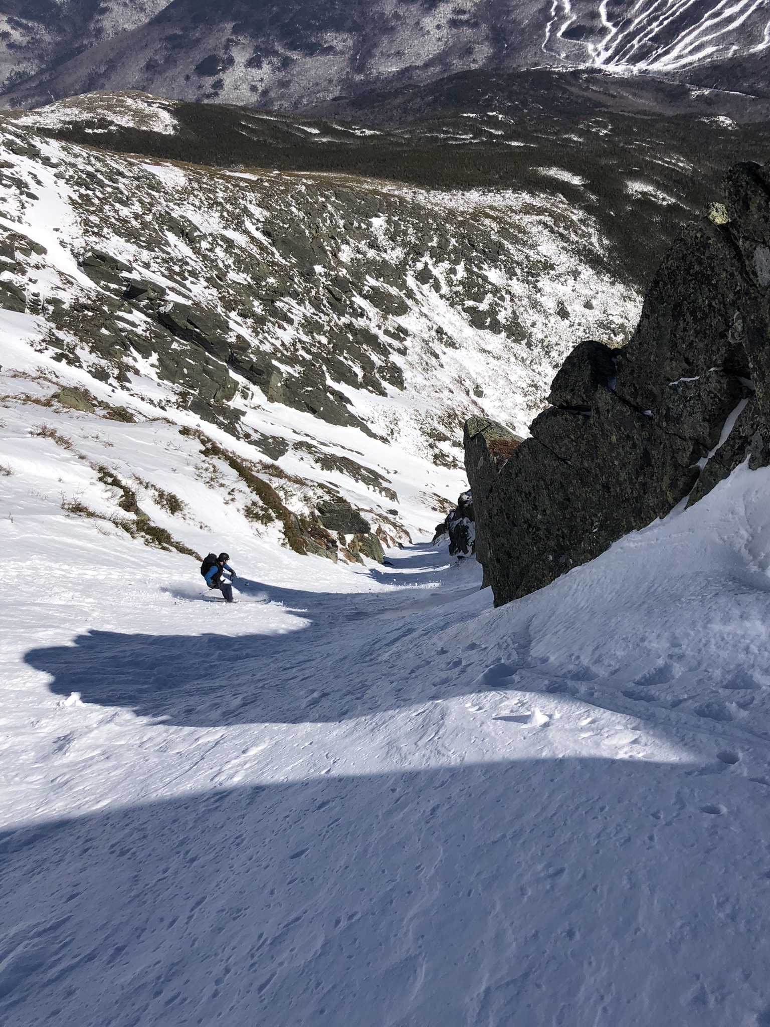
There are ski descents happening this year in the whites that haven’t happened since 2019 or earlier. Yale Gully for instance, which we were lucky enough to ski this weekend. As is typical though a lot depends on wind, and there’s been no shortage of crazy wind this season. Dodges did not look filled in at all for some reason and I’m not hearing of many folks skiing ammo or the west side. Wildcat valley trail was as good as I’ve ever skied it two weeks ago, but on that same day the skiing on the frontside was wind blown and not good.
-
Wow, wildcat reporting 29”
-
80” for the season after yesterdays 5”. One more advisory event will get me to average more or less.
-
Just got off the hill where it was 6-8” above 800’ or so.
-
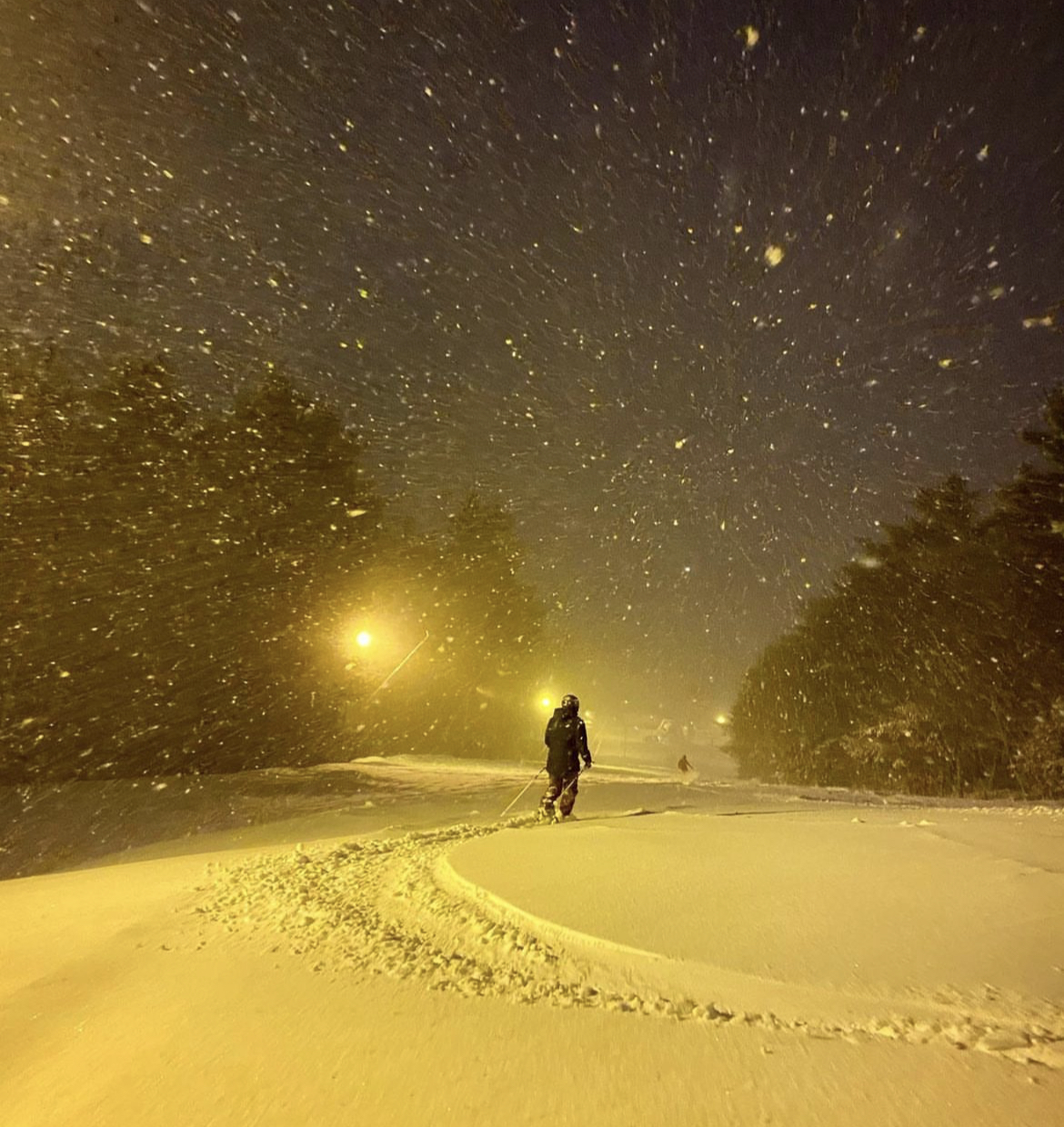
Been puking here for past 3 hours. Just did 5” in that time, so over 2” per hour rates.
-
Finally starting to crank here, let’s see what we can do over the next 4-6 hours
-
Same here. Forecast bust?
-
About as good as it gets on the rock pile yesterday. Was lucky everything lined up and got into Huntington Ravine for Diagonal and Yale gullies.

-
Lol that’s my old UPS guy Jacques, hope he’s doing well
-
Jay was great mid winter skiing today, glad we made the trip over. .