

Kmlwx
-
Posts
13,203 -
Joined
-
Last visited
Content Type
Profiles
Blogs
Forums
American Weather
Media Demo
Store
Gallery
Posts posted by Kmlwx
-
-
58 minutes ago, ge0 said:
Saw it last night. Pretty neat. Is this over or will there be more tonight?
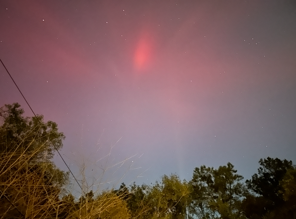
Yeah - @SomeguyfromTakomaPark said - it'll likely be limited to G1 to G2 level "storming" tonight. Last night was definitely the show. Now we turn our eyes back to the sun for more activity. The solar disk looks a bit more quiet right now - but that can change in a hurry!
-
 1
1
-
-
8 minutes ago, Interstate said:
But in my 48 years of life. I have never seen such vivid colors like last night. Is there more than meets the eye here?
Similar to how we all salivate and wait for a 30+ inch snowstorm...a well timed series of strong flares all with CMEs (the May event I think was a bunch of M-class flares in quick succession) would be a good bet for having a huge storm. It's obviously more complicated (Bz has to be tipped to the south I believe) but the basic building blocks is we want a HUGE CME or better yet a series of them. Often times the first CME will "clear out" space ahead of it leading to the subsequent CMEs (even if weaker) overperforming. It's rare - but if there was ever a time during the sun's 11 year cycle to watch - it's now.
-
I don't think it's unreasonable to say there could be more solar storms of this magnitude before this solar cycle winds down. It seems like for years all of the sunspots would hurl CMEs on the farside only - our "luck" has changed seemingly. While there hasn't been prolific amounts of high M or X flares - there have been a few very well timed ones.
-
-
7
-
-
It definitely surged again the past 15 minutes or so!
-
8 minutes ago, WxUSAF said:
Crazy how bright it was with twilight still present!
I'm shocked at that aspect as well. Would have expected it to be brighter now. Goes to show how space weather is.
-
6 minutes ago, SomeguyfromTakomaPark said:
I thought it was the sunset!!!! Then I was like oh crap the sun is gone.
I kept telling myself the first "sheet" that flew in was a cloud with the sunset bouncing off of it!
-
It has definitely died off a bit. It will likely ebb and flow - HUGE thanks to @WxUSAF - as soon as I saw your picture I went out. Had I been a few minutes slower I likely would have missed that first surge.
-
2
-
-
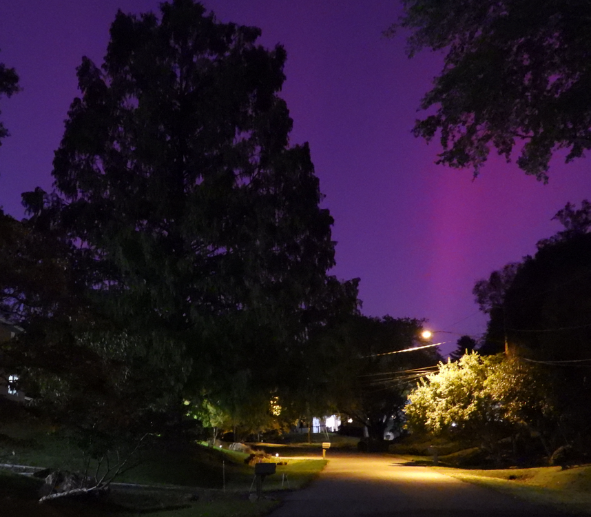
Every other time - save for maybe a tiny peek - I have fallen asleep or a storm has failed. This is wonderful. Savor this folks!
-
2
-
-

-
2
-
-
-
3
-
-
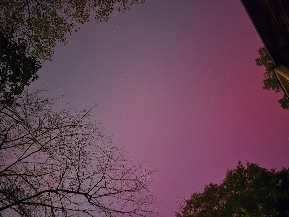
Sooo cool!
-
2
-
-
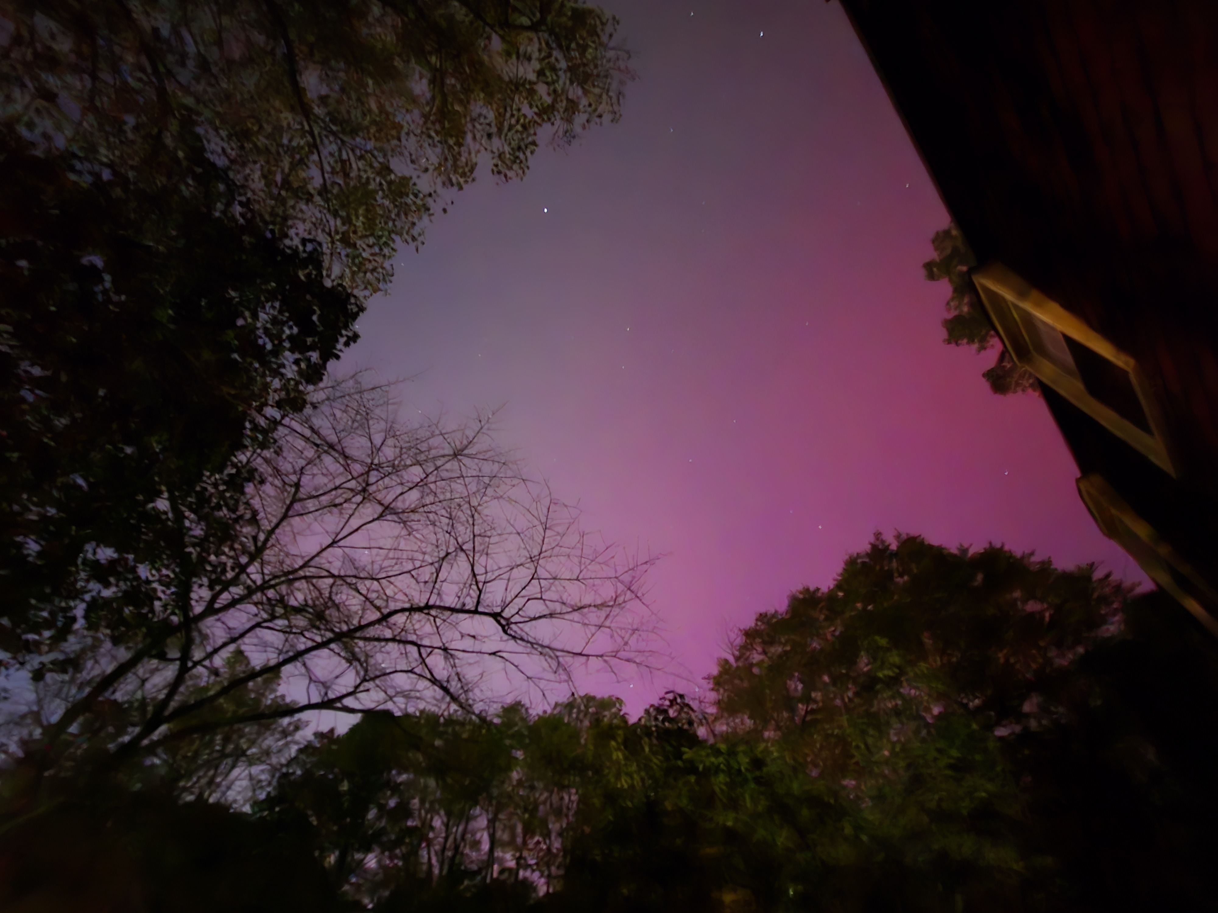
Another M7.7 flare it looks like. Again it looks rather impulsive rather than drawn out. We'll see.
-
11 minutes ago, eyewall said:
Could add to the main one though. We shall see! May 10th was all M flares stacked up.
Keeping an eye on imagery to see if there's any faint halo CME with the most recent impulsive flare. That sunspot bears continued watching!
-
1
-
-
28 minutes ago, WxUSAF said:
Tomorrow and Friday nights I think
Tomorrow night seems like the best shot. Think that by Friday night the storm will have subsided unless more activity erupts. Space weather is so fickle, though.
Let's hope the storm onset and peak holds off until we are well after dark tomorrow evening. Would suck to waste daylight hours on Kp7-9 values. -
Another X-class flare. But this one looks (at least preliminarily) to be more impulsive. Probably a lower chance of a CME with this one. But who knows. The existing CME from yesterday is still coming.
-
If this pans out - the weather looks spectacular for visibility of any geomag storm
-
1
-
-
1 hour ago, Eskimo Joe said:
My wife's cousin in Sarasota wanted to leave town but their work sent a memo out saying they aren't closing. I really, really hope this isn't the mindset of most businesses down there.
They should be held criminally responsible if any of their employees are injured, killed or otherwise harmed.
-
2
-
-
3 hours ago, WxWatcher007 said:
Exceptionally late start to CV season, but it looks like it’s underway.
Heck...maybe out seasons are shifting a bit. We all have mentioned that winter seems to start later and later but hang on later as well...fitting that hurricane season would follow that pattern.
-
I wonder if they are going to do rapid center fixes until the Air Force plane gets there.
-
1
-
-
38 minutes ago, mattie g said:
I think it's going to get to Category 7. Lots of hot water and all that kind of stuff. Could be wrong, but I think I know enough to make a bold call.
Bearish. Why not just go with Cat 10?
-
6 minutes ago, 09-10 analogy said:
I have an issue with water seepage in my basement, and am a firm believer in the superstition that if you mention something unpleasant enough, it won't happen, so every time there's a heavy rain, then like Pavlov's dogs, I drool "June 2006."
The weather just likes making a mockery out of us amateur forecasters and such. If I tell my friends 2-4 inches of snow, it will either be nothing or 6+...if I tell them thunderstorms, they'll all miss. Always the same. We have a pretty toxic hobby
")
-
6 minutes ago, H2O said:
Woke up to some decent rain
Name checks out.
-
2
-
 5
5
-
-
21 minutes ago, 09-10 analogy said:
Yeah, usually this kind of overnight activity is one and done. This is the third period of heavy rain in an hour or so. I think this is related to the PRE to our south that's setting the table for the dangerous flooding in the southern Apps from the tropical system. I'd call it a PRE here but it seems decidedly uncertain at this point just how much of Helene's remnants affect the *immediate* DC weather.
Seems a little less dramatic than it looked earlier. But it was still coming down pretty hard on my morning Dunkin run.


Aurora Alert
in Mid Atlantic
Posted
100% agree. Plenty of time at/near solar max remains. And it doesn't have to be a Carrington-level event to get us with great auroral activity. Heck...even a series of modest M-flares can have a cumulative effect larger than a single X flare. So many variables! Tough enough with Earth weather forecasting. Solar weather......no thanks on having that as a profession!