

Kmlwx
-
Posts
12,582 -
Joined
-
Last visited
Content Type
Profiles
Blogs
Forums
American Weather
Media Demo
Store
Gallery
Posts posted by Kmlwx
-
-
Also - the stuff over the KDOX radar area has more convective looks to it. Wouldn't be surprised if there are some brief spinnys or gustnados with that stuff.
-
 2
2
-
-
Just now, dailylurker said:
The wind is getting noticeable stronger here in AA County. I live in a wooded area. It goes from calm and silent to hearing a gust coming through the forest from the SE. It's becoming more frequent and stronger.
Will certainly be interesting to see how the wind forecasts fare. On one hand, the storm is weakening...but there is still that pressure gradient and the system will be getting closer.
-
10 minutes ago, Eskimo Joe said:
Pretty ho hum so far. Hope we can manage another round of sustained rain this afternoon or a lot of these rainfall forecasts are in trouble.
KDOX radar and the eastern side of the KLWX radar scope seems to support heavy rain incoming in the coming hours. We'll see how it rotates in and if it sustains.
-
2
-
-
-
Outages around the area are definitely higher than earlier - but really nothing significant. We'll see how things fare as we get into the afternoon as the system works its way up towards us.
-
1
-
-
Overall lull in a lot of metro area - still rainy but definitely not as intense as earlier. Looks like stuff will rotate up from the lower bay area and eastern shore.
-
Really good day to just hunker down and play board games or watch a movie/binge watch a series. Dreary/rainy out there.
-
3
-
-
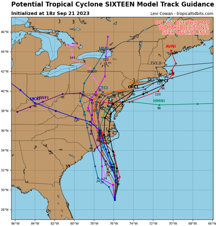
6z GFS has a weird low hook into the coast after 200hrs. Wacky!
-
1
-
-
Thought I was going to get a lull but it's filled in over PG/Calvert/Charles - really coming down out there!
-
4
-
-
TEAL72 is up out of Keesler for the next recon stint.
-
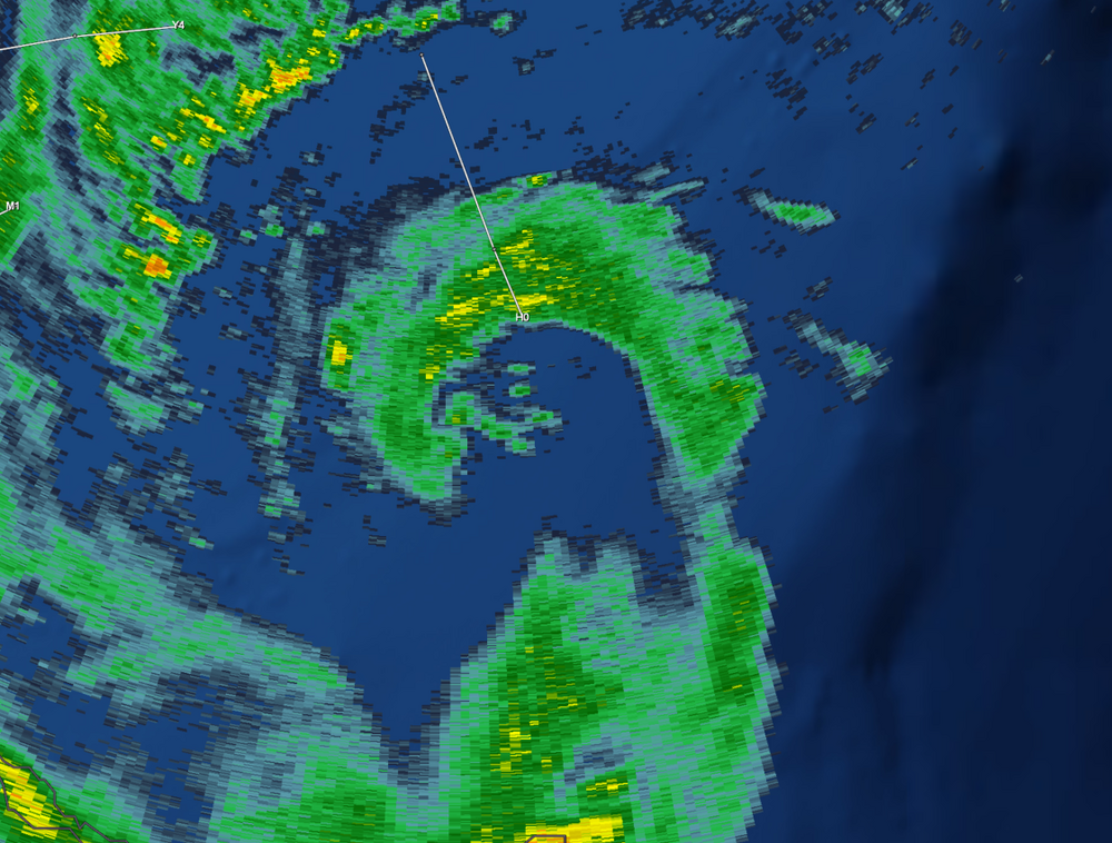
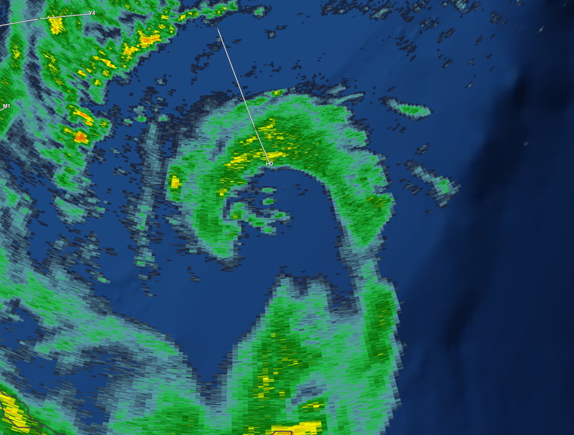
Has evolved pretty nicely in a short amount of time, actually.
-
5
-
-
Maybe an eyewall trying to form? Some lightning in there as well!

-
3
-
-
1 minute ago, Kmlwx said:
Gusts, not sustained I believe
Also due to it being in transition by the time it gets up here.
-
3 minutes ago, Random Chaos said:
Little surprised that there is not even a Tropical Storm Watch for the northern Chesapeake Bay. Most of the models are predicting 35-40mph-winds.
Gusts, not sustained I believe
-
1
-
-
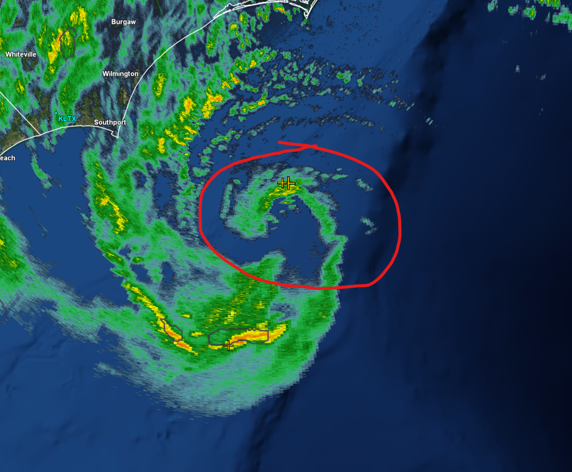
Did the center go/reform SW?
-
 at the guy in the tropical forum thread saying that the shallow shelf waters were upwelled by Hurricane Lee wtf!
-
1
-
 5
5
-
-
19 minutes ago, LongBeachSurfFreak said:
Shorter window than you would think. It has a few more hours to play with the Gulf Stream before it hits the shallow shelf waters. Those waters were significantly upwelled during Lee.
Did you forget where Hurricane Lee went?
-
2
-
-
1 minute ago, TSSN+ said:
Convection trying to wrap the center
Great sat pic! Imagine if it had some more time to get going.
-
1
-
-
-
Just now, H2O said:
I can see the backend already
Stop summoning Ji.
-
1
-
3
-
-
Well and also discussions from NHC indicate it will get some baroclinic help. Not a "typical" system or pure tropical by any means. So if folks are looking at satellite and expecting a warm core red-meat beast - they going off of incorrect information.
-
4
-
-
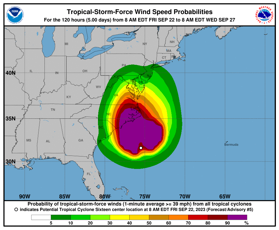
Apologies if posted already - getting caught up -
-
7
-
 2
2
-
-
1 hour ago, BristowWx said:
If it was January with that low track of the GFS for Saturday...there would be some large Bob Chill emojis and the words DC crushed and anihilated would be needed
The low is pretty far west...probably a lot of pinging if not 33 and rain
-
1
-
-
37 minutes ago, Eskimo Joe said:
I was looking at yesterdays run
 . This is what I get for trying to start a cloudy Monday with no coffee.
I figured as much
- Mondays really suck. At least we likely will have *something* tropical to track probably

Tropical Storm Ophelia—Tropical Storm Warning for Coastal Mid-Atlantic
in Mid Atlantic
Posted
DCA gusted to 30 knots.