ORH_wxman
-
Posts
93,099 -
Joined
-
Last visited
Content Type
Profiles
Blogs
Forums
American Weather
Media Demo
Store
Gallery
Everything posted by ORH_wxman
-
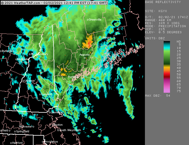
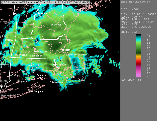
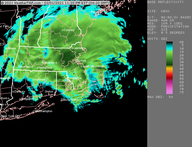
Yeah the CF was basically right there just to his east. In this case, I think being a little further south was better for being into higher QPF so that is why places like Wilmington, Lowell, Littleton, Bedford, etc ended up doing a little better. It was a matter of slightly more precip from the firehose.
-
That happens in most large events. Though arguably to achieve true top dog status, you want at least an 18 hour event...that is what usually puts it over the top from like a 15-20 incher into a 2+ footer.
-
Depends what model you believe....it might never occur or it could occur tonight or tomorrow. ULL doesn't lift north of us until tomorrow night so any one of these litle vorticity spokes rotating around it underneath us could potentially fire off some snow showers....but nothing is guaranteed.
-
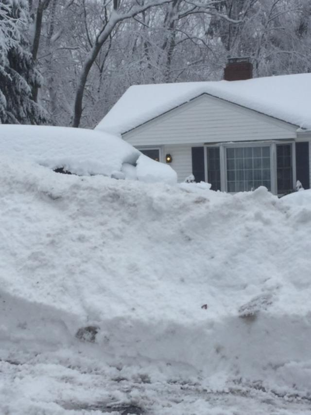
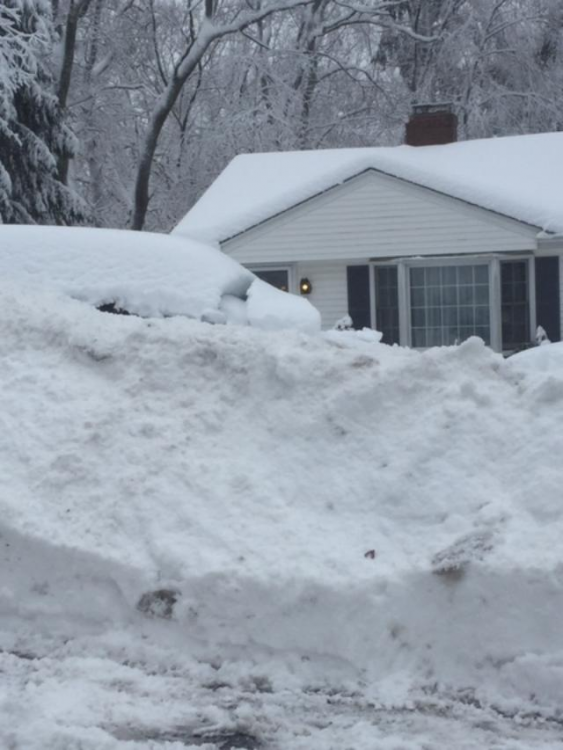
My Ariens was worth its weight in gold today....took some work, but it crushed the waterlogged 3 to 4 foot snow banks on each part of my horseshoe driveway.
-
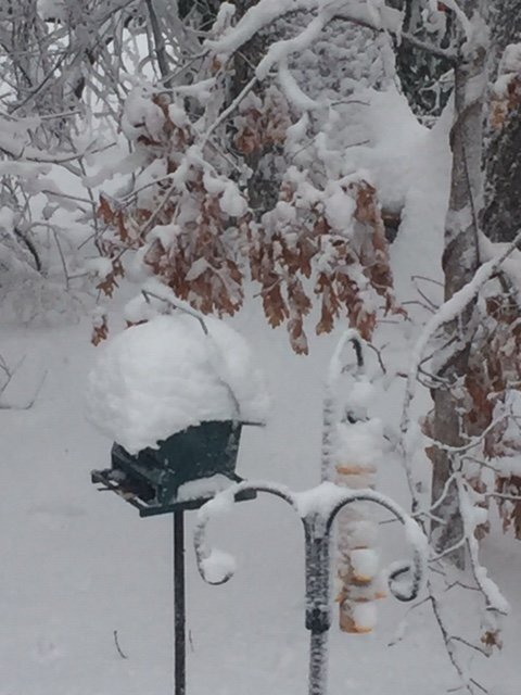
Just finished cleaning everything outside (cars driveway walk deck etc).....what a ridiculous pack this is. Total depth is around 18" and it has some MEAT to it. We basically had the equivaent of sheet drizzle (except it was snizzle that accumulated a few tenths) all morning that just added in liquid equivalent into the pack without really changing it. All the paste froze just enough to cling to everything with temps hovering around 29-30F after the CF sunk back SE around 4am. Too bad the currier and ives stuff doesn't look like much now. It would be perfect to get a couple inches of fluff on top. But who knows, ULL to our south typically unpredictable so maybe some bands delivers for a large area.
-
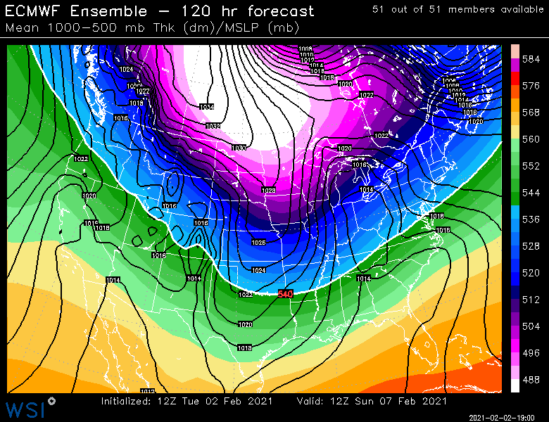
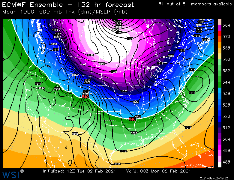
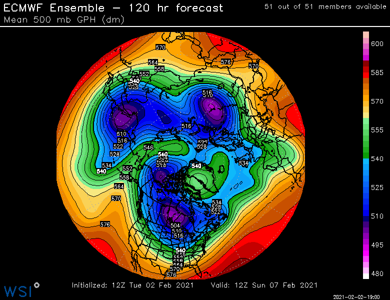
I'm not sure this is really a Miller A...I guess it could be one if it becomes strong enough down south....but the ensemble mean is almost more of a B look....the OP run was def a Miller A, but if this comes in a little flatter through the TN valley, then we're looking more B-ish or at least hybrid ala ensemble mean,.
-
I've seen worse looks at day 5 on an ensemble mean....I kind of agree with Tip that this has a fast mover look to it....the NAO block sort of compresses the flow's ability to have a lot of downstream ridging...so you pop this coastal off the Delmarva or ACY and it screams NE. I suppose if the trough dug enough, it could try and stemwind briefly, but it eventually would get shot ENE somewhere up the line with that downstream blocking look.
-
Euro clips SNE with a fast mover on 2/10 as well.
-
Can barely see the back tree line on your cam. Now that's what I'm talking about.....Nice.
-
Shawnee peak area/Bridgton to Sunday River over to Phin is getting smoked
-
I finished with 17 as well, though my "new depth" was more like 15.5.....you prob beat me by an inch or two if you measured new depth of 17. Your area looked slightly better than me last night. BTW I saw a pic from a coworker in Millis and they literally got like 7" of slime. I cannot believe that gradient. They are like 5-7 miles from me....lol
-
You should know by now that we don't pay back the coast on the east slopes of the ORH hills. We just steal snow, and then when the coast gets smoked, we sneak into the club when the bouncer isn't looking.
-
Cory just smashed his accordion using his Kocin book as a baseball bat.
-
Man, that stuff pointing toward Maine SE of PWM looks impressive.

-
Yeah the smaller battery ones are good for the 6-10" blower powder snows. For a compound like that up there, I'd prob have a heavy duty one and then a little smaller one that can handle all the small to moderate powder events you get.
-
Nice man....the Randolph magic finally showing through.
-
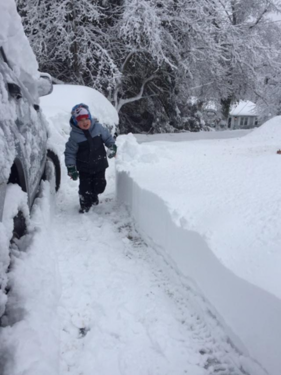
Man snow...epic snow banks. 2nd pic is my oldest following my snow blower track
-
Had an additional 1.5 overnight for 17. New depth is more like 14.5-15 (total depth 18ish)....that paste at the end plus several tenths of very dense snizzle on top is definitely helping compact things. This pack is ridiculous now.
-
Last few hours were paste after blower powder in the first half.
-
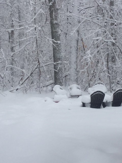
Buried

-
This one was a bit unique in that it had a really good sig on the north side of the ML warm front. That firehose basically getting lifted over the top of the temp gradient...pretty good recipe for big time rates that can sustain for several hours rather than relying on putrid decaying mesobands.
-
Fatties have recommenced in this stuff after it went to really cruddy flakes for about 20-25 min
-
Nope...not in the NW and W suburbs/exurbs it didn’t. Definitely an old school 128 to 495 storm. Looks like about 15.5” in Holliston...though honestly it would prob be 3-4” more if the snow didn’t fall “in the wrong order”...it was absolute 20 to 1 blower powder for the first half of the event and then it went to slightly denser but still powdery snow...and finally it went to paste. That prob helped compact things down quite a bit despite the insane rates. Hopefully we limp home with a few more.
-
Looks like Methuen is getting hammered at the moment
-
I really thought you’d get like 6-8”. Like a Slightly better version of 2/13/14...but just a smidge too much marine influence i guess. Kind of sucks this one couldn’t be a few degrees colder so that there were fewer screw zones.