

ORH_wxman
-
Posts
93,092 -
Joined
-
Last visited
Content Type
Profiles
Blogs
Forums
American Weather
Media Demo
Store
Gallery
Everything posted by ORH_wxman
-
Euro suggests a pretty nice band near BOS back into N RI in the latter stages. Could be several inches if that panned out.
-
Yeah that changed quick
-
Black hills might be even better. Lead, SD FTW.
-
He cheers on torches that kill vulnerable people in the summer.
-
Yep. It’s also like in cutters he tries to turn them all into Grinch 2020 storms and melting snows to Quebec when 99% of them don’t do that. He knows he’s making it up but he just does it to get responses.
-
There were multiple big snow events after mid-month in 1977. Then of course there was the infamous May '77 storm too....but the 2nd half of March '77 was very snowy. Who lknows, maybe we'll follow a similar path.
-
Old record at ORH was 66F in 1977. Smoked that one pretty good. 3/11 was vulnerable for a lot of stations, so plenty of records today.
-
It's actually two storms on the GFS. Back to back.
-
3/16-17 making a comeback on guidance. Still gotta watch after that too near the equinox.
-
No, it will be more like Wilmington gets 10-14" of paste, ORH gets 17", and Methuen is outside the best rates and gets 4" of slime that slides off his windshield during the event.
-
Yeah prob about a week to perhaps 10 day window there.
-
Yeah some spots there have their snowiest months in March/April.
-
DSD today.
-
Yeah maybe...it depends where in the yard though....where I measure is down to like 2-3" but there are shaded spots that still have over half a foot. I think that 2-3" will go today. There are houses in the neighborhood that have 100% full pack in their shaded yard and it looks at least 6" deep, lol. Typical uneven March melt-out.
-
Looks like my snow depth is going to go to zero today finally...well maybe a "trace" since as long as you have patches in the yard, that's a trace. There has been continuous snow pack since January 26th, so a pretty good run. We had continuous from Dec 9th through January 12th in 2017-2018 so this beats that stretch. Have to go back to 2015 I think to beat this 43 day stretch. The previous 5 years have not been good pack winters. We had longer stretches than this in 2008-2009, 2010-2011, 2012-2013, 2013-2014, and 2014-2015.
-
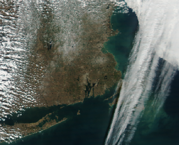
This is the week after the 2013 firehose storm...there were a couple torchy 50F days afterward which receded the snowpack, but it's interesting because you can see that secondary jackpot area still SW of Boston
-
I was working in BOS on 3/7/13....took the train home. Accumulations were noticeable once past 128 in Wellesley, and by the time I got back to ORH, there was about 4-5". But nobody thought the 20"+ amounts were happening even that evening. I was still on the 9-14" bandwagon. The firehose just went insane after midnight it was like consistent 1-2" per hour for the next 8-10 hours.
-
Yeah if we could have snuck that 1/3 storm into the picture and had it be a solid warning snowfall, the entire tenure of the month would have changed. That pack would have stuck around for the next 3 weeks until 1/26 replenished it and then going off to the races in February.
-
This is Bretton Woods at its finest...you could maybe add in a similar day later into March or April when temps are around 40-45ish at the base and you have corn snow going on. But these bluebird days late in the season make the presidentials stand out so much. Almost blinding to look at without goggles or sunglasses.
-
ORH is still due for more regression.....they had nearly 120" in 2014-2015 against their annual average of 69.1" Since that season: 2015-2016: 47.2 2016-2017: 78.3 2017-2018: 96.1 2018-2019: 51.4 2019-2020: 44.9 2020-2021 (so far): 70.7 Mean: 64.8" So they are running a little below average (mean could still come up with additional snowfall this year), but not nearly enough to offset the good times.
-
March 2020 was pretty boring until the 3/23 event.
-
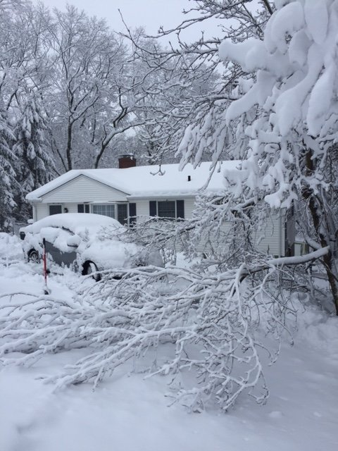
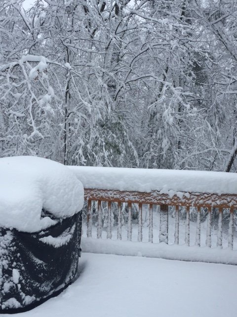
Yeah Ginxy, we lost power for 3 days in that one. We had about 12” of grease...even at the bottom of the hill was more like 9-10”. Noticeable elevation gradient
-
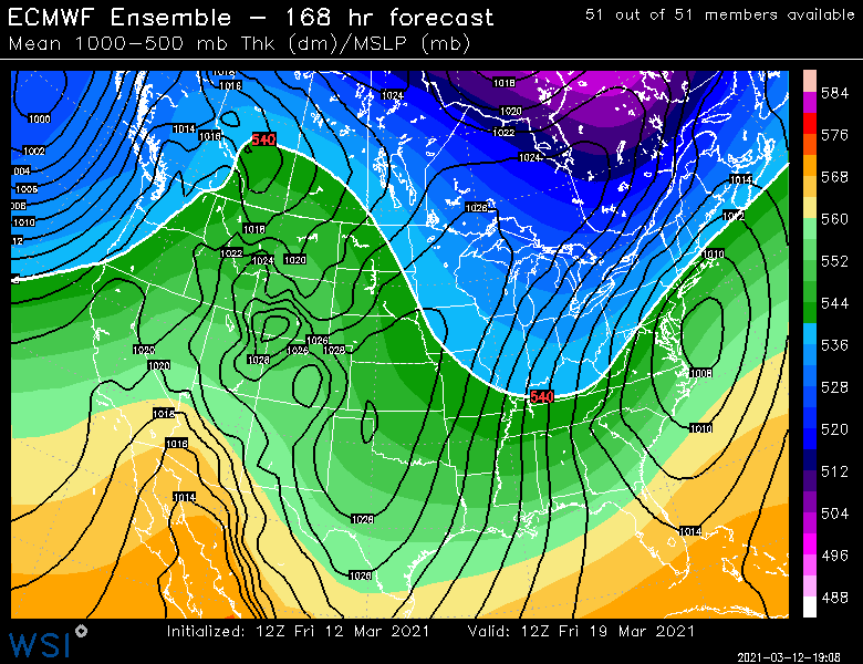
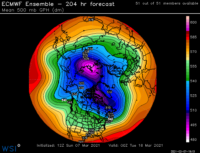
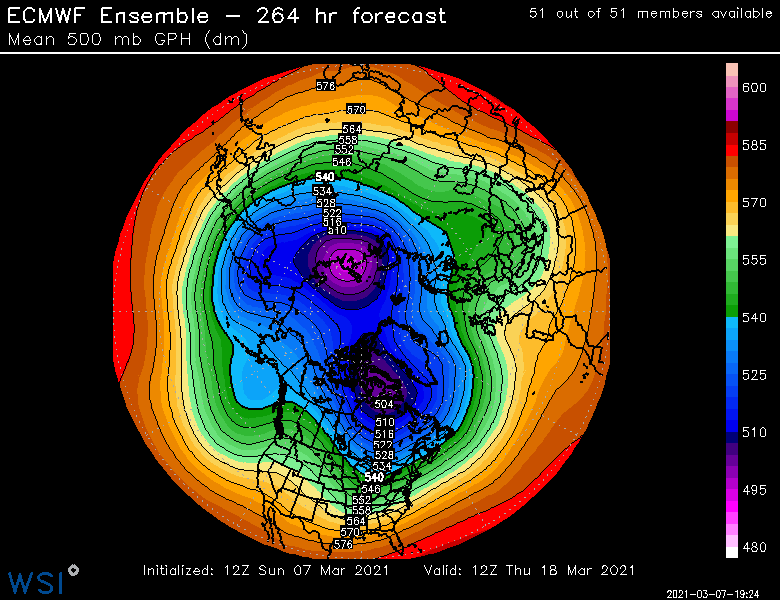
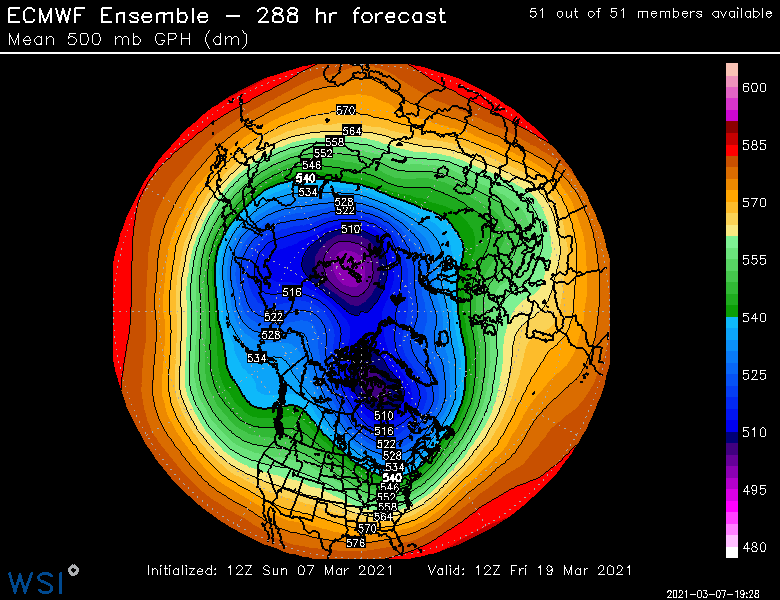
FWIW, EPS still looking interesting post-ides. This is prob the first “chance”. OP wasn’t loving it but EPS shows how it could success...sort of like how the GFS does it. You have a southern stream wave on the heels of that northern stream cold shot. Time it perfectly right into that cold airmass The other chances would likely come a few days later when it tries to go more classic western ridge/eastern trough look
-
Yep we got smoked by that derecho here on 10/7/20. Lost power and some trees came down in the neighborhood. But obviously that was kind of an odd setup being so late in the season. Not your classical “severe season” set up. Definitely aided by stronger kinematics in October.
-
Severe season is easy in SNE. Almost always expect under performers...a few EF0 warm front spinners, maybe a rogue EF1 and then a lot of marginal hail and rotting branches down from 40 knot gusts. About twice or three times a decade we get a real sweet setup. We’re like the mid-Atlantic coast for snow events when it comes to severe wx. Hopefully you get to chase out in the plains.


