ORH_wxman
-
Posts
93,095 -
Joined
-
Last visited
Content Type
Profiles
Blogs
Forums
American Weather
Media Demo
Store
Gallery
Everything posted by ORH_wxman
-
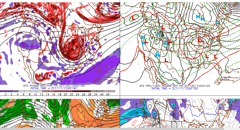
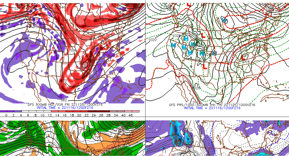
I mean from a pure synoptic standpoint, it doesn't get more classic than that look....you have the confluence to our north from the 50/50 low...split flow over central Canada and a very powerful cutoff shortwave in the OH valley with a western ridge to give it a little room to dig....too bad it's 8-9 days out

-
That shortwave is on 'roids....could be a crazy solution. 8-9 days out though.....
-
Trough digging too much that run anyway....gonna spawn a low near Houston, lol.
-
Models are going to swing a ton on a day 8-9 threat....why all the hand-wringing? We used to barely even look beyond D6 on deterministic solutions. GEFS def seemed to have the better idea over the EPS though on the pattern late next week.
-
GEFS also shows the system.....D8 though so no use in getting too invested

-
Couple chances for flurries/snow showers elsewhere too....two solid vort maxes move through. First one later tomorrow and then another on Sunday. So those who didn't get first flakes a couple nights ago have a chance this weekend. Could even see some today too, though the latter two days look better.
-
Yes frequently a 50/50 low can just be a PV lobe that sets up shop there.
-
Good base builder. Hopefully it stays on the mountain. Just need to avoid a cutter next weekend and it might.
-
Yeah the town is great. You can walk anywhere in town which makes it super easy. Lots of places to eat and grab beers. I like the old hotel in town. Has a great bar.
-
Telluride is awesome. Did it in early January 2016 after they got croaked with several feet of snow in late December 2015…we had a couple refresher type snows while I was there (like 2-4” type deals). It was quite cold though when I went. They have some super gnarly terrain if you want it. You’ll prob have much warmer weather being March unless they have some big cutoff over then, then it will be frigid, lol. We stayed down in the actual town which was fun to ski down to at the end of the day…going right down the north face.
-
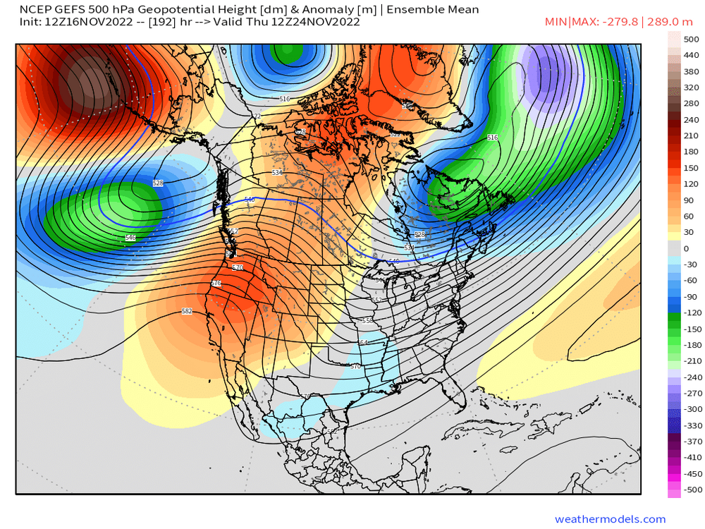
Yeah that pattern with the poleward Aleutian ridge and some major weakness in the NAO/AO region is something I like to see heading into December.
-
EPS is def a bit colder out in clown range than last night's run. Aleutian ridge quite a bit more poleward which in tandem with the -NAO/AO is a pretty good pattern for winter threats. Definitely not a lot of consistency on guidance out in the extended as Scott said. That decaying block in the Baffin region will have to be watched....sometimes they can be stubborn. A similar type block helped out on a few events in Dec 1995 when the PAC was kind of meh.
-
Euro still not biting on the GFS/GGEM type push of cold prior to Tday.....keeps it north of the Canadian border. It did trend much better with the blocking, but it wasn't enough on this run.
-
Euro and GFS were pretty darn close inside of 36h...but I'd say the GFS was prob worse at like D3 and 4....it was flatter than a lot of guidance.
-
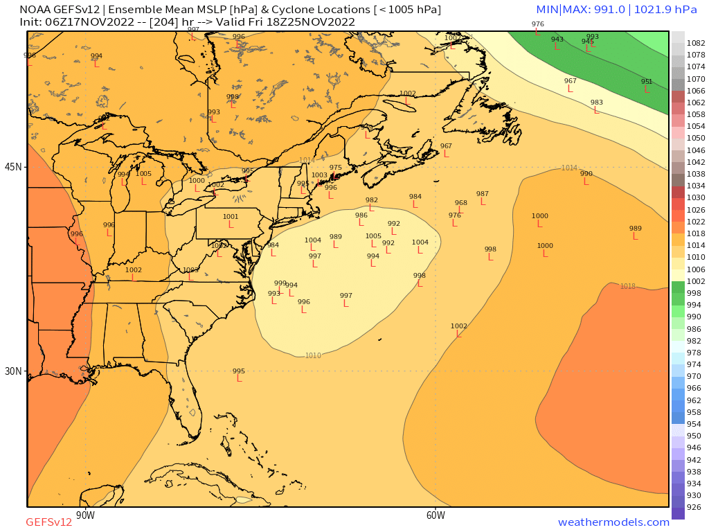
Here's GEFS....def agrees with the OP. But you'd like to see more guidance on board before thinking more wintry solution for Tday weekend. FWIW, GGEM did trend quite a bit toward the GFS suite, but not all the way there.
-
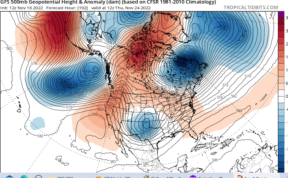
Yes....the remnant EPO/PNA ridge sort of teams up with the reotgrading NAO block and forms a ridge-bridge right in the Baffin Island/N Davis Strait region.....it presses that PV lobe down into SE Canada....below is the look on Tday on that run. This is what sets the stage for the winter wx. If we don't get that, then it will be pretty mild like the Euro.....night and day solutions.
-
Yeah you have the cold firmly established prior to the system getting in here. That's a classic long duration overrunning look there. Probably not gonna happen, but that is what you want to see for those looking at model guidance for next weekend if you are trying to get a wintry system in here.
-
GFS is showing the colder Tday and beyond solution....you can see the overrunning setup there with the classic Scooter high from the Canadian prairies sprawling east. Euro does not show this though....this is where the model disagreement is on how much that cold presses south.

-
With really weak sun angle now, I wouldn't be surprised to see a lot of local ponds with ice on them by next Wednesday. Even when you're hitting like 38-41F during the day, it's only for a few hours and you have a lot of shade now these days at 2-3pm with the low sun angle. Then you're going 18-25F at night for 10+ hours.
-
Higher terrain in SNE may struggle to hit 40F for the next week after today. Full on winter in NNE...esp at elevation. Should be plenty of Tip's pond ice (albeit thin) by middle of next week. T-day and beyond still kind of a wildcard on model guidance. GEFS looks MUCH colder than EPS for Tday weekend. So we gotta see how that unfolds over the next few days on model guidance.
-
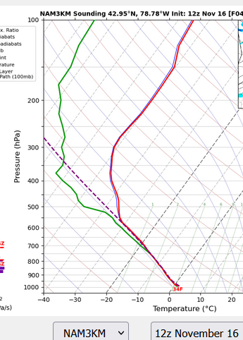
The NAM warm layer was like 10-15mb thick....lol. It didn't really make a lot of sense. It was something that could get wiped out anyway with good lift. The fact that all other guidance disagreed with it too was kind of a red flag. Usually when NAM does well, you'll at least see some other guidance hedging a little toward it even if it's not as robust as NAM, but that wasn't the case yesterday.
-
Yes, it looks quite unstable on the soundings. I'd be surprised if there wasn't some reports of TSSN.
-
Went back and looked at yesterday's model runs....one red flag on the NAM was that it's warmest layer was basically right at 850mb....it didn't have that big elevated warm tongue around 750-800mb that we often see on front enders. And it was pretty cold in the layer below 850 down to around 950mb. When the NAM scores a coup on these, it's often a larger elevated warm layer significantly higher than 850mb...we didn't have that yesterday. PRobably something to think about the next time the NAM is the warmest....see exactly where in the column the warm layer is.
-
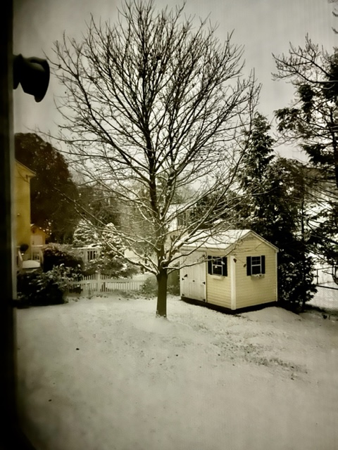
There was still some waterlogged snow on winter hill this morning.