-
Posts
93,092 -
Joined
-
Last visited
Content Type
Profiles
Blogs
Forums
American Weather
Media Demo
Store
Gallery
Everything posted by ORH_wxman
-
Pretty meh where I am for wind events. Nothing like Oct 2017 when I was in my first year here and we roared from the south. Seems like CT got it good and then maybe into SE MA. Interior MA was more middling. ORH peak gust so far is 43 knots which is not exceptional for them like those 50+ knot gusts in CT valleys.
-
If they do it would only be right near that exit. They will do everything to try and keep it open though. They don’t want to shut it down. If they somehow close it, you could prob take the Pembroke exit a few miles east and then come in on genesee rd (rt 33) from the east until it intersects with transit.
-
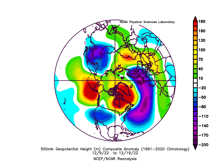
It should be clarified that when people like me, Coastal, etc say the pattern is good, it means the longwave pattern. Shortwaves also make up a pattern, but the problem is shortwaves cannot be forecasted more than a few days in advance. So if the shortwaves end up kind of unfavorable, one can claim "the pattern wasn't good".....but that's not how we are using the term "pattern"....we're specifically talking about the longwave pattern and it is clear to me that not everyone in here understands that. Especially the ones that simply use "total snowfall results" as the arbiter of what is a good or bad pattern. We've actually cleaned up before in shit patterns....it's just a lot harder to do (see January 2006....ORH had something like 25" of snow over a 3 week period from 4 different events during a dumpster fire pattern.)
-
I think threads can be created a bit further than that if the signal is very strong...there are certain events where that is possible. But yeah....generally we at least wait until inside 100 hours.
-
There was never much of any support for this threat....it was always a long shot. It's not a good idea to make threads on systems that have a decent chance of never forming to begin with.
-
You can use 30 years if you want for snowfall but you'd have to understand that it won't be as predictive of the future as a longer term mean. A lot of decadal cycles go about 25-30 years so if you aren't capturing the both the peaks and valleys of those cycles, then you'll get a skewed presentation of what your snowfall climate really is. The 1980s has been eliminated from the 30 year mean....but those of us who remember that decade know what can happen. If you looked at only the mid-1990s and beyond, you would not see how things can go badly for longer periods like they did in the 1980s and early 1990s....because that 30 year climate calculation has artificially removed that period from the record. For temperatures, it makes a bit more sense to eliminate the decades of yore, but it's a lot more perilous for snowfall IMHO.
-
Mid 40s since 1996 though.....ORH would be like 75" average if started at that point. I'd lop off at least 3-4 inches from that to get a better long term average.
-
His avg is prob a little higher than that...I'd put it closer to 40. But yeah, he's def over-achieved. My bet is the only winter he's been below average recent;y was 2019-2020....his area keeps getting bailed out by a biggie (blizzard last year, Superbowl storm in 2021, 3/4/19 a few years ago, etc)
-
He feels the need to emphasize what's been said like 800 times....it's a longshot. But it's the Tblizz M.O......keep b*tching and whining until one hits you with the jackpot.
-
"The previous failure does not predict the future" is a good way to look at things.
-
Dec 30ish through Jan 5 is prob just a week-long furnace with nothing interesting. Things might get ok after that though as we see AK pig retrograding to Aleutians.
-
We basically had one on 12/11. But yeah, there's been a dearth recently. We had several in the 2018-2019 winter....those were kind of fun. I remember we had back to back clippers in late Feb that winter...first one was like 4" and then another 2-3".....refreshing the landscape.
-
He also just posted a DJF composite for phase 7.....there is nothing specific in his composite that tells us it was during negative ENSO and it doesn't single out January.
-
Maybe...but the last time we were in a deep -PDO was 2007-2013 and we were making naked snow angels with SWFEs being passed out like halloween candy. I know the impulse is to need a scapegoat that is larger than just nuances.....such as "there is just something larger I cannot see or put my finger on, but I'm convinced it's there and we need to get rid of it"......but when we're grasping at not-fully-empirical phantoms like that, sometimes it means we actually just succumbed to some misfortune just as we were fortunate in some previous periods. We want further explanation when sometime it doesn't require it. Now, being the skeptic that I am on many things....I can't prove there isn't some nefarious "Screw SNE" underlying demon lurking in the Pacific that only a robust El Nino can flush away.....but I'd want to see how it works before being convinced it's there. Missing a firehose snowstorm by 1-2C on 12/16.....getting some weird exotic phase on 1/17 last winter to cost us a legit KU event, etc, etc. We can go on and on, but a lot of our misses don't seem to be the result of large scale underlying mechanics.
-
Given the previous 2 El Ninos sucked donkey balls....I'm not convinced it's the answer. Sometimes you just whiff on a decent pattern. Surprised we only got the minor 12/11 event out of this, but that's the way it goes sometimes. We've gotten blasted on worse looks
-
Blizzard is not a good word to use to describe a storm threat unless there is ample evidence that blizzard conditions are likely. Not every coastal nor Easter is a blizzard.
-
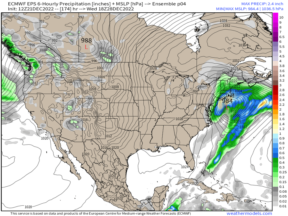
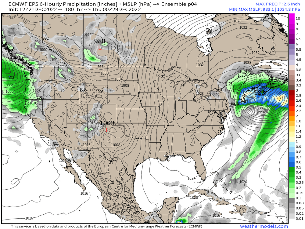
End of EPS didn't look terrible, but it will prob take some time to get true cold into the source region again. That said, we can snow with good synoptics even in a stale airmass in early January....and a ridge centered over Utah/Idaho/Alberta always carries some potential.
-
Yeah this is the view I'm taking on this. Unlikely to occur, but there's enough potential that keep half an eye on it and see if the ridge improves a bit or the spacing between the main shortwave and the PV.


