

ORH_wxman
-
Posts
93,095 -
Joined
-
Last visited
Content Type
Profiles
Blogs
Forums
American Weather
Media Demo
Store
Gallery
Everything posted by ORH_wxman
-
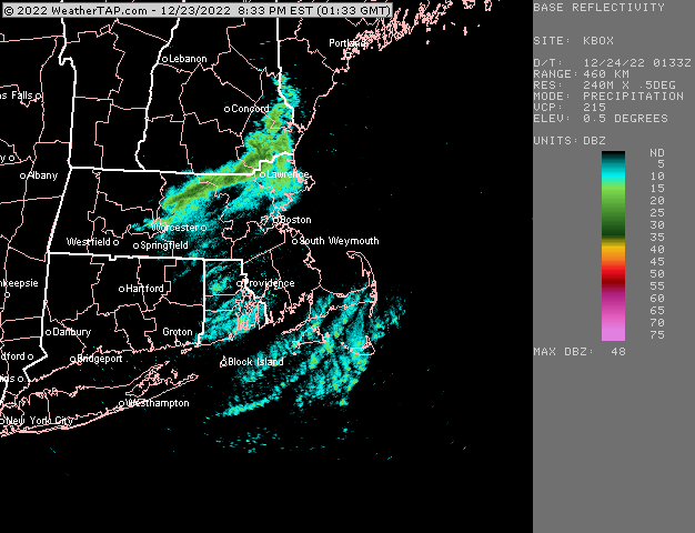
Awesome. That’s the best…getting the unexpected white Christmas from a squall that sort of stalled over your area. Still going too
-
And his friend in Lunenburg
-
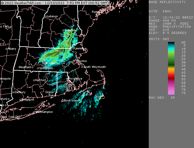
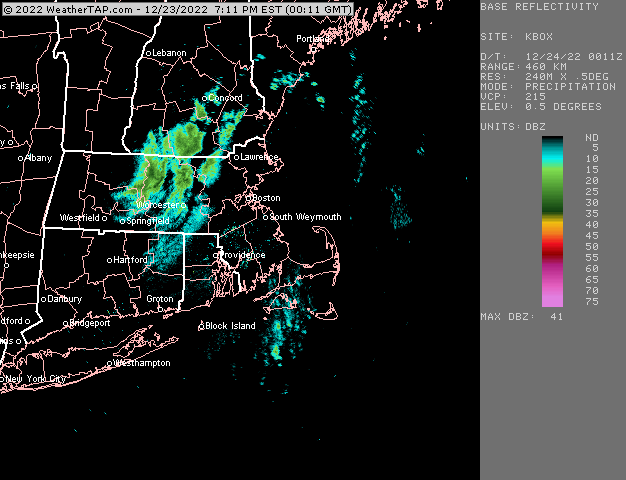
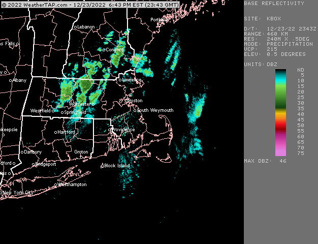
Almost a streamer going into the MA/NH border region
-
Someone in N ORH county is gonna get advisory snow out of that. Those heavy bands are almost training over Hubbdave’s area to Westminster/Gardner/FIT/Lunenburg FIT airport might just be missing it south but it looks like they are about to get it good
-
Solid squall lines
-
They are getting hit good in N ORH county right now. White Xmas saved there.
-
The craziest thing about that is it looked so lame aloft. Obviously there was a reason models weren’t spitting out much. Though there was one met (I want to say it was Kevin Lemanowicz but it could have been someone else) that came on at 11pm the night before and said something like “there’s one model that went nuts just now and is giving a much bigger snow event for the interior….but it’s an outlier so I’m tossing it out” and he was holding the paper (prob from old difax machine) in his hand and crumpled it up and tossed it off the screen, LOL. But other than that one reference, there was zero indication that the storm would be what it was.
-
See if there is a back door you can walk out.
-
ORH finally hit 50 knots last hour. First round was pretty lame inland around here but the second pulse has been stronger. I can hear it a lot more too just from an anecdotal standpoint.
-
Yes that is def an anomaly but it was a potent Niña. Mostly got skunked until mid January 1956. But the real stuff didn’t really happen until Feb/Mar. Mar ‘56 is locally around my area one of the most epic months you’ll see. Over 50” that month after a prolific Feb. Snow depths over 40”. Mar ‘56 had no torches either.
-
That’s amazing for that pit.
-
2012-2013 is another example…interior had some snow events in December but the coast was totally hosed until February. There were tons of melts in January 2013 when the pattern turned favorable after mid-month and we didn’t get a good system and then a huge cutter….that was a good one. Then Feb/Mar 2013 happened. Most of these winters though that rebounded strongly we’re not La Niñas. You could maybe say 2010-2011 was slow to start for CT….the Boxing Day dryslot from hell wasn’t exactly a prolific snow event (a lot of areas struggled to barely get warning snow…a few isolated spots didn’t even get that)…but then after the huge NYE/NEw Years day torch period, it was off to the races for an epic 4 weeks.
-
I wouldn’t expect anything and be pleasantly surprised if you get hit by a rogue squall.
-
The one issue with hoping for a backloaded winter is that those are a lot more common in El Niño. Though if we can get going by 1/7-1/10, it doesn’t necessarily have to be backloaded…
-
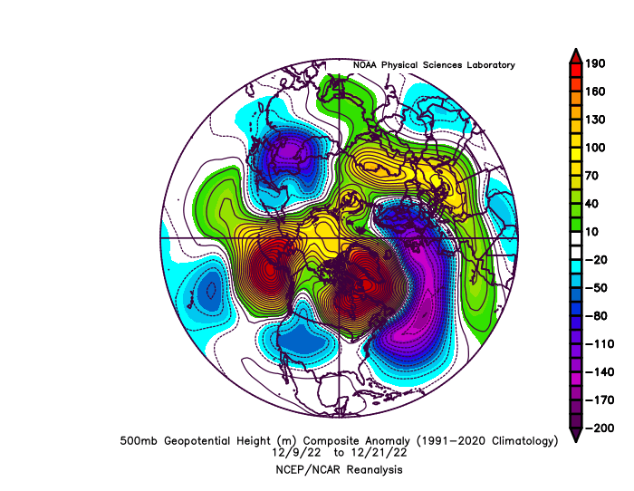
Correct. There wasn’t some larger scale SE ridge on the longwave pattern that was causing our problems. It’s pretty obvious looking at the longwave pattern I posted above earlier.
-
Finally got some damage here
-
We didn’t have much of a SE ridge signal at all once the block formed. Only transient during the initial evolution in the Dec 5-8 range. The height response to the NAO block was pretty classic to the south…all along that latitude band. Typically we’d prob get something decent out of this look but not this time…just the smaller event on 12/11
-
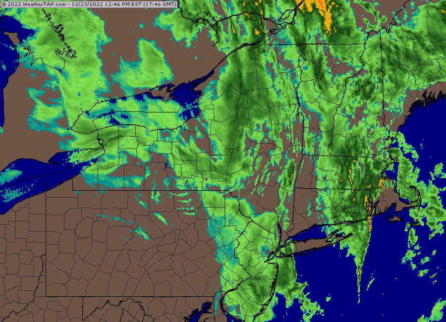
I’m taking the under on any snow after the flip. Radar doesn’t look that impressive to me to the SW. I think best chance might be for a rogue squall or two later on this evening.
-
CLE -3F with heavy snow and 44 knot gusts
-
Yeah look at the location of the western ridge on those two frames. That’s really the biggest difference. We buried a bit of the PV into the NW instead of having a chunk of it get trapped under the block like in the first image which also allowed the western ridge to amplify a bit further east.
-
To answer your question earlier on temps, my guess is it maybe gets to high single digits in spots tonight? Western CT will be colder than eastern MA at higher latitude. It’s about the worst type of delivery for us to get very cold…so it will modify quite a bit from from negative temps we currently see in western PA. But the airmass itself is so impressive that even on an awful delivery vector, it will still be pretty cold.
-
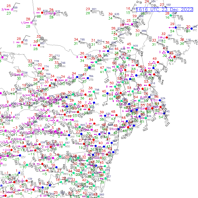
You can see it punching into SW NJ right now on the sfc plot
-
If you sharpen up the trough just a bit more, there could be a decent band of fronto snows…I think there’s too much work to do to get a legit major coastal storm, but there’s still a chance we could get a shovelable event. Low chance…but it’s still possible.
-
Increased ridging in central Canada is helping a bit on the 12z GFS.
-
NAM was mildly intriguing. Might end up producing some light snow even if the bigger storm idea is a bust.


