ORH_wxman
-
Posts
93,092 -
Joined
-
Last visited
Content Type
Profiles
Blogs
Forums
American Weather
Media Demo
Store
Gallery
Everything posted by ORH_wxman
-
Possible coastal storm centered on Feb 1 2026.
ORH_wxman replied to Typhoon Tip's topic in New England
Well you don’t want it to initially close off near ACK because it’s prob not captured yet when it first closes off. You want it to close off near VA/NC and then swing northeast. -
Possible coastal storm centered on Feb 1 2026.
ORH_wxman replied to Typhoon Tip's topic in New England
You don’t want the low closing off over SC/GA. Need it more around VA/NC. -
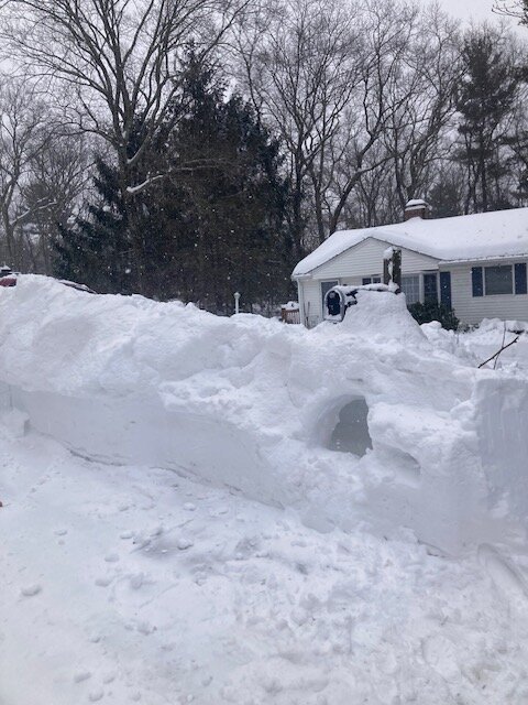
22.1 total in Holliston after the pure blower fluff last night.
-
Possible coastal storm centered on Feb 1 2026.
ORH_wxman replied to Typhoon Tip's topic in New England
We def want this closing off further north. The only mechanism that really brings the low north is the closing off of the upper low itself as it expands. So if you dig it too far south initially, it has more trouble recovering the latitude. -
Their ‘97 reference for ORH is incorrect. Total there was 33.0”.
-
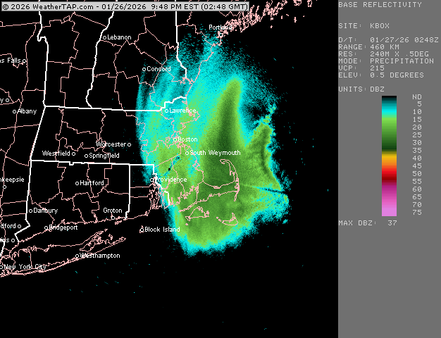
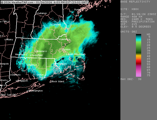
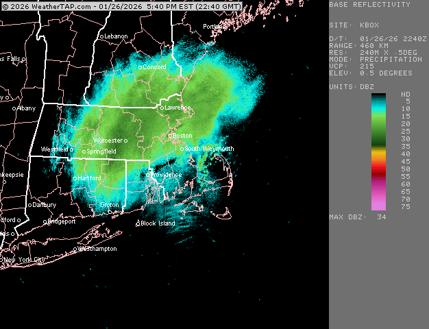
Last band for BOS and then south shore. What a great event
-
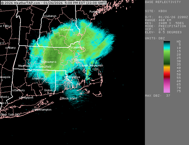
Pretty insane dPVA going into an area of LL convergence and already saturated.
-
Yeah. Almost acting like an embedded WINDEX event. Esp over the Cape and adjacent where there is steep lapse rates.
-
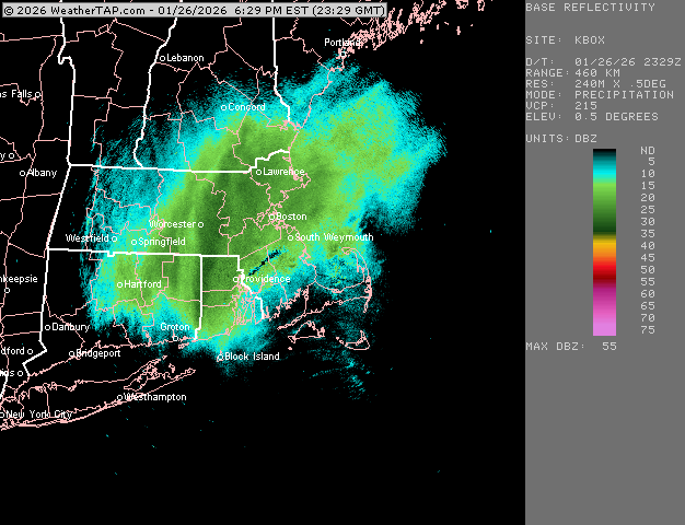
It’s actually snowing pretty decent in this band back by 495….vis dropped quite a bit…but man, that PYM band
-
Man this band is getting even stronger. Duxbury to PYM incoming…then prob Cape
-
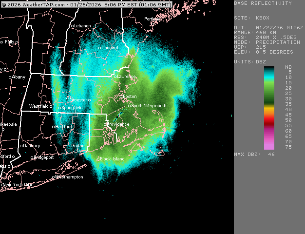
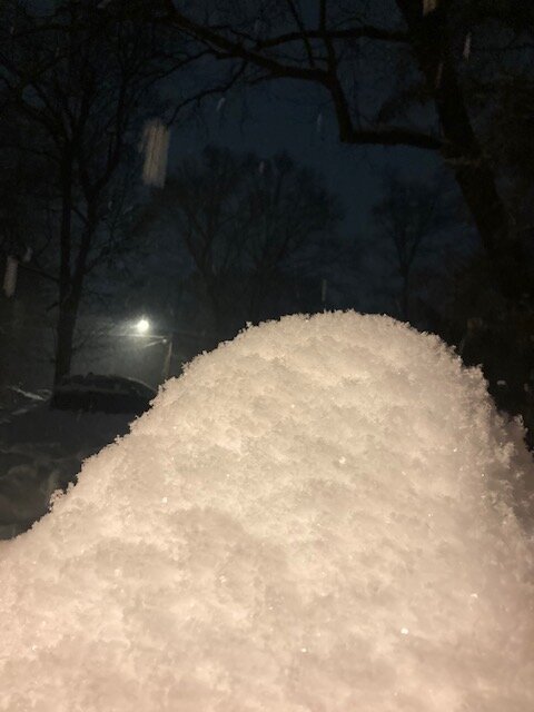
2 inches new in this stuff now….20 burger achieved.
-
We just need Mainejayhawk to AI a pic of you trying to repair a broken weed whacker while Scooter is in the background laughing surrounded by feet of snow.
-
Best to come in BOS.
-
Right in that band
-
Yeah I think we had 13 to 1 or so yesterday. I thought we may end up better than that, but not surprised either. I remember saying 13 or 14 to 1 is a good default in cold storms where good DGZ crosshair isn’t obvious…. Today’s stuff was obvious on model guidance. I was very confident in high ratio fluff for Monday PM stuff but yesterday is a very good example of not going crazy with ratios on a high QPF dump from a prototype SWFE
-
If I had these ratios yesterday I would’ve had a 40 burger. Prob 25 or 30 to 1 in this if not more.
-
Tried to grab a pic of how it’s stacking. Not as good as Dave’s but same idea
-
Pure nukage with mini cotton balls. This will be a really nice finale for you folks out east. Most guidance enhanced it a bit too out there as it interacts with the low level onshore flow…you can already see those bands near Cape Ann reacting and near Scooter
-
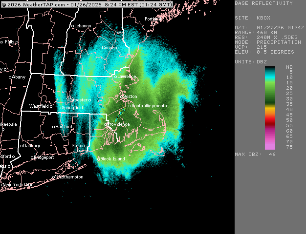
Ok this is legit nuking now. Before it was like that super efficient 3/4-1 mile cotton balls but now it’s just ripping down with vis under a half mile.
-
How much new in the last 90 min? That band has been intense. Just getting into the meat of it here and it was already stacking up with fatties falling.
-
Pure cotton balls falling
-
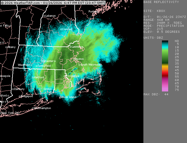
Cape Ann about to get another round of enhancement it looks like…ORH band is really ramping up too
-
Possible coastal storm centered on Feb 1 2026.
ORH_wxman replied to Typhoon Tip's topic in New England
Well if you keep trending the main shortwave well northeast like the ICON did, eventually it will just be a low in the OH valley redeveloping off Mid-atlantic. Right now it's not doing that. -
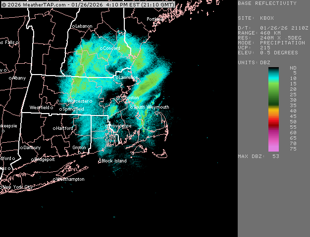
Here comes the vortmax stuff blossoming right on queue (guidance was really hitting after 21z). Should be pretty decent for a few hours
-
Snow banks are real deal out of this. Would’ve easily surpassed 25” if we had like 18 to 1 instead of 13 to 1 or so. But the QPF always shows up in the snow banks. My oldest son decided to dig a hole into the snow bank while I was clearing out the mailbox