ORH_wxman
-
Posts
93,099 -
Joined
-
Last visited
Content Type
Profiles
Blogs
Forums
American Weather
Media Demo
Store
Gallery
Everything posted by ORH_wxman
-
3k was ran from your basement
-
This one was below zero for a while
-
Seems like the northern extent of it did tick a little north. Don’t think it affects his area. Might affect places like PYM-EWB but prob not a game-changer in the overall scheme of the storm. An hour or two earlier could cost them a couple inches.
-
They are getting ratios that we typically get in SWFE…being not as deep into the arctic airmass.
-
Had that one saved from a long time ago. I think we made that in the ‘07-08 winter.
-
Radar nudity
-
This setup is pretty cool. We haven’t really had a storm like this when you combine the type of storm with the magnitude of the airmass. It’s like a Jan ‘05 airmass but a massive juiced SWFE type storm that in a normal winter airmass might front end us and then give a whole mess of IP/ZR/RA well into CNE. But this is not a normal airmass.
-
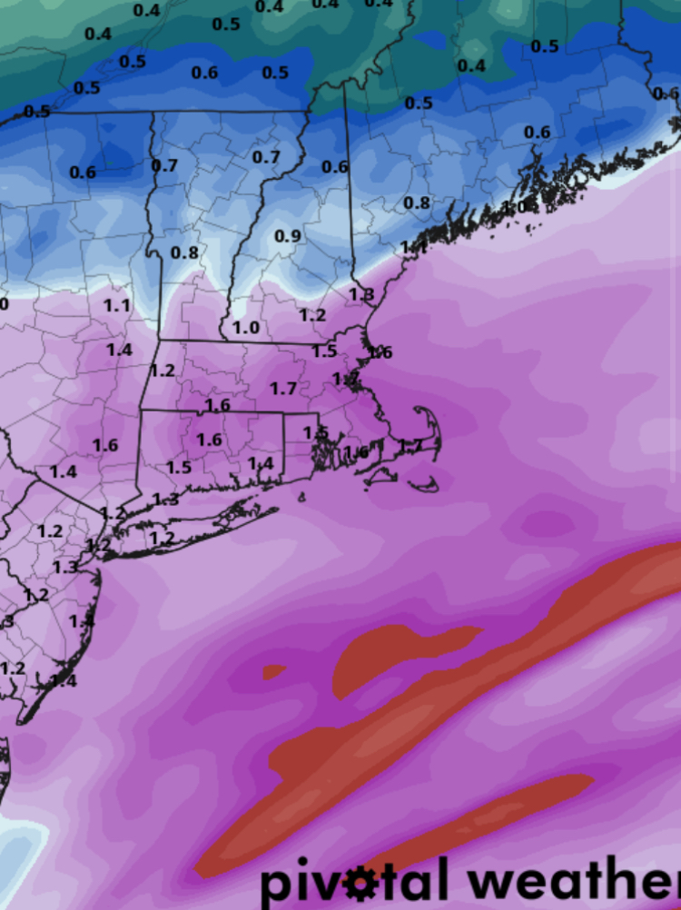
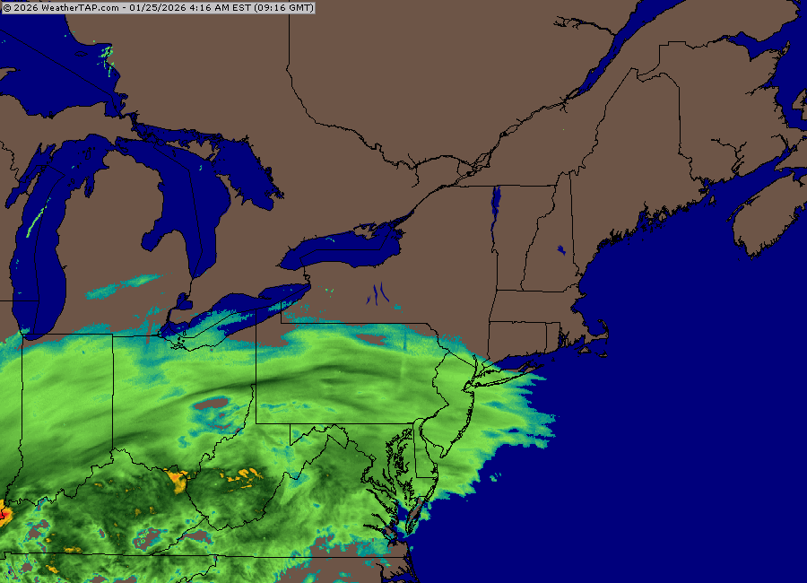
Wow juicy. Has all of us in Central and E MA over 1.5” of QPF.
-
I picture you more like this (except it’s snowing out)

-
Canadians at it again.
-
Yes it did.
-
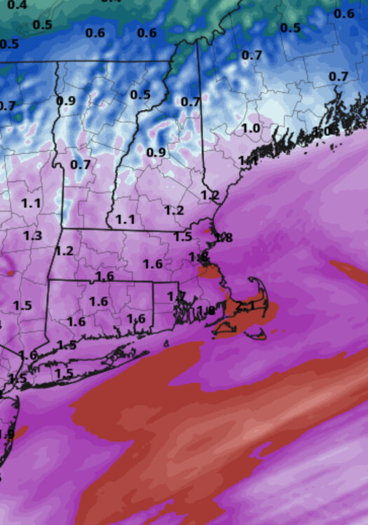
Your area very well might jack or at least near-jack.
-
CAD wouldn’t really impact sleet vs snow. CAD will be lower level. It’s prob weird shaped because it’s marginal…the warm layer above 0C is prob very very thin so slightly different rates/dynamics might cause it to flip between snow and sleet at that point.
-
January 2026 regional war/obs/disco thread
ORH_wxman replied to Baroclinic Zone's topic in New England
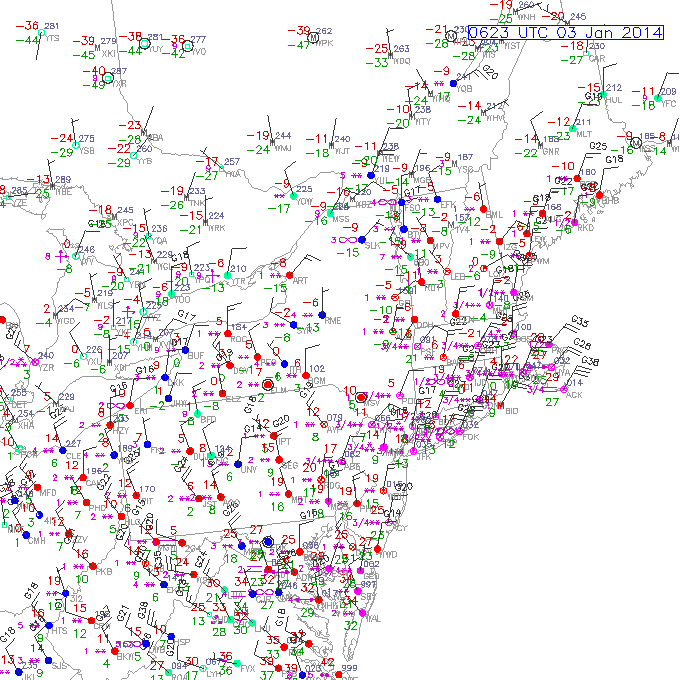
https://www.meteo.psu.edu/ewall/NARR/1981/us1206.php Feb ‘99 was similar too https://www.meteo.psu.edu/ewall/NARR/1999/us0225.php -
Jan ‘05 def did. Jan ‘11 for sure. Jan ‘17. Those were coastals though. This is basically a massive SWFE. We do get some coastal characteristics below about 800-850mb, but can’t really recall a similar system. Maybe Feb 5, 2014…that was a really juiced SWFE. Airmass wasn’t like this though. This airmass being so cold is what makes this one a different beast.
-

-
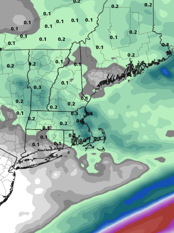
GFS has some decent goodies for Monday too. Esp east.
-
Looks like Reggie not running again. They did finally run the 12z after nobody cared.
-
Yes. Maybe not quite as wild as 12k but same general idea.
-
3k gives you a 20-burger even with 10 to 1 ratios.
-
Queue @Typhoon Tip talking about cotton balls falling in the orange glow of the lights on Monday evening if that NAM ending happens.
-
This is just the Monday stuff.
-
Def is showing an IVT hanging back and when that stronger vort energy hits it, some nice precip blossoms. It shows some pretty nice snows right into late Monday night over eastern areas. Some spots get over 0.30” of liquid between 18z Monday and the end of the storm. That would prob be very high ratio fluff and take storms totals to higher end of the ranges. Im still ambiguous on how Monday plays out but an 18z NAM version would be very good.
-
Yeah both Feb ‘78 and Feb ‘03 beat April ‘97 for storm total but neither of them beat the 24 hour record from ‘97.