

ORH_wxman
-
Posts
93,092 -
Joined
-
Last visited
Content Type
Profiles
Blogs
Forums
American Weather
Media Demo
Store
Gallery
Everything posted by ORH_wxman
-
There? If everything went right, you might get like 8-10”…….I suppose you could argue for a foot if you’re in one of those 300 foot elevations near Foxborough…but that’s like a 90th percentile outcome. Right now, I’d set expectations as a couple inches of mashed potatoes and hope things trend better.
-
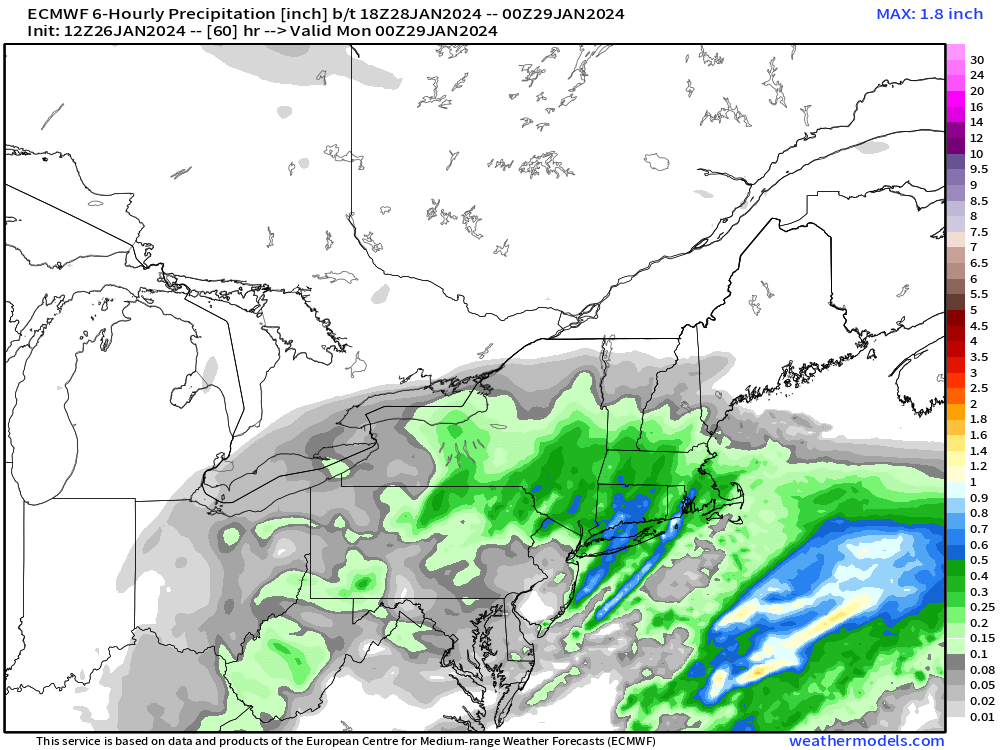
Euro looked like it was unsure on how to link the WCB/CCB…hoping to get more clarity going forward…I mean, WTF is this for the 6-hourly QPF map? Looks like convective cells training
-
Seeing that kink in H5 around 60h is a good thing. I think if we can see that feature continue to show up on future runs, it raises the ceiling on the event.
-
Looks a little north of the euro. Regardless, I’m glad to see more model runs giving better QPF rates. GFS is still pretty flaccid but it will eventually cave. Bigger question is whether the northern models are too amped or not.
-
No not for all of us. A significant percentage of this forum will get a real event.
-
Euro tries to curl that vort in pretty close and it causes CCB to go wild from like western CT up through deep interior MA and into NH.
-
Big for CNE too
-
This is gonna be a good run for at least some of SNE.
-
77 at IAD.
-
Cautiously optimistic for our area. We have a little bit of elevation and being out near 495 helps. I’d like to see some more solutions that give some higher rates like the NAM…and it doesn’t have to be 12-15” like the NAM, but at least a couple 3 hour panels that drop 0.25”+ of QPF. I feel pretty good telling people in this area that we’re probably getting at least 2-3” but whether it’s likely we get 6”+ is still not answered yet.
-
I’d give it another 12-24 hours. We’re like in the 54-60 hour range right now which is kind of fringe for meso guidance.
-
It was a Flop... February 2024 Disco. Thread
ORH_wxman replied to Prismshine Productions's topic in New England
Not too often you get a pattern in early February that could produce a big snowstorm or 60F depending on only minor differences in the handling of the central CONUS block/ridge. -
It was a Flop... February 2024 Disco. Thread
ORH_wxman replied to Prismshine Productions's topic in New England
Reinvigorated it too around 234-240 with another vort lobe. Almost reminds me of Dec ‘92 the way that happened on the Saturday after the initial violence on Friday. Highly doubt we see anything from that but there’s a low probability we can squeeze a shortwave underneath. -
Agreed. I think you’ll be fine assuming you grab more than 0.6-0.7 of QPF. But if it’s intermittent crap that eventually gets you to 0.5 then it’s prob just a couple of inches of mashed potato slop. I do like the midlevel track on a lot of these runs so I’m cautiously optimistic that we’ll get a nice period of moderate to heavy snow over the interior.
-
It was a Flop... February 2024 Disco. Thread
ORH_wxman replied to Prismshine Productions's topic in New England
Ok that’s funny on the 12z GFS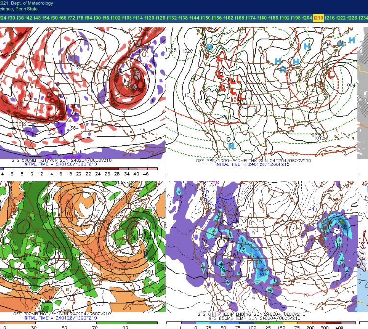
-
Not a lot of confidence in 12z guidance…except maybe ORH county/Berks doing pretty well. Otherwise there’s all sorts of issues elsewhere (precip cutoff to the north and ptype issues south and east).
-
It was a Flop... February 2024 Disco. Thread
ORH_wxman replied to Prismshine Productions's topic in New England
Yes you are correct…it didn’t have the room to amplify because of the 1/24 storm (that’s why Scooter was throwing furniture in his basement when that 1/24 storm amplified to hit us) and the ridge was already a bit too far east….or so we thought at the time. -
It was a Flop... February 2024 Disco. Thread
ORH_wxman replied to Prismshine Productions's topic in New England
I feel like a lot of people memory-holed the late 1990s…that was a sneaky awful stretch if you like snow and cold. Anyways, if I can grab back to back 20”+ months (January starting to look like it might get there) with maybe one decent event in March, it would be hard to call this winter a total ratter. The warmth has sucked but it’s been active with plenty to track. -
Ran that one from my basement. Just destroyed by a paste bomb on NAM. No power for days.
-
It was a Flop... February 2024 Disco. Thread
ORH_wxman replied to Prismshine Productions's topic in New England
Yep. I think Tip is correct it’s always been there to some extent…it’s just gotten worse. Anyways, I digress. I agree with Tip that there is some “interesting” potential from 1/30ish to the first week of February. It’s not favored, but some of these extremely meridional solutions with potent shortwaves riding down the east side of that ridge (almost a pseudo omega block) can blow up with little warning. They aren’t necessarily events that you track from a full week out. Partially because the source of said shortwaves are basically in a data-void area…or at least in an area where satellite data gets very distorted due to the very low tropopause up near the pole. These aren’t originating out in the pacific like usual. -
It was a Flop... February 2024 Disco. Thread
ORH_wxman replied to Prismshine Productions's topic in New England
Yep. It has gotten indisputably worse too over the years. Everything is eithe “MECS/HECS or bust” or “new climate is like DC” or “winter is over, we’re kicking the can again on the pattern change” The hilarious part is you to ORH might end up with a 30 inch month of January if this next storm produces warning snowfall. -
Euro was on crack.
-
I’d feel pretty good for ORH county getting decent snow….495 belt is prob decent as well but a bit more uncertain due to elevation not being as high. Kevins area is also a bit more uncertain but due to midlevel temps rather than elevation.
-
Yeah it was my first winter back up here after living in Texas from age 2 to 7 and I remember seeing ads for Watatic that fall even as an elementary school kid who didn’t ski yet…the dude actually put ads out he was so confident and then got the shaft, lol. I wonder why they never let him reopen. It probably would have been good for the area to have another ski area. I always wondered if Wa-Wa did some “influencing” to keep them closed.
-
I was living in Holden in 1988 when they almost reopened. Some dude bought the place and was ready to open it but he never got the permits and it just slowly got engulfed by the wilderness since then.


